Category:Maps of Central Europe
Jump to navigation
Jump to search
Deutsch: Karten von Mitteleuropa.
English: Maps of Central Europe.
Français : Cartes de l'Europe centrale.
Wikimedia category | |||||
| Upload media | |||||
| Instance of | |||||
|---|---|---|---|---|---|
| Category combines topics | |||||
| Central Europe | |||||
region of Europe .svg) | |||||
| Instance of | |||||
| Part of | |||||
| Has part(s) | |||||
 | |||||
Use the appropriate category for maps showing all or a large part of Central Europe. See subcategories for smaller areas:
| If the map shows | Category to use |
|---|---|
| Central Europe on a recently created map | Category:Maps of Central Europe or its subcategories |
| Central Europe on a map created more than 70 years ago | Category:Old maps of Central Europe or its subcategories |
| the history of Central Europe on a recently created map | Category:Maps of the history of Central Europe or its subcategories |
| the history of Central Europe on a map created more than 70 years ago | Category:Old maps of the history of Central Europe or its subcategories |
Subcategories
This category has the following 26 subcategories, out of 26 total.
+
C
D
H
L
M
T
V
Pages in category "Maps of Central Europe"
This category contains only the following page.
Media in category "Maps of Central Europe"
The following 120 files are in this category, out of 120 total.
-
 Aaker central europa.png 805 × 553; 26 KB
-
 AddOnStandorte2010.jpg 419 × 495; 21 KB
-
 Alpshl-map-2019.svg 580 × 360; 1.8 MB
-
 Avantgarde CE.jpg 833 × 565; 126 KB
-
 Avantgarde CE.svg 450 × 456; 495 KB
-
 Boarisch-mit-Flaggn.png 1,024 × 1,022; 120 KB
-
 Bucharest Nine map.png 926 × 994; 149 KB
-
 Carpathian Rus' (1920-1938).svg 269 × 206; 2.24 MB
-
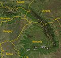 Carpathians-satellite.jpg 2,625 × 2,521; 2.6 MB
-
 Carte religieuse - Europe centrale - 1901.svg 1,977 × 1,709; 2.35 MB
-
 CarteSGPNK2014.png 333 × 263; 24 KB
-
 CEDC.svg 380 × 295; 363 KB
-
 Centraal-Europa-Subportalen Europa.JPG 444 × 327; 21 KB
-
 Centraal-Europa.png 1,093 × 1,093; 235 KB
-
 Central and Eastern Europe Map.png 2,416 × 3,230; 1.37 MB
-
 Central Europe (a).png 1,218 × 1,245; 139 KB
-
 Central Europe (Brockhaus).PNG 1,218 × 1,245; 81 KB
-
 Central Europe (Brockhaus).svg 446 × 456; 362 KB
-
 Central Europe (by A.Mutton).PNG 1,218 × 1,245; 77 KB
-
 Central Europe (by E. Schenk).PNG 1,236 × 1,245; 75 KB
-
 Central Europe (CIA).jpg 1,028 × 1,242; 247 KB
-
 Central Europe (definitions).png 6,460 × 3,403; 1.36 MB
-
 Central Europe (economy).jpg 2,306 × 1,450; 3.28 MB
-
 Central Europe (Geographie universelle, 1927).PNG 833 × 565; 33 KB
-
 Central Europe (Geographie universelle, 1927).svg 450 × 456; 495 KB
-
 Central Europe (Larousse).PNG 823 × 781; 251 KB
-
 Central Europe (Lonnie R. Johnson).PNG 957 × 898; 259 KB
-
 Central Europe (Lonnie R. Johnson)2.PNG 1,218 × 1,245; 84 KB
-
 Central Europe (Mayers Enzyklopaedisches Lexikon).PNG 1,218 × 1,245; 77 KB
-
 Central Europe (Meyers Grosses Taschenlexikon).PNG 941 × 898; 234 KB
-
 Central Europe (proposal 2).PNG 1,200 × 1,000; 51 KB
-
 Central Europe - DPLA - e9fda1ac1b59cde186795263c198efc2.jpg 2,556 × 3,278; 5.63 MB
-
 Central Europe 1902.PNG 799 × 543; 21 KB
-
 Central Europe 72h rain fall at 2. June 2013.png 674 × 567; 399 KB
-
 Central Europe 72h rain fall at 2.6.2013 en.png 674 × 567; 397 KB
-
 Central Europe in CIA World Factbook.png 952 × 898; 230 KB
-
 Central Europe Katzenstein.png 800 × 588; 133 KB
-
 Central Europe Kundera.png 944 × 899; 224 KB
-
 Central europe large.png 624 × 440; 73 KB
-
 Central Europe Locater.png 255 × 155; 34 KB
-
 Central Europe location map.svg 1,796 × 1,245; 601 KB
-
 Central Europe map green.png 983 × 900; 129 KB
-
 Central Europe, 1967.jpg 4,747 × 2,890; 3.75 MB
-
 Central-Europe-Encarta.png 415 × 422; 9 KB
-
 Central-Europe-map.svg 680 × 520; 522 KB
-
 Central-Europe-map1.png 415 × 422; 5 KB
-
 Central-Europe-map2.png 415 × 422; 12 KB
-
 Central-Europe-SwanseaUniv.png 415 × 422; 16 KB
-
 Central-Europe-UTexas.png 415 × 422; 16 KB
-
 CentralEurope.png 1,093 × 1,093; 188 KB
-
 Earth-grazing meteoroid of 13 October 1990 locations map cs.svg 1,148 × 1,244; 490 KB
-
 Earth-grazing meteoroid of 13 October 1990 locations map sk.svg 1,148 × 1,244; 490 KB
-
 East Central Europe.PNG 1,218 × 1,245; 91 KB
-
 EconGas Internationalität.jpg 260 × 173; 8 KB
-
 EconGas Standorte.jpg 345 × 367; 13 KB
-
 Eeurope rel84.jpg 1,014 × 1,184; 355 KB
-
 Europa 17 u. 18 Jh.jpg 5,536 × 4,336; 10.3 MB
-
 Europa Centrale.png 507 × 422; 32 KB
-
 Europa centrale2.gif 341 × 272; 27 KB
-
 Europe (UN divisions Eastern, East Central and Southeastern Europe).PNG 1,218 × 1,245; 85 KB
-
 Europe centrale, Castellan.png 839 × 854; 269 KB
-
 Europe centrale, Peter Jordan.png 935 × 898; 80 KB
-
 Europe centrale, Wackermann.png 841 × 852; 271 KB
-
 Europe médiane, Czesław Miłosz.png 839 × 830; 274 KB
-
 Europe médiane.png 834 × 851; 282 KB
-
 Flaechenvgleuropa.jpg 498 × 467; 54 KB
-
 Geostrategy map of Central Europe.png 1,645 × 1,734; 5.2 MB
-
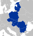
 Groupe de Visegrad.png 942 × 899; 223 KB
-
 Hist central europe blank.png 455 × 400; 118 KB
-
 Hist central europe.JPG 423 × 339; 33 KB
-
 Indogermanen-Mythos Karte 1907.jpg 1,064 × 659; 1.26 MB
-
 INL location map.png 1,078 × 518; 89 KB
-
 Italia di marmo (3093248342).jpg 886 × 1,181; 1.1 MB
-
 Karte der Eisenbahnen Deutschlands um 1857.jpg 400 × 383; 86 KB
-
 LocationCentralEurope.PNG 680 × 520; 118 KB
-
 Major geographic features of Central Europe.PNG 2,266 × 1,567; 4.79 MB
-
 Map european routes 3 5.png 578 × 392; 168 KB
-
 Map of central Europe in Great Britain's new allies-The Czecho-Slovaks.png 907 × 1,383; 526 KB
-
 Map of Visegrad Group.png 1,059 × 778; 34 KB
-
 Median Europe.png 680 × 520; 118 KB
-
 Minorités ethniques d'Autriche-Hongrie (1910).svg 1,360 × 1,052; 1.24 MB
-
 Mitteleuropa 1828.JPG 5,136 × 3,654; 3.99 MB
-
 Mitteleuropa aus österreichischer Sicht II.png 1,218 × 1,245; 51 KB
-
 Mitteleuropa ENG Leg wielgórski.PNG 779 × 1,072; 221 KB
-
 Mitteleuropa ENG wielgórski.PNG 779 × 1,072; 212 KB
-
 Mitteleuropa no labels wielgórski.PNG 779 × 1,072; 183 KB
-
 Mitteleuropa POL Leg wielgórski.PNG 779 × 1,072; 211 KB
-
 Mitteleuropa POL wielgórski.PNG 779 × 1,072; 201 KB
-
 Mitteleuropa-Konfessionen 1901.JPG 2,895 × 2,181; 1.73 MB
-
 Mitteleuropa.png 594 × 494; 203 KB
-
 Mitteleuropa2.png 262 × 217; 46 KB
-
 NATO East Flank.svg 2,560 × 1,958; 547 KB
-
 Ostmitteleuropa.png 261 × 217; 7 KB
-
 Pannonische Florenprovinz.svg 1,200 × 1,080; 1.16 MB
-
 Political map of Central Europe mk.svg 680 × 520; 528 KB
-
 Porta coeli Tišnov 5894.jpg 1,704 × 2,272; 947 KB
-
 Post- & Reise-Karte von Deutschland und den Nachbar-Staaten.jpg 12,329 × 10,395; 28.21 MB
-

-

-

-
 Post- und Reisekarte von Deutschland 1854.jpg 400 × 310; 64 KB
-
 PSM V85 D314 Boundaries of central europe and the distribution of races.png 1,618 × 1,489; 569 KB
-
 RegioesHistoricasEuropaCentral.png 461 × 341; 180 KB
-
 Rhineland.jpg 430 × 335; 37 KB
-
 Roumanie - Europe centrale.png 595 × 469; 79 KB
-
 Saint Coloman of Stockerau churches (OSM, 2014).png 647 × 414; 334 KB
-
 Sommet Europe centrale 1994.png 964 × 898; 230 KB
-

-
 Sprachenkarte Kozenn 1906.jpg 1,528 × 1,550; 2.06 MB
-
 Sredna Evropa.PNG 1,200 × 1,000; 46 KB
-
 Staatenbund SGA.PNG 1,218 × 1,245; 81 KB
-
 Strahlenexposition DACHL.png 2,772 × 2,375; 4.52 MB
-
 Tabula moderna Poloniæ Ungariæ Boemiæ Germaniæ Russiae Lithunæ - RRA 3= 72. Pièce 20.jpg 2,314 × 1,714; 1.01 MB
-

-
 The division of Europe by cardinal directions.Center of Europe near Vilnius.png 2,200 × 2,300; 771 KB
-
 Topographic map of Central Europe-eu.png 523 × 600; 618 KB
-
 Topographic map of Central Europe-eu.svg 553 × 634; 1.01 MB
-
 Topographical map of the Carpathian Ruthenia region.svg 520 × 444; 2.22 MB
-
 Ukraine - Europe centrale.svg 1,090 × 756; 365 KB
-
 Ukrajna - Hozzácsatolt területek.svg 1,090 × 756; 365 KB


.svg)


.png)
.PNG)
.PNG)
.PNG)
.jpg)
.png)
.jpg)
.PNG)
.svg)
.PNG)
.PNG)
2.PNG)
.PNG)
.PNG)
.PNG)


.PNG)


.jpg)


.svg)


.png)


