Category:Auto trails
Jump to navigation
Jump to search
type of highway | |||||
| Upload media | |||||
| Subclass of | |||||
|---|---|---|---|---|---|
| Location |
| ||||
| |||||
Auto trails were a system of named highways in the United States in the early 20th century, preceding the U.S. numbered highway system (U.S. Routes) which came into existence in November 1926.
Subcategories
This category has the following 15 subcategories, out of 15 total.
Media in category "Auto trails"
The following 11 files are in this category, out of 11 total.
-
 1917 Map Showing Marked Through Routes In Illinois.jpg 6,993 × 10,400; 8.7 MB
-
 1921 Map Showing Marked Through Routes In Illinois.jpg 8,322 × 10,400; 13.68 MB
-
 1922 Map Showing Marked Through Routes In Illinois.jpg 8,201 × 10,400; 14.31 MB
-
 AndersonHighwayFlorida.jpg 502 × 311; 50 KB
-
 Map of Iowa Showing Principal Automobile Routes.jpg 3,737 × 3,014; 2.4 MB
-
 Map of Liberty Highway.png 1,377 × 400; 145 KB
-
 Mississippi River Scenic Highway Map.png 338 × 948; 83 KB
-
 OldSpanishTrailMap.jpg 3,300 × 1,281; 1.48 MB
-
 Ozark Trails road schematic.svg 1,414 × 922; 441 KB
-
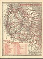 Cram Transcontinental Highways of the United States 1922 UTA (left).jpg 1,204 × 1,642; 2.51 MB
-
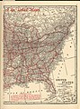 Cram Transcontinental Highways of the United States 1922 UTA (right).jpg 1,216 × 1,642; 2.51 MB


.jpg)
.jpg)