Файл:German Reich (1939).svg
Змест старонкі недаступны на іншых мовах.
Выгляд
З Вікіпедыі, свабоднай энцыклапедыі

Памер гэтага PNG-прагляду для SVG-файла: 450 × 456 пікселяў. Іншыя разрозненні: 237 × 240 пікселяў | 474 × 480 пікселяў | 758 × 768 пікселяў | 1 011 × 1 024 пікселяў | 2 021 × 2 048 пікселяў.
Арыгінальны файл (файл SVG, намінальна 450 × 456 кропак, аб’ём файла: 453 KB)
Гэты файл з на Вікісховішчы і можа выкарыстоўвацца іншымі праектамі. Апісанне на яго старонцы ў Wikimedia Commons прыведзена ніжэй.
Тлумачэнне
Назвы
Апішыце ў адным радку, што ўяўляе сабой гэты файл
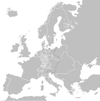
Η έκταση του Γερμανικού Ράιχ το 1939, πριν την έναρξη του Πολέμου
Элементы, адлюстраваныя на гэтым файле
адлюстроўвае
Нейкае значэнне без элементу ў Вікіданых
20 жніўня 2012
Гісторыя файла
Націснуць на даце з часам, каб паказаць файл, якім ён тады быў.
| Дата і час | Драбніца | Памеры | Удзельнік | Тлумачэнне | |
|---|---|---|---|---|---|
| актуальн. | 20:17, 25 ліпеня 2013 |  | 450 × 456 (453 KB) | Alphathon | Removed the Flevoland polders (Netherlands) which were not completed until 1942/1968 |
| 09:51, 20 жніўня 2012 |  | 450 × 456 (454 KB) | TRAJAN 117 | {{Information |Description ={{en|1=The German Reich in 1939.}} |Source ={{own}} {{AttribSVG|Blank map of Europe October 1938 - March 1939.svg|Alphathon}} |Author =TRAJAN 117 {{created with Inkscape}} |Date ... |
Выкарыстанне файла
Наступная 1 старонка выкарыстоўвае гэты файл:
Глабальнае выкарыстанне файла
Гэты файл выкарыстоўваецца ў наступных вікі:
- Выкарыстанне ў arz.wikipedia.org
- Выкарыстанне ў el.wikipedia.org
- Выкарыстанне ў en.wikipedia.org
- Выкарыстанне ў es.wikipedia.org
- Выкарыстанне ў fi.wikipedia.org
- Выкарыстанне ў ms.wikipedia.org
- Выкарыстанне ў www.wikidata.org
Метаданыя
У файле ёсць дадатковыя звесткі, магчыма, дададзеныя лічбавай фотакамерай ці сканерам, з якіх гэты файл паходзіць. Калі арыгінальны файл быў зменены, то частка гэтых звестак магла страціць актуальнасць у дачыненні да змененага файла.
| Кароткая назва | Countries of Europe |
|---|---|
| Назва выявы | A blank Map of Europe. Every country has an id which is its ISO-3166-1-ALPHA2 code in lower case.
Members of the EU have a class="eu", countries in europe (which I found turkey to be but russia not) have a class="europe".
Certain countries are further subdivided the United Kingdom has gb-gbn for Great Britain and gb-nir for Northern Ireland. Russia is divided into ru-kgd for the Kaliningrad Oblast and ru-main for the Main body of Russia. There is the additional grouping #xb for the "British Islands" (the UK with its Crown Dependencies - Jersey, Guernsey and the Isle of Man)

Contributors.
Original Image: (http://commons.wikimedia.org/wiki/Image:Europe_countries.svg) Júlio Reis (http://commons.wikimedia.org/wiki/User:Tintazul).
Recolouring and tagging with country codes: Marian "maix" Sigler (http://commons.wikimedia.org/wiki/User:Maix)
Improved geographical features: http://commons.wikimedia.org/wiki/User:W!B:
Updated to reflect dissolution of Serbia & Montenegro: http://commons.wikimedia.org/wiki/User:Zirland
Updated to include British Crown Dependencies as seperate entities and regroup them as "British Islands", with some simplifications to the XML and CSS: James Hardy (http://commons.wikimedia.org/wiki/User:MrWeeble)
Released under CreativeCommons Attribution ShareAlike (http://creativecommons.org/licenses/by-sa/2.5/). |
| Шырыня | 450 |
| Вышыня | 456 |


