
Heavy to excessive rainfall will continue along the Gulf Coast through Friday. A Moderate Risk of Excessive Rainfall is outlooked along the Central Gulf Coast today where scattered to numerous instances of flash flooding is likely. In the Western U.S., a late summer heatwave will continue through the weekend. Read More >
Last Map Update: Thu, Sep 5, 2024 at 9:10:46 pm CDT


Current Weather Observations... | |||||||||||||||||||||||||||||||||||||||||||||||||||||||||||||||||||||||||||||||||||||||||||||||||||||||||||||||||||||||||||||||||||||||||||||||||||||||||||||||||||||||||||||||||||||
|
|
Local Weather History For September 5th...
|
|
Beckham County in western Oklahoma was pounded with large hail back
on this day in 2008. Thunderstorms developed in the Texas Panhandle and moved east through the evening hours, developing into supercells. Baseball-size hail was the greatest impact, with damage to windows and businesses reported. |
|
Text Product Selector (Selected product opens in current window)
|
|
 |
 |
 |
 |
 |
 |
| Observations | Discussion | Air Quality | Hydrology | FAQ | Social Media |
 |
 |
 |
 |
 |
 |
| Storm Reports | Gridded Forecast | Aviation | Climate | Storm Data | Weather Radio |
 |
 |
 |
 |
 |
 |
| Satellite | Hourly Forecast | Fire Weather | Past Events | StormReady | Storm Spotters |


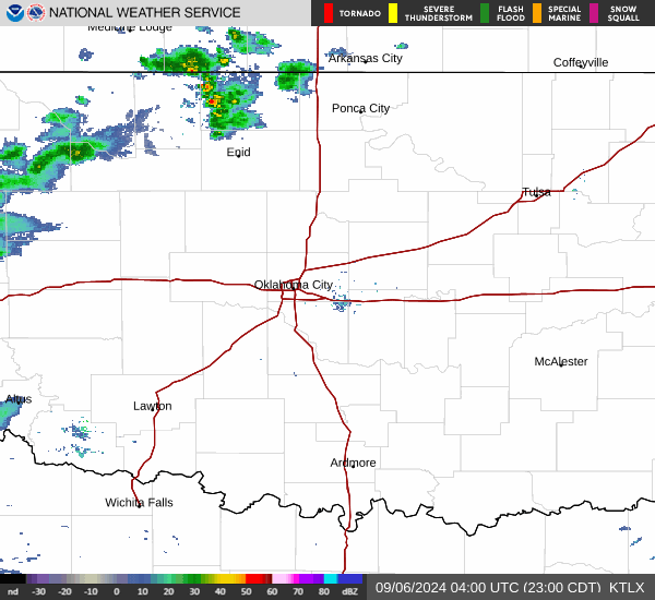 Local Radar
 Weather Map
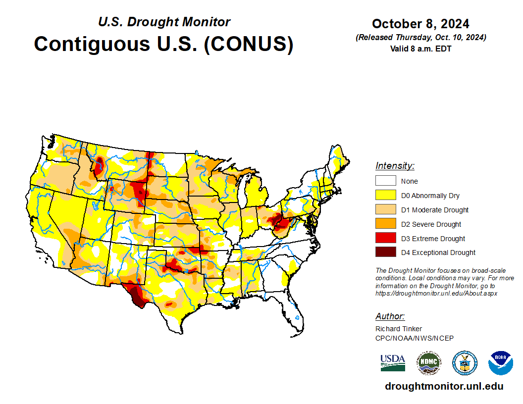 Drought Conditions