
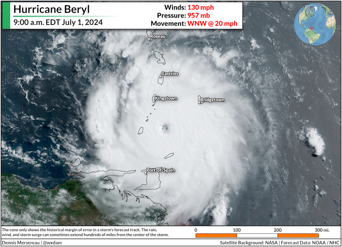
Hurricane Beryl rapidly strengthened into a category four storm this weekend with maximum sustained winds of 130 mph. The storm became the earliest category four hurricane ever observed in the Atlantic Ocean, beating the previous record by a full week.
This was far from the first record this relatively young storm broke early in its life.
Beryl was the earliest hurricane we've ever seen so far east in the tropical Atlantic. It was the first major hurricane in this part of the world during the months of June or July. It's going to be the strongest hurricane to hit the Windward Islands this early in the season.
Hurricane #Beryl intensified from a tropical depression to a 105kt (120mph) category-3 in 42 hours, and 115kt (130mph) category-4 in 48 hours.
— Sam Lillo (@splillo) July 1, 2024
Here's how that intensification compares to all tropical depressions on record in the Atlantic.
Unprecedented barely covers it. pic.twitter.com/YFLW3DmDdO
The storm's rate of intensification places it among a very small group of any Atlantic hurricane observed since modern records began in 1851. Meteorologist Sam Lillo crunched the numbers and posted Sunday that the storm's rapid intensification is unheard of this early in the season, matched only by a handful of historical storms that formed at the peak of the season in August and September.
What gives?
Experts have been worried that we're in for a very active hurricane season this year. Seasonal outlooks from NOAA and Colorado State University both called for a tremendous number of storms—so many, in fact, that we may exhaust the list of names for only the third time since the 1950s.
The ingredients behind an active season aren't just about the raw number of storms that form. After all, we had Tropical Storm Chris in the Gulf of Mexico on Sunday. The storm lasted for less than a day as it formed while making landfall on Mexico's east coast.
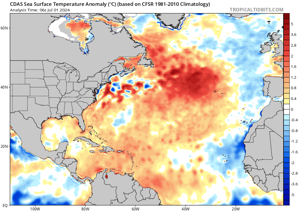 |
| SOURCE: Tropical Tidbits |
While we'll probably have plenty of short-lived and forgettable storms, the ingredients present across the Atlantic are favorable for creating storms like Beryl.
Warmer-than-normal sea surface temperatures are running as hot now as they should at the peak of the season. Combine that with favorable atmospheric conditions expected as La Niña develops and the ingredients are there for explosive development of any healthy tropical disturbance that can take root and take advantage of its environment.
We (hopefully) won't see more record-breaking storms this year. But Beryl makes it clear that the environment is more than capable of supporting very intense storms this hurricane season. This early-season storm is a warning shot to prepare emergency kits and emergency plans now rather than waiting until the peak of the season. It could be a long summer.


0 comments: