
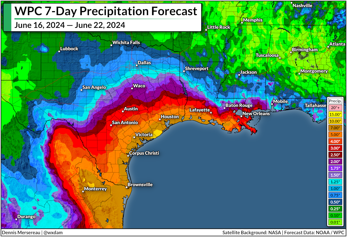
A tropical disturbance slowly moving into the western Gulf of Mexico will bring copious amounts of rain over the next couple of days, leading to a threat for flash flooding across coastal portions of Texas and Louisiana.
Forecasters expect the heaviest precipitation to fall over coastal Texas, where 5-10 inches of rain is possible through the middle of the week. Locally higher totals are possible. The region has famously poor drainage—especially the Houston metro area—so the likelihood of flash flooding during heavy rain is almost a given.
Remember, never try to drive across a flooded roadway. It's impossible to tell how deep the water is until it's too late, and the road may be washed out beneath the floodwaters. It only takes a few inches of moving water to lift up a vehicle and carry it downstream.
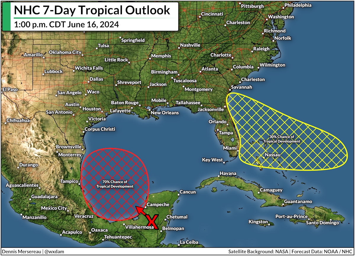
The slug of moisture is arriving with a tropical disturbance moseying into the western Gulf of Mexico. The National Hurricane Center gives the area a 60 percent chance of developing into a tropical depression over the next few days as it moves into the region.
Heavy rain is coming whether or not this develops into a named system. Some of the worst heavy rain events are the result of unnamed tropical disturbances—just look at what happened in Florida last week.
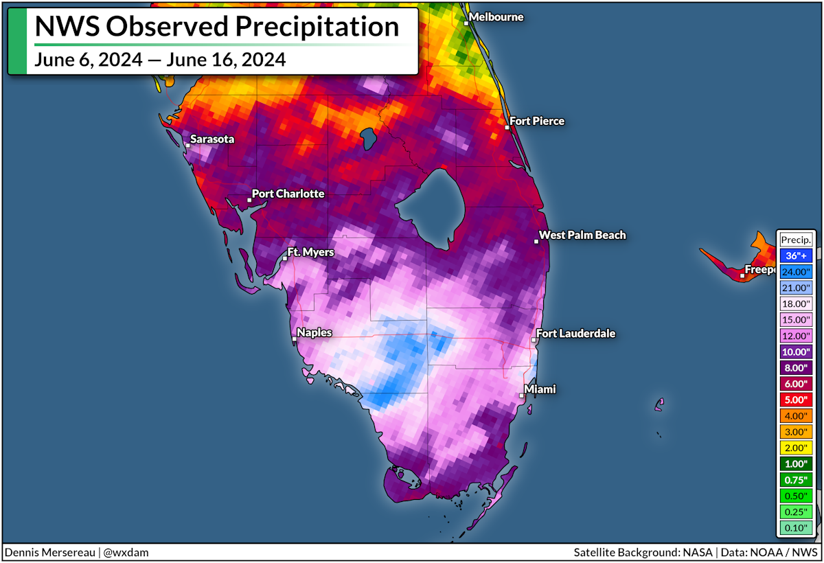
A tropical disturbance sent a vast amount of tropical moisture streaming over southern Florida. Persistent thunderstorms developed over the region, wringing out that moisture in the form of drenching rains that fell at several inches per hour at times.
Some areas wound up with more than two feet of rain, with the National Weather Service's latest precipitation analysis showing even more than that over the past ten days.
This latest tropical disturbance is a reminder that the Atlantic Ocean is open for business—and this season could mean business.
All major hurricane forecasts are calling for an extremely active hurricane season with predictions rivalling the busiest seasons on record. We could see more than 20 named storms this year if the forecasts pan out.

Extremely warm sea surface temperatures are driving those forecasts—and they're also likely driving the persistent heavy rain we've seen (and will soon see) across the Gulf Coast.
Warmer waters raise air temperatures over the ocean, allowing the air to hold more moisture than it would otherwise. It's likely that warmer sea surface temperatures are increasing the amount of moisture we're seeing over the region, which is enhancing rainfall totals in turn.
How unusually warm is the ocean right now?
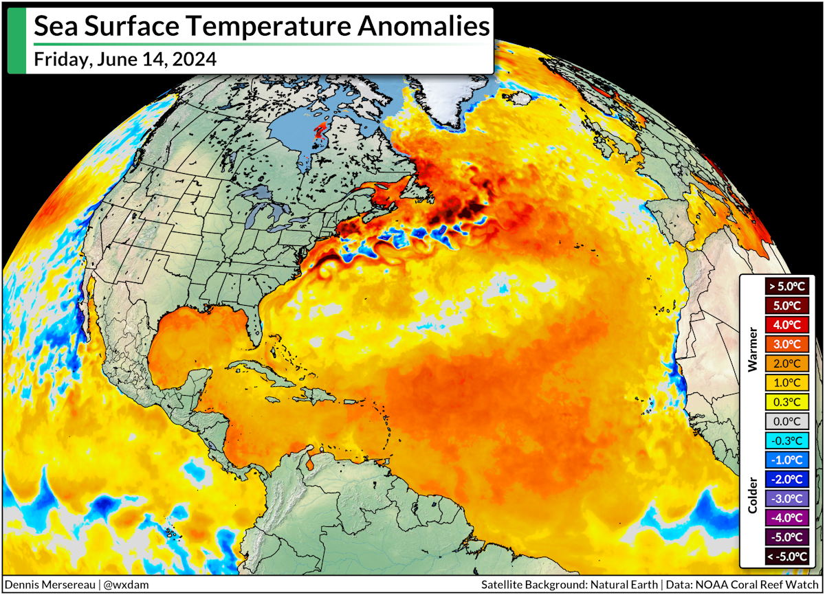
Sea surface temperature anomalies are running 1-2°C above normal throughout almost the entire tropical Atlantic basin.
Compare that to this time last year, where the extent and intensity of anomalies were still ugly, but a little less intense than we're dealing with this year:

It's worth noting that last year's very warm temperatures were able to fuel one of the most active hurricane seasons on record, overpowering the influence of El Niño which tends to subdue tropical activity in the Atlantic.
This year, though, we've got even warmer waters and a La Niña in the Pacific, which is favorable to tropical development in the Atlantic. It could be a long, rainy summer. Hold on.


0 comments: