

It's something worth watching (oh I love that cliche, don't you?), as well as a glaring reminder that we're diving deeper into what's expected to be a very active hurricane season.
Two Disturbances On The Map
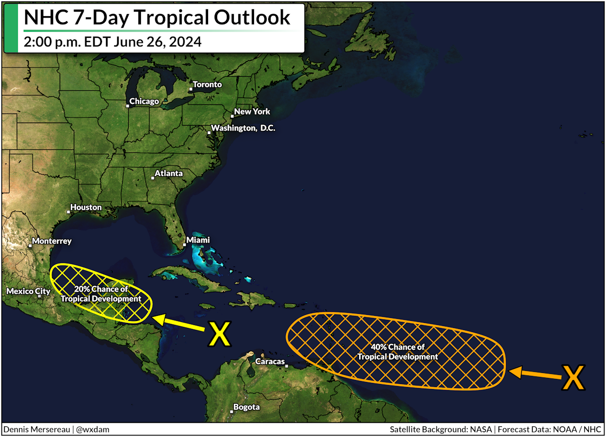
Wednesday afternoon's forecast from the National Hurricane Center paints two areas on the map for potential tropical development over the next seven days.
The first area has a 20 percent chance of development as it heads toward the Yucatan Peninsula through the weekend. This area is relatively disorganized, and weather models aren't pumping it up much before it reaches land in a couple of days. Regardless, the disturbance is likely to produce heavy rain across Central America as it pushes inland.
It's that disturbance far out in the tropical Atlantic Ocean that's raising some eyebrows.
This area has a 40 percent (medium) chance of development by next week as it steadily makes its way toward the Caribbean Sea. This area has plenty of warm water and gradually more favorable conditions to get its act together as it approaches the region.
Between the two areas, that disturbance far out in the Atlantic has the best chance of growing into Beryl by this time next week.
What happens after that is a little iffy because it's more than a week out. It's likely that a strong center of high pressure over the central Atlantic would keep any systems far enough south to avoid the U.S. East Coast, but folks across the Gulf always have to monitor anything entering the Caribbean...just in case.
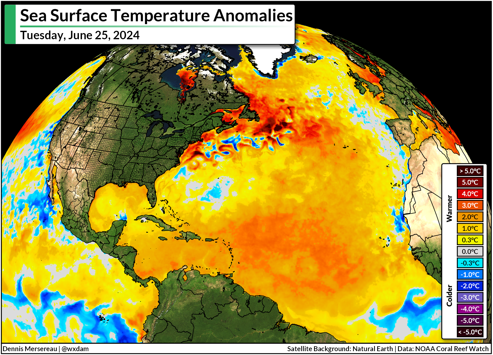
Sea surface temperatures across the tropical Atlantic are more than 2 degrees Celsius warmer than normal. The Atlantic has been running a fever for over a year now, and it's this relatively hot water that's fueling deep concern as we head deeper into this hurricane season.
Last year, forecasters expected El Niño in the eastern Pacific to keep a lid on the Atlantic hurricane season by increasing destructive wind shear across the ocean basin. However, those warm sea surface temperatures overpowered any effects of El Niño to drive 2023 to see one of the most active seasons on record.
This year, we're officially in ENSO-neutral territory, meaning neither El Niño nor La Niña are present. There are better-than-even odds that we'll tilt into La Niña by this fall, which lessens wind shear and makes conditions more favorable for tropical systems to take root over the Atlantic.
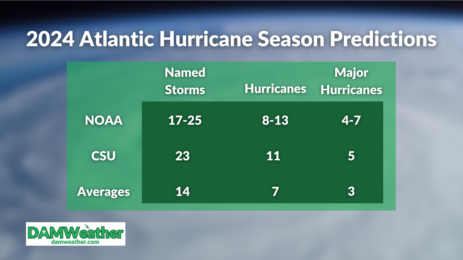
Between those warmer-than-normal waters and an expected La Niña, expert seasonal outlooks are calling for one of the most active Atlantic hurricane seasons on record.
Take advantage of the relative quietness of the early season to make plans in case a storm threatens your area. Build an emergency supply kit now so you don't have to scramble for supplies later. Make preparations to deal with and avoid flooding even if you're hundreds of miles inland.


0 comments: