So on the left you'll see, er... Weird glitch on Google Street View shows some places permanently in the DARK
- Street view shots show the stillness of night in cities across the world which were captured by Google
- Google Street View is a technology featured in the firm's Google Maps and Google Earth software
- It was launched in 2007 in several cities in the United States, and has since expanded to include cities and rural areas worldwide
The Google Street car is constantly out and about across cities and towns all over the world snapping the latest photos of your streets.
While most of the images which appear on Google Earth and Google Street view are in the day time, often showing an unknowing parent pushing their child in a push chair or people out walking their dogs, the software also shows some places which are permanently in the dark.
Eerie images taken by the patrolling cars in places such as the US, the UK and Taiwan, show the strange snaps which don't give much away when it comes to discovering what certain areas are like.
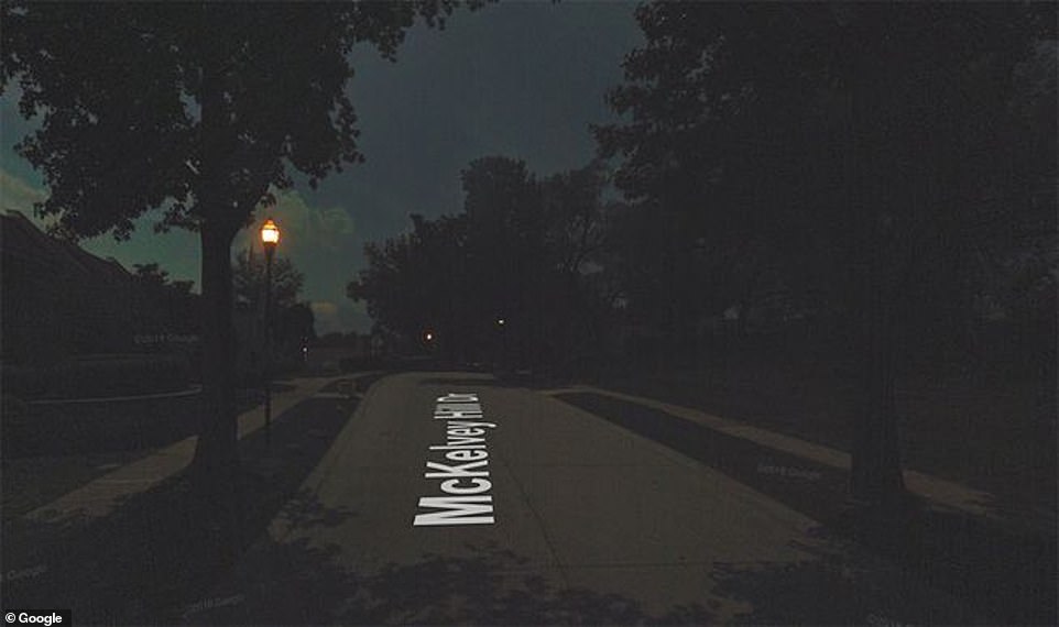
One image shows a street in the city of Maryland Heights in Missouri, USA, where the sky seems to be coming to light in the distance, with one street lamp seeming to illuminate the whole of the shot.

Mckelvey Hill Drive, Maryland Heights, Missouri, USA was captured in complete darkness by the Google Street View team

An image of a highway in Taiwan's Taipei is shown in near enough complete darkness while oncoming vehicles move in the direction of the camera
While the street looks clear and a few trees can be seen lined up, the image doesn't give much away. The central suburb of St Louis has a population of around 27,000, with Mayor Mike Moeller overseeing the day to day goings on of the area, however, none of the 27,000 people can be seen in the shot.
This is while another shot was taken on a seemingly busy highway in Taiwan's Taipei. Only the fluorescent lights of the oncoming vehicles can be seen as well as a distinct sign post on the left hand side of the shot.
While many threads across social media sites such as Reddit slam the idea of Google taking images at night. Some have praised the company for shedding light on what certain areas are like in the dead of night and how well lit they are.

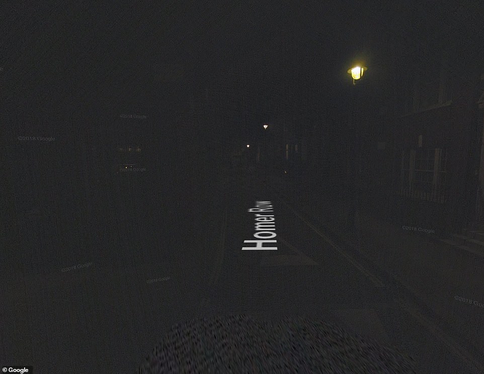
Homer Row in Marylebone London can barely be seen apart from a few street lamps which are lighting up the road

The I-95 if New Jersey at night. The Interstate-95 is a long stretch of highway which traverses nearly the full extent of the East Coast of the United States, from Florida to Maine
However, the idea that the images could show how well-lit areas were didn't work out so well for one shot of Homer Row in London, which looks to be in almost complete darkness aside from a few street lamps, with the pavements and houses either side of the road being almost invisible.
Homer Row is a street in the West End of London, in the Marylebone district of the City of Westminster. The name of the street, as well as its surrounding streets was said to have been inspired by Edward Homer, who was a friend of John Simmon Harcourt who had owned the land on which the streets were built.
Reflecting on what Google Street View was orginally designed for, the company said that service was put in place to enhance the users' experience.
'Google is dedicated to helping you discover the world around you. Imagery on our platforms is intended to enhance your experience, helping you preview and explore places nearby or across the globe. We go to great lengths to make sure that imagery is useful, and reflects the world our users explore.'
But how useful are some of the images and do the night time shots help users at all? One image taken on the I-95 in New Jersey fails to even pick up the brightness of the lights of the car in front of it, with the road markings on the road appearing to be extremely faint.
The Interstate-95 is a long stretch of highway which traverses nearly the full extent of the East Coast of the United States, from Florida to Maine.
The I-95 enters New Jersey at the Delaware River and crosses over the river into Burlington county where the road then continues west into Pennsylvania. However, no street signs can be seen on the road and it is hard to make out the words on the signs which can almost be seen on the right hand side of the shot.
Delving into Google's privacy policy relating to the Street View function, it is clear to point out that the images featured are not real time and are subject to change.
'Our images show only what our vehicles were able to see on the day that they drove past the location. Afterward, it takes months to process them.
'This means that content you see could be anywhere from a few months to a few years old. In some locations where we have collected imagery over many years, you may also be able to view changes to that imagery in our Time Machine function.'
Most watched News videos
- JD Vance puts his debate skills to use during 'Face the Nation'
- Border czar leaves ABC journalist fuming over his deportation flights
- Dr. Phil accompanies ICE to arrest migrant sex offender in Chicago
- Watch the difference between Melania kissing Trump vs Gavin Newsom
- Sickening moment two snowmobilers caught BULLYING fox on frozen lake
- Melania Trump comforts California wildfire victims in Slovenian
- Colombia says it overcame the 'impasse' with the US government
- Elie Mystal shares how the media needs to cover 'Trump 2.0'
- RFK Jr. talks Big Pharma, Ozempic, and a treatment for diabetes
- 'Clean out that whole thing': Trump's radical plan for war-torn Gaza
- Al Sharpton marches in support of Costco's DEI stance
- Currys security fight off 'shoplifter' in bid to reclaim 'stolen' TV


I'm sure that Lon dis tan in darkness has to be be...
by The_Mutts_Nuts 6