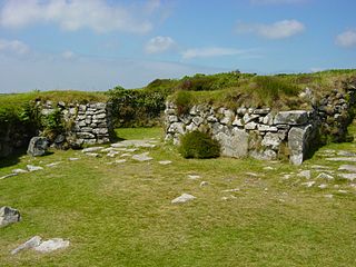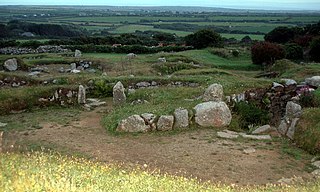
Chysauster Ancient Village is a late Iron Age and Romano-British village of courtyard houses in Cornwall, United Kingdom, which is currently in the care of English Heritage. The village included eight to ten houses, each with its own internal courtyard. To the south east is the remains of a fogou, an underground structure of uncertain function.

Carn Euny is an archaeological site near Sancreed, on the Penwith peninsula in Cornwall, United Kingdom with considerable evidence of both Iron Age and post-Iron Age settlement. Excavations on this site have shown that there was activity at Carn Euny as early as the Neolithic period. There is evidence that shows that the first timber huts there were built about 200 BC, but by the 1st century BC, these had been replaced by stone huts. The remains of these stone huts are still visible today.

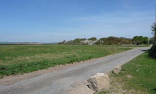
Chûn Castle is a large Iron Age hillfort (ringfort) near Penzance in Cornwall, England, United Kingdom. The fort was built about 2,500 years ago, and fell into disuse until the early centuries AD when it was possibly re-occupied to protect the nearby tin mines. It stands beside a prehistoric trackway that was formerly known as the Old St Ives Road and the Tinners’ Way. The name Chûn derives from Cornish: Chi an Woon. The area is now sometimes known as Chûn Downs. Nearby is Chûn Quoit.
Souterrain is a name given by archaeologists to a type of underground structure associated mainly with the European Atlantic Iron Age.

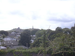
Carn Brea is a civil parish and hilltop site in Cornwall, England, United Kingdom. The population of Carn Brea including Bosleake and Church Coombe was 8,013 at the 2011 census. The hilltop site is situated approximately one mile (1.6 km) southwest of Redruth. The settlements of Bosleake, Brea, Broad Lane, Carn Arthen, Carn Brea Village, Carnkie, Four Lanes, Grillis, Illogan Highway, Pencoys, Penhallick, Piece, Pool, Tolskithy, Tregajorran, Treskillard, Tuckingmill and West Tolgus are in the parish.

Pendeen is a village and ecclesiastical parish on the Penwith peninsula in Cornwall, United Kingdom. It is 3 miles north-northeast of St Just and 7 mi (11 km) west of Penzance. It lies along the B3306 road which connects St Ives to Land's End and the A30 road.

Boscaswell is a village in the extreme west of Cornwall, England, UK. It lies towards the cliffs from Pendeen, looking west across fields to the Atlantic Ocean. Boscaswell lies within the St Just in Penwith division of Cornwall Council. The village consists mainly of terraced cottages, built of granite, and a council house estate. Many of the cottages would once have housed families whose menfolk worked at the Geevor Tin Mine. Higher Boscaswell is a hamlet south-east of Pendeen.

Kelly Rounds, or Castle Killibury is an Iron Age hill fort in Cornwall, England, United Kingdom. It is situated beside the A39 trunk road approximately two miles east of Wadebridge.

Sancreed is a village and civil parish in Cornwall, England, approximately three miles (5 km) west of Penzance.

Manaccan is a civil parish and village on the Lizard peninsula in south Cornwall, England, United Kingdom. The village is about five miles (8 km) south-southwest of Falmouth.

Halliggye Fogou is one of many fogous in Cornwall, England, United Kingdom.

Boscawen-Ûn is a Bronze Age stone circle close to St Buryan in Cornwall, UK. It consists of nineteen upright stones in an ellipse with another, leaning, middle stone just south of the centre. There is a west-facing gap in the circle, which may have formed an entrance. The elliptical circle has diameters 24.9 and 21.9 metres. It is located at grid reference SW412274.

William Copeland Borlase was a British antiquarian and Liberal politician who sat in the House of Commons from 1880 until 1887 when he was ruined by bankruptcy and scandal.
Bosporthennis is a hamlet south of Treen in the civil parish of Zennor on the Penwith peninsula in west Cornwall, England, United Kingdom.

Caer Bran Hill Fort is an archaeological site near Sancreed and Carn Euny Iron Age village, on the Penwith peninsula in Cornwall.

Bartinney Castle is an Iron Age enclosure located in the Penwith Peninsula of Southwest Cornwall, England, United Kingdom, it is surrounded by a circular earthwork standing on a hill surrounded by various archaeological prehistoric remains, including ancient settlements, field systems, tumuli and cairns.

Nine Maidens Downs is a moorland southwest of Four Lanes in Cornwall, England, UK.

A plen-an-gwarry or plain-an-gwary, is a "playing-place" or round, a medieval amphitheatre found in Cornwall. A circular outdoor space used for plays, sports, and public events, the plen-an-gwary was a Cornish variant of a construction style found across Great Britain. Formerly common across Cornwall, only two survive nearly complete today: the Plain in St Just in Penwith and Saint Piran's Round near Perranporth.

Boleigh Fogou is a fogou near St. Buryan in Cornwall. It can be reached via the B3315 Penzance to Land's End road near The Pipers standing stones. Iron Age pottery was found at the fogou along with carvings that may have been brought from elsewhere. It is unusual in structure as it has more than one entranceway.

Craig Weatherhill was a Cornish archaeologist, novelist and writer on the history, archaeology, place names and mythology of Cornwall.


