Digos

Last updated

Digos
City of Digos
DIGOS CITY City Hall (Philippines).JPG
City Hall
Digos Banner.jpg
Digos Davao del Sur.png
Motto: 
HUGPONG DIGOSEÑOS!
Ph locator davao del sur digos.png
Map of Davao del Sur with Digos highlighted
OpenStreetMap
Digos
Philippines location map (square).svg
Red pog.svg
Digos
Location within the Philippines
Coordinates: 6°45′N125°21′E / 6.75°N 125.35°E / 6.75; 125.35
Country Philippines
Region Davao Region
Province Davao del Sur
District Lone district
Founded July 19, 1949
CityhoodSeptember 8, 2000
Barangays 26 (see Barangays)
Government
[1]
  Type Sangguniang Panlungsod
   Mayor Josef F. Cagas
   Vice Mayor Johari G. Baña
   Representative John Tracy F. Cagas
   City Council
Members
   Electorate 120,677 voters (2022)
Area
[2]
  Total287.10 km2 (110.85 sq mi)
Elevation
190 m (620 ft)
Highest elevation
1,979 m (6,493 ft)
Lowest elevation
0 m (0 ft)
Population
 (2020 census) [3]
  Total188,376
  Density660/km2 (1,700/sq mi)
   Households
47,948
Demonym Digoseño
Economy
   Income class 2nd city income class
   Poverty incidence
8.91
% (2021) [4]
   Revenue 1,081 million (2020)
   Assets 2,481 million (2020)
   Expenditure 1,004 million (2020)
   Liabilities 1,284 million (2020)
Service provider
   Electricity Davao del Sur Electric Cooperative (DASURECO)
Time zone UTC+8 (PST)
ZIP code
8002
PSGC
IDD : area code +63(0)82
Native languages Davawenyo
Cebuano
Obo
Kalagan
Tagalog
Ata Manobo
Website www.digoscity.gov.ph

Digos, officially the City of Digos (Cebuano : Dakbayan sa Digos; Filipino : Lungsod ng Digos), is a 1st class component city and capital of the province of Davao del Sur, Philippines. According to the 2020 census, it has a population of 188,376 people. [3]

Contents

The city lies on the western shores of Davao Gulf and southern foothills of Mount Apo on the island of Mindanao, centrally located between the three major cities in Mindanao, Davao City in the north, General Santos in the south and Cotabato City in the west.

It is considered as part of Metropolitan Davao.

It is known for its sweet-juicy 'carabao variety mango,' sold locally and exported abroad, thus being dubbed as the Mango Capital City of the Philippines. It is also considered as The Gate City Of The South.

On September 8, 2000, Digos was converted into a city. [5]

History

In the early days, Digos was a watercourse, a meeting place of inhabitants belonging to the Austronesians who settled along the southern foothills of Mount Apo. The Digos River meets Davao Gulf and it is ideal for fishing and bathing.

Digos was once part of the Sultanate of Maguindanao. During the 1800s, it was under the influence of Datu Bago, a Maguindanaon datu who led the resistance in Davao Region against the Spanish Empire.

During the Spanish Era, a group of natives carrying bows and arrows were approached by some Spaniards traversing the very fertile tracts of land in Davao. One Lopez Jaena Pacheco, a conquistador during the administration of Governor Claveria serving as the head of the group, inquired about the name of the place from the barefooted natives. Believing that the Spaniards were asking where they were bound to, the natives answered "Padigus", which means "to take a bath". Since then the place was identified as Digos.

As a portion of the "food bowl" of the province of Davao del Sur, otherwise known as the Padada Valley, Digos lured many migrants, majority of whom came from the Visayas and Ilocos regions to settle permanently in the area. Before World War II, an enterprising American by the name of N.E. Crumb leased 10.24 km2 and transformed the place into an Abaca Plantation. This became the hub of economic activity in the locality during those days.

Digos was occupied by the Japanese troops in 1942.

In 1945, through the brave efforts of the combined forces of the Philippine Commonwealth Army, the local Davaoeño guerrilla units from the Davao peninsula, and the United States military, the Japanese soldiers were defeated.

Through the initiation of Davao Congressman Apolinario Cabigon, Digos, became a regular municipality of the unified Davao in 1949 by virtue of Presidential Executive Order No. 236, dated July 1, 1949, issued by President Elpidio Quirino. Its coverage included the barrios of Tres de Mayo, Goma Bansalan, Matanao, Darapuay and the Poblacion, where the seat of government was located. [6] Before its creation into a municipality, Digos was a barrio of Santa Cruz, a town 16 kilometers (9.9 mi) away. On July 19, 1949, the town was formally inaugurated with Benito Rabor appointed as Mayor.

On May 8, 1967, the municipality became part of Davao del Sur following Davao's division under Republic Act No. 4867. [7]

Digos in later years, before its conversion into a city, was regarded as the capital town of the Province of Davao del Sur, long before it gained the status of a First-Class Municipality in 1993, being center for trade, commerce and education, accruing to its strategic location at the cross point of two principal thoroughfares in the south.

Cityhood

In July 1998, the bid to convert into a city was moved and initiated by Mayor Arsenio A. Latasa, considering its very satisfactory qualifications required for in R.A. 7160

House Bill No. 5672 dated November 24, 1998, of Congress authored by Davao Del Sur 1st district Congressman Douglas Cagas, led to the drafting of Republic Act No. 8798, converting the Municipality of Digos into a component City of Davao del Sur, which was signed by President Joseph Estrada on July 14, 2000, [8] and ratified by the Digoseños on September 8, 2000.

Geography

Digos shares common boundaries with the municipalities of Hagonoy in the south, Bansalan in the north and northwest by Siranagan and Miral Creek and with Santa Cruz in the northeast. It is bounded in the east by Davao Gulf. It has a total land area of 28,710 hectares (70,900 acres) consisting of 26 barangays; nine (9) of which comprise the poblacion or urban center.

The land topography of Digos ranges from hilly to mountainous in the north-northeast portion and flat and slightly rolling at the coastal barangays, while the urban area and the surrounding barangays in the south portion are generally flat. Generally, climate in Digos falls under the fourth type while wind direction is prevalent from northeast to southwest. On the other hand, rainfall is evenly distributed throughout the year wherein during the period from 1995 to 2000, there was no observed extreme dry or wet season.

Climate

Climate data for Digos
MonthJanFebMarAprMayJunJulAugSepOctNovDecYear
Mean daily maximum °C (°F)30
(86)
30
(86)
31
(88)
32
(90)
31
(88)
30
(86)
29
(84)
30
(86)
30
(86)
30
(86)
30
(86)
29
(84)
30
(86)
Mean daily minimum °C (°F)23
(73)
23
(73)
23
(73)
24
(75)
24
(75)
24
(75)
24
(75)
24
(75)
24
(75)
24
(75)
23
(73)
22
(72)
24
(74)
Average precipitation mm (inches)59
(2.3)
46
(1.8)
41
(1.6)
54
(2.1)
105
(4.1)
159
(6.3)
179
(7.0)
197
(7.8)
162
(6.4)
147
(5.8)
102
(4.0)
65
(2.6)
1,316
(51.8)
Average rainy days1311.712.214.522.625.626.627.525.526.021.216.0242.4
Source: Meteoblue [9]

Barangays

Digos is politically subdivided into 26 barangays. Each barangay consists of puroks while some have sitios.

  • Aplaya
  • Balabag
  • San Jose (Balutakay)
  • Binaton
  • Cogon
  • Colorado
  • Dawis
  • Dulangan
  • Goma
  • Igpit
  • Kiagot
  • Lungag
  • Mahayahay
  • Matti
  • Kapatagan (Rizal)
  • Ruparan
  • San Agustin
  • San Miguel (Odaca)
  • San Roque
  • Sinawilan
  • Soong
  • Tiguman
  • Tres De Mayo
  • Zone 1 (Pob.)
  • Zone 2 (Pob.)
  • Zone 3 (Pob.)

Demographics

Population census of Digos
YearPop.±% p.a.
1960 31,174    
1970 47,588+4.32%
1975 59,533+4.59%
1980 70,065+3.31%
1990 96,806+3.29%
1995 106,565+1.82%
2000 125,171+3.51%
2007 145,514+2.10%
2010 149,891+1.08%
2015 169,393+2.36%
2020 188,376+2.11%
Source: Philippine Statistics Authority [10] [11] [12] [13]

Economy

Poverty incidence of Digos

5
10
15
20
25
30
2006
22.30
2009
18.75
2012
14.72
2015
14.18
2018
5.46
2021
8.91

Source: Philippine Statistics Authority [14] [15] [16] [17] [18] [19] [20] [21]

View of Digos Digos City overlooking (Digos, Davao Del Sur; 08-17-2023).jpg
View of Digos

Agriculture is a major component of Digos's economy. Some 9,330 households or 37% of the total households are dependent on agriculture for their livelihood. Of the total households dependent on agriculture, 91% are engaged in farming and the remaining 9% in fishing. The total area devoted to agriculture covered 8,944.1 hectares (22,101 acres), representing 31% of the total land area of Digos. The more important agricultural crops grown in the area include coconut, sugarcane, mango and banana. Among the agricultural crops, the staple crops rice and corn are the most widely grown.

Government

Elected officials

Members of the Digos City Council (2022–2025):

Culture

Fiestas and festivals

Infrastructure

Intersection of Rizal Avenue (Pan-Philippine Highway) and Roxas Street in the city proper Digos Poblacion, Rizal Avenue-Roxas (Digos, Davao Del Sur; 08-17-2023).jpg
Intersection of Rizal Avenue (Pan-Philippine Highway) and Roxas Street in the city proper

Transportation

Local means of transportation is served by almost 5,000 tricycles known locally as just "Pedicab". Transportation to its barangays and adjacent municipalities are served by single Motorcycles (SKYLAB/HABAL-HABAL), Multicabs, Jeepneys, and L300 Vans. Public Utility Vans also served routes to and from the cities of Davao, Cotabato, Kidapawan, Tacurong-Isulan, Koronadal and General Santos.

Bus Company operating in the city of Digos:

Hospitals/healthcare facilities

  • Digos Doctors Hospital
  • CM Torregosa Birthing Home and Woman Center
  • Medical Center Of Digos Cooperative
  • Gonzales-Maranan Clinics & Hospital
  • Davao del Sur Provincial Hospital
  • Dominican Hospital
  • Sunga Hospital
  • Llanos Medical Clinic & Hospital
  • Paulino Hospital
  • Masongsong Clinic & Hospital
  • Davao del Sur Medical Specialist
  • Digos Medical Multi-test
  • Bethlehem Birthing Center
  • Monarca Lying Inn Clinic
  • Mayor's Birthing Place
  • Kayden-Blaise Birthing Home

Education

Public and private schools in Digos:

Tertiary

Secondary

Digos City National High School Digos City National High School Main Building Facade.jpg
Digos City National High School

Notable personalities

Related Research Articles

<span class="mw-page-title-main">Davao del Sur</span> Province in Davao Region, Philippines

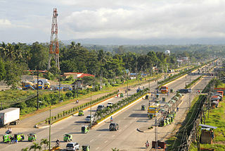
Davao del Sur, officially the Province of Davao del Sur, is a province in the Philippines located in the Davao Region in Mindanao. Its capital is Digos. Davao City is the largest city in terms of area and population within the province's jurisdiction, yet it is administratively independent from the province; as such, Davao City is only grouped for geographical and statistical purposes and serves as the regional center of Davao Region.

<span class="mw-page-title-main">Davao Region</span> Administrative region of the Philippines

Davao Region, formerly called Southern Mindanao, is an administrative region in the Philippines, designated as Region XI. It is situated at the southeastern portion of Mindanao and comprises five provinces: Davao de Oro, Davao del Norte, Davao del Sur, Davao Oriental, and Davao Occidental.

<span class="mw-page-title-main">Soccsksargen</span> Region in Mindanao, Philippines

Soccsksargen, formerly known as Central Mindanao, is an administrative region of the Philippines, designated as Region XII. Located in south-central Mindanao, its name is an acronym that stands for the region's four provinces and one highly urbanized city. The regional center is in Koronadal, located in the province of Cotabato del Sur, and the center of commerce and industry is General Santos, which is the most populous city in the region.

<span class="mw-page-title-main">Cotabato City</span> Independent component city in Maguindanao del Norte, Philippines

Cotabato City, officially the City of Cotabato, is a first class independent component city in the Bangsamoro Autonomous Region in Muslim Mindanao, Philippines. According to the 2020 census, it has a population of 325,079 people, making it as the most populated city under the independent component city status.

<span class="mw-page-title-main">Bislig</span> Component city in Surigao del Sur, Philippines

Bislig, officially the City of Bislig, is a 3rd class component city in the province of Surigao del Sur, Philippines. According to the 2020 census, it has a population of 99,290 people.

<span class="mw-page-title-main">San Francisco, Agusan del Sur</span> Municipality in Agusan del Sur, Philippines

San Francisco, officially the Municipality of San Francisco, is a 1st class municipality in the province of Agusan del Sur, Philippines. According to the 2020 census, it has a population of 80,760 people.

<span class="mw-page-title-main">Tacurong</span> Component city in Sultan Kudarat, Philippines

Tacurong, officially the City of Tacurong, is a 4th class component city in the province of Sultan Kudarat, Philippines. According to the 2020 census, it has a population of 109,319 people.

<span class="mw-page-title-main">Santo Tomas, Davao del Norte</span> Municipality in Davao del Norte, Philippines

Santo Tomas, officially the Municipality of Santo Tomas, is a 1st class municipality in the province of Davao del Norte, Philippines. According to the 2020 census, it has a population of 128,667 people.

<span class="mw-page-title-main">Bayang</span> Municipality in Lanao del Sur, Philippines

Bayang, officially the Municipality of Bayang, is a 5th class municipality in the province of Lanao del Sur, Philippines. According to the 2020 census, it has a population of 28,023 people.

<span class="mw-page-title-main">Bansalan</span> Municipality in Davao del Sur, Philippines

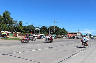
Bansalan, officially the Municipality of Bansalan, is a 1st class municipality in the province of Davao del Sur, Philippines. According to the 2020 census, it has a population of 62,737 people.

<span class="mw-page-title-main">Hagonoy, Davao del Sur</span> Municipality in Davao del Sur, Philippines

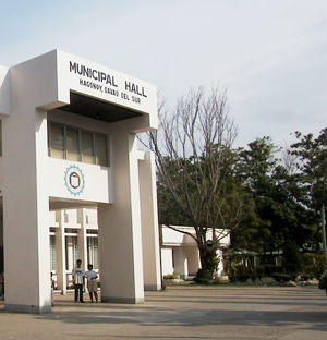
Hagonoy, officially the Municipality of Hagonoy, is a 3rd class municipality in the province of Davao del Sur, Philippines. According to the 2020 census, it has a population of 56,919 people.

<span class="mw-page-title-main">Jose Abad Santos, Davao Occidental</span> Municipality in Davao Occidental, Philippines

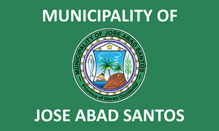
Jose Abad Santos, officially the Municipality of Jose Abad Santos, is a 1st class municipality in the province of Davao Occidental, Philippines. According to the 2020 census, it has a population of 73,381 people.

<span class="mw-page-title-main">Magsaysay, Davao del Sur</span> Municipality in Davao del Sur, Philippines

Magsaysay, officially the Municipality of Magsaysay, is a 3rd class municipality in the province of Davao del Sur, Philippines. According to the 2020 census, it has a population of 56,263 people.

<span class="mw-page-title-main">Malalag</span> Municipality in Davao del Sur, Philippines

Malalag, officially the Municipality of Malalag, is a 2nd class municipality in the province of Davao del Sur, Philippines. According to the 2020 census, it has a population of 40,158 people.

<span class="mw-page-title-main">Malita</span> Capital of Davao Occidental, Philippines

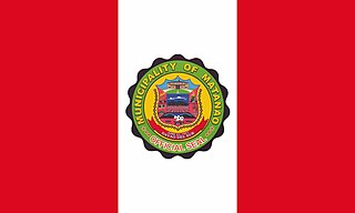
Malita, officially the Municipality of Malita, is a 1st class municipality and capital of the province of Davao Occidental, Philippines. According to the 2020 census, it has a population of 118,197 people making it the most populous town in the province.

<span class="mw-page-title-main">Matanao</span> Municipality in Davao del Sur, Philippines

Matanao, officially the Municipality of Matanao, is a 2nd class municipality in the province of Davao del Sur, Philippines. At the 2020 census it had a population of 60,493 people. It is situated on the island of Mindanao, the second-largest and southernmost major island in the Philippines.

<span class="mw-page-title-main">Padada</span> Municipality in Davao del Sur, Philippines

Padada, officially the Municipality of Padada, is a 3rd class municipality in the province of Davao del Sur, Philippines. According to the 2020 census, it has a population of 29,878 people, making it the least populated municipality in the province.

<span class="mw-page-title-main">Santa Cruz, Davao del Sur</span> Municipality in Davao del Sur, Philippines

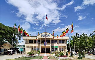
Santa Cruz, officially the Municipality of Santa Cruz, is a 1st class municipality in the province of Davao del Sur, Philippines. According to the 2020 census, it has a population of 101,125 people.

<span class="mw-page-title-main">Sulop</span> Municipality in Davao del Sur, Philippines

Sulop, officially the Municipality of Sulop, is a 3rd class municipality in the province of Davao del Sur, Philippines. According to the 2020 census, it has a population of 35,151 people.

<span class="mw-page-title-main">Davao Occidental</span> Province in Davao Region, Philippines

Davao Occidental, officially the Province of Davao Occidental, is a province in the Philippines located in the Davao Region in Mindanao. Its capital is the municipality of Malita, the most populous town in the province. To the east lies Davao Gulf. It also shares a maritime border with the Indonesian province of North Sulawesi to the south.

References

  1. City of Digos | (DILG)
  2. "2015 Census of Population, Report No. 3 – Population, Land Area, and Population Density" (PDF). Philippine Statistics Authority. Quezon City, Philippines. August 2016. ISSN   0117-1453. Archived (PDF) from the original on May 25, 2021. Retrieved July 16, 2021.
  3. 1 2 Census of Population (2020). "Region XI (Davao Region)". Total Population by Province, City, Municipality and Barangay. Philippine Statistics Authority . Retrieved July 8, 2021.
  4. "PSA Releases the 2021 City and Municipal Level Poverty Estimates". Philippine Statistics Authority. April 2, 2024. Retrieved April 28, 2024.
  5. NSCB - 2001 Factsheet - 12 New Cities Created Archived April 23, 2006, at the Wayback Machine , July–December 2000.
  6. Executive Order No. 236 (July 1, 1949), Organizing the Municipalities of Digos, Padada, and Panabo, in the Province of Davao, The Lawphil Project, retrieved July 27, 2024
  7. Republic Act No. 4867 (May 8, 1967), An Act Creating the Provinces of Davao del Norte, Davao del Sur and Davao Oriental, The Lawphil Project, retrieved July 26, 2024
  8. Republic Act No. 8798 (July 15, 2000), An Act Converting the Municipality of Digos, Davao Del Sur Province, Into a Component City to Be Known as the City of Digos, The Lawphil Project, retrieved July 27, 2024
  9. "Digos: Average Temperatures and Rainfall". Meteoblue. Retrieved January 28, 2020.
  10. Census of Population (2015). "Region XI (Davao Region)". Total Population by Province, City, Municipality and Barangay. Philippine Statistics Authority . Retrieved June 20, 2016.
  11. Census of Population and Housing (2010). "Region XI (Davao Region)" (PDF). Total Population by Province, City, Municipality and Barangay. National Statistics Office . Retrieved June 29, 2016.
  12. Censuses of Population (1903–2007). "Region XI (Davao Region)". Table 1. Population Enumerated in Various Censuses by Province/Highly Urbanized City: 1903 to 2007. National Statistics Office.
  13. "Province of Davao del Sur". Municipality Population Data. Local Water Utilities Administration Research Division. Retrieved December 17, 2016.
  14. "Poverty incidence (PI):". Philippine Statistics Authority. Retrieved December 28, 2020.
  15. "Estimation of Local Poverty in the Philippines" (PDF). Philippine Statistics Authority. November 29, 2005.
  16. "2003 City and Municipal Level Poverty Estimates" (PDF). Philippine Statistics Authority. March 23, 2009.
  17. "City and Municipal Level Poverty Estimates; 2006 and 2009" (PDF). Philippine Statistics Authority. August 3, 2012.
  18. "2012 Municipal and City Level Poverty Estimates" (PDF). Philippine Statistics Authority. May 31, 2016.
  19. "Municipal and City Level Small Area Poverty Estimates; 2009, 2012 and 2015". Philippine Statistics Authority. July 10, 2019.
  20. "PSA Releases the 2018 Municipal and City Level Poverty Estimates". Philippine Statistics Authority. December 15, 2021. Retrieved January 22, 2022.
  21. "PSA Releases the 2021 City and Municipal Level Poverty Estimates". Philippine Statistics Authority. April 2, 2024. Retrieved April 28, 2024.
  22. Karlo Sacamos (April 25, 2019). "Scottie bought Digos lot with first Ginebra paycheck. His dream house now sits there". Spin.ph. Sports Interactive Network (SPIN.PH). Retrieved January 6, 2020.