Hurricane Beryl makes landfall in Texas as Category 1 storm
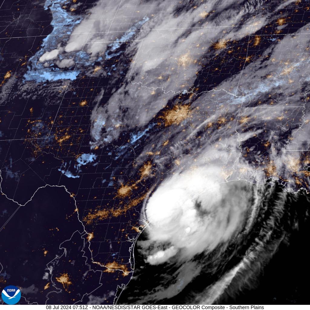
Hurricane Beryl has roared ashore, making landfall around Matagorda, Texas, at 3:50 a.m. CT Monday as a Category 1 hurricane with gusts over 80 mph.
Over the coming hours, Beryl will continue to move inland, bringing flooding rains, life-threatening storm surge, damaging wind gusts, and the threat of tornadoes.
The cyclone’s powerful hurricane-force winds could lead to power outages and property damage.
Already, gusts have hit 91 mph in Freeport, 89 mph in Matagorda Bay, 85 mph in Matagorda City, and 81 mph in Palacios.
More than 90,000 electrical customers in Texas have already lost power.
Numerous hurricane warnings, storm surge warnings, and tropical storm warnings were posted ahead of the storm’s arrival and are still in effect on the Texas Gulf Coast.
Storm surge is forecast to reach 3-7 feet in some spots near Beryl, and water was already pushing into the Texas coast and bays along Beryl’s approach.
Measurements have reached 3.2 feet in Sargent and 2.6 feet in Matagorda Bay as of 2:30 a.m. CT.
“That (storm) surge is just pouring into Treasure Island,” said FOX Weather Storm Tracker Mark Sudduth. “You could literally see it pouring in like a raging river right now.”

The ferocious gusts are blasting torrential rainfall falling at rates of 2-4 inches an hour.
“It feels like the entire backs of my legs are on fire because it stings,” FOX Weather Meteorologist Britta Merwin said as she reported live from Surfside Beach, Texas early Monday morning. “The raindrops almost turn into a needle head. Almost like, as if you were getting a tattoo. Like, it’s that kind of feel of that persistent needle pressure against your skin.”
Forecast for Beryl
Hurricane-force winds over 74 mph are likely to continue near the storm’s center – which is forecast to pass near the Houston metro area later Monday morning – with tropical storm-force gusts of 40 mph or more stretching 115 miles out from Beryl’s center.
Much of East Texas could see 5–10 inches of rain, with localized amounts up to 15 inches by the time Beryl moves out.
The Houston area is currently forecast to receive 5–8 inches of rain, with heavier amounts in the southern and western suburbs.

Meteorologists with the National Weather Service office in Corpus Christi, Texas, said any of the outer rain bands could also produce tropical storm-force gusts and even spin up an isolated tornado.
As Beryl continues northward, it’ll bring rain and strong winds as far north as Michigan by the end of the workweek.
Beryl’s current forecast cone shows the storm will weaken as it moves north but maintains tropical depression strength from Arkansas through Michigan throughout the week.
A tropical depression is a cyclone with maximum sustained winds of 38 mph or less.

Unlike tropical storms and hurricanes, tropical depressions are identified by numbers rather than names.
The Weather Prediction Center outlined an area from Arkansas through central Illinois that could see flash flooding Tuesday into Wednesday.


Beryl’s destructive past
Beryl formed on June 29 and became the season’s first hurricane. After it rapidly intensified across the Atlantic and into the Caribbean, the storm broke multiple records throughout its trek.
Beryl made its first landfall as an extremely dangerous Category 4 hurricane on Carriacou Island on Monday, July 1.
Just hours after pummeling the Windward Islands, Beryl continued strengthening, reaching Category 5 strength Monday evening.

Beryl shattered the record for the earliest Category 5 hurricane observed in the Atlantic basin.
Beryl continued through the Caribbean Sea, making a close pass to Jamaica on Wednesday, where Jamaica’s Prime Minister Andrew Holness was forced to declare the island a disaster area.
Beryl produced massive waves along the coast in Kingston as Beryl moved miles off the Jamaican coast. Storm surge sent water rushing into Kingston as Beryl passed the island.
Hurricane Beryl continued, heading straight for Mexico’s Yucatán Peninsula.

By early Saturday morning, Beryl made its second official landfall just northeast of Tulum at 6:05 a.m. ET as a strong Category 2 hurricane with peak winds estimated at 110 mph.
The hurricane dropped torrential rains, and brought storm surge to some of Mexico’s popular tourist destinations.
Even though the Yucatán Peninsula weakened the blow, Beryl still managed to emerge over the southwestern Gulf of Mexico Saturday, where it continued to move northward through the weekend.
Texas was Beryl’s third and final landfall before the storm is forecast to deteriorate as it moves northward through the US.
Beryl has killed at least 10 people as it made its journey across the Caribbean.