Landkreis Würzburg
Jump to navigation
Jump to search
rural district in Lower Franconia, Bavaria, Germany | |||||
| Upload media | |||||
| Instance of |
| ||||
|---|---|---|---|---|---|
| Location | Lower Franconia, Bavaria, Germany | ||||
| Capital | |||||
| Head of government |
| ||||
| Inception |
| ||||
| Population |
| ||||
| Area |
| ||||
| Elevation above sea level |
| ||||
| official website | |||||
 | |||||
Situierung
[edit]-
Lage in Deutschland
-
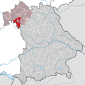
Lage in Bayern
Kommunen
[edit]-
Sämtliche Kommunen
Städte
[edit]Aub
[edit]Main gallery: Aub.
Main category: Aub
-
Lage im Landkreis
-
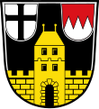
Wappen
-
Marktplatz
-
Ortsansicht 1523
-
Hauseingang am Marktplatz aus der Echterzeit (Julius Echter von Mespelbrunn)
-
Stadtmauer
-
Verfallener Wehrturm
-
Wehrturm der Stadtmauer
-
Schloss Aub
-
Bergfried von Schloss Aub
-
Burg- und Kirchturm hinter der Stadtmauer
-
Wappen am Spital, zentral Julius Echter von Mespelbrunn]], links Truchseß von Baldersheim, rechts Familie von Rosenberg
Eibelstadt
[edit]Main category: Eibelstadt
-
Lage im Landkreis
-
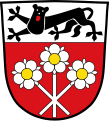
Wappen
-
Ortsansicht
-
Stadtmauer südlich und Unteres Tor
Ochsenfurt
[edit]Main category: Ochsenfurt
-
Lage im Landkreis
-
Wappen
-
Marktplatz
-
Fähre
-
1623
Röttingen
[edit]Main category: Röttingen
-
Lage im Landkreis
-
Wappen
-
Rathaus
-
Röttinger Käppele
-
Schneckenturm mit Haus in der Erbsengasse
-
Stadttor
Märkte
[edit]Bütthard
[edit]Main category: Bütthard
-
Lage im Landkreis
-
Wappen
Eisenheim
[edit]Main category: Eisenheim
-
Lage im Landkreis
-
Wappen
Frickenhausen am Main
[edit]Main gallery: Frickenhausen am Main.
Main category: Frickenhausen am Main
-
Lage im Landkreis
-
Wappen
-
Rathaus
-
Ortsansicht
Gelchsheim
[edit]Main category: Gelchsheim
-
Lage im Landkreis
-
Wappen
-
Rathaus
Giebelstadt
[edit]Main category: Giebelstadt
-
Lage im Landkreis
-
Wappen
Helmstadt
[edit]Main category: Helmstadt
-
Lage im Landkreis
-
Wappen
-
Helmstadt, katholische Pfarrkirche St. Martin, spätbarocker Chorflankenturm mit Apsis aus dem Jahr 1723
-
St. Ägidius (Holzkirchhausen); die katholische Kuratiekirche St. Ägidius ist ein Saalbau mit Dachreiter als Glockenturm, entstanden in den Jahren 1712 bis 1713
Giebelstadt
[edit]Main category: Giebelstadt
-
Lage im Landkreis
-
Wappen
-
Giebelstadt und der Flugplatz von oben
Höchberg
[edit]Main category: Höchberg
-
Lage im Landkreis
-
Wappen
-
Pfarrkirche Mariä Geburt in Höchberg
-
Doppelwohnhaus (Sonnemannstraße 25—27)
Neubrunn
[edit]Main category: Neubrunn (Lower Franconia)
-
Lage im Landkreis
-
Wappen
Randersacker
[edit]Main category: Randersacker
-
Lage im Landkreis
-
Ortsansicht
-
Weinberge
Reichenberg
[edit]Main category: Reichenberg (Lower Franconia)
-
Lage im Landkreis
-
Wappen
-
Schloss
Remlingen
[edit]Main category: Remlingen (Lower Franconia)
-
Lage im Landkreis
-
Wappen
-
Ehemaliges Castellsches Schloss (Schloßberg 1)
-
Schloßgasse 2, sogenanntes Hirschengelände
Rimpar
[edit]Main category: Rimpar
-
Lage im Landkreis
-
Wappen
-
Schloss Grumbach
Sommerhausen
[edit]Main category: Sommerhausen
-
Lage im Landkreis
-
Wappen
Winterhausen
[edit]Main category: Winterhausen
-
Lage im Landkreis
-
Wappen
Zell am Main
[edit]Main category: Zell am Main
-
Lage im Landkreis
-
Wappen
-
um 1847
sonstige Gemeinden
[edit]-
AltertheimMain category: Altertheim
-
BergtheimMain category: Bergtheim
-
BieberehrenMain category: Bieberehren
-
EisingenMain category: Eisingen (Bavaria)
-
ErlabrunnMain category: Erlabrunn
-
EstenfeldMain category: Estenfeld
-
GaukönigshofenMain category: Gaukönigshofen
-
GerbrunnMain category: Gerbrunn
-
GeroldshausenMain category: Geroldshausen
-
GreußenheimMain category: Greußenheim
-
GünterslebenMain category: Güntersleben
-
HettstadtMain category: Hettstadt
-
HolzkirchenMain category: Holzkirchen (Lower Franconia)
-
KirchheimMain category: Kirchheim (Lower Franconia)
-
KistMain category: Kist
-
KleinrinderfeldMain category: Kleinrinderfeld
-
KürnachMain category: Kürnach
-
LeinachMain category: Leinach
-
MargetshöchheimMain category: Margetshöchheim
-
OberpleichfeldMain category: Oberpleichfeld
-
ProsselsheimMain category: Prosselsheim
-
RiedenheimMain category: Riedenheim
-
RottendorfMain category: Rottendorf
-
SonderhofenMain category: Sonderhofen
-
TauberrettersheimMain category: Tauberrettersheim
-
TheilheimMain category: Theilheim
-
ThüngersheimMain category: Thüngersheim
-
UettingenMain category: Uettingen
-
UnterpleichfeldMain category: Unterpleichfeld
-
VeitshöchheimMain category: Veitshöchheim
-
Waldbrunn (Unterfranken)Main category: Waldbrunn (Lower Franconia)
-
WaldbüttelbrunnMain category: Waldbüttelbrunn
Urban districts (cities): Amberg · Ansbach · Aschaffenburg · Augsburg · Bamberg · Bayreuth · Coburg · Erlangen · Fürth · Hof · Ingolstadt · Kaufbeuren · Kempten · Landshut · Memmingen · Munich · Nuremberg · Passau · Regensburg · Rosenheim · Schwabach · Schweinfurt · Straubing · Weiden in der Oberpfalz · Würzburg




![Wappen am Spital, zentral Julius Echter von Mespelbrunn]], links Truchseß von Baldersheim, rechts Familie von Rosenberg](https://upload.wikimedia.org/wikipedia/commons/thumb/0/09/Aub04.jpg/120px-Aub04.jpg)

