File:Greater China Rapid Transit.svg

Original file (SVG file, nominally 1,270 × 787 pixels, file size: 350 KB)
Captions
Captions
Summary
[edit]| DescriptionGreater China Rapid Transit.svg |
English: Map of Greater China with cities operating/under construction/planning a Rapid Transit
|
| Date |
4 October 2009 (first version) 2 August 2019 (current version) |
| Source | File:China provinces numbered with regional colors.svg |
| Author | ASDFGH |
| Other versions |
For Chinese version see
China
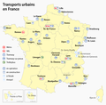
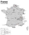
Czech Republic France
Germany
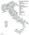
Italy
Japan
Korea Poland
Spain & Portugal
Turkey
British Isles Former Soviet Union
Balkans
North Africa
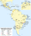
Latin America
United States of America
|
Licensing
[edit]- You are free:
- to share – to copy, distribute and transmit the work
- to remix – to adapt the work
- Under the following conditions:
- attribution – You must give appropriate credit, provide a link to the license, and indicate if changes were made. You may do so in any reasonable manner, but not in any way that suggests the licensor endorses you or your use.
- share alike – If you remix, transform, or build upon the material, you must distribute your contributions under the same or compatible license as the original.

|
Permission is granted to copy, distribute and/or modify this document under the terms of the GNU Free Documentation License, Version 1.2 or any later version published by the Free Software Foundation; with no Invariant Sections, no Front-Cover Texts, and no Back-Cover Texts. A copy of the license is included in the section entitled GNU Free Documentation License.http://www.gnu.org/copyleft/fdl.htmlGFDLGNU Free Documentation Licensetruetrue |
Original upload log
[edit]Transferred from en.wikipedia to Commons by Sreejithk2000 using CommonsHelper.
- 2009-10-04 00:53 ASDFGH 857×699× (235105 bytes)
- 2009-10-04 00:48 ASDFGH 857×699× (215440 bytes) {{Information |Description=map of Greater China with cities operating/under construction/planning a Rapid Transit * Red = Operating * Blue = Under Construction * Green = Planning |Source=[[:File:China provinces numbered with regional colors.
File history
Click on a date/time to view the file as it appeared at that time.
| Date/Time | Thumbnail | Dimensions | User | Comment | |
|---|---|---|---|---|---|
| current | 15:41, 31 December 2019 |  | 1,270 × 787 (350 KB) | Furfur (talk | contribs) | +Hohhot |
| 17:49, 10 December 2019 |  | 1,270 × 787 (512 KB) | Furfur (talk | contribs) | + Macau | |
| 19:18, 27 November 2019 |  | 1,270 × 787 (511 KB) | Furfur (talk | contribs) | error correction | |
| 20:01, 26 November 2019 |  | 1,270 × 787 (511 KB) | Furfur (talk | contribs) | update: Changzhou, Xuzhou | |
| 19:25, 2 August 2019 |  | 1,270 × 787 (505 KB) | Furfur (talk | contribs) | update | |
| 02:40, 18 January 2016 |  | 1,130 × 700 (621 KB) | SSYoung (talk | contribs) | Update Nanchang | |
| 03:33, 23 December 2015 |  | 1,130 × 700 (621 KB) | SSYoung (talk | contribs) | Update Qingdao | |
| 08:23, 13 November 2014 |  | 1,130 × 700 (615 KB) | ASDFGH (talk | contribs) | update | |
| 00:57, 3 July 2014 |  | 857 × 699 (473 KB) | ASDFGH (talk | contribs) | update Wuxi | |
| 02:49, 3 June 2014 |  | 857 × 699 (476 KB) | Siyuwj (talk | contribs) | Update Ningbo |
You cannot overwrite this file.
File usage on Commons
The following 49 pages use this file:
- User:Chumwa/OgreBot/Potential transport maps/2016 January 11-20
- User:Chumwa/OgreBot/Potential transport maps/2019 August 1-10
- User:Chumwa/OgreBot/Potential transport maps/2019 December 1-10
- User:Chumwa/OgreBot/Potential transport maps/2019 November 21-30
- User:Chumwa/OgreBot/Public transport information/2015 December 21-31
- User:Chumwa/OgreBot/Public transport information/2016 January 11-20
- User:Chumwa/OgreBot/Public transport information/2019 August 1-10
- User:Chumwa/OgreBot/Public transport information/2019 December 1-10
- User:Chumwa/OgreBot/Public transport information/2019 November 21-30
- User:Chumwa/OgreBot/Transport Maps/2015 December 21-31
- User:Chumwa/OgreBot/Transport Maps/2016 January 11-20
- User:Chumwa/OgreBot/Transport Maps/2019 August 1-10
- User:Chumwa/OgreBot/Transport Maps/2019 December 1-10
- User:Chumwa/OgreBot/Transport Maps/2019 November 21-30
- User:Chumwa/OgreBot/Travel and communication maps/2016 January 11-20
- User:Chumwa/OgreBot/Travel and communication maps/2019 August 1-10
- User:Chumwa/OtherVersions - OePNV-Karten
- File:Carte des transports urbains en France.png
- File:Greater China Rapid Transit.svg
- File:Karte der ÖPNV-Systeme in Deutschland 2008.png
- File:Karte der ÖPNV-Systeme in Lateinamerika.png
- File:Karte der ÖPNV-Systeme in Nordafrika.png
- File:Karte der ÖPNV-Systeme in Spanien und Portugal.png
- File:Karte der ÖPNV-Systeme in den Staaten der ehemaligen Sowjetunion.png
- File:Karte der ÖPNV-Systeme in den USA.png
- File:Karte ÖPNV-Systeme in Italien.png
- File:Karte ÖPNV-Systeme in der Türkei.png
- File:Metro, tram a trolejbusy v ČR.jpg
- File:Metro map of China.svg
- File:Núcleos de Cercanías de Renfe.svg
- File:OePNVSystemeDeutschland.png
- File:OePNVSystemeDeutschlandJanuar2003.jpg
- File:OePNVSystemeFrankreich-fr.png
- File:OePNVSystemeFrankreich.png
- File:OePNVSystemeJapanJanuar2003.png
- File:OePNVSystemePolenMai2007.png
- File:Public transport system map of the USA.png
- File:Public transport systems of Italy.png
- File:Rail networks USA map.svg
- File:Réseaux de trolleybus en France.png
- File:Transports urbains de France.png
- File:Tranvía en España.svg
- File:ÖPNV-System in den Benelux-Staaten.png
- File:ÖPNV-Systeme Tschechische Republik.png
- File:ÖPNV-Systeme auf den Britischen Inseln.png
- File:ÖPNV-Systeme in China.png
- File:ÖPNV-Systeme in Korea.png
- File:ÖPNV-Systeme in Südosteuropa.png
- File:ÖPNV-Südkorea de.svg
File usage on other wikis
The following other wikis use this file:
- Usage on en.wikipedia.org
- Usage on zh.wikipedia.org
Metadata
This file contains additional information such as Exif metadata which may have been added by the digital camera, scanner, or software program used to create or digitize it. If the file has been modified from its original state, some details such as the timestamp may not fully reflect those of the original file. The timestamp is only as accurate as the clock in the camera, and it may be completely wrong.
| Width | 1270px |
|---|---|
| Height | 787.1px |


