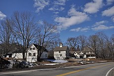
Category:Danville, New Hampshire
Jump to navigation
Jump to search
| Object location | | View all coordinates using: OpenStreetMap |
|---|
town in Rockingham County, New Hampshire, United States | |||||
| Upload media | |||||
| Instance of | |||||
|---|---|---|---|---|---|
| Location | Rockingham County, New Hampshire | ||||
| Inception |
| ||||
| Population |
| ||||
| Area |
| ||||
| Elevation above sea level |
| ||||
| official website | |||||
 | |||||
Subcategories
This category has only the following subcategory.
Media in category "Danville, New Hampshire"
The following 10 files are in this category, out of 10 total.
-
Danville Meeting House.JPG 5,184 × 3,456; 8.09 MB
-
Danville Town Hall 1.JPG 5,184 × 3,456; 7 MB
-
DanvilleNH ElmFarm.jpg 1,024 × 680; 202 KB
-
DanvilleNH JohnElkinsFarmstead.jpg 1,024 × 680; 259 KB
-
DanvilleNH TownHallAndFireStation.jpg 1,024 × 680; 247 KB
-
Interior Danville meeting house.jpg 3,008 × 2,000; 2.6 MB
-
Post Office, Danville NH.jpg 5,472 × 3,648; 6.23 MB
-
Rockingham-Danville-NH.png 600 × 481; 12 KB
-
Town Hall, Danville NH.jpg 3,264 × 2,448; 2.01 MB


