Category:Grendon, Northamptonshire
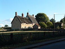
English: Grendon is a village and civil parish in the North Northamptonshire district, in the county of Northamptonshire, England.
village and civil parish in Northamptonshire, England, UK | |||||
| Upload media | |||||
| Instance of | |||||
|---|---|---|---|---|---|
| Location | North Northamptonshire, Northamptonshire, East Midlands, England | ||||
| Population |
| ||||
| Said to be the same as | Grendon (Wikimedia duplicated page, civil parish) | ||||
 | |||||
Subcategories
This category has the following 2 subcategories, out of 2 total.
G
H
Media in category "Grendon, Northamptonshire"
The following 67 files are in this category, out of 67 total.
-
3 year old hedge in Grendon.JPG 1,875 × 1,275; 878 KB
-
Blackmile Lane byway to Strixton - geograph.org.uk - 6144020.jpg 1,600 × 1,066; 385 KB
-
Bridleway and lane coming from the watersports centre - geograph.org.uk - 6145270.jpg 1,600 × 1,066; 460 KB
-
Byway heading away from Strixton Plantation - geograph.org.uk - 3169896.jpg 2,560 × 1,920; 986 KB
-
Byway road sign.JPG 2,048 × 1,536; 458 KB
-
Byway to Strixton - geograph.org.uk - 6145297.jpg 1,600 × 1,066; 347 KB
-
Chequers Lane, Grendon - geograph.org.uk - 2545856.jpg 1,496 × 1,122; 770 KB
-
Conveyor belt in the quarrying works - geograph.org.uk - 5989238.jpg 1,600 × 1,066; 339 KB
-
Cottages and flowers on Chequers Lane - geograph.org.uk - 5851890.jpg 1,600 × 1,066; 366 KB
-
Dry Stone Wall - Blackmile Lane, Grendon, Northamptonshire.jpg 2,048 × 1,536; 545 KB
-
Entering Grendon - geograph.org.uk - 6144022.jpg 1,600 × 1,066; 378 KB
-
Footpath in the paddock - geograph.org.uk - 5851950.jpg 1,600 × 1,066; 527 KB
-
Footpath into Grendon - geograph.org.uk - 6143976.jpg 1,600 × 1,066; 428 KB
-
Footpath into Grendon - geograph.org.uk - 6145287.jpg 1,600 × 1,066; 512 KB
-
Footpath to the church - geograph.org.uk - 5851865.jpg 1,600 × 1,066; 463 KB
-
Footpath to Yardley Road - geograph.org.uk - 5851947.jpg 1,600 × 1,066; 580 KB
-
Footpath towards Grendon - geograph.org.uk - 5989236.jpg 1,600 × 1,066; 499 KB
-
Footpath towards Grendon - geograph.org.uk - 5989253.jpg 1,600 × 1,066; 454 KB
-
Footpath towards Grendon - geograph.org.uk - 6143980.jpg 1,600 × 1,066; 490 KB
-
Footpath towards Strixton - geograph.org.uk - 5851952.jpg 1,600 × 1,066; 595 KB
-
Footpath towards the substation - geograph.org.uk - 6144024.jpg 1,600 × 1,066; 556 KB
-
Former Crown Inn, Grendon - geograph.org.uk - 3536203.jpg 4,320 × 3,240; 2.88 MB
-
Gre3ndonAM.jpg 604 × 453; 52 KB
-
MainRdGrendon.JPG 2,048 × 1,536; 657 KB
-
Grendon - geograph.org.uk - 6921672.jpg 4,000 × 3,000; 2.49 MB
-
Grendon Electricity Sub Station - geograph.org.uk - 141037.jpg 640 × 480; 74 KB
-
Grendon, Northamptonshire byway.jpg 2,048 × 1,536; 703 KB
-
GRENDON.JPG 2,048 × 1,536; 594 KB
-
GrendonCottages.jpg 1,536 × 2,048; 536 KB
-
Half Moon public House, Grendon, Northants, England (2005).jpg 1,236 × 807; 207 KB
-
Hedge1.jpg 1,195 × 1,481; 623 KB
-
House opposite St Mary's church, Grendon - geograph.org.uk - 3536213.jpg 4,320 × 3,240; 2.86 MB
-
Lower End, Northants - geograph.org.uk - 5161796.jpg 640 × 480; 60 KB
-
Lower End, Northants - geograph.org.uk - 5161798.jpg 640 × 480; 64 KB
-
Newly planted hedge in Grendon.JPG 1,195 × 1,481; 496 KB
-
OldForgeCottage.JPG 3,332 × 1,916; 1.74 MB
-
Paths around Lower End - geograph.org.uk - 5161799.jpg 640 × 480; 78 KB
-
Paths around Lower End - geograph.org.uk - 5161800.jpg 640 × 480; 54 KB
-
Paths around Lower End - geograph.org.uk - 5161801.jpg 640 × 480; 112 KB
-
Paths around Lower End - geograph.org.uk - 5161802.jpg 640 × 480; 39 KB
-
Paths around Lower End - geograph.org.uk - 5161803.jpg 640 × 480; 98 KB
-
Paths around Lower End - geograph.org.uk - 5161842.jpg 640 × 480; 107 KB
-
Paths around Strixton - geograph.org.uk - 5161804.jpg 640 × 480; 66 KB
-
Playground undergoing refurbishment - geograph.org.uk - 5851863.jpg 1,600 × 1,066; 432 KB
-
Pylons by the road to the watersports centre - geograph.org.uk - 6144007.jpg 1,066 × 1,600; 276 KB
-
St Mary's church from the footpath - geograph.org.uk - 5851882.jpg 1,066 × 1,600; 311 KB
-
Stile on the path to Strixton - geograph.org.uk - 5851954.jpg 1,600 × 1,066; 497 KB
-
Stream looking south - geograph.org.uk - 6145293.jpg 1,066 × 1,600; 420 KB
-
Tea break - geograph.org.uk - 3169917.jpg 2,560 × 1,920; 1.05 MB
-
The Half Moon, Grendon - geograph.org.uk - 2545847.jpg 1,496 × 1,122; 476 KB
-
The road to Grendon - geograph.org.uk - 5851818.jpg 1,600 × 1,066; 397 KB
-
The road to Long Lodge Farm - geograph.org.uk - 6143965.jpg 1,600 × 1,066; 497 KB
-
TheOldForge.JPG 2,304 × 3,456; 4.5 MB
-
Trees by Yardley Road - geograph.org.uk - 5851827.jpg 1,600 × 1,066; 460 KB
-
Woodland by the quarrying works - geograph.org.uk - 5989256.jpg 1,600 × 1,066; 419 KB
-
Woods Castle Ashby - geograph.org.uk - 722480.jpg 480 × 640; 73 KB
-
Byway - geograph.org.uk - 141033.jpg 640 × 480; 102 KB
-
Byway past Strixton Plantation - geograph.org.uk - 141029.jpg 640 × 480; 131 KB
-
Footpath-Farm Track - geograph.org.uk - 141038.jpg 640 × 480; 95 KB
-
Grendon - geograph.org.uk - 141204.jpg 640 × 480; 100 KB
-
Grendon Hall - geograph.org.uk - 141186.jpg 640 × 467; 98 KB
-
Inside a Ruin - geograph.org.uk - 141219.jpg 640 × 466; 107 KB
-
Lower End - geograph.org.uk - 141035.jpg 640 × 480; 103 KB
-
Parish Boundary Brook - geograph.org.uk - 140812.jpg 640 × 480; 84 KB
-
Ruined Farm Buildings - geograph.org.uk - 141211.jpg 640 × 467; 94 KB
-
The Old Lodge - geograph.org.uk - 146927.jpg 640 × 480; 124 KB
-
Young Oil Seed Rape Crop - geograph.org.uk - 141031.jpg 640 × 480; 93 KB


