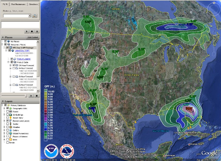
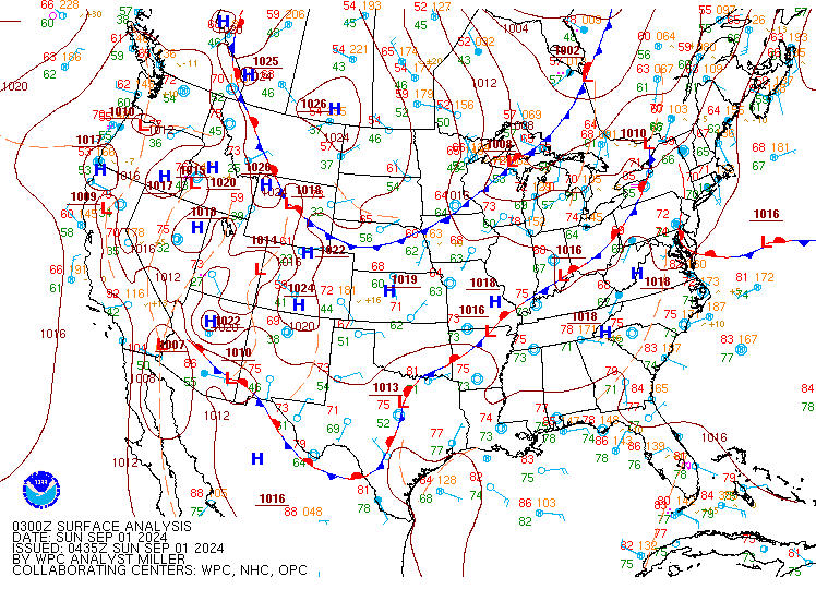
Excessive Rainfall Discussion
NWS Weather Prediction Center College Park MD
825 PM EDT Sun Sep 1 2024
Day 1
Valid 01Z Mon Sep 02 2024 - 12Z Mon Sep 02 2024
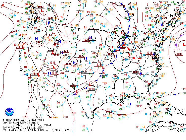
...THERE IS A SLIGHT RISK OF EXCESSIVE RAINFALL FROM SOUTHEASTERN
VIRGINIA THROUGH EAST-CENTRAL NORTH CAROLINA...
...01Z Update...
...Southern Mid-Atlantic to southern Appalachians...
Slight Risk expanded to central NC given training scenario with a
near parallel-stratiform MCS approaching Raleigh which was hit with
heavy rain this afternoon. A moist pre-frontal environment with PW
of 2.0 to 2.2 inches (according to SPC Mesoanalysis/RAP) is being
reinforced with southerly flow this evening. The slow- moving but
potent cold front will emerge out of the central Appalachians
overnight and slowly push activity east over Hampton Roads and
eastern NC which saw heavy rains in recent days and is still
draining, resulting in depressed FFG values in the area.
Some activity over the southern Appalachians and Piedmont east over
northern GA and SC may organize a bit in the low shear environment
and lead to additional isolated flooding where a Marginal Risk
persists.
...Upper Texas Coast...
Cyclonic flow off Upper Texas Coast will once again allow overnight
repeating activity into a generally narrow strip the coast with
confidence most south of Houston per recent HRRRs. Given that this
is farther south than the activity last night, the Marginal Risk
was trimmed from LA and limited to the Upper Texas Coast.
...West Texas...
An 250 mb upper trough centered over NM will continue to drift east
overnight while a surface trough lingers over west Texas. move
into far West Texas today while a surface boundary lingers across
the Hill Country. PW of 1.5-1.6" (about +1 to +2 sigma) and MUCAPE
of 1000-2000 J/kg will continue to allow activity to redevelop this
evening, allowing the Marginal Risk to be maintained from North
through West Texas.
Jackson
Day 1 threat area:
www.wpc.ncep.noaa.gov/qpf/94epoints.txt
Excessive Rainfall Discussion
NWS Weather Prediction Center College Park MD
825 PM EDT Sun Sep 1 2024
Day 2
Valid 12Z Mon Sep 02 2024 - 12Z Tue Sep 03 2024
...THERE IS A SLIGHT RISK OF EXCESSIVE RAINFALL FOR PORTIONS OF
THE HILL COUNTRY OF TEXAS...
...2030Z Update...
...Texas...
No significant changes were made, but there were a few smaller
adjustments. The latest guidance is honing in on where the
heaviest rain will be, and has been trending southward and a bit
heavier with how high the highest bullseye totals will be. As such,
the northern and western ends of the Slight were trimmed away from
the NM and OK borders. Meanwhile somewhat higher rainfall totals
are possible across portions of the Hill Country.
Elsewhere across Texas, the greatest rainfall amounts may be along
the Gulf Coast from Houston/Galveston southwestward through Corpus
Christi. However, due to higher FFG values since much of this coast
has been relatively dry, only isolated flash flooding is expected
at this point in that area. However, any localized organization
could cause more widely scattered instances of flash flooding.
Thus, a Slight for portions of the upper and middle Texas Coasts
may be needed with future updates.
...Carolinas...
No changes were made to the Marginal Risk area. Most of the
heaviest rain remains largely off the coast, so the primary
flooding threat will be in any urban or immediate coastal areas.
Additional trimming or even a cancellation of the Marginal here is
possible with future updates...especially if trends shifting the
heaviest rains south and east continue.
Wegman
...Previous Discussion...
...Texas...
Mid-level vort and upper trough will move into West Texas on
Monday atop increased moisture from the southeast. Guidance
continues to show modest QPF of 1-5 inches near and around the Hill
Country, with various foci in the deterministic models. ECMWF-AIFS
was still decidedly north compared to the other models. The CSU
machine learning first guess fields still suggest a broad Slight
Risk over the Hill Country, so at least there is some consistency
over the past 24-36 hours in this guidance vs the models (which is
the point). FFG values are lowest near/south of San Angelo to Del
Rio (due to recent rain) where the HREF probs of exceeding these
values reach ~50%.
...Carolinas...
Cold front will sink farther into the Carolinas from day 1, which
will nudge the excessive rainfall threat south as well. Best
dynamics move offshore with the trough axis so the Marginal Risk
should cover any remaining isolated flooding threat due to
afternoon convection.
Fracasso
Day 2 threat area:
www.wpc.ncep.noaa.gov/qpf/98epoints.txt
Excessive Rainfall Discussion
NWS Weather Prediction Center College Park MD
825 PM EDT Sun Sep 1 2024
Day 3
Valid 12Z Tue Sep 03 2024 - 12Z Wed Sep 04 2024
...THERE IS A SLIGHT RISK OF EXCESSIVE RAINFALL FOR PORTIONS OF
CENTRAL TEXAS...
...2030Z Update...
...Texas...
In coordination with SJT/San Angelo, TX forecast office, a Slight
risk area for portions of central Texas was added with this update.
A large portion of the flooding potential Day 3/Tuesday will be
contingent on a verified forecast from Day 2/Monday, as Monday will
have the heavier rain/stronger storms of the two days. However,
even the lesser amounts of rain expected Tuesday should still cause
flooding issues in the area with a widespread 1-1.5 inches forecast
with locally higher amounts.
The heaviest rains in the state are expected to be along the Gulf
Coast from Galveston south and west through Corpus Christi. Locally
heavy rains to 2 inches per hour will be possible. For now the
greatest flooding threat remains confined to any urban areas, but
should Monday's rains overperform here then a Slight may be needed
for the hardest hit areas with future updates.
...Idaho/Montana...
A small Marginal Risk area was added to northern Idaho and western
Montana with this update. A potent shortwave trough will interact
with up to 2 sigma above normal atmospheric moisture on Tuesday.
PWATs rising to near 1 inch will support storms capable of heavy
rain that may produce isolated flash flooding should the storms
impact particularly flood sensitive or more urban areas.
Wegman
...Previous Discussion...
...Texas...
Mid-level vort will be exiting the region though precipitable
water values will remain high (+1 to +2 sigma initially, then
decreasing late Tuesday). Depending on how much (and where) rain
falls on day 2, there is room to upgrade some of this region to a
Slight Risk pending better model agreement in future runs. For now,
ensemble consensus is just east of the Hill Country but individual
models are quite varied north/south. First guess fields from the
CSU machine learning algorithm do show a Slight Risk outline,
lending credence to a future upgrade.
Fracasso
Day 3 threat area:
www.wpc.ncep.noaa.gov/qpf/99epoints.txt
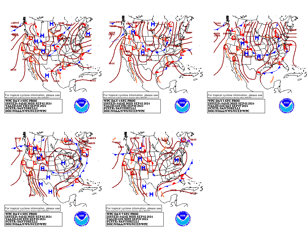
Extended Forecast Discussion
NWS Weather Prediction Center College Park MD
212 PM EDT Sun Sep 1 2024
The main heavy rainfall focus during the period will be across the
South as shortwave energy moves inland from the western Gulf and a
surface front lingers along/near the coast. Precipitation coverage
and totals remain uncertain, but the overall dynamics and
anomalous moisture support a heavy to excessive rainfall threat
with slow-moving storms. This is covered by fairly broad Marginal
Risks on the Days 4 and 5 EROs (covering Wednesday to Thursday
night), with a focus for a possible eventual slight upgrade across
the Gulf Coast and/or farther inland across portions of the Lower
Mississippi/Tennesse Valley on Wednesday and Thursday. Later, the
lingering frontal boundary across the South will promote additional
rain and locally heavy downpours with amounts and locations still
very uncertain, but the trend is for increased rain totals along
the Gulf Coast and into parts of the Southeast. By the weekend,
some moisture may spread into the Ohio Valley and/or Eastern
Seaboard. Meanwhile, some light to modest precipitation should
accompany a shortwave moving through the Interior West, and rain
chances could spread into the Northern Plains and Midwest/Great
Lakes later next week along and ahead of the northern front.
Increasing heat is expected across much of the West, with moderate
to major HeatRisk threats across the Southwest and central valleys
of California. Elsewhere, from the central U.S. into the East,
temperatures will be below or near normal as systems move through.
Kebede/Santorelli


