Swans Island, Maine | |
---|---|
Coordinates: 44°9′8″N68°26′36″W / 44.15222°N 68.44333°W | |
Country | United States |
State | Maine |
County | Hancock |
Villages | Swans Island Atlantic Minturn |
Area | |
• Total | 80.81 sq mi (209.30 km2) |
• Land | 12.41 sq mi (32.14 km2) |
• Water | 68.40 sq mi (177.16 km2) |
Elevation | 13 ft (4 m) |
Population (2020) | |
• Total | 355 |
• Density | 28/sq mi (11.0/km2) |
Time zone | UTC-5 (Eastern (EST)) |
• Summer (DST) | UTC-4 (EDT) |
ZIP code | 04685 |
Area code | 207 |
FIPS code | 23-75455 |
GNIS feature ID | 0582757 |
Website | www.swansisland.org |
Swan's Island is an island town in Hancock County, Maine, United States. It is named after Colonel James Swan, of Fife, Scotland, who purchased the island and some surrounding areas and organized their colonization in the eighteenth century. [2] The population was 355 at the 2020 census. [3] The town is accessible by state ferry service [4] from Bass Harbor.
The island has a summertime population of approximately 1,000. There is a general store on the island, which opened in spring 2007, and at least one inn. There are also a number of small cottage-industry shops. The main industry is lobster fishing, which employs 40 people full-time and many others in part-time work. [5]
Swan's Island is also home to the Sweet Chariot Music Festival, an annual summertime show of folk music and sea chanties. [6]
Swan's Island was first charted in 1606 by Samuel de Champlain's expedition, and at the time was used by local Indians as a seasonal hunting ground.
James Swan, a member of the Sons of Liberty and Boston Tea Party participant, [7] purchased the island in 1786. In 1791, David Smith, an American Revolutionary War veteran, became the first settler of European extraction on the island. [8]
The population grew slowly to more than 1,000 by 1900. Fish processing was the dominant industry into the 1930s, when it became no longer profitable in the area. The state-run ferry, which began service in 1960, helped make Swan's Island a popular summer tourism destination. [8] [9] The ferry also is used to carry the mail to the island. [10]
According to the United States Census Bureau, the town has a total area of 80.81 square miles (209.30 km2), of which 12.41 square miles (32.14 km2) is land and 68.40 square miles (177.16 km2) is water. [1]
There are three villages in the town: The Harbor, Atlantic, and Minturn.
Census | Pop. | Note | %± |
---|---|---|---|
1810 | 51 | — | |
1840 | 283 | — | |
1850 | 423 | 49.5% | |
1860 | 492 | 16.3% | |
1870 | 451 | −8.3% | |
1880 | 765 | 69.6% | |
1890 | 632 | −17.4% | |
1900 | 758 | 19.9% | |
1910 | 749 | −1.2% | |
1920 | 566 | −24.4% | |
1930 | 576 | 1.8% | |
1940 | 452 | −21.5% | |
1950 | 468 | 3.5% | |
1960 | 402 | −14.1% | |
1970 | 323 | −19.7% | |
1980 | 337 | 4.3% | |
1990 | 348 | 3.3% | |
2000 | 327 | −6.0% | |
2010 | 332 | 1.5% | |
2020 | 355 | 6.9% | |
U.S. Decennial Census [11] |
As of the census [12] of 2010, there were 332 people, 146 households, and 99 families living in the town. The population density was 26.8 inhabitants per square mile (10.3/km2). There were 483 housing units at an average density of 38.9 units per square mile (15.0 units/km2). The racial makeup of the town was 96.1% White, 0.9% African American, 0.9% Native American, and 2.1% from two or more races. Hispanic or Latino of any race were 0.3% of the population.
There were 146 households, of which 26.0% had children under the age of 18 living with them, 56.8% were married couples living together, 6.2% had a female householder with no husband present, 4.8% had a male householder with no wife present, and 32.2% were non-families. 28.8% of all households were made up of individuals, and 14.4% had someone living alone who was 65 years of age or older. The average household size was 2.27 and the average family size was 2.73.
The median age in the town was 46.3 years. 19.3% of residents were under the age of 18; 5% were between the ages of 18 and 24; 24.3% were from 25 to 44; 33.6% were from 45 to 64; and 17.5% were 65 years of age or older. The gender makeup of the town was 52.1% male and 47.9% female.
As of the census [13] of 2000, there were 327 people, 142 households, and 90 families living in the town. The population density was 23.4 people per square mile (9.0 people/km2). There were 421 housing units at an average density of 30.2 units per square mile (11.7 units/km2). The racial makeup of the town was 98.17% White, 0.31% African American, and 1.53% from two or more races.
There were 142 households, out of which 26.8% had children under the age of 18 living in them; 59.2% were married couples living together; 2.1% had a female householder with no husband present, and 36.6% were non-families. 30.3% of all households were made up of individuals, and 13.4% had someone living alone who was 65 years of age or older. The average household size was 2.30 and the average family size was 2.87.
In the town, the population was spread out, with 23.9% under the age of 18; 8.3% from 18 to 24; 24.5% from 25 to 44; 24.8% from 45 to 64, and 18.7% who were 65 years of age or older. The median age was 41 years. For every 100 females, there were 105.7 males. For every 100 females age 18 and over, there were 112.8 males.
The median income for a household in the town was $28,438, and the median income for a family was $32,083. Males had a median income of $29,028 versus $18,750 for females. The per capita income for the town was $14,515. About 11.3% of families and 16.0% of the population were below the poverty line, including 15.1% of those under age 18 and 21.7% of those age 65 or over.
A travel agency specializing in trails, describes attractions for the island that include six historic homes dating to the 1700s, a listing on the National Register of Historic Places, a lighthouse, nature features that include nesting bald eagles, waterfowl, as well as deer, and trails, hiking, and camping. [14]
Eagle Lake is a town in Aroostook County, Maine, United States. The population was 772 at the 2020 census. The town was named by a body of troops heading from Bangor to the Aroostook War for the many eagles that they saw around the lake. A total of 49.0% of the population speaks French, reflecting a trend in Northeastern Maine.
Frenchville is a town in Aroostook County, Maine, United States. The population was 1,052 at the 2020 census.
Grand Isle is a town in Aroostook County, Maine, United States. The population was 366 at the 2020 census. The village of Grand Isle is in the northwestern part of the town.
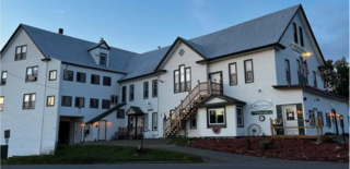
Island Falls is a town in Aroostook County, Maine, United States. The population was 758 at the 2020 census. The primary village of Island Falls in the town is situated at a falls in the West Branch Mattawamkeag River.
Stockholm is a town in Aroostook County, Maine, United States. The population was 250 at the 2020 census.
Frenchboro is a town in Hancock County, Maine, United States, and a village within this town located on Long Island, southeast of Swans Island. The population was 29 at the 2020 census. The town is accessible by state ferry service from Bass Harbor.
Mount Desert is a town on Mount Desert Island in Hancock County, Maine, United States. The population was 2,146 at the 2020 census. Incorporated in 1789, the town currently encompasses the villages of Otter Creek, Seal Harbor, Northeast Harbor, Somesville, Hall Quarry, and Pretty Marsh.
Tremont is a town in Hancock County, Maine, United States. It is located on the southwestern side of Mount Desert Island, known to locals as "the quiet side."
Verona Island is a town located on an island of the same name in the Penobscot River in Hancock County, Maine, United States. The population was 507 at the 2020 census.
Isle au Haut is a town in Knox County, Maine, United States, on an island of the same name in Penobscot Bay. The population was 92 at the 2020 census. Home to portions of Acadia National Park, Isle au Haut is accessible by ferry from Stonington. The 6 mile ride takes about 45 minutes.
Dresden is a town in Lincoln County, Maine, United States, that was incorporated in 1794. The population was 1,725 at the 2020 census.
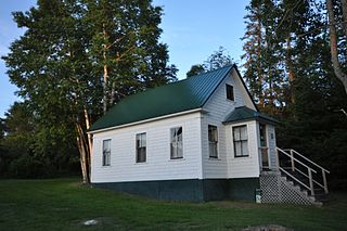
Upton is a town in Oxford County, Maine, United States. The population was 69 at the 2020 census. Totally.
Frankfort is a town on the Penobscot River estuary in Waldo County, Maine, United States. The population was 1,231 at the 2020 census.
Swanville is a town in Waldo County, Maine, United States. The population was 1,377 at the 2020 census.
Beals is a town in Washington County, Maine, United States, located on an island opposite Jonesport. The town was named after Manwarren Beal, an early settler. The population was 443 at the 2020 census.
Beddington is a town in Washington County, Maine, United States. The population was 60 at the 2020 census. It is the third-smallest organized town in Maine after Frye Island and Frenchboro.
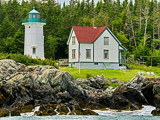
Cutler is a town in Washington County, Maine, United States. The town was named after Joseph Cutler, an early settler, who hailed from Newburyport, Massachusetts. The population was 524 at the 2020 census.
Richmond is a town in Sagadahoc County, Maine, United States. The population was 3,522 at the 2020 census. It is part of the Portland–South Portland–Biddeford, Maine metropolitan statistical area, situated at the head of Merrymeeting Bay.
Westport Island, formerly Westport, is a town in Lincoln County, Maine, United States. In the 19th century the island was known as Jeremysquam, a nickname islanders still use for it. The population was 719 at the 2020 census.
Winterport is a town in Waldo County, Maine, United States. The population was 3,817 at the 2020 census. The Winterport Historic District, extending several blocks along Main Street, was listed on the National Register of Historic Places in 1975.