Palchuram

Last updated

Coordinates: 11°50′08″N75°51′26″E / 11.835502°N 75.857202°E / 11.835502; 75.857202

Geographic coordinate system Coordinate system

A geographic coordinate system is a coordinate system that enables every location on Earth to be specified by a set of numbers, letters or symbols. The coordinates are often chosen such that one of the numbers represents a vertical position and two or three of the numbers represent a horizontal position; alternatively, a geographic position may be expressed in a combined three-dimensional Cartesian vector. A common choice of coordinates is latitude, longitude and elevation. To specify a location on a plane requires a map projection.

Contents

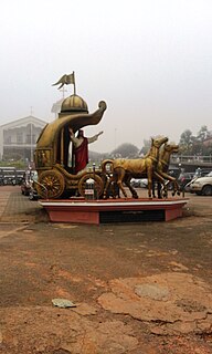
The Palchuram or 'Milky Way' Mananathavady 57.jpg
The Palchuram or 'Milky Way'
Welcome to Wayanad Invitation board to Wayanad.jpg
Welcome to Wayanad

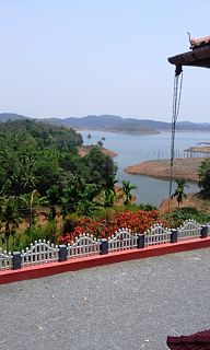
Palchuram or The Milky Mountain Road is mountain village and hairpin road near Mananthavady town in Wayanad district of Kerala state in India.

Mananthavady City in Kerala, India

Mananthavady is a municipality and taluk in the Wayanad district of Kerala, India.The town is located on the banks of Mananthavady River, a tributary of the Kabini River. Mananthavady has been referred to as "Hosenkadi" in a dictum scribbled under a copper artefact found at the Ananthanathaswamy Temple at Varadoor. The dominant view on the etymology is that the word is derived from "Mane Eytha Vady ". This view is strengthened by the existence of a place called Ambukuthy, literally the location where the arrow pierced, on the outskirts of the town. This area was once ruled by the Pazhassi dynasty and the tomb of Pazhassi Raja is an important heritage site located in the heart of the town. Mananthavady was a major army camp for the British during their campaign against Pazhassi. One can still see the vestiges of the colonial period - canteen, club, barracks, rest house, cemetery - around Mananthavady. This is also the headquarters of the Adivasi Gothra Mahasabha. The District Hospital in Mananthavady is the only major treatment facility for the service of the tribal communities and other less privileged sections of Wayanad.
Wayanad district District in Kerala, India

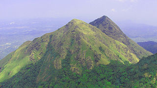
Wayanad is an Indian district in the north-east of Kerala state with headquarters at the municipality of Kalpetta. It is set high on the Western Ghats with altitudes ranging from 700 to 2100. The district was formed on 1 November 1980 as the 12th district in Kerala by carving out areas from Kozhikode and Kannur districts. About 885.92 sq.km of area of the district is under forest. Wayanad has three municipal towns—Kalpetta, Mananthavady and Sulthan Bathery. There are many indigenous tribals in this area.

Kerala State in southern India

Kerala is a state on the southwestern, Malabar Coast of India. It was formed on 1 November 1956, following passage of the States Reorganisation Act, by combining Malayalam-speaking regions. Spread over 38,863 km2 (15,005 sq mi), Kerala is the twenty-second largest Indian state by area. It is bordered by Karnataka to the north and northeast, Tamil Nadu to the east and south, and the Lakshadweep Sea to the west. With 33,387,677 inhabitants as per the 2011 Census, Kerala is the thirteenth-largest Indian state by population. It is divided into 14 districts with the capital being Thiruvananthapuram. Malayalam is the most widely spoken language and is also the official language of the state.

Location

Palchuram is located 22 kilometres (14 mi) west of Mananthavady town, adjacent to the Boys Town village. There is a spiral hairpin road here going all the way down to Kottiyoor in Kannur district.

Boys Town, Mananthavady Place

Boys Town is a small village near Mananthavady in Wayanad, Kerala, India. The village is 13 km from Mananthavady.

Kottiyoor Village in Kerala, India

Kottiyoor is a village and the 23rd Wild Life Sanctuary of Kerala, situated in eastern hilly area of Kannur. Kottiyoor is located in the serene hills of Western Ghats. The ancient pilgrimage conducted here yearly, called 'Kottiyoor Vysakha Mahotsavam' attracts thousands of devotees every year. The Vavali river flows through Kottiyoor.

Kannur district District in Kerala, India

Kannur is one of the 14 districts along the west coast in the state of Kerala, India. The town of Kannur is the district headquarters and gives the district its name. The old name, Cannanore is the anglicised form of the Malayalam name "Kannur". Kannur district is bounded by Kasaragod District to the north, Kozhikode district to the south and Wayanad District to the southeast. To the east the district is bounded by the Western Ghats, which forms the border with the state of Karnataka. The Arabian Sea lies to the west. Paithalmala is the highest point in the Kannur District (1,372m). Enclosed within the southern part of the district is the Mahé district of the Union Territory of Puducherry. The district was established in 1957.

Post office

There is a post office at Ambayathode and the pin code is 674651

Education

Tourist attraction

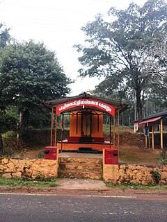
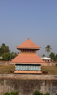
The Palchuram Hairpin Bends attract many tourists for the photographic options it offers. There are a few temples and churches in the area.

Palchuram Falls is a four-step waterfall with a height of 300 metres (980 ft). It is 2 kilometres (1.2 mi) from Boys Town junction. The footpath to the falls is quiet dangerous and tiring.

See also

Related Research Articles

Brahmagiri (hill), Karnataka mountain range in the Western Ghats of India

Brahmagiri, is a mountain range in the Western Ghats of south India. It is situated on the border between Kodagu district in Karnataka state in the north and Wayanad district of Kerala state on the south. Brahmagiri Hill, at 1608 m height, is a scenic tourist attraction. The top of Brahmagiri Hill is well forested and has a lot of wildlife.

Thirunelli Temple building in India

Thirunelli Temple is an ancient temple dedicated to Lord Maha Vishnu on the side of Brahmagiri hill in Kerala, near the border with Karnataka state. The temple is at an altitude of about 900m in north Wayanad in a valley surrounded by mountains and beautiful forests. It is 32 km away from Manathavady.

Pulpally Place in Kerala, India

Pulpally is a mid-sized town in Wayanad District of Kerala, India. Geographically a Village in Sultan Bathery Taluk and a "Grama Panchayath" under local self governance system. It is about 24 km from Sultan Battery, and is almost surrounded by forest.

Tharuvana Village in Kerala, India

Tharuvana is a village in Vellamunda Panchayath of Wayanad district, Kerala, India. The place is a junction connecting the Vythiri-Tharuvana road to State Highway 54 running between Kuttiady and Mananthavady.

Mazhuvannur Place

Mazhuvannur is where the Axe of Lord Shiva is believed to have fallen )

Nadavayal is a town near Sultan Bathery in Wayanad district, Kerala, India. This small town hosted early migrants from Travancore (Thiruvithaamkoor).

Kaniyambetta Village in Kerala, India

Kaniyambetta or Pachilakkad is a village in the Wayanad district of Kerala state, southern India. This places are mainly known as kamblakkad. Village office of kamblakkad is situated here.It is about 8 km from the district capital Kalpetta.

Anchukunnu village in Kerala, India

Anjukunnu is a village in Wayanad district in the state of Kerala, India.

Edavaka, Mananthavady Grama Panchayat in Kerala, India

Edavaka is a Gram Panchayat in the Wayanad district of the Kerala State, India.

Kuppadi village in Kerala, India

Kuppadi is a village near Sultan Bathery in Wayanad district in the state of Kerala, India.The famous St Mary's College, Sulthan Bathery is situated in this village.

Padinharethara village in Kerala, India

Padinharethara , Padinjarethara or Padincharethara is a big town and important junction in Wayanad district in the state of Kerala, India.

Poothadi village in Kerala, India

Poothadi is a village near Kenichira, Panamaram area in Wayanad district in the state of Kerala, India.

Thalappuzha, Wayanad village in Kerala, India

Thalappuzha, Thavinhal or Thavinjal, is a village in Wayanad district in the state of Kerala, India. It is formally known as aranguthum chall, meaning the place for cultural programs.

Karingari is a small serene village near Tharuvana in Vellamunda panchayath, Mananthavady area, Wayanad, Kerala, India.

Kommayad is a small village which is situated 10 kilometres (6.2 mi) from Mananthavady, 26 kilometres (16 mi) from Kalpetta. Karat Shiva Temple is one of the oldest temple situated in the village.

Kambalakkad human settlement in India

Kambalakkad is one of the small towns near Kalpetta in the Wayanad district, Kerala, India. It is about 8 kilometres (5.0 mi) away from district headquarters at Kalpetta, and is one of the main towns on the Kalpetta-Manathavady highway.

Transportation in Wayanad describes the transportation in Wayanad

The district capital of Wayanad is Kalpetta town. Kalpetta has very good road connectivity with the rest of Kerala and neighboring South Indian cities. NH766 connects Kalpetta with Kozhikode and Mysore. State Highways connect Kalpetta with Ooty in Tamil Nadu and Madikeri in Karnataka.

Ambayathode Town in Kerala, India

Ambayathode is a little town near the famous Kottiyoor temple town in Kannur district of Kerala province in India. Ambayathodu witnessed massive landslides during Kerala Floods 2018.

Chungakkunnu

Chungakkunnu (ചുങ്കക്കുന്ന്) is a small town in Kannur district of Kerala State, India. It is located on the bank of river Bavali between Kelakam town and Hindu Pilgrim center Kottiyoor. Chungakkunnu was a famous place for settlement during Malabar Migration. More than 2000 migrated families still live here. And it is well known for its timber merchants. Most of the people depend on agriculture for their livelihood. Rubber, Coconut, Cashew, and Black pepper are main crops cultivated here.

References