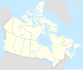
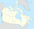
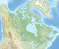
මුල් ගොනුව (SVG ගොනුව, නාමමාත්රිකව 1,114 × 942 පික්සල්, ගොනු විශාලත්වය: 365 කි.බ.)
මෙම ගොනුව Wikimedia Commons වෙතින් වන අතර අනෙකුත් ව්යාපෘතීන් විසින්ද භාවිතා කල හැක.
එහි ගොනු විස්තර පිටුව තුල අඩංගු විස්තර මෙහි පහත දැක්වෙයි.
සාරාංශය
Map Info
Properties
| Projection:
|
Lambert conformal conic
|
| Datum:
|
WGS84
|
| Central Meridian:
|
95.000000°W
|
| Latitude of Origin:
|
60.000000°N
|
| Standard Parallel #1:
|
49.000000°N
|
| Standard Parallel #2:
|
77.000000°N
|
Mathematics (conversion from latitude and longitude to image coordinate)
| x (%)=
|
201.7818903*(((tan(pi*(90-$1)/360))*(((1+0.08181919084*sin(pi*$1/180))/(1-0.08181919084*sin(pi*$1/180)))^0.04090959542))^0.9007900864)*sin(0.01572175288*($2+95))+43.98563734
|
| y (%)=
|
238.6252927*(((tan(pi*(90-$1)/360))*(((1+0.08181919084*sin(pi*$1/180))/(1-0.08181919084*sin(pi*$1/180)))^0.04090959542))^0.9007900864)*cos(0.01572175288*($2+95))-15.81495465
|
| $1:
|
latitude in degrees (positive for all locations in Canada).
|
| $2:
|
longitude in degrees (negative for all locations in Canada).
|
| x (%):
|
x coordinate expressed as percentage of image width (measured from left edge).
|
| y (%):
|
y coordinate expressed as percentage of image height (measured from top edge).
|
POIs
|
|
x (px)
|
y (px)
|
x (%)
|
y (%)
|
Latitude
|
Longitude
|
| Top Left Corner:
|
0.000 |
0.000 |
0.00 |
0.00 |
68.220310°N |
176.138684°W
|
| Top Right Corner:
|
1114.000 |
0.000 |
100.00 |
0.00 |
62.238635°N |
9.994317°W
|
| Bottom Right Corner:
|
1114.000 |
942.000 |
100.00 |
100.00 |
34.831244°N |
61.953430°W
|
| Bottom Left Corner:
|
0.000 |
942.000 |
0.00 |
100.00 |
37.392537°N |
121.850536°W
|
| Centre:
|
557.000 |
471.000 |
50.00 |
50.00 |
63.068962°N |
88.152750°W
|
| Origin:
|
490.000 |
541.000 |
43.99 |
57.43 |
60.000000°N |
95.000000°W
|
| North Pole:
|
490.000 |
-148.977 |
43.99 |
-15.81 |
90.000000°N |
⸻
|
| Thechàl Dhâl:
|
67.523 |
368.241 |
6.06 |
39.09 |
61.022873°N |
138.564925°W
|
බලපත්රීකරණය
මෙම කෘතියෙහි හිමිකම් අයිතීන් දරන්නා වන මම,පහත වරපත යටතේ එය ප්රකාශයට පත් කරමි:
- ඔබ නිදහස්:
- බෙදාහදා ගැනීමට – කාර්යය පිටපත් කිරීමට,බෙදා හැරීමට සහ සම්ප්රේෂණය කිරීමට
- නැවත සංකලනය කිරීමට – කාර්යයට අනුවර්තනය වීමට
- පහත කොන්දේසිවලට යටත්ව:
- attribution – වරපත වෙත බැඳියක්ද සපයමින් ඔබ විසින් සුදුසු කර්තෘභාරය ප්රදානය කල යුතු අතර, කිසියම් වෙනස්වීම් සිදුකලේ නම් එයද සඳහන් කල යුතු වෙයි. ඕනෑම සුදුසු ආකාරයට මෙය ඔබ විසින් සිදුකල හැකි මුත්, වරපත්දායකයා විසින් ඔබ හෝ ඔබගේ භාවිතය හෝ පිටසන් කරන බවට ඇඟවෙන ලෙසින් එය සිදු නොකල යුතු වෙයි.
- share alike – මෙම විෂය කාරණා භාවිතා කොට නැවත සංකලනය, ප්රතියෝජනය හෝ වැඩිදියුණුව කලේ නම්, ඉන්පසු ඔබගේ දායකත්වය ඔබ විසින් බෙදාහැරිය යුත්තේ මුල් වරපත හා සමාන හෝ සංගතික හෝ වරපතක් භාවිතා කරමිනි.
https://creativecommons.org/licenses/by-sa/4.0CC BY-SA 4.0 Creative Commons Attribution-Share Alike 4.0 truetrueමෙම ගොනුව නිරූපණය කරන්නෙඑ කුමක්දැයි තනි පේළියේ පැහැදිළි කිරීමක් එක් කරන්න.
carte politique du Canada
Location map of Canada
ගොනු ඉතිහාසය
ගොනු භාවිතය
පහත දැක්වෙන පිටු 6 ක් විසින් මෙම ගොනුව භාවිතා කෙරෙයි:
ගෝලීය ගොනු භාවිතය
පහත දැක්වෙන අනෙකුත් විකියන් මගින් මෙම ගොනුව භාවිතා කරයි:
- af.wikipedia.org හි භාවිතය
- azb.wikipedia.org හි භාවිතය
- ban.wikipedia.org හි භාවිතය
- ca.wikipedia.org හි භාවිතය
- cs.wikipedia.org හි භාවිතය
මෙම ගොනුවේ තවත් ගෝලීය භාවිත බලන්න.
සමහරවිට ඩිජිටල් කැමරාවක් හෝ ස්කෑනරයක් හෝ භාවිතයෙන්, නිමැවා හෝ සංඛ්යාංකකරණය (ඩිජිටල්කරණය) කොට එක් කල , අමතර තොරතුරු මෙම ගොනුවේ අඩංගුය.
ගොනුව මුලින්ම පැවැති තත්ත්වයෙහි සිට විකරණය කොට තිබේ නම්, සමහරක් තොරතුරු විකරිත ගොනුව පූර්ණ වශයෙන් පිළිඹිමු නොකරනු ඇත.


