
Holyně
This article needs additional citations for verification. (January 2022) |
Holyně
Holyně | |
|---|---|
Cadastral Area of Prague | |
 Pod lípou square | |
 Location of Holyně in Prague | |
| Coordinates: 50°1′44″N 14°21′17″E / 50.02889°N 14.35472°E | |
| Country | Czech Republic |
| Region | Prague |
| District | Prague 5 |
| Area | |
| • Total | 193 km2 (75 sq mi) |
| Population (2011) | |
| • Total | 451 |
| • Density | 2.3/km2 (6.1/sq mi) |
| Time zone | UTC+1 (CET) |
| • Summer (DST) | UTC+2 (CEST) |
Holyně is a small village and cadastral area (katastrální území) in Prague. It is located in the western part of the city. As of 2011, there were 451 inhabitants living in Holyně.[1]
It is a part of municipal district (městská část) of Praha-Slivenec.
Neighboring cadastral areas
Gallery
-
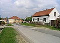 U Náhonu street
 -
 Chapel
 -
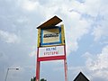 Bus stop


References
Wikimedia Commons has media related to Holyně.
- ^ "Historický lexikon obcí České republiky - 1869 - 2011". Historický lexikon obcí České republiky - 1869 - 2011 (in Czech). Retrieved 2022-01-23.
| International | |
|---|---|
| National | |
This Prague location article is a stub. You can help Wikipedia by expanding it. |