
Alloy, West Virginia
Alloy, West Virginia | |
|---|---|
 A Norfolk Southern train in Alloy | |
 Alloy  Alloy | |
| Coordinates: 38°08′15″N 81°16′27″W / 38.13750°N 81.27417°W | |
| Country | United States |
| State | West Virginia |
| County | Fayette |
| Elevation | 659 ft (201 m) |
| Time zone | UTC-5 (Eastern (EST)) |
| • Summer (DST) | UTC-4 (EDT) |
| ZIP code | 25002 |
| Area codes | 304 & 681 |
| GNIS feature ID | 1553716[1] |
Alloy is an unincorporated community in Fayette County, West Virginia, United States. Alloy is located along the Kanawha River and U.S. Route 60, 5 miles (8.0 km) southwest of Gauley Bridge. Alloy was originally known as Boncar (anagram of carbon) until the mid-1930s. Both the original placename and the current placename refer to the ferroalloy plant[2] that still operates here (producing about 30% of all the silicon metal in North America). The metals plant was originally the Electro Metallurgical Co.; a unit of Union Carbide and Carbon Corporation. Alloy has a post office with ZIP code 25002.[3]
Gallery
-
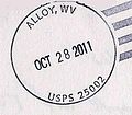 Postmark from Alloy
 -
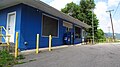 Post office
 -
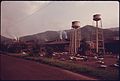 Union Carbide plant in Alloy, 1975
 -
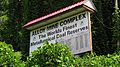 Sign at mine


References
- ^ U.S. Geological Survey Geographic Names Information System: Alloy, West Virginia
- ^ Kenny, Hamill (1945). West Virginia Place Names: Their Origin and Meaning, Including the Nomenclature of the Streams and Mountains. Piedmont, WV: The Place Name Press. p. 77.
- ^ ZIP Code Lookup

This article about a location in Fayette County, West Virginia is a stub. You can help Wikipedia by expanding it. |