
Clyffe Pypard
| Clyffe Pypard | |
|---|---|
 | |
| Population | 289 (in 2011)[1] |
| OS grid reference | SU074769 |
| Unitary authority | |
| Ceremonial county | |
| Region | |
| Country | England |
| Sovereign state | United Kingdom |
| Post town | Swindon |
| Postcode district | SN4 |
| Dialling code | 01793 |
| Police | Wiltshire |
| Fire | Dorset and Wiltshire |
| Ambulance | South Western |
| UK Parliament | |
| Website | Parish |
Clyffe Pypard is a village and civil parish about 3.5 miles (5.6 km) south of Royal Wootton Bassett in North Wiltshire, England.[2]
The parish includes the large hamlet of Bushton, the small hamlet of The Barton, the former separate village of Bupton, and the shrunken medieval village of Woodhill.
History
The ancient name of White Cleeve (or "Clive" in the Domesday Book) refers to the chalk escarpment that traverses the parish.[3]
The Latin phrase at the former Goddard Arms pub, Cervus non Servus (the stag is not a slave) was the motto of the Goddard family, who owned the manor for many years.
Sir Nikolaus Pevsner, the German-born British scholar of history of art and, especially, of history of architecture is buried in the churchyard of St Peter.
Bushton
Bushton has the sole remaining pub in the parish, and the village hall.[4]
Bupton
Bupton can be found in the southwest of the parish and its name appears to arise from land owner William Bubbe, since variations of the name include ‘Bubbeton’ and ‘Great Bupton’. Bupton today consists of farms and farmland, but in the 14th century it was a medieval village with many more dwellings than today.[5]
Woodhill
There was a small chapel and windmill at Woodhill in the 14th century. The name Woodhill derives from a corruption of ‘woad’, as the location is a ‘hill where Woad grows’ – woad being a plant which gave a blue dye for fabric.[5] Woodhill Park is a Georgian country house built in the 18th century. Richard Pace added the southeast range in 1804.[3] Northwest of the house is the site of the medieval village, including evidence of a moated manor house; the site is a scheduled ancient monument.[6]
RAF Clyffe Pypard
RAF Clyffe Pypard is a former Royal Air Force training station which was located 4.1 miles (6.6 km) south of Royal Wootton Bassett, on high ground to the south of the village of Clyffe Pypard.[7]
The airfield opened in 1941 with grass runways measuring around 1300 yards and temporary accommodation under RAF Flying Training Command. It closed in 1947 but was used after this date by RAF Lyneham for accommodation and by the British Army for battle practice[8] until 1961.[9] The airfield is currently farmland with only a small amount of buildings left standing.[9]
Based units
No. 29 Elementary Flying Training School (EFTS) used the airfield for pilot training, flying the de Havilland Tiger Moth, with a satellite field at Alton Barnes.[8]
Gallery
-
 St Peter's Church
 -
 The Goddard Arms
 -
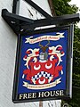 Inn sign with Cervus non servus


References
- ^ "Wiltshire Community History - Census". Wiltshire Council. Retrieved 20 November 2014.
- ^ GenUKI
- ^ a b Crittall, Elizabeth (ed.). "Victoria County History - Wiltshire - Vol 9 pp23-43". British History Online. University of London. Retrieved 18 April 2016.
- ^ "Village Hall". Clyffe Pypard and Bushton Villages. Retrieved 18 April 2016.
- ^ a b "Clyffe Pypard". Wiltshire Community History. Wiltshire Council. Retrieved 18 April 2016.
- ^ Historic England. "Medieval settlement, moat and fishponds at Woodhill Park Farm (1018128)". National Heritage List for England. Retrieved 18 April 2016.
- ^ "RAF Clyffe Pypard - a history". Duncan Curtis. Retrieved 6 March 2016.
- ^ a b "RAF Clyffe Pypard". Altantik Wall. Retrieved 3 April 2012.
- ^ a b "Clyffe Pypard". Airfield of Britain Conservation Trust. Retrieved 4 April 2012.
External links
![]() Media related to Clyffe Pypard at Wikimedia Commons
Media related to Clyffe Pypard at Wikimedia Commons