
Llandyssil: Difference between revisions
→Sheep Dog Trials: replaced permanent dead link |
Changing short description from "Village in Wales" to "Village in Powys, Wales" |
||
| (29 intermediate revisions by 13 users not shown) | |||
| Line 1: | Line 1: | ||
{{Short description|Village in Powys, Wales}} |
|||
{{for|the town in Ceredigion, also known formerly as Llandyssil|Llandysul}} |
|||
{{Use dmy dates|date=October 2019}} |
{{Use dmy dates|date=October 2019}} |
||
{{Infobox UK place |
{{Infobox UK place |
||
| country = Wales |
| country = Wales |
||
| static_image = St Tyssil Parish Church - geograph.org.uk - 687550.jpg |
|||
| map_type = |
| map_type = |
||
| coordinates = {{coord|52.550|-3.186|display=inline,title}} |
| coordinates = {{coord|52.550|-3.186|display=inline,title}} |
||
| os_grid_reference = SO1995 |
|||
| official_name = Llandyssil |
| official_name = Llandyssil |
||
| unitary_wales = [[Powys]] |
| unitary_wales = [[Powys]] |
||
| constituency_westminster = [[Montgomeryshire (UK Parliament constituency)|Montgomeryshire]] |
| constituency_westminster = [[Montgomeryshire (UK Parliament constituency)|Montgomeryshire]] |
||
| constituency_welsh_assembly = [[Montgomeryshire (Senedd constituency)|Montgomeryshire]] |
| constituency_welsh_assembly = [[Montgomeryshire (Senedd constituency)|Montgomeryshire]] |
||
| community_wales = [[ |
| community_wales = [[Abermule with Llandyssil]] |
||
| post_town = MONTGOMERY |
| post_town = MONTGOMERY |
||
| postcode_district = SY15 |
| postcode_district = SY15 |
||
| postcode_area = SY |
| postcode_area = SY |
||
| population = |
| population = 300 |
||
| population_ref = |
| population_ref = |
||
| dial_code = 01686 |
| dial_code = 01686 |
||
| Line 18: | Line 23: | ||
}} |
}} |
||
'''Llandyssil''' ({{lang-cy|Llandysul}}) is a village in the community of [[Abermule with Llandyssil]],<ref name="Election notice">{{cite web|url=http://pstatic.powys.gov.uk/fileadmin/Docs/Elections/NOE_A3_Communities.pdf|title=Powys County Council - Election of Community Councillors|website=Government of Powys|accessdate=22 May 2017|archive-url=https://web.archive.org/web/20180116071700/http://pstatic.powys.gov.uk/fileadmin/Docs/Elections/NOE_A3_Communities.pdf|archive-date=16 January 2018|url-status=dead}}</ref> in [[Powys]], Wales, in the traditional county of [[Montgomeryshire]]. It is about two miles from the town of [[Montgomery, Powys|Montgomery]]. |
|||
'''Llandyssil''' is a village in [[Powys]], Wales, about two miles from the town of [[Montgomery, Powys|Montgomery]]. |
|||
In 2001 there were 420 inhabitants in the parish, of whom 300 lived in the village itself.<ref>{{cite web|url=http://www.llandyssil-powys.co.uk/|archiveurl=https://web.archive.org/web/20130506211620/http://llandyssil-powys.co.uk/|archivedate=2013-05-06|title= Welcome to Llandyssil-Croeso I Llandyssil|website=llandyssil-powys.co.uk}}</ref><ref group=notes>The population figures are approximate because the 2001 Census figures do not coincide with the historic boundaries of the parish</ref><ref>English E (ed) 1999 "A Collected History of the Communities of Llandyssil, Abermule and Llanmerewig".</ref> |
|||
==Connection with Celtic saints== |
==Connection with Celtic saints== |
||
{{stack| |
{{stack| |
||
[[File:St Tysul's Church, Llandyssil c1860.jpeg|thumb|250px|Old St Tysul's Church, Llandyssil c.1855 |
[[File:St Tysul's Church, Llandyssil c1860.jpeg|thumb|250px|Old St Tysul's Church, Llandyssil c.1855 (from a drawing by Harry Longville Jones)]] |
||
[[File:St Tyssul 01.jpg|thumb|left|St Tyssul holding Llandyssil Church |
[[File:St Tyssul 01.jpg|thumb|left|St Tyssul holding Llandyssil Church (window in Montgomery church)]] |
||
}} |
}} |
||
Llandyssil takes its name from [[Saint Tysul|St Tysul]], a little known Welsh saint of the 7th century |
Llandyssil takes its name from [[Saint Tysul|St Tysul]], a little known Welsh saint of the 7th century.<ref>Bartrum P C “A Welsh Classical Dictionary: People in History and Legend up to about A.D. 1000”, National Library of Wales, 1993, 630. Tysul’s full name was Tysul ap Corun ap Cunedda - or son of Corun, son of Cunedda</ref> Only two churches in Wales were dedicated to this saint, Llandyssil in Montgomeryshire and [[Llandysul]] in Ceredigion, and the feast day for this saint was celebrated on 31 January.<ref>Thomas D R The History of the Diocese of [[St Asaph]], Vol I, Caxton Press, Oswestry 1908 (2 ed.),524.</ref> The old church in the village (largely demolished in 1866) stood in the graveyard to the southeast of the present village. This suggests that the present settlement dates back to the period around 700. There is also a connection with another early Welsh and Breton saint, St [[Padarn]].<ref>“Bartrum”, 522-524.</ref> On the highland to the south in Cefn y Coed is the farm Cwm Badarn. The Llandyssil Brook rises in this Cwm or valley, and between Cwm Badarn Farm and the Pinion is a rock-cut spring, that was possibly a [[holy well]], dedicated to St Padarn. |
||
==History== |
==History== |
||
In the |
In the medieval period, Llandyssil was in the [[Cantref]] of [[Cedewain]] in the [[Kingdom of Powys]]. The parish was divided into four townships: Bolbro, Bronywood (or Bronycoed), Bryntalch and Rhandir. Rhandir, which contained the parish church, was the largest of these townships. It was probably an amalgamation of three other townships; Cefn-y-coed, Coedywig and Trefganol.<ref>’‘Thomas’’ Vol 1, 524,</ref> |
||
In 1536, following the [[Laws in Wales Acts 1535 and 1542|Act of Union]], Llandyssil became part of the new county of [[Montgomeryshire]]. For ecclesiastical administration, the parish was in the [[Diocese of St Asaph|Bishopric of St Asaph]], the [[Archdeaconry of Montgomery]] and the [[Deanery of Cedewain]].<ref>"Thomas" Vol 1, 524</ref> For Parliamentary representation, Llandyssil fell within the County of Montgomery until 1885, when, for electoral purposes, it was included within the [[Montgomery (UK Parliament constituency)|Montgomery Boroughs]]. It was transferred back to the county in 1918, when only one MP represented [[Montgomeryshire]]. |
|||
For Parliamentary representation, Llandyssil fell within the County of Montgomery until 1885, when, for electoral purposes, it was included within the [[Montgomery Boroughs]]. It was transferred back to the County in 1918, when only one MP represented [[Montgomeryshire]]. |
|||
With the establishment of the [[Montgomeryshire|Montgomeryshire County Council]] in 1894, Llandyssil Parish Council was created, and it was included in Forden Rural District Council. In 1974, as a result of |
With the establishment of the [[Montgomeryshire|Montgomeryshire County Council]] in 1894, Llandyssil Parish Council was created, and it was included in Forden Rural District Council. In 1974, as a result of local government reform, Llandyssil Parish Council became a Community Council within the [[District of Montgomeryshire|Montgomeryshire District Council]].<ref>“English”, unpaginated. This provides a very detailed history of the Parish and the successor Community Council,</ref> At this time, [[Llanmerewig]] was joined with Llandyssil to form the new [[community council]], and in 1984 this was renamed [[Abermule]] with Llandyssil Community Council. At this time, the council covered the old parishes of Llanmerewig and Llandyssil, together with Dolforwyn, which had been a township in [[Bettws Cedewain]] parish. In 1996, with the abolition of the Montgomeryshire District Council, the Community Council became part of [[Powys County Council]]. |
||
==Population and language== |
==Population and language== |
||
According to census returns, the historical population of Llandyssil has been as follows:<ref>{{Cite web|url=http://history.powys.org.uk/school1/montgomery/dyspop.shtml|title=Victorian Montgomery - Llandysul population|website=history.powys.org.uk}}</ref> |
|||
The Census returns are as follows:.<ref>http://www {{webarchive|url=https://web.archive.org/web/20010426175339/http://www/ |date=2001-04-26 }}. history.powys.org.uk/school1/primhome.shtm. "Montgomery and the border district: Victorian Powys”. [[Powys Digital History Project]]. This gives information about the census returns - which has been supplemented with information from local directories</ref> |
|||
{{historical populations|cols=3|align=none |
{{historical populations|cols=3|align=none |
||
|1801|645 |
|1801|645 |
||
| Line 54: | Line 61: | ||
|1961|520 |
|1961|520 |
||
}} |
}} |
||
In 1880 a portion of the township of Bolbro was transferred from Llandyssil to [[Llanmerewig]] and the size of the parish was reduced from 4187 acres to 3800 acres. This may be reflected in the decrease in population between the 1881 and 1891 censuses. |
In 1880, a portion of the township of Bolbro was transferred from Llandyssil to [[Llanmerewig]] and the size of the parish was reduced from 4187 acres to 3800 acres. This may be reflected in the decrease in population between the 1881 and 1891 censuses. |
||
During the later part of the 18th century, it appears that the Welsh language was supplanted by English for general usage in the village.<ref>Pryce W R T “Changing Language Geographies of Montgomeryshire c1749-1991” in Jenkins D (ed) “The Historical Atlas of Montgomeryshire”, Powysland Club, Welshpool 1999, 118</ref> There |
During the later part of the 18th century, it appears that the [[Welsh language]] was supplanted by English for general usage in the village.<ref>Pryce W R T “Changing Language Geographies of Montgomeryshire c1749-1991” in Jenkins D (ed) “The Historical Atlas of Montgomeryshire”, Powysland Club, Welshpool 1999, 118</ref> There remain some Welsh speakers in the village, but they have mainly come from elsewhere in Montgomeryshire. |
||
==Archaeological and historic monuments== |
==Archaeological and historic monuments== |
||
Llandyssil is particularly rich in archaeological sites, especially of the Later [[Bronze Age]] and [[Iron Age]].<ref> |
Llandyssil is particularly rich in archaeological sites, especially of the Later [[Bronze Age]] and [[Iron Age]].<ref>{{cite web|url=https://www.cpat.org.uk/ycom/mont/llandyssil.pdf|title=Historic Settlement Survey, Montgomeryshire - Llandyssil|website= Clwyd Powys Archaeological Trust}}</ref><ref name="RCHMW">RCHMW: An Inventory of Ancient Monuments Volume 1, County of Montgomery, HMSO, 1911, 77</ref> To the northeast is [[Ffridd Faldwyn, Montgomery|Ffridd Faldwyn]], possibly the largest [[hillfort]] in Wales, which is adjacent to Town Hill in Montgomery. Most of the sites have been discovered by [[aerial photography]].<ref name="RCHMW" /> The main sites are as follows. |
||
===Prehistoric=== |
===Prehistoric=== |
||
The prehistoric sites include:<ref>Silvester, Robert J, 2011, Recent Research on Late Prehistoric and Romano-British Enclosures in Montgomeryshire, "The Montgomeryshire Collections" : 99 : 1-26. This provides the most recent survey of the Llandyssil earthworks in their Montgomeryshire context</ref> |
The prehistoric sites include:<ref>Silvester, Robert J, 2011, Recent Research on Late Prehistoric and Romano-British Enclosures in Montgomeryshire, "The Montgomeryshire Collections" : 99 : 1-26. This provides the most recent survey of the Llandyssil earthworks in their Montgomeryshire context</ref> |
||
*Brynderwen Enclosure |
*Brynderwen Enclosure. Ditched enclosure close to the river Severn, dated to c.3350-3000 BC. Late Neolithic [[Peterborough ware]] pottery has been found at the site .<ref>Gibson, A M & Musson, C R, 1990, A cropmark enclosure and a sherd of later Neolithic pottery from Brynderwen, Llandyssil, Powys, The Montgomeryshire Collections : 78 : 11-15</ref> |
||
*Cefn Llan Hillfort in Cefnycoed. |
*Cefn Llan Hillfort in Cefnycoed. This enclosure, situated on low hill, is a [[Scheduled monument|scheduled ancient monument]]. The site is overgrown and its bank is starting to erode.<ref>“RCHMW” : 77, no 385, no386</ref><ref>{{cite web|url=https://archwilio.org.uk/arch/query/page.php?watprn=CPAT187&dbname=cpat&tbname=core&sessid=CHI2tev981h&queryid=Q028292001646673871|title= CPAT Regional Historic Environment Record - Cefn Llan Hillfort|website=Archwilio}}</ref> To the north of the hillfort is a triple-ditched [[Enclosure (archaeology)|enclosure]].<ref>{{cite web|url=https://archwilio.org.uk/arch/query/page.php?watprn=CPAT3645&dbname=cpat&tbname=core&sessid=CHI2tev981h&queryid=Q145011001646673953|title=CPAT Regional Historic Environment Record - Cefn Llan enclosure|website=Archwilio}}</ref> |
||
* Cloddiau. This is a triple-ditched enclosure,<ref>Chris Musson “Wales from the Air: Patterns of Past and Present” RCAHMW c.1996, 133, aerial photograph.</ref><ref>”Musson”, 87</ref> possibly a late [[Bronze Age]] or [[Iron Age]] cattle krall{{What|reason=What is a cattle krall?|date=September 2023}} or [[banjo enclosure]].<ref>{{Cite web|url=https://historicengland.org.uk/images-books/publications/iha-banjo-enclosures/heag198-banjo-enclosures/|title =Banjo Enclosures - Introduction to Heritage Assets |website=Historic England|date=July 2018}}</ref> |
|||
*Cefn Llan Enclosure (to N of Hillfort). Triple ditched enclosure c121m across, triple ditches only visible on the S side, the rest being single or double ditched. Linear earthworks to SW could be related.<ref>http://www {{webarchive|url=https://web.archive.org/web/20010426175339/http://www/ |date=2001-04-26 }}://cofiadurcahcymru.org.uk/arch/cpat/english/cpat_interface.html CPAT PRN3645</ref> |
|||
*Coed y Wig hillfort.<ref>{{cite web|url=https://archwilio.org.uk/arch/query/page.php?watprn=CPAT3717&dbname=cpat&tbname=core&sessid=CHI2tev981h&queryid=Q693308001646674244|title= CPAT Regional Historic Environment Record - Coed y Wig hillfort|website=Archwilio}}</ref> An Iron Age hillfort revealed by aerial photography. |
|||
* Cloddiau. Possible Late Bronze or Iron Age Cattle Krall or [[Banjo enclosure]]<ref>{{Cite web|url=http://www.english-heritage.org.uk/.../iha-banjo-enclosures/banjoenclosures.pdf|title = English Heritage}}</ref> with triple banks and funnel entrance.<ref>Chris Musson “Wales from the Air: Patterns of Past and Present” RCAHMW c.1996, 133, excellent air photograph.</ref><ref>”Musson”, 87</ref> Triple ditched sub-circular enclosure 92 x 78m enclosing an inner area of 2526m. Well-defined entrance to NE with flanking ditches. Excavations in 1993 showed the 4m wide inner ditch was just below the edge of the scarp, but no stratigraphy survived in either the rampart or the interior.<ref>Britnell, W J & Thomas, D, 2010, Trial excavations on defended enclosure sites in the Llandyssil area of Montgomeryshire in 1993-94 CPAT Report 1042</ref><ref>"Silvester" 2011, 2-4, fig2</ref> |
|||
*Cuckoo Hill Hillfort.<ref>{{cite web|url=https://archwilio.org.uk/arch/query/page.php?watprn=CPAT1822&dbname=cpat&tbname=core&sessid=CHI2tev981h&queryid=Q499315001646673471|title=CPAT Regional Historic Environment Record - Cuckoo Hall hillfort|website=Archwilio}}</ref> Another triple-ditched enclosure, this was excavated in 1993. A single rim [[Potsherd|sherd]], probably dating from Roman times, was discovered there.<ref name="Britnell & Thomas 2010">"Britnell & Thomas" 2010</ref><ref>"Silvester" 2011, 19</ref> |
|||
*Coed y Wig hillfort.<ref>http://www.cofiadurcahcymru.org.uk/arch/cpat/english/cpat_interface.html PRN 3717</ref> NGR: SO1957096216. Iron Age Hillfort revealed by aerial photography. Possible enclosure, treble ditched to SE but only single ditch visible to E. NE part not visible. Site is set on 2 E-W ridges with a broad natural gully between. The ditches seem to be cutting across from one ridge to another. |
|||
*Fron Fraith Wood Hillfort.<ref>{{cite web|url=https://archwilio.org.uk/arch/query/page.php?watprn=CPAT3722&dbname=cpat&tbname=core&sessid=CHI2tev981h&queryid=Q430558001646673608|title=CPAT Regional Historic Environment Record - Fron Fraith Wood hillfort|website=Archwilio}}</ref> This is the northwest part of two ditched enclosures. Excavated in 1994.<ref name="Britnell & Thomas 2010" /> |
|||
*Cuckoo Hill Hillfort.<ref>http://www.archwilio.org.uk CPAT PRN 1822</ref> NGR: SO1829794715. 3-ditched ovate enclosure 132.1 x 89.6m with no obvious entrance. Ditches to W show as cropmarks - those to E as parchmarks and slight earthworks. Defences spanning 31m. Located on low SW-NW ridge. Later house platforms cut into earthworks on SE side. Excavation 1993: triple ditched enclosure with earthworks surviving to c.0.2m high, the inner ditch was identified - width 3.7m. No stratigraphy was present. Single rim-sherd of probable Roman date from upper fill of ditch<ref name="Britnell & Thomas 2010">"Britnell & Thomas" 2010</ref><ref>"Silvester" 2011, 19</ref> |
|||
*Goron Ddu Hillfort.<ref>{{cite web|url=https://archwilio.org.uk/arch/query/page.php?watprn=CPAT155&dbname=cpat&tbname=core&sessid=CHI2tev981h&queryid=Q622838001646674343|title=CPAT Regional Historic Environment Record -Goron Ddu enclosure|website=Archwilio}}</ref> This hillfort overlooks the river Severn to the north of the village. Geophysical survey has shown a concentration of features in the centre of the enclosure, but with insufficient clarity to distinguish [[Roundhouse (dwelling)|roundhouses]].<ref>"Silvester" 2011, 16-17</ref> |
|||
*Fron Fraith Wood Hillfort.<ref>http://www.cofiadurcahcymru.org.uk/arch/cpat/english/cpat_interface.html CPAT PRN 3722</ref> NGR: SO1695893508. North-west part of two ditched enclosures, possibly circular with diameter c90m. The ditches are c5m across and there is a possible entrance gap on east. The enclosure is 110m NE/SW by 65m across. Excavated in 1994.<ref name="Britnell & Thomas 2010"/> |
|||
*Mount Pleasant Defended Enclosure.<ref>{{cite web|url=https://archwilio.org.uk/arch/query/page.php?watprn=CPAT7500&dbname=cpat&tbname=core&sessid=CHI2tev981h&queryid=Q358983001646674420|title=CPAT Regional Historic Environment Record - Mount Pleasant enclosure|website=Archwilio}}</ref> A scheduled ancient monument, this is a double-ditched enclosure with surviving earthworks. Inside the enclosure, the remains of a clay dump [[Rampart (fortification)|rampart]] were discovered, with the remains of a hearth and grains of [[spelt]]. [[Radiocarbon dating]] suggests that the site was occupied in the earlier Iron Age.<ref>"Silvester" 2011, 19, fig11, for plan of site</ref> |
|||
*Goron Ddu Hillfort.<ref>http://www.cofiadurcahcymru.org.uk/arch/cpat/english/cpat_interface.html CPAT PRN 155</ref> NGR: SO1860096570. East of Upper Bryntalch farm, on the crest of a short ridge, aligned north-east/south-west, overlooking the river Severn at an altitude of 200m OD, to the N of the village. The site consists of a double banked enclosure with widely spaced ditches. The inner ditch defines an approximately ovate enclosure measuring about 67m north-east/south-west and reducing in width from 62m at the south-west end to 40m at the north-east end. The outer ditch defines a sub-rectangular enclosure with rounded corners, measuring 131m north-east/south-west by about 95m overall. Geophysical survey has shown a concentration of features in the centre of the enclosure, but with insufficient clarity to distinguish round houses.<ref>"Silvester" 2011, 16-17</ref> |
|||
*Mount Pleasant Defended Enclosure.<ref>http://www.cofiadurcahcymru.org.uk/arch/cpat/english/cpat_interface.html CPAT PRN7500</ref> NGR: SO1898893669. Scheduled ancient monument 1996. Double-ditched enclosure, 94.4m by 110m, with surviving earthworks, partly encapsulated in field boundaries. Excavation in 1994 identified the inner edge of the ditch, inside which were the remains of a clay dump rampart. Inside the rampart were remains of a hearth and grains of [[spelt wheat]], and two post-holes which may have formed part of a four-post structure. Radiocarbon dates from the postholes of 2270-2330BP (Before Present) suggest that the site was occupied in the earlier [[Iron Age]].<ref>"Silvester" 2011, 19, fig11, for plan of site</ref> |
|||
===Roman=== |
===Roman=== |
||
*The Roman |
*The [[Roman roads|Roman road]] from [[Forden Gaer]]/[[Lavrobrinta]]<ref>“Musson” 88-89, with aerial photograph of the Roman fort</ref> to [[Caersws]] runs through the parish along the river, probably largely in line with the B3484 from [[Caerhowel Bridge|Caerhowel]] railway bridge to the [[Abermule]] railway bridge. A length of the road was uncovered in 2006, during the construction of the Felin Hafren housing estate in Abermule. |
||
===Early Medieval and Norman=== |
===Early Medieval and Norman=== |
||
*Brynderwen |
*Brynderwen [[motte-and-bailey castle]] is an early castle that guarded the river Severn crossing. The motte has gone and the bailey area is occupied by a farm.<ref>RCHMW : “An Inventory of Ancient Monuments Volume 1, County of Montgomery”, HMSO, 1911, 77, no 386</ref><ref>{{Cite web|url=https://coflein.gov.uk/en/site/306271/|title=Site Record - Garn Wen, Cairn Ii|website=Coflein}}</ref> |
||
*Cefn Bryntalch |
*Cefn Bryntalch motte-and-bailey castle stands to the southwest of Cefn Bryntalch house.<ref>RCHMW : An Inventory of Ancient Monuments Volume 1, County of Montgomery, HMSO, 1911, 77, no 387</ref><ref>Musson C, “Montgomeryshire Past and Present from the Air”, The Powysland Club, 2011, 93, Col. Plate</ref> |
||
*Mound by Llandyssil Bridge. |
*Mound by Llandyssil Bridge. This may have been a barrow or medieval mill mound. Place names in the vicinity, such as Cae Melyn and Ty Melyn (originally Cae Melin and Ty Melin – Welsh for Mill Field and Mill House) may support its identification as a windmill mound for a [[post mill]].{{Citation needed|date=September 2023}} |
||
==Church and chapel buildings== |
|||
[[File:St Tyssil Parish Church - geograph.org.uk - 687550.jpg|thumb|left|170px|St Tysul's Parish Church]] |
|||
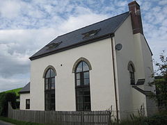
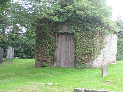
*Old Church and Graveyard. The former church of St Tysul stood on the hillside overlooking the village. Now only a stone porch with an 18th-century doorway remains, standing in the churchyard. The single-chambered medieval parish church is shown in a woodcut illustration<ref name="Cambrensis">"Archaeologia Cambrensis" 125-132 and 269-272</ref> to have been extensively rebuilt in the 18th century with round arched windows and roof dormers. It had also the most elaborate of the Montgomeryshire timber west bell-towers — a tower which was enclosed by an open gallery, corbelled out from the supporting framework, built inside the nave. Lych Gate to the graveyard by the architect Harold Hughes, of Bangor 1907.<ref>"Thomas" 524-529</ref>[[File:Chapel In Decline - geograph.org.uk - 906412.jpg|thumb|right|Bethesda Presbyterian Chapel]] |
|||
*St Tysul. By the architect [[Thomas Henry Wyatt]], 1863–6. Nave with west aisle, chancel, SE tower and spire. The church is orientated nearly north–south rather than the usual east–west. The four-bay arcade to the nave with polished red granite columns, with red sandstone and white limestone blocks used to decorate the stone arches. Chancel arch in Early English style. [[Caen stone]] and [[alabaster]] reredos. Monument to John Pugh (1784). Bells by Mears and Stainbank of Whitechapel,<ref>"Thomas" 524-529</ref> and recent clock by [[J. B. Joyce & Co|Joyce]] of Whitchurch. |
|||
*Wesleyan Chapel, with Gothic windows, now converted into a house called “The Arches”. |
|||
*Bethesda Presbyterian Chapel, Cefn y Coed. Low building with three bays of cambered sash windows and porch. Founded 1840, but possibly the building is later. A good example of a simple rural chapel. Closed in 2008 and currently unused. |
|||
== Notable buildings and bridges == |
== Notable buildings and bridges == |
||
=== Churches and chapels === |
|||
[[File:St Tyssil Parish Church - geograph.org.uk - 687550.jpg|thumb|left|170px|St Tysul's Parish Church]]The medieval church of St Tysul formerly stood on the hillside overlooking the village. It was extensively rebuilt in the 18th century with round arched windows and roof dormers.<ref name="Cambrensis">"Archaeologia Cambrensis" 125-132 and 269-272</ref> Now only a stone porch with an 18th-century doorway remains, standing in the churchyard.[[File:Chapel In Decline - geograph.org.uk - 906412.jpg|thumb|right|Bethesda Presbyterian Chapel]]The current St Tysul's church, by the architect [[Thomas Henry Wyatt]], was built between 1863–66. Its nave has polished red granite columns, with red sandstone and white limestone blocks used to decorate the stone arches. Its [[Chancel|chancel arch]] is in Early English style. |
|||
The village's [[Wesleyan theology|Wesleyan]] chapel, with [[Gothic Revival architecture|Gothic]] windows, has been converted into a house. |
|||
The Bethesda [[Presbyterian Church of Wales|Presbyterian]] Chapel, Cefn y Coed, was founded in 1840. It was closed in 2008 and is currently unused. |
|||
=== Other buildings === |
|||
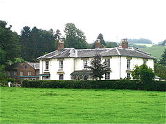
[[File:Cefnbryntalch - geograph.org.uk - 203602.jpg|thumb|Cefn Bryntalch]] |
[[File:Cefnbryntalch - geograph.org.uk - 203602.jpg|thumb|Cefn Bryntalch]] |
||
*Cefn Bryntalch. The house of 1867–69 by [[G F Bodley]] is an important early example of the Queen Anne revival. The house was completed by [[Philip Webb]]. The client was Richard Jones, who had made a fortune in the flannel trade. The exterior is cleanly detailed and well-executed in red brick, with prominent string-courses. The south front with three big gables and a balance of irregular chimneys and near-regular windows, and many C18 features – a hipped roof, two bays, sash-windows, and the central Venetian window. The symmetrical entrance front is rather a C17 vernacular – the west front is picturesque and irregular in contrast, an asymmetrical gable anchored by a shafted chimney; lower tile-hung wing. The interior is neo-Georgian, though the plan is arranged with the main sides at right-angles. The rear Courtyard has one side – a low service range extends from the house, with a stringcourse, and pediment over the doorway. At the North end, a large barn with timber-framing picturesquely closes the vista.<ref>Haslam R Powys: The Buildings of Wales Penguin, London 1979, 75</ref> |
|||
*Cefn Bryntalch. Built between 1867–69, this house by [[George Frederick Bodley|G F Bodley]] is an important early example of the [[Queen Anne style architecture|Queen Anne revival]]. The house was completed by [[Philip Webb]]. The client was Richard Jones, who had made a fortune in the flannel trade.<ref>Haslam R Powys: The Buildings of Wales Penguin, London 1979, 75</ref> It is a [[Listed building|Grade II* listed building]]<ref>{{NHAW|num=7714|desc=Cefn Bryntalch Hall|grade=II*|access-date=15 February 2023}}</ref> and its [[Victorian era|Victorian]] garden is listed, also at Grade II*, on the [[Cadw/ICOMOS Register of Parks and Gardens of Special Historic Interest in Wales]]. The hall was home to the composer [[Peter Warlock]] in the early 20th century.<ref>{{NHAW|uid=344|num=PGW(Po)29(POW)|desc=Cefn Bryntalch Hall|class=HPG|access-date=6 February 2023}}</ref> |
|||
*Rectory. 1812–14 by the Shrewsbury architect [[Joseph Bromfield]]. An attractive and well-preserved Regency design. Stuccoed, with hipped roofs and hoodmoulded windows. The original front was of three bays. The low hip-roofed tower to the rear gives the air of a picturesque Tuscan villa. The interior of the house was modified, bay windows and a new brick wing were added by [[Thomas Penson]] in 1858 for the Rev Henry Foulkes.<ref>Foulkes Parish Notes, Llandyssil Church Records, Powys County Archives</ref> In 1865, the east range was added to match by Thomas Garland, clerk of works to [[Thomas Henry Wyatt]]. He also renewed the veranda, keeping the original iron stanchions, but adding wooden circles in the spandrels of the arcade. Grade II listed.<ref>“Llandyssil Rectory: its architecture and building history” Montgomeryshire Collections, Vol. 90, 2002, 99-108.</ref> |
|||
*Rectory. Built between 1812–14 by the Shrewsbury architect [[Joseph Bromfield]] and modified in 1858 by [[Thomas Penson]], it has a well-preserved [[Regency architecture|Regency]] design.<ref>Foulkes Parish Notes, Llandyssil Church Records, Powys County Archives</ref> In 1865, the east range was added to match by Thomas Garland, clerk of works to [[Thomas Henry Wyatt]]. The building is Grade II listed.<ref>“Llandyssil Rectory: its architecture and building history” Montgomeryshire Collections, Vol. 90, 2002, 99-108.</ref> |
|||
*Former School, opposite the church and built at the same time. By the architect [[Thomas Henry Wyatt]]. Now Village Hall Two-bay school with truncated chimney; gabled master's house. The interior contains some woodwork from the old church's box pews. The building has recently been restored and a weatherboarded extension added to the south. |
|||
*Former School (now the Village Hall), opposite the church and built at the same time. Thomas Henry Wyatt was the architect. |
|||
*Phipp's Tenement. Three-bay farmhouse built of substantial square-timber framing. The dormer gable is dated 1630. At right angles to the main building a timber framed barn.<ref>Peter Smith "Houses of the Welsh Countryside" 2nd ed, 1988, HMSO/RCAHMW, fig. 177a</ref> |
|||
*Phipp's Tenement. A three-bay farmhouse built of substantial square-timber framing, with a dormer gable dated 1630.<ref>Peter Smith "Houses of the Welsh Countryside" 2nd ed, 1988, HMSO/RCAHMW, fig. 177a</ref> |
|||
*Plas Robin. An old stone house which stood on the opposite side of the road to Phipp's Tenement. Demolished before 1960. |
|||
*Plas Robin. An old stone house which stood on the opposite side of the road to Phipp's Tenement. Demolished in 1972. |
|||
*Oak House and Smithy (Inn and later village shop), built mainly of local Llandyssil siltstone and dating c1700, with surviving “Montgomeryshire” iron-framed windows. Possibly an Inn when the Old Coach road came through the village. Became the village shop when the Upper House was built. Shop owned by the Varley family and closed in 1959–60. |
|||
*Oak House and Smithy, built mainly of local Llandyssil siltstone and dating c.1700, with surviving “Montgomeryshire” iron-framed windows. It was possibly an inn, and was later the village shop owned by the Varley family, which closed in 1959–60. |
|||
[[File:River Severn, Fron footbridge - geograph.org.uk - 923467.jpg|thumb|right|River Severn, Fron footbridge - geograph.org.uk - 923467]] |
[[File:River Severn, Fron footbridge - geograph.org.uk - 923467.jpg|thumb|right|River Severn, Fron footbridge - geograph.org.uk - 923467]] |
||
*The Upper House. Built as a |
*The Upper House. Built as a pub before 1849.<ref>shown on Llandyssil Tithe Map of 1849- photocopy in Powys Archives, Llandrindod</ref> The village [[quoits]] court was behind the pub until 2003. [[File:River Severn, Brynderwen road bridge - geograph.org.uk - 659348.jpg|thumb|left|River Severn, Brynderwen road bridge - geograph.org.uk - 659348]] |
||
[[File:Fronfraith Hall, Llandyssil.png|thumb|Print of Fronfraith Hall, Llandyssil, 1870]] |
[[File:Fronfraith Hall, Llandyssil.png|thumb|Print of Fronfraith Hall, Llandyssil, 1870]] |
||
*Brynderwen Bridge |
*Brynderwen Bridge. Built in 1852, close to Abermule, this is a single 109-ft span across the river [[River Severn|Severn]] (and a smaller span across the canal) on five iron girders. Designed by [[Thomas Penson]]. The bridge came from Brymbo ironworks near Wrexham, and would have been transported to the site by the Montgomeryshire Canal. Grade II* listed.<ref>C. R. Anthony “Penson’s Progress: the work of a 19th-century county surveyor”, Montgomeryshire Collections, 1995, Vol 83, 115-175.</ref> |
||
*Fron Footbridge. An elegant iron suspension footbridge over the |
*Fron Footbridge. An elegant iron suspension footbridge over the Severn, taking a footpath from Severn Villa to Lower Llegodig Farm. Built in 1926 by [[David Rowell & Co.]] of London. |
||
*Middle Llegodig. Timber-framed lobby-entry house of c. 1700, a late example of its type |
*Middle Llegodig. Timber-framed lobby-entry house of c. 1700, a late example of its type. |
||
*[[Fronfraith Hall]], designed by James Pickard of Shrewsbury, |
*[[Fronfraith Hall]], designed by James Pickard of Shrewsbury, c. 1860. Its west wing burnt down in 1966.<ref>"English" Section 6.1</ref> |
||
==Clergy== |
|||
===Sinecure Rectors=== |
|||
{{div col begin}} |
|||
*1537 John Vaughan |
|||
*1556 Morgan Griffith |
|||
*1575 Griffith Lewis D.D. |
|||
*1607 Godfrey Goodman MA |
|||
*1616 Thomas Kyffin |
|||
*1622 John Berkeley D.D. |
|||
*1625 Robert Lloyd |
|||
*1660 Michael Hughes |
|||
{{colend}} |
|||
==Quoiting== |
==Quoiting== |
||
Playing [[ |
Playing [[quoits]] was a widespread pastime in many rural areas. It had largely died in much of England by the [[World War II|Second World War]], but after the War enjoyed a revival in Mid-Wales, when the quoits were made by a light engineering company in [[Newtown, Powys|Newtown]]. In Llandyssil the 'old' or 'long' quoits rules were followed. The quoits court was moved to behind the Upper House pub by 1983, where Wales beat Scotland in an international match. In a 1991 international match at Llandyssil, Wales convincingly beat Scotland 252 to 83. The last championship match was held at Llandyssil in 2003, after which the court was closed.<ref>http://www.lindahome.co.uk/Quoits1/ABindex.htm {{Dead link|date=February 2022|fix-attempted=yes}}</ref> <ref>{{cite web|url=http://www.ukquoits.org|title=The History of Quoits in Wales|author=Albert Baker|website=ukquoits.org}}</ref> |
||
<ref>The History of Quoits in Wales http://www.ukquoits.org</ref> |
|||
==Sheep |
==Sheep dog trials== |
||
The 2012 Welsh National Sheep Dog Trials were held on the field by |
The 2012 Welsh National [[Sheepdog trial|Sheep Dog Trials]] were held on the field by the bridge at Henfron, Llandyssil, between 19 and 21 July 2012.<ref>{{Cite web|url=http://www.dailypost.co.uk/news/local-news/pentrefoelas-sheepdog-handler-back-top-2652705|title=Pentrefoelas sheepdog handler back on top|first=Andrew|last=Forgrave|date=1 August 2012|website=North Wales Live}}</ref> |
||
==Notable people== |
==Notable people== |
||
*Rear Admiral Sir Charles Thomas Jones (1778–1853), Royal Navy officer and High Sheriff of Montgomeryshire in 1832.<ref>Richard Williams “Montgomeryshire Worthies", Newtown (1884), 59</ref> |
|||
*[[John Billington]] (1936- ) British Junior High Jump Champion. AAA championships at Birmingham, 1954, when he cleared 6'0" (1.83metres).<ref>htmp://www.gbr athletics.com/bc/bc3.htm</ref> |
|||
[[File:Otter Hunt.png|150px|thumb|Otter Hunt - John Lloyd of Abermule and George Thomas, by Thomas Weaver ca.1817]] |
|||
*[[Julie Christie]], Oscar winning film actress. Lived at Whitehall, Cefn y Coed, in Llandyssil 1981–2010. [http://www.rightmove.co.uk/property-for-sale/property-35092856.html Whitehall Farm][http://www.express.co.uk/entertainment/films/561026/Julie-Christie-reveals-left-Hollywood-stardom-tend-sheep-farm-in-Wales-Madding-Crowd-fame] |
|||
[[File:Diz Disley at 1981 Essex Festival, UK (Tony Rees photo).jpg|thumb|140px|[[Diz Disley]], 1981)]] |
|||
*[[Rupert Davies (Canadian politician)|Senator Rupert Davies]] (1879-1967), Canadian politician and newspaper editor, who was born in [[Welshpool]], purchased [[Fronfraith Hall]] in 1932 and continued to use it as his home in Wales until he sold it in 1948.<ref>“English’’, 6, section 1</ref> |
|||
*George Thomas (1786–1859), writer and poet, was the first postmaster of Llandyssil. In 1817 he wrote a poem about otter hunting, commemorated by a painting in the [[National Museum Cardiff|National Museum of Wales]].<ref>Frazer Thomas. George Thomas of Llandyssil, 1786–1859. The Montgomeryshire Collections, Vol 97, 2009, 101-121</ref> |
|||
*[[Diz Disley]] (1931–2010), jazz guitarist. Lived in Oak Cottages in the 1930s. |
|||
*[[Lumley Jones|Brigadier General Lumley O W Jones]] (1876–1918), British Army General<ref>https://www.twgpp.org/photograph/view/2776855, with photograph of headstone{{dead link|date=March 2022|fix-attempted=yes}}</ref><ref>{{Cite web|url=http://www.ww1wargraves.co.uk/ww1_cemeteries/ww1_cemetery_b.asp|title = WW1 Cemeteries in France - World War One Cemetery in France - French WW1 Memorials}}</ref> |
|||
*Henry Powell Ffoulkes (1815–1886). Rector of Llandyssil 1857–1879 and [[Archdeacon of Montgomery]] 1861–1886. Ffoulkes demolished the old Church in Llandyssil, amid considerable criticism.<ref name="Cambrensis" /> He built the new church on its present site in 1863 at the cost of £3000. He also arranged for the building of the school and schoolhouse. He was a member of the [[Oxford Movement]]. A manuscript history of Llandyssil by Foulkes has recently been deposited in the Powys County Archives.<ref>Brown R L, Henry Powell Ffoulkes, Archdeacon of Montgomery. The Montgomeryshire Collections, Vol 94, 2006, 131-142</ref> |
|||
*[[Rupert Davies (politician)|Rupert Davies]] (1879-1967), Canadian politician and newspaper editor; owned Fronfraith Hall between 1932 and 1948<ref>“English’’, 6, section 1</ref> |
|||
*[[Peter Warlock]] - alias Philip Heseltine (1894–1930). Composer. Lived at Cefn Bryntalch. Composed many of his more important works there and played the organ in Llandyssil Church. |
|||
*[[Peter Warlock]] (1894–1930), composer, lived at Cefn Bryntalch, where he composed many works; also played the organ in Llandyssil church |
|||
*[[Nigel Heseltine]] (1916–1995), writer and colonial administrator. An illegitimate son of Peter Warlock, who was brought up by the Buckley Jones family at Cefn Bryntalch.<ref>Meic Stephens (ed) "The New Companion to the Literature of Wales", 2nd edition, UWP, 1998, 317</ref> |
|||
*[[Nigel Heseltine]] (1916–1995), writer and colonial administrator brought up at Cefn Bryntalch<ref>Meic Stephens (ed) "The New Companion to the Literature of Wales", 2nd edition, UWP, 1998, 317</ref> |
|||
*Rear Admiral Sir Charles Thomas Jones (1778–1853), third son of Charles Thomas Jones of Fronfraith. Saw distinguished service in the Royal Navy and was knighted in 1809. High Sheriff of Montgomeryshire 1832.<ref>Richard Williams “Montgomeryshire Worthies", Newtown (1884), 59</ref> |
|||
*[[Diz Disley]] (1931–2010), jazz guitarist, lived in Oak Cottages in the 1930s |
|||
* Brigadier General Lumley O W Jones (1887–1918), son of Richard and Catherine Jones of Cefn Bryntalch. Brigadier General commanding the 13th Infantry Brigade. Chevalier of the Legion of Honour (France). Died of pneumonia 14 September 1918 aged 41 and buried at the Bagneux British Cemetery at Gezaincourt. He had started the war as a captain in 2nd Essex Regiment, and took part in nearly every battle on the Western Front. He was the last of 12 British General Officers to die on the Somme.<ref>http://www {{webarchive|url=https://web.archive.org/web/20010426175339/http://www/ |date=2001-04-26 }}. twgpp.org/information.php?id=2776855, with photograph of headstone</ref><ref>{{Cite web|url=http://www.ww1wargraves.co.uk/ww1_cemeteries/ww1_cemetery_b.asp|title = WW1 Cemeteries in France - World War One Cemetery in France - French WW1 Memorials}}</ref> |
|||
*[[John Billington]] (born 1936), high jumper<ref>{{Cite web|url=http://www.gbrathletics.com/bc/bc3.htm|title=British Athletics Championships 1945-1959|website=www.gbrathletics.com}}</ref> |
|||
[[File:Otter Hunt.png|300px|thumb|Otter Hunt - John Lloyd of Abermule and George Thomas, by Thomas Weaver c.1817]] |
|||
*[[Julie Christie]] (born 1940), actress, lived at Whitehall Farm, Cefn y Coed from 1981–2010<ref>{{cite web|url=http://www.rightmove.co.uk/property-for-sale/property-35092856.html|archiveurl=https://web.archive.org/web/20120205092245/http://www.rightmove.co.uk:80/property-for-sale/property-35092856.html|archivedate=2012-02-05|title=Whitehall Farm|website=Rightmove}}</ref><ref>{{Cite web|url=https://www.express.co.uk/entertainment/films/561026/Julie-Christie-reveals-left-Hollywood-stardom-tend-sheep-farm-in-Wales-Madding-Crowd-fame|title='I had to escape Hollywood's madding crowd!' Julie Christie on swapping glamour for sheep|first=Garth|last=Pearce|date=28 February 2015|website=Express.co.uk}}</ref> |
|||
*Richard Morgan. Lived at [[Fronfraith Hall|Fronfraith]]. MP for [[Montgomery Boroughs]] 1592–3. He was married to Margaret Lloyd, daughter of Thomas Lloyd of Gwernabuarth. |
|||
*[[Iolo Williams]] (born 1962), naturalist and TV presenter, lives in Llandyssil<ref>[http://www.countytimes.co.uk/news/122653/tv-presenter-iolo-williams-says-sign-the-petition-.aspx "TV presenter Iolo Williams says 'sign the petition'"], ''County Times'' ([[Welshpool]]), 13 May 2013.</ref> |
|||
*[[Robert Morgan (bishop)|Robert Morgan]] (1608–1673). Third son of Richard Morgan MP of [[Fronfraith Hall|Fronfraith]]. In 1660 he became [[Archdeacon of Merioneth]], and he was consecrated [[Bishop of Bangor]] in 1666. |
|||
*[[Brian Sewell]] (1931-2015), art historian and media personality. The illegitimate son of the composer Peter Warlock. For the first three years of his life, he was brought up at Cefn Bryntalch by his mother, Mary Jessica Perkins, who married Robert Sewell in 1936. |
|||
*George Thomas (1786–1859), writer and poet. In 1817 he married Bridget Stoakes of Kerry at Llandyssil, and lived for the remainder of his life in the parish at Bank Farm. Clerk to the Governors of the Montgomery Workhouse (Camlad House), and also observed the [[Chartism|Chartist Uprisings]], about which he wrote a poem. He became the first postmaster of Llandyssil. In 1817 he wrote a poem about Otter Hunting, and his involvement in the sport with John Lloyd of the Court, [[Abermule]] is commemorated by a painting in the [[National Museum of Wales]].<ref>Frazer Thomas. George Thomas of Llandyssil, 1786–1859. The Montgomeryshire Collections, Vol 97, 2009, 101-121</ref> |
|||
*[[Iolo Williams]] (1962-). Naturalist and television presenter. Lives in Llandyssil.<ref>[http://www.countytimes.co.uk/news/122653/tv-presenter-iolo-williams-says-sign-the-petition-.aspx "TV presenter Iolo Williams says 'sign the petition'"], ''County Times'' ([[Welshpool]]), 13 May 2013.</ref> |
|||
{{clear}} |
{{clear}} |
||
==Gallery== |
==Gallery== |
||
<gallery> |
<gallery mode=packed> |
||
File:St Tyssul 02.jpg|St Tyssul depicted in window in Montgomery church |
|||
File:St Tyssul 02.jpg|St Tyssul, Montgomery church |
|||
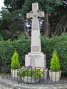
File:Llandyssil War Memorial.jpg|Llandyssil War Memorial |
File:Llandyssil War Memorial.jpg|Llandyssil War Memorial |
||
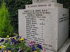
File:Llandyssil War Memorial - the 1914-18 War.JPG|Llandyssil War Memorial - the 1914–18 War |
File:Llandyssil War Memorial - the 1914-18 War.JPG|Llandyssil War Memorial - the 1914–18 War |
||
File:Llandyssil Bridge - geograph.org.uk - 612385.jpg|Llandyssil Bridge |
File:Llandyssil Bridge - geograph.org.uk - 612385.jpg|Llandyssil Bridge |
||
File:The Upper House, Public House, Llandyssil.JPG|The Upper House, Public House, Llandyssil |
File:The Upper House, Public House, Llandyssil.JPG|The Upper House, Public House, Llandyssil |
||
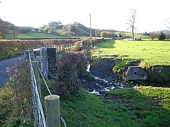
File:Brook from Llandyssil Bridge - geograph.org.uk - 612383.jpg|Brook from Llandyssil Bridge |
File:Brook from Llandyssil Bridge - geograph.org.uk - 612383.jpg|Brook from Llandyssil Bridge |
||
File:Brooklyn, Llandysssil.JPG|Brooklyn, Llandyssil |
File:Brooklyn, Llandysssil.JPG|Brooklyn, Llandyssil |
||
File:The Old Rectory, Llandyssil.JPG|The Old Rectory, Llandyssil |
File:The Old Rectory, Llandyssil.JPG|The Old Rectory, Llandyssil |
||
| Line 163: | Line 159: | ||
File:Dormer Window dated 1630, Phipp's Tenement , Llandyssil.JPG|Dormer Window dated 1630, Phipp's Tenement, Llandyssil |
File:Dormer Window dated 1630, Phipp's Tenement , Llandyssil.JPG|Dormer Window dated 1630, Phipp's Tenement, Llandyssil |
||
</gallery> |
</gallery> |
||
==Notes== |
|||
{{reflist|group=notes}} |
|||
==References== |
==References== |
||
| Line 196: | Line 195: | ||
[[Category:History of Montgomeryshire]] |
[[Category:History of Montgomeryshire]] |
||
[[Category:Historic Montgomeryshire Parishes]] |
[[Category:Historic Montgomeryshire Parishes]] |
||
[[Category:Registered historic parks and gardens in Powys]] |
|||
Revision as of 10:35, 20 July 2024
| Llandyssil | |
|---|---|
 | |
 Llandyssil Location within Powys | |
| Population | 300 |
| OS grid reference | SO1995 |
| Community | |
| Principal area | |
| Country | Wales |
| Sovereign state | United Kingdom |
| Post town | MONTGOMERY |
| Postcode district | SY15 |
| Dialling code | 01686 |
| Police | Dyfed-Powys |
| Fire | Mid and West Wales |
| Ambulance | Welsh |
| UK Parliament | |
| Senedd Cymru – Welsh Parliament | |
Llandyssil (Welsh: Llandysul) is a village in the community of Abermule with Llandyssil,[1] in Powys, Wales, in the traditional county of Montgomeryshire. It is about two miles from the town of Montgomery.
In 2001 there were 420 inhabitants in the parish, of whom 300 lived in the village itself.[2][notes 1][3]
Connection with Celtic saints


Llandyssil takes its name from St Tysul, a little known Welsh saint of the 7th century.[4] Only two churches in Wales were dedicated to this saint, Llandyssil in Montgomeryshire and Llandysul in Ceredigion, and the feast day for this saint was celebrated on 31 January.[5] The old church in the village (largely demolished in 1866) stood in the graveyard to the southeast of the present village. This suggests that the present settlement dates back to the period around 700. There is also a connection with another early Welsh and Breton saint, St Padarn.[6] On the highland to the south in Cefn y Coed is the farm Cwm Badarn. The Llandyssil Brook rises in this Cwm or valley, and between Cwm Badarn Farm and the Pinion is a rock-cut spring, that was possibly a holy well, dedicated to St Padarn.
History
In the medieval period, Llandyssil was in the Cantref of Cedewain in the Kingdom of Powys. The parish was divided into four townships: Bolbro, Bronywood (or Bronycoed), Bryntalch and Rhandir. Rhandir, which contained the parish church, was the largest of these townships. It was probably an amalgamation of three other townships; Cefn-y-coed, Coedywig and Trefganol.[7]
In 1536, following the Act of Union, Llandyssil became part of the new county of Montgomeryshire. For ecclesiastical administration, the parish was in the Bishopric of St Asaph, the Archdeaconry of Montgomery and the Deanery of Cedewain.[8] For Parliamentary representation, Llandyssil fell within the County of Montgomery until 1885, when, for electoral purposes, it was included within the Montgomery Boroughs. It was transferred back to the county in 1918, when only one MP represented Montgomeryshire.
With the establishment of the Montgomeryshire County Council in 1894, Llandyssil Parish Council was created, and it was included in Forden Rural District Council. In 1974, as a result of local government reform, Llandyssil Parish Council became a Community Council within the Montgomeryshire District Council.[9] At this time, Llanmerewig was joined with Llandyssil to form the new community council, and in 1984 this was renamed Abermule with Llandyssil Community Council. At this time, the council covered the old parishes of Llanmerewig and Llandyssil, together with Dolforwyn, which had been a township in Bettws Cedewain parish. In 1996, with the abolition of the Montgomeryshire District Council, the Community Council became part of Powys County Council.
Population and language
According to census returns, the historical population of Llandyssil has been as follows:[10]
|
|
|
In 1880, a portion of the township of Bolbro was transferred from Llandyssil to Llanmerewig and the size of the parish was reduced from 4187 acres to 3800 acres. This may be reflected in the decrease in population between the 1881 and 1891 censuses.
During the later part of the 18th century, it appears that the Welsh language was supplanted by English for general usage in the village.[11] There remain some Welsh speakers in the village, but they have mainly come from elsewhere in Montgomeryshire.
Archaeological and historic monuments
Llandyssil is particularly rich in archaeological sites, especially of the Later Bronze Age and Iron Age.[12][13] To the northeast is Ffridd Faldwyn, possibly the largest hillfort in Wales, which is adjacent to Town Hill in Montgomery. Most of the sites have been discovered by aerial photography.[13] The main sites are as follows.
Prehistoric
The prehistoric sites include:[14]
- Brynderwen Enclosure. Ditched enclosure close to the river Severn, dated to c.3350-3000 BC. Late Neolithic Peterborough ware pottery has been found at the site .[15]
- Cefn Llan Hillfort in Cefnycoed. This enclosure, situated on low hill, is a scheduled ancient monument. The site is overgrown and its bank is starting to erode.[16][17] To the north of the hillfort is a triple-ditched enclosure.[18]
- Cloddiau. This is a triple-ditched enclosure,[19][20] possibly a late Bronze Age or Iron Age cattle krall[clarification needed] or banjo enclosure.[21]
- Coed y Wig hillfort.[22] An Iron Age hillfort revealed by aerial photography.
- Cuckoo Hill Hillfort.[23] Another triple-ditched enclosure, this was excavated in 1993. A single rim sherd, probably dating from Roman times, was discovered there.[24][25]
- Fron Fraith Wood Hillfort.[26] This is the northwest part of two ditched enclosures. Excavated in 1994.[24]
- Goron Ddu Hillfort.[27] This hillfort overlooks the river Severn to the north of the village. Geophysical survey has shown a concentration of features in the centre of the enclosure, but with insufficient clarity to distinguish roundhouses.[28]
- Mount Pleasant Defended Enclosure.[29] A scheduled ancient monument, this is a double-ditched enclosure with surviving earthworks. Inside the enclosure, the remains of a clay dump rampart were discovered, with the remains of a hearth and grains of spelt. Radiocarbon dating suggests that the site was occupied in the earlier Iron Age.[30]
Roman
- The Roman road from Forden Gaer/Lavrobrinta[31] to Caersws runs through the parish along the river, probably largely in line with the B3484 from Caerhowel railway bridge to the Abermule railway bridge. A length of the road was uncovered in 2006, during the construction of the Felin Hafren housing estate in Abermule.
Early Medieval and Norman
- Brynderwen motte-and-bailey castle is an early castle that guarded the river Severn crossing. The motte has gone and the bailey area is occupied by a farm.[32][33]
- Cefn Bryntalch motte-and-bailey castle stands to the southwest of Cefn Bryntalch house.[34][35]
- Mound by Llandyssil Bridge. This may have been a barrow or medieval mill mound. Place names in the vicinity, such as Cae Melyn and Ty Melyn (originally Cae Melin and Ty Melin – Welsh for Mill Field and Mill House) may support its identification as a windmill mound for a post mill.[citation needed]
Notable buildings and bridges
Churches and chapels
The medieval church of St Tysul formerly stood on the hillside overlooking the village. It was extensively rebuilt in the 18th century with round arched windows and roof dormers.[36] Now only a stone porch with an 18th-century doorway remains, standing in the churchyard.

The current St Tysul's church, by the architect Thomas Henry Wyatt, was built between 1863–66. Its nave has polished red granite columns, with red sandstone and white limestone blocks used to decorate the stone arches. Its chancel arch is in Early English style.
The village's Wesleyan chapel, with Gothic windows, has been converted into a house.
The Bethesda Presbyterian Chapel, Cefn y Coed, was founded in 1840. It was closed in 2008 and is currently unused.
Other buildings

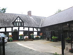
- Cefn Bryntalch. Built between 1867–69, this house by G F Bodley is an important early example of the Queen Anne revival. The house was completed by Philip Webb. The client was Richard Jones, who had made a fortune in the flannel trade.[37] It is a Grade II* listed building[38] and its Victorian garden is listed, also at Grade II*, on the Cadw/ICOMOS Register of Parks and Gardens of Special Historic Interest in Wales. The hall was home to the composer Peter Warlock in the early 20th century.[39]
- Rectory. Built between 1812–14 by the Shrewsbury architect Joseph Bromfield and modified in 1858 by Thomas Penson, it has a well-preserved Regency design.[40] In 1865, the east range was added to match by Thomas Garland, clerk of works to Thomas Henry Wyatt. The building is Grade II listed.[41]
- Former School (now the Village Hall), opposite the church and built at the same time. Thomas Henry Wyatt was the architect.
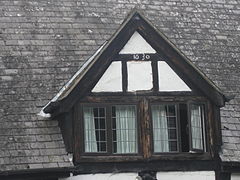
- Phipp's Tenement. A three-bay farmhouse built of substantial square-timber framing, with a dormer gable dated 1630.[42]
- Plas Robin. An old stone house which stood on the opposite side of the road to Phipp's Tenement. Demolished in 1972.
- Oak House and Smithy, built mainly of local Llandyssil siltstone and dating c.1700, with surviving “Montgomeryshire” iron-framed windows. It was possibly an inn, and was later the village shop owned by the Varley family, which closed in 1959–60.

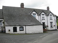
- The Upper House. Built as a pub before 1849.[43] The village quoits court was behind the pub until 2003.

River Severn, Brynderwen road bridge - geograph.org.uk - 659348


- Brynderwen Bridge. Built in 1852, close to Abermule, this is a single 109-ft span across the river Severn (and a smaller span across the canal) on five iron girders. Designed by Thomas Penson. The bridge came from Brymbo ironworks near Wrexham, and would have been transported to the site by the Montgomeryshire Canal. Grade II* listed.[44]
- Fron Footbridge. An elegant iron suspension footbridge over the Severn, taking a footpath from Severn Villa to Lower Llegodig Farm. Built in 1926 by David Rowell & Co. of London.
- Middle Llegodig. Timber-framed lobby-entry house of c. 1700, a late example of its type.
- Fronfraith Hall, designed by James Pickard of Shrewsbury, c. 1860. Its west wing burnt down in 1966.[45]
Quoiting
Playing quoits was a widespread pastime in many rural areas. It had largely died in much of England by the Second World War, but after the War enjoyed a revival in Mid-Wales, when the quoits were made by a light engineering company in Newtown. In Llandyssil the 'old' or 'long' quoits rules were followed. The quoits court was moved to behind the Upper House pub by 1983, where Wales beat Scotland in an international match. In a 1991 international match at Llandyssil, Wales convincingly beat Scotland 252 to 83. The last championship match was held at Llandyssil in 2003, after which the court was closed.[46] [47]
Sheep dog trials
The 2012 Welsh National Sheep Dog Trials were held on the field by the bridge at Henfron, Llandyssil, between 19 and 21 July 2012.[48]
Notable people
- Rear Admiral Sir Charles Thomas Jones (1778–1853), Royal Navy officer and High Sheriff of Montgomeryshire in 1832.[49]

.jpg)
- George Thomas (1786–1859), writer and poet, was the first postmaster of Llandyssil. In 1817 he wrote a poem about otter hunting, commemorated by a painting in the National Museum of Wales.[50]
- Brigadier General Lumley O W Jones (1876–1918), British Army General[51][52]
- Rupert Davies (1879-1967), Canadian politician and newspaper editor; owned Fronfraith Hall between 1932 and 1948[53]
- Peter Warlock (1894–1930), composer, lived at Cefn Bryntalch, where he composed many works; also played the organ in Llandyssil church
- Nigel Heseltine (1916–1995), writer and colonial administrator brought up at Cefn Bryntalch[54]
- Diz Disley (1931–2010), jazz guitarist, lived in Oak Cottages in the 1930s
- John Billington (born 1936), high jumper[55]
- Julie Christie (born 1940), actress, lived at Whitehall Farm, Cefn y Coed from 1981–2010[56][57]
- Iolo Williams (born 1962), naturalist and TV presenter, lives in Llandyssil[58]
Gallery
-
 St Tyssul, Montgomery church
 -
 Llandyssil War Memorial
 -
 Llandyssil War Memorial - the 1914–18 War
 -
 Llandyssil Bridge
 -
 The Upper House, Public House, Llandyssil
 -
 Brook from Llandyssil Bridge
 -
 Brooklyn, Llandyssil
 -
 The Old Rectory, Llandyssil
 -
 View over Llandyssil from the old churchyard.
 -
 The Former Wesleyan Chapel, Llandyssil
 -
 Lych Gate, St Tysul's Old churchyard, Llandyssil
 -
 The re-built porch of the Old Church, Llandyssil
 -
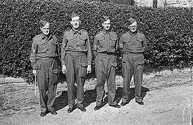 Llandyssil Home Guard after a Church Parade at Parish Church
 -
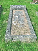 Llandyssil Churchyard. Grave of Walter Buckley Jones and wife Edith
 -
 Llandyssil Churchyard. Grave of Richard Jones and wife Catharina.
 -
 Phipp's Tenement and Barn, Llandyssil
 -
 Dormer Window dated 1630, Phipp's Tenement, Llandyssil


.jpg)


Notes
- ^ The population figures are approximate because the 2001 Census figures do not coincide with the historic boundaries of the parish
References
- ^ "Powys County Council - Election of Community Councillors" (PDF). Government of Powys. Archived from the original (PDF) on 16 January 2018. Retrieved 22 May 2017.
- ^ "Welcome to Llandyssil-Croeso I Llandyssil". llandyssil-powys.co.uk. Archived from the original on 6 May 2013.
- ^ English E (ed) 1999 "A Collected History of the Communities of Llandyssil, Abermule and Llanmerewig".
- ^ Bartrum P C “A Welsh Classical Dictionary: People in History and Legend up to about A.D. 1000”, National Library of Wales, 1993, 630. Tysul’s full name was Tysul ap Corun ap Cunedda - or son of Corun, son of Cunedda
- ^ Thomas D R The History of the Diocese of St Asaph, Vol I, Caxton Press, Oswestry 1908 (2 ed.),524.
- ^ “Bartrum”, 522-524.
- ^ ’‘Thomas’’ Vol 1, 524,
- ^ "Thomas" Vol 1, 524
- ^ “English”, unpaginated. This provides a very detailed history of the Parish and the successor Community Council,
- ^ "Victorian Montgomery - Llandysul population". history.powys.org.uk.
- ^ Pryce W R T “Changing Language Geographies of Montgomeryshire c1749-1991” in Jenkins D (ed) “The Historical Atlas of Montgomeryshire”, Powysland Club, Welshpool 1999, 118
- ^ "Historic Settlement Survey, Montgomeryshire - Llandyssil" (PDF). Clwyd Powys Archaeological Trust.
- ^ a b RCHMW: An Inventory of Ancient Monuments Volume 1, County of Montgomery, HMSO, 1911, 77
- ^ Silvester, Robert J, 2011, Recent Research on Late Prehistoric and Romano-British Enclosures in Montgomeryshire, "The Montgomeryshire Collections" : 99 : 1-26. This provides the most recent survey of the Llandyssil earthworks in their Montgomeryshire context
- ^ Gibson, A M & Musson, C R, 1990, A cropmark enclosure and a sherd of later Neolithic pottery from Brynderwen, Llandyssil, Powys, The Montgomeryshire Collections : 78 : 11-15
- ^ “RCHMW” : 77, no 385, no386
- ^ "CPAT Regional Historic Environment Record - Cefn Llan Hillfort". Archwilio.
- ^ "CPAT Regional Historic Environment Record - Cefn Llan enclosure". Archwilio.
- ^ Chris Musson “Wales from the Air: Patterns of Past and Present” RCAHMW c.1996, 133, aerial photograph.
- ^ ”Musson”, 87
- ^ "Banjo Enclosures - Introduction to Heritage Assets". Historic England. July 2018.
- ^ "CPAT Regional Historic Environment Record - Coed y Wig hillfort". Archwilio.
- ^ "CPAT Regional Historic Environment Record - Cuckoo Hall hillfort". Archwilio.
- ^ a b "Britnell & Thomas" 2010
- ^ "Silvester" 2011, 19
- ^ "CPAT Regional Historic Environment Record - Fron Fraith Wood hillfort". Archwilio.
- ^ "CPAT Regional Historic Environment Record -Goron Ddu enclosure". Archwilio.
- ^ "Silvester" 2011, 16-17
- ^ "CPAT Regional Historic Environment Record - Mount Pleasant enclosure". Archwilio.
- ^ "Silvester" 2011, 19, fig11, for plan of site
- ^ “Musson” 88-89, with aerial photograph of the Roman fort
- ^ RCHMW : “An Inventory of Ancient Monuments Volume 1, County of Montgomery”, HMSO, 1911, 77, no 386
- ^ "Site Record - Garn Wen, Cairn Ii". Coflein.
- ^ RCHMW : An Inventory of Ancient Monuments Volume 1, County of Montgomery, HMSO, 1911, 77, no 387
- ^ Musson C, “Montgomeryshire Past and Present from the Air”, The Powysland Club, 2011, 93, Col. Plate
- ^ "Archaeologia Cambrensis" 125-132 and 269-272
- ^ Haslam R Powys: The Buildings of Wales Penguin, London 1979, 75
- ^ Cadw. "Cefn Bryntalch Hall (Grade II*) (7714)". National Historic Assets of Wales. Retrieved 15 February 2023.
- ^ Cadw. "Cefn Bryntalch Hall (PGW(Po)29(POW))". National Historic Assets of Wales. Retrieved 6 February 2023.
- ^ Foulkes Parish Notes, Llandyssil Church Records, Powys County Archives
- ^ “Llandyssil Rectory: its architecture and building history” Montgomeryshire Collections, Vol. 90, 2002, 99-108.
- ^ Peter Smith "Houses of the Welsh Countryside" 2nd ed, 1988, HMSO/RCAHMW, fig. 177a
- ^ shown on Llandyssil Tithe Map of 1849- photocopy in Powys Archives, Llandrindod
- ^ C. R. Anthony “Penson’s Progress: the work of a 19th-century county surveyor”, Montgomeryshire Collections, 1995, Vol 83, 115-175.
- ^ "English" Section 6.1
- ^ http://www.lindahome.co.uk/Quoits1/ABindex.htm [permanent dead link]
- ^ Albert Baker. "The History of Quoits in Wales". ukquoits.org.
- ^ Forgrave, Andrew (1 August 2012). "Pentrefoelas sheepdog handler back on top". North Wales Live.
- ^ Richard Williams “Montgomeryshire Worthies", Newtown (1884), 59
- ^ Frazer Thomas. George Thomas of Llandyssil, 1786–1859. The Montgomeryshire Collections, Vol 97, 2009, 101-121
- ^ https://www.twgpp.org/photograph/view/2776855, with photograph of headstone[permanent dead link]
- ^ "WW1 Cemeteries in France - World War One Cemetery in France - French WW1 Memorials".
- ^ “English’’, 6, section 1
- ^ Meic Stephens (ed) "The New Companion to the Literature of Wales", 2nd edition, UWP, 1998, 317
- ^ "British Athletics Championships 1945-1959". www.gbrathletics.com.
- ^ "Whitehall Farm". Rightmove. Archived from the original on 5 February 2012.
- ^ Pearce, Garth (28 February 2015). "'I had to escape Hollywood's madding crowd!' Julie Christie on swapping glamour for sheep". Express.co.uk.
- ^ "TV presenter Iolo Williams says 'sign the petition'", County Times (Welshpool), 13 May 2013.
External links
- Llandyssil Community Trust, Village Hall and Dragonfest
- Local history resources for Llandyssil
- Homepage for Abermule with Llandyssil Community Council
- Details of the recently demolished brick arch in the garden at Brooklyn, opposite the Church
- Listed buildings in Abermule with Llandyssil Community Council
- Records held by Powys County Archives
- Victorian Powys- useful information for Llandyssil given in the Montgomery Town section
- Indexed database for archaeological finds in under Llandyssil Community entry.
- Photos of Llandyssil and surrounding area on geograph
Places adjacent to Llandyssil | ||||||||||||||||
|---|---|---|---|---|---|---|---|---|---|---|---|---|---|---|---|---|
| ||||||||||||||||