
Altus, Oklahoma: Difference between revisions
Tags: Mobile edit Mobile web edit |
|||
| (48 intermediate revisions by 37 users not shown) | |||
| Line 1: | Line 1: | ||
{{Use mdy dates|date=July 2023}} |
|||
{{Infobox settlement |
{{Infobox settlement |
||
| name = Altus, Oklahoma |
| name = Altus, Oklahoma |
||
| settlement_type = [[City]] |
| settlement_type = [[City]] |
||
| motto = "City with a future to share"<ref>{{Cite web| |
| motto = "City with a future to share"<ref>{{Cite web| url=http://www.altusok.gov| title=The City of Altus Oklahoma| publisher=City of Altus| access-date=October 16, 2018}}</ref> |
||
<!-- Images --> |
<!-- Images --> |
||
| image_skyline = Jackson courthouse.jpg |
| image_skyline = Jackson courthouse.jpg |
||
| image_caption = Jackson County Courthouse in Altus |
| image_caption = Jackson County Courthouse in Altus |
||
| ⚫ | |||
| image_seal = <!-- Maps --> |
|||
| image_map = OKMap-doton-Altus.PNG |
|||
| map_caption = Location of Altus, Oklahoma |
|||
| image_map1 = |
|||
| map_caption1 = <!-- Location --> |
|||
| subdivision_type = [[List of sovereign states|Country]] |
| subdivision_type = [[List of sovereign states|Country]] |
||
| subdivision_name = United States |
| subdivision_name = United States |
||
| Line 24: | Line 19: | ||
| government_type = Council-Manager |
| government_type = Council-Manager |
||
| leader_title = Mayor |
| leader_title = Mayor |
||
| leader_name = |
| leader_name = Robert Garrison |
||
| leader_title1 = City Manager |
| leader_title1 = City Manager |
||
| leader_name1 = |
| leader_name1 = Gary Jones |
||
| established_title = |
| established_title = |
||
| established_date = <!-- Area --> |
| established_date = <!-- Area --> |
||
| area_footnotes = <ref name=" |
| area_footnotes = <ref name="TigerWebMapServer">{{cite web|title=ArcGIS REST Services Directory|url=https://tigerweb.geo.census.gov/arcgis/rest/services/TIGERweb/Places_CouSub_ConCity_SubMCD/MapServer|publisher=United States Census Bureau|accessdate=September 20, 2022}}</ref> |
||
| area_total_km2 = |
| area_total_km2 = 47.69 |
||
| area_land_km2 = 47. |
| area_land_km2 = 47.17 |
||
| area_water_km2 = 0.52 |
| area_water_km2 = 0.52 |
||
| area_total_sq_mi = 18. |
| area_total_sq_mi = 18.41 |
||
| area_land_sq_mi = 18. |
| area_land_sq_mi = 18.21 |
||
| area_water_sq_mi = 0.20 |
| area_water_sq_mi = 0.20 |
||
| unit_pref = Imperial |
| unit_pref = Imperial |
||
<!-- Population --> |
<!-- Population --> |
||
| population_as_of = [[ |
| population_as_of = [[2020 United States Census|2020]] |
||
| ⚫ | |||
| population_footnotes = <ref name="Census 2010">{{Cite web| url=https://factfinder.census.gov/bkmk/table/1.0/en/DEC/10_SF1/G001/1600000US4001700| title=Geographic Identifiers: 2010 Census Summary File 1 (G001): Altus city, Oklahoma| publisher=U.S. Census Bureau| work=American Factfinder| access-date=October 16, 2018| archive-url=https://archive.today/20200213111928/https://factfinder.census.gov/bkmk/table/1.0/en/DEC/10_SF1/G001/1600000US4001700| archive-date=February 13, 2020| url-status=dead}}</ref> |
|||
| population_total = |
| population_total = 18729 |
||
| population_density_km2 = |
| population_density_km2 = 397.03 |
||
| population_density_sq_mi = |
| population_density_sq_mi = 1028.33 |
||
<!-- General information --> |
<!-- General information --> |
||
| timezone |
| timezone = [[North American Central Time Zone|Central (CST)]] |
||
| utc_offset |
| utc_offset = -6 |
||
| timezone_DST |
| timezone_DST = CDT |
||
| utc_offset_DST |
| utc_offset_DST = -5 |
||
| elevation_footnotes |
| elevation_footnotes = <ref name=gnis/> |
||
| |
| elevation_ft = 1365 |
||
| ⚫ | |||
| elevation_ft = 1398 |
|||
| postal_code_type = [[ZIP code]]s |
|||
| ⚫ | |||
| |
| postal_code = 73521-73523 |
||
| |
| area_code = [[Area code 580|580]] |
||
| |
| blank_name = [[Federal Information Processing Standard|FIPS code]] |
||
| ⚫ | |||
| blank_name = [[Federal Information Processing Standard|FIPS code]] |
|||
| ⚫ | |||
| ⚫ | |||
| website = {{URL|www.altusok.gov}} |
|||
| ⚫ | |||
| |
| footnotes = |
||
| |
|pop_est_as_of = |
||
|pop_est_footnotes = |
|||
|pop_est_as_of = 2019 |
|||
| ⚫ | |||
|pop_est_footnotes = <ref name="USCensusEst2019CenPopScriptOnlyDirtyFixDoNotUse"/> |
|||
| pushpin_relief = Yes |
|||
| ⚫ | |||
| pushpin_map_caption = Location within Oklahoma##Location within the United States |
|||
| pushpin_map = Oklahoma#USA |
|||
| pushpin_label = Altus |
|||
}} |
}} |
||
'''Altus''' ({{IPAc-en|ˈ|æ|l|t|ə|s}}) is a city and the [[county seat]] |
'''Altus''' ({{IPAc-en|ˈ|æ|l|t|ə|s}}) is a city in and the [[county seat]] of [[Jackson County, Oklahoma|Jackson County]], [[Oklahoma]], United States.<ref name="GR6">{{cite web|url=http://www.naco.org/Counties/Pages/FindACounty.aspx |access-date=2011-06-07 |title=Find a County |publisher=National Association of Counties |url-status=dead |archive-url=https://web.archive.org/web/20110531210815/http://www.naco.org/Counties/Pages/FindACounty.aspx |archive-date=2011-05-31 }}</ref> The population was 18,729 at the [[2020 United States Census|2020 census]].<ref name="Census 2020">{{Cite web|url=https://data.census.gov/profile/Altus_city,_Oklahoma?g=1600000US4001700| title=Altus city, Oklahoma| publisher=U.S. Census Bureau| work=Census.data.gov| access-date=February 14, 2022}}</ref> |
||
Altus is home to [[Altus Air Force Base]], the [[United States Air Force]] training base for [[C-17 Globemaster III|C-17]], [[Boeing KC-46 Pegasus|KC-46]] and [[KC-135]] aircrews. It is also home to [[Western Oklahoma State College]] and [[Southwest Technology Center]]. |
Altus is home to [[Altus Air Force Base]], the [[United States Air Force]] training base for [[C-17 Globemaster III|C-17]], [[Boeing KC-46 Pegasus|KC-46]] and [[KC-135]] aircrews. It is also home to [[Western Oklahoma State College]] and [[Southwest Technology Center]]. |
||
==History== |
==History== |
||
The town that would later be named Altus was founded in 1886.<ref name="osu">[http://countyext.okstate.edu/jackson/JC%20Ec%20Dev.%20Site/comindex/altus.html Altus] {{webarchive|url=https://web.archive.org/web/20101026020958/http://countyext.okstate.edu/jackson/JC%20Ec%20Dev.%20Site/comindex/altus.html |date=2010-10-26 }}, [http://countyext.okstate.edu/ Oklahoma State University County Extension Service] (accessed May 10, 2010)</ref> The community was originally called "Frazer", a settlement of about 50 people on Bitter Creek that served as a trading post on the [[Great Western Cattle Trail]]. Cowboys driving herds northward often stopped to buy [[buttermilk]] from John McClearan. Thus, the town was known locally as "Buttermilk Station". The Frazer post office opened February 18, 1886. A [[flash flood]] nearly destroyed Frazer on June 4, 1891. The residents moved to higher ground {{convert|2.5|miles|km}} east of the original site. W. R. Baucum suggested renaming the town "Altus", a Latin word meaning "high". This name stuck, although the town was also known as "Leger" from July 10, 1901, to May 14, 1904.<ref name="EOHC-Altus">{{cite encyclopedia |url=http://www.okhistory.org/publications/enc/entry.php?entry=AL013 |first=Frances |last=Herron |title=Altus | |
The town that would later be named Altus was founded in 1886.<ref name="osu">[http://countyext.okstate.edu/jackson/JC%20Ec%20Dev.%20Site/comindex/altus.html Altus] {{webarchive|url=https://web.archive.org/web/20101026020958/http://countyext.okstate.edu/jackson/JC%20Ec%20Dev.%20Site/comindex/altus.html |date=2010-10-26 }}, [http://countyext.okstate.edu/ Oklahoma State University County Extension Service] (accessed May 10, 2010)</ref> The community was originally called "Frazer", a settlement of about 50 people on Bitter Creek that served as a trading post on the [[Great Western Cattle Trail]]. Cowboys driving herds northward often stopped to buy [[buttermilk]] from John McClearan. Thus, the town was known locally as "Buttermilk Station". The Frazer post office opened February 18, 1886. A [[flash flood]] nearly destroyed Frazer on June 4, 1891. The residents moved to higher ground {{convert|2.5|miles|km}} east of the original site. W. R. Baucum suggested renaming the town "Altus", a Latin word meaning "high". This name stuck, although the town was also known as "Leger" from July 10, 1901, to May 14, 1904.<ref name="EOHC-Altus">{{cite encyclopedia |url=http://www.okhistory.org/publications/enc/entry.php?entry=AL013 |first=Frances |last=Herron |title=Altus |encyclopedia=Encyclopedia of Oklahoma History and Culture |publisher=[[Oklahoma Historical Society]] |date=2009 |edition=online |access-date=January 16, 2014}}</ref> |
||
The population doubled between the time of Oklahoma statehood and the 1910 census and even increased during the [[Great Depression]].<ref name="surv"/> Although Altus had been designated as the Jackson county seat at the time of statehood, an election was held in 1908 to determine the permanent seat. The two towns contending were Altus and [[Olustee, Oklahoma|Olustee]]. Altus won by a vote of 2,077 to 1,365. The county courthouse was built there in 1910.<ref name="EOHC-Altus"/> An irrigation project in the 1940s and World War II led to further growth in the town as the nearby airfield was used to train military pilots.<ref name="surv"/> |
|||
Altus was an important city on the defunct [[Wichita Falls and Northwestern Railway]], one of the [[Frank Kell]] and [[Joseph A. Kemp]] properties, which stretched from [[Wichita Falls, Texas]], to [[Forgan, Oklahoma|Forgan]] in [[Beaver County, Oklahoma|Beaver County]] in far northwestern Oklahoma. It was later purchased by the [[Missouri–Kansas–Texas Railroad]] and since 1991 is operated by the [[Wichita, Tillman and Jackson Railway]].<ref>{{cite encyclopedia |url=https://tshaonline.org/handbook/online/articles/eqw10 |first=Donovan L. |last=Hofsommer |title=Wichita Falls and Northwestern Railway |work=[[Handbook of Texas Online]] |date=June 15, 2010 |publisher=[[Texas State Historical Association]] |access-date=April 21, 2013}}</ref> |
|||
In 1908, the [[Kansas City, Mexico and Orient Railway]] (acquired by the [[Atchison, Topeka and Santa Fe Railway]] in 1929) built a line through Altus. Around the same time, the Altus, Wichita Falls and Hollis Railway (which became the [[Wichita Falls and Northwestern Railway]] in 1911, then was acquired by the [[Missouri, Kansas and Texas Railway]] in 1922) constructed a line from Altus to the Oklahoma-Texas border. The railroads stimulated economic growth in the area and made Altus a regional agricultural center. By 1930, Altus had eight cotton gins, two cotton compresses, and eighteen wholesale businesses.<ref name="EOHC-Altus"/> |
In 1908, the [[Kansas City, Mexico and Orient Railway]] (acquired by the [[Atchison, Topeka and Santa Fe Railway]] in 1929) built a line through Altus. Around the same time, the Altus, Wichita Falls and Hollis Railway (which became the [[Wichita Falls and Northwestern Railway]] in 1911, then was acquired by the [[Missouri, Kansas and Texas Railway]] in 1922) constructed a line from Altus to the Oklahoma-Texas border. The railroads stimulated economic growth in the area and made Altus a regional agricultural center. By 1930, Altus had eight cotton gins, two cotton compresses, and eighteen wholesale businesses.<ref name="EOHC-Altus"/> |
||
| Line 83: | Line 79: | ||
Altus is located in northeastern Jackson County. It is situated in what used to be Old Greer County, an area with disputed ownership until a [[U.S. Supreme Court|Supreme Court]] decision awarded it to [[Oklahoma Territory]] instead of [[Texas]].<ref name="surv">{{cite report |url=http://www.okhistory.org/shpo/architsurveys/RLSofAltusParts.pdf |title=Reconnaissance Level Survey of Certain Parts of the City of Altus |date=1993 |publisher=[[Oklahoma Historical Society]] |access-date=May 10, 2010 |archive-url=https://web.archive.org/web/20160721204915/http://www.okhistory.org/shpo/architsurveys/RLSofAltusParts.pdf |archive-date=July 21, 2016 |url-status=dead }}</ref> The city lies between the main channel and [[North Fork Red River|North Fork]] of the [[Red River of the South|Red River]].<ref name="surv"/> |
Altus is located in northeastern Jackson County. It is situated in what used to be Old Greer County, an area with disputed ownership until a [[U.S. Supreme Court|Supreme Court]] decision awarded it to [[Oklahoma Territory]] instead of [[Texas]].<ref name="surv">{{cite report |url=http://www.okhistory.org/shpo/architsurveys/RLSofAltusParts.pdf |title=Reconnaissance Level Survey of Certain Parts of the City of Altus |date=1993 |publisher=[[Oklahoma Historical Society]] |access-date=May 10, 2010 |archive-url=https://web.archive.org/web/20160721204915/http://www.okhistory.org/shpo/architsurveys/RLSofAltusParts.pdf |archive-date=July 21, 2016 |url-status=dead }}</ref> The city lies between the main channel and [[North Fork Red River|North Fork]] of the [[Red River of the South|Red River]].<ref name="surv"/> |
||
According to the [[United States Census Bureau]], the city of Altus has a total area of {{convert|48.1|sqkm|order=flip}}, of which {{convert|47.6|sqkm|order=flip}} are land and {{convert|0.5|sqkm|order=flip|1}}, or 1.08%, are water.<ref name="Census 2010"/> |
According to the [[United States Census Bureau]], the city of Altus has a total area of {{convert|48.1|sqkm|order=flip}}, of which {{convert|47.6|sqkm|order=flip}} are land and {{convert|0.5|sqkm|order=flip|1}}, or 1.08%, are water.<ref name="Census 2010">{{Cite web| url=https://factfinder.census.gov/bkmk/table/1.0/en/DEC/10_SF1/G001/1600000US4001700| title=Geographic Identifiers: 2010 Census Summary File 1 (G001): Altus city, Oklahoma| publisher=U.S. Census Bureau| work=American Factfinder| access-date=October 16, 2018| archive-url=https://archive.today/20200213111928/https://factfinder.census.gov/bkmk/table/1.0/en/DEC/10_SF1/G001/1600000US4001700| archive-date=February 13, 2020| url-status=dead}}</ref> |
||
===Climate=== |
===Climate=== |
||
Altus has a [[humid subtropical climate]] ([[Köppen climate classification|Köppen]] ''Cfa'') bordering upon a [[semi-arid climate]] (''BSk''). Summers are very hot to sweltering, though occasionally heavy rainfall does occur due to remains of Gulf of Mexico hurricanes moving inland. |
Altus has a [[humid subtropical climate]] ([[Köppen climate classification|Köppen]] ''Cfa'') bordering upon a [[semi-arid climate]] (''BSk''). Summers are very hot to sweltering, though occasionally heavy rainfall does occur due to remains of Gulf of Mexico hurricanes moving inland. A record high of {{convert|120|F|C|1|disp=or}} was recorded twice in 1936.<ref>{{cite web|title=Record Highest Temperatures by State (through 2003)|url=http://www.ncdc.noaa.gov/oa/pub/data/special/maxtemps.pdf|work=NOAA.gov|publisher=NOAA|access-date=January 31, 2012}}</ref> |
||
Autumn is brief, with generally very warm afternoons and comfortably cool mornings, while winter is extremely variable. [[Chinook wind]]s can sometimes raise temperatures to uncomfortably hot even in the low winter sun, in the process often drying out vegetation to produce [[wildfire]]s. On the other hand, if a [[block (meteorology)|block]] forms over the [[Gulf of Alaska]] very cold air can be driven into the Plains States from Canada, producing temperatures below {{convert|0|F|C|1|disp=or}} in extreme cases. Such cold temperatures on average occur once every three winters, although on average 78.5 mornings each year fall to or below the freezing point. Snowfall is rare and erratic: the most in a months being {{convert|16.1|in|m|2}} in January 1966, while most rainfall comes during the unsettled spring season, when heavy [[thunderstorm]]s can occur from the convergence of hot and cold air masses to produce very intense short-period rainfall. The wettest month has been May 1980 with {{convert|13.34|in|mm|1}}, whilst zero precipitation has on occasion been recorded in every month except May and June, and the wettest 24 hour period on October 20, 1983 with {{convert|7.10|in|mm|1}}. The wettest calendar year has been 1941 with {{convert|49.30|in|mm|1}} and the driest 1970 with {{convert|10.42|in|mm|1}}. |
Autumn is brief, with generally very warm afternoons and comfortably cool mornings, while winter is extremely variable. [[Chinook wind]]s can sometimes raise temperatures to uncomfortably hot even in the low winter sun, in the process often drying out vegetation to produce [[wildfire]]s. On the other hand, if a [[block (meteorology)|block]] forms over the [[Gulf of Alaska]] very cold air can be driven into the Plains States from Canada, producing temperatures below {{convert|0|F|C|1|disp=or}} in extreme cases. Such cold temperatures on average occur once every three winters, although on average 78.5 mornings each year fall to or below the freezing point. Snowfall is rare and erratic: the most in a months being {{convert|16.1|in|m|2}} in January 1966, while most rainfall comes during the unsettled spring season, when heavy [[thunderstorm]]s can occur from the convergence of hot and cold air masses to produce very intense short-period rainfall. The wettest month has been May 1980 with {{convert|13.34|in|mm|1}}, whilst zero precipitation has on occasion been recorded in every month except May and June, and the wettest 24 hour period on October 20, 1983 with {{convert|7.10|in|mm|1}}. The wettest calendar year has been 1941 with {{convert|49.30|in|mm|1}} and the driest 1970 with {{convert|10.42|in|mm|1}}. |
||
| Line 201: | Line 197: | ||
|2000= 21447 |
|2000= 21447 |
||
|2010= 19813 |
|2010= 19813 |
||
|2020= 18729 |
|||
|estyear=2019 |
|||
|estimate=18338 |
|||
|estref=<ref name="USCensusEst2019CenPopScriptOnlyDirtyFixDoNotUse">{{cite web|url=https://www.census.gov/programs-surveys/popest/data/tables.2019.html|date=May 24, 2020|title=Population and Housing Unit Estimates|publisher=United States Census Bureau|access-date=May 27, 2020}}</ref> |
|||
|footnote=Sources:<ref name="GR2" /><ref name="Census1910">{{cite web|title=Population-Oklahoma|url=http://www2.census.gov/prod2/decennial/documents/36894832v3ch3.pdf|work=U.S. Census 1910|publisher=U.S. Census Bureau|access-date=22 November 2013}}</ref><ref name="Census1930">{{cite web|title=Population-Oklahoma|url=http://www2.census.gov/prod2/decennial/documents/03815512v1ch08.pdf|work=15th Census of the United States|publisher=U.S. Census Bureau|access-date=27 November 2013}}</ref><ref name="Census1960">{{cite web|title=Number of Inhabitants: Oklahoma|url=http://www2.census.gov/prod2/decennial/documents/37749197v1p38ch2.pdf|work=18th Census of the United States|publisher=U.S. Census Bureau|access-date=22 November 2013 }}{{dead link|date=October 2016|bot=InternetArchiveBot|fix-attempted=yes }}</ref><ref name="Census1990">{{cite web|title=Oklahoma: Population and Housing Unit Counts|url=https://www.census.gov/prod/cen1990/cph2/cph-2-38.pdf|publisher=U.S. Census Bureau|access-date=22 November 2013}}</ref><ref name="CensusPopEst">{{cite web|title=Incorporated Places and Minor Civil Divisions Datasets: Subcounty Population Estimates: April 1, 2010 to July 1, 2012|url=https://www.census.gov/popest/data/cities/totals/2012/SUB-EST2012.html|publisher=U.S. Census Bureau|access-date=25 November 2013|url-status=dead|archive-url=https://web.archive.org/web/20130611010502/http://www.census.gov/popest/data/cities/totals/2012/SUB-EST2012.html|archive-date=11 June 2013 }}</ref> |
|footnote=Sources:<ref name="GR2" /><ref name="Census1910">{{cite web|title=Population-Oklahoma|url=http://www2.census.gov/prod2/decennial/documents/36894832v3ch3.pdf|work=U.S. Census 1910|publisher=U.S. Census Bureau|access-date=22 November 2013}}</ref><ref name="Census1930">{{cite web|title=Population-Oklahoma|url=http://www2.census.gov/prod2/decennial/documents/03815512v1ch08.pdf|work=15th Census of the United States|publisher=U.S. Census Bureau|access-date=27 November 2013}}</ref><ref name="Census1960">{{cite web|title=Number of Inhabitants: Oklahoma|url=http://www2.census.gov/prod2/decennial/documents/37749197v1p38ch2.pdf|work=18th Census of the United States|publisher=U.S. Census Bureau|access-date=22 November 2013 }}{{dead link|date=October 2016|bot=InternetArchiveBot|fix-attempted=yes }}</ref><ref name="Census1990">{{cite web|title=Oklahoma: Population and Housing Unit Counts|url=https://www.census.gov/prod/cen1990/cph2/cph-2-38.pdf|publisher=U.S. Census Bureau|access-date=22 November 2013}}</ref><ref name="CensusPopEst">{{cite web|title=Incorporated Places and Minor Civil Divisions Datasets: Subcounty Population Estimates: April 1, 2010 to July 1, 2012|url=https://www.census.gov/popest/data/cities/totals/2012/SUB-EST2012.html|publisher=U.S. Census Bureau|access-date=25 November 2013|url-status=dead|archive-url=https://web.archive.org/web/20130611010502/http://www.census.gov/popest/data/cities/totals/2012/SUB-EST2012.html|archive-date=11 June 2013 }}</ref> |
||
}} |
}} |
||
As of the [[census]] of 2010, there were 19,813 people living in the city.<ref name="Census 2010"/> The |
As of the [[census]] of 2010, there were 19,813 people living in the city.<ref name="Census 2010"/> The population density was {{convert|1,200|PD/sqmi|PD/km2|sp=us|adj=off}}. There were 8,890 housing units at an average density of {{convert|540|/sqmi|/km2|sp=us|adj=off}}.<ref name="Census 2010"/> The racial makeup of the city was 72.62% [[White (U.S. Census)|White]], 10.41% [[African American (U.S. Census)|African American]], 1.48% [[Native American (U.S. Census)|Native American]], 1.38% [[Asian (U.S. Census)|Asian]], 0.20% [[Pacific Islander (U.S. Census)|Pacific Islander]], 10.32% from [[Race (United States Census)|other races]], and 3.59% from two or more races. [[Hispanic (U.S. Census)|Hispanic]] or [[Latino (U.S. Census)|Latino]] of any race were 17.25% of the population. |
||
There were 7,896 households, out of which 38.9% had children under the age of 18 living with them, 55.6% were [[Marriage|married couples]] living together, 11.7% had a female householder with no husband present, and 28.7% were non-families. 25.1% of all households were made up of individuals, and 9.5% had someone living alone who was 65 years of age or older. The average household size was 2.62 and the average family size was 3.14. |
There were 7,896 households, out of which 38.9% had children under the age of 18 living with them, 55.6% were [[Marriage|married couples]] living together, 11.7% had a female householder with no husband present, and 28.7% were non-families. 25.1% of all households were made up of individuals, and 9.5% had someone living alone who was 65 years of age or older. The average household size was 2.62 and the average family size was 3.14. |
||
| Line 218: | Line 212: | ||
U.S. Routes [[U.S. Route 62 in Oklahoma|62]] and [[U.S. Route 283#Oklahoma|283]] cross in the center of Altus. US 62 leads east {{convert|73|mi}} to [[Lawton, Oklahoma|Lawton]], and west {{convert|66|mi}} to [[Childress, Texas]], while US 283 leads north {{convert|23|mi}} to [[Mangum, Oklahoma|Mangum]], and south {{convert|34|mi}} to [[Vernon, Texas]]. |
U.S. Routes [[U.S. Route 62 in Oklahoma|62]] and [[U.S. Route 283#Oklahoma|283]] cross in the center of Altus. US 62 leads east {{convert|73|mi}} to [[Lawton, Oklahoma|Lawton]], and west {{convert|66|mi}} to [[Childress, Texas]], while US 283 leads north {{convert|23|mi}} to [[Mangum, Oklahoma|Mangum]], and south {{convert|34|mi}} to [[Vernon, Texas]]. |
||
Altus/Quartz Mountain Regional Airport (KAXS; FAA ID: AXS), 3 miles to the north, has a 5501’ x 75’ paved runway.<ref>{{cite web|url= https://www.airnav.com/airport/KAXS |title= Altus/Quartz Mountain Regional Airport|publisher=AirNav.com| |
Altus/Quartz Mountain Regional Airport (KAXS; FAA ID: AXS), 3 miles to the north, has a 5501’ x 75’ paved runway.<ref>{{cite web|url= https://www.airnav.com/airport/KAXS |title= Altus/Quartz Mountain Regional Airport|publisher=AirNav.com|access-date=January 14, 2021}}</ref> |
||
Commercial air transportation is available at the Lawton-Fort Sill Regional Airport, about 57 miles to the east.<ref>{{cite web|url=https://www.google.com/maps/dir/Lawton-Fort+Sill+Regional+Airport,+Southwest+11th+Street,+Lawton,+OK/Altus,+OK/@34.5723756,-99.1502247,10z/data=!3m1!4b1!4m13!4m12!1m5!1m1!1s0x87ad1f5f4fb4e93d:0xc99afe6d3d51b2cc!2m2!1d-98.4155887!2d34.5690812!1m5!1m1!1s0x87ab64ec18dc2d4f:0xacb0762d79ecd227!2m2!1d-99.3340442!2d34.637765 |title= Lawton-Fort Sill Regional Airport to Altus, Oklahoma|publisher=Google Maps| |
Commercial air transportation is available at the Lawton-Fort Sill Regional Airport, about 57 miles to the east.<ref>{{cite web|url=https://www.google.com/maps/dir/Lawton-Fort+Sill+Regional+Airport,+Southwest+11th+Street,+Lawton,+OK/Altus,+OK/@34.5723756,-99.1502247,10z/data=!3m1!4b1!4m13!4m12!1m5!1m1!1s0x87ad1f5f4fb4e93d:0xc99afe6d3d51b2cc!2m2!1d-98.4155887!2d34.5690812!1m5!1m1!1s0x87ab64ec18dc2d4f:0xacb0762d79ecd227!2m2!1d-99.3340442!2d34.637765 |title= Lawton-Fort Sill Regional Airport to Altus, Oklahoma|publisher=Google Maps|access-date=January 14, 2021}}</ref> |
||
The [[Wichita, Tillman and Jackson Railway]] provides rail freight service.<ref name=WTJR>{{cite web|url= https://rgpc.com/railroads/wichita-tillman-jackson-railway/ |title= Wichita, Tillman & Jackson Railway Company|publisher=Rio Grande Pacific|accessdate=November 4, 2021}}</ref> |
|||
==Points of interest== |
==Points of interest== |
||
* [[Lake Altus-Lugert]], about {{convert|18|mi}} to the north |
* [[Lake Altus-Lugert]], about {{convert|18|mi}} to the north |
||
* [[Great Plains State Park]], on [[Tom Steed Reservoir]], about {{convert|30|mi}} east-northeast. |
|||
* [[Great Plains State Park]], on [[Tom Steed Reservoir]], about {{convert|30|mi}} east-northeast.<ref>{{cite web|url= https://www.google.com/maps/dir/Great+Plains+State+Park,+East+1566+Road,+Mountain+Park,+OK/Altus,+OK/@34.691612,-99.281669,11z/data=!3m1!4b1!4m13!4m12!1m5!1m1!1s0x87b328eb4a8380bb:0xcb7daa3c938241ae!2m2!1d-98.9681519!2d34.7456577!1m5!1m1!1s0x87ab64ec18dc2d4f:0xacb0762d79ecd227!2m2!1d-99.3340442!2d34.637765 |title=Great Plains State Park to Altus, Oklahoma|publisher=Google Maps|access-date=August 15, 2020}}</ref> |
|||
| ⚫ | |||
* Altus City Reservoir, including 18-hole disc golf course |
|||
* Altus Dog Park (at Altus City Reservoir)<ref>{{Cite web|url=https://www.altusok.gov/277/Altus-Parks|title=Altus Parks {{!}} Altus, OK|website=www.altusok.gov|language=en|access-date=2018-10-04}}</ref> |
|||
* The Greens of Altus, previously the Elks Golf & Country Club, a 9-hole municipal golf course constructed in 1941.<ref>{{cite web|url= https://www.golfadvisor.com/courses/11100-the-greens-of-altus-golf-course |title=The Greens of Altus Golf Course|publisher=Golf Advisor|access-date=August 16, 2020}}</ref> |
|||
* A City Gymnasium, a City Auditorium, and both a Community Center East Section and a Community Center West Section.<ref name=Facilities>{{cite web|url=https://www.altusok.gov/Facilities |title=Facilities|publisher=The City of Altus|access-date=August 16, 2020}}</ref> |
|||
* A city pool, at the Linda Wiginton Aquatic Center.<ref name=Facilities /> |
|||
* Altus Splashpad (opened in 2018)<ref>{{Cite news|url=https://www.altustimes.com/sports/16879/splash-pad-to-make-a-splash-in-altus|title=Splash pad to make a splash in Altus {{!}} Altus Times|date=2018-05-05|work=Altus Times|access-date=2018-10-04|language=en-US|archive-url=https://web.archive.org/web/20181004230211/https://www.altustimes.com/sports/16879/splash-pad-to-make-a-splash-in-altus|archive-date=2018-10-04|url-status=dead}}</ref> |
|||
* Altus Senior Activity Center, 221 N. Park Lane (opened in 2018)<ref>{{Cite news|url=https://www.altustimes.com/news/16938/senior-activity-center-opens-with-a-flourish|title=Senior Activity Center opens {{!}} Altus Times|date=2018-05-08|work=Altus Times|access-date=2018-10-04|language=en-US|archive-url=https://web.archive.org/web/20181004230200/https://www.altustimes.com/news/16938/senior-activity-center-opens-with-a-flourish|archive-date=2018-10-04|url-status=dead}}</ref> |
|||
| ⚫ | |||
* Altus City Park |
|||
* [[Altus Air Force Base]] |
* [[Altus Air Force Base]] |
||
* Museum of the Western Prairie |
|||
* '''Frisco 1615''' is a steam locomotive built by ALCO in 1917 as a [[2-10-0]] [[Russian locomotive class Ye]] (commonly called a "Russian Decapod").<ref name="R1615">{{cite web|url=http://www.rgusrail.com/okslsf1615.html| title= SLSF #1615|publisher=rgusrail.com|access-date=March 4, 2020}}</ref> It was purchased from Frisco by [[Eagle-Picher|Eagle Picher Industries Inc]] in 1951 and used to haul lead and zinc from the Picher Field to the E-P mill in [[Miami, Oklahoma]] until 1954.<ref name ="R1615" /> It was acquired by the City of Altus, Oklahoma on October 22, 1967, and remains on static display there at the Altus Parks and Recreation Complex on E Katy Drive.<ref name ="R1615" /> |
|||
==Education== |
==Education== |
||
The public schools of Altus are in Oklahoma School District number 18. In the Altus Public School District there are nine schools, including five elementary schools, an intermediate school, a junior high school, a high school, and a learning center. For the 2011–2012 school year there were approximately 3,851 students.<ref>{{cite web| url=http://www.altusschools.k12.ok.us/district/|title=Altus Public Schools|publisher=Altus Public Schools|access-date=2012-03-06}}</ref> |
The public schools of Altus are in Oklahoma School District number 18. In the Altus Public School District there are nine schools, including five elementary schools, an intermediate school, a junior high school, a high school, and a learning center. For the 2011–2012 school year there were approximately 3,851 students.<ref>{{cite web| url=http://www.altusschools.k12.ok.us/district/|title=Altus Public Schools|publisher=Altus Public Schools|access-date=2012-03-06}}</ref> |
||
[[Western Oklahoma State College]] and [[Southwest Technology Center]] provide opportunities for higher education in the area.<ref name="EOHC-Altus"/> |
[[Western Oklahoma State College]] and [[Southwest Technology Center]] provide opportunities for higher education in the area.<ref name="EOHC-Altus"/> |
||
| Line 250: | Line 236: | ||
* [[Mark Cotney]], National Football League (NFL) player (Tampa Bay Buccaneers) |
* [[Mark Cotney]], National Football League (NFL) player (Tampa Bay Buccaneers) |
||
* [[Herschal Crow]], Oklahoma state senator |
* [[Herschal Crow]], Oklahoma state senator |
||
* [[Brandon Dickerson]], |
* [[Brandon Dickerson]], music video director |
||
* [[Eddie Fisher (baseball)|Eddie Fisher]], relief pitcher |
* [[Eddie Fisher (baseball)|Eddie Fisher]], relief pitcher |
||
* [[Suzi Gardner]], guitarist for the band [[L7 (band)|L7]] |
|||
* [[1987 NCAA Women's Gymnastics Championship#Top Ten Individual All-Around Results|Kelly Garrison]], 1988 Olympic gymnast (competed as Kelly Garrison-Steves) |
* [[1987 NCAA Women's Gymnastics Championship#Top Ten Individual All-Around Results|Kelly Garrison]], 1988 Olympic gymnast (competed as Kelly Garrison-Steves) |
||
* [[Jason Gildon]], NFL player; all-time sack leader for the Pittsburgh Steelers |
* [[Jason Gildon]], NFL player; all-time sack leader for the Pittsburgh Steelers |
||
* [[David Green (entrepreneur)|David Green]], founder of Hobby Lobby |
* [[David Green (entrepreneur)|David Green]], founder of Hobby Lobby |
||
* Sean Lewis, Major League Baseball catcher (San Francisco Giants) |
|||
* [[Steve Marino]], professional golfer who currently plays on the [[PGA Tour]] |
* [[Steve Marino]], professional golfer who currently plays on the [[PGA Tour]] |
||
* [[Moon Martin]], singer and musician |
* [[Moon Martin]], singer and musician |
||
| Line 261: | Line 247: | ||
* [[Thomas C. Oden]], [[United Methodist Church|United Methodist]] [[theologian]] and religious author |
* [[Thomas C. Oden]], [[United Methodist Church|United Methodist]] [[theologian]] and religious author |
||
* [[Juan Pérez (outfielder)|Juan Pérez]], Major League Baseball player for the San Francisco Giants, played at Western Oklahoma State College |
* [[Juan Pérez (outfielder)|Juan Pérez]], Major League Baseball player for the San Francisco Giants, played at Western Oklahoma State College |
||
* [[Samuel M. Sampler]], World War I Medal of Honor Recipient |
|||
* [[Andrelton Simmons]], shortstop, Los Angeles Angels, played at Western Oklahoma State College |
* [[Andrelton Simmons]], shortstop, Los Angeles Angels, played at Western Oklahoma State College |
||
* [[John Sterling (American football)|John Sterling]], NFL player (Green Bay Packers and Denver Broncos) |
* [[John Sterling (American football)|John Sterling]], NFL player (Green Bay Packers and Denver Broncos) |
||
* [[Viva Wright]], PhD Canine Studies |
|||
* [[Rodney Yee]], yoga instructor |
* [[Rodney Yee]], yoga instructor |
||
{{div col end}} |
{{div col end}} |
||
Revision as of 13:02, 8 June 2024
Altus, Oklahoma | |
|---|---|
 Jackson County Courthouse in Altus | |
| Motto: "City with a future to share"[1] | |
 Altus Location within Oklahoma  Altus Location within the United States | |
| Coordinates: 34°39′23″N 99°18′22″W / 34.65639°N 99.30611°W | |
| Country | United States |
| State | Oklahoma |
| County | Jackson |
| Government | |
| • Type | Council-Manager |
| • Mayor | Robert Garrison |
| • City Manager | Gary Jones |
| Area | |
| • Total | 18.41 sq mi (47.69 km2) |
| • Land | 18.21 sq mi (47.17 km2) |
| • Water | 0.20 sq mi (0.52 km2) |
| Elevation | 1,365 ft (416 m) |
| Population (2020) | |
| • Total | 18,729 |
| • Density | 1,028.33/sq mi (397.03/km2) |
| Time zone | UTC-6 (Central (CST)) |
| • Summer (DST) | UTC-5 (CDT) |
| ZIP codes | 73521-73523 |
| Area code | 580 |
| FIPS code | 40-01700 [4] |
| GNIS feature ID | 2409689[3] |
| Website | www |
Altus (/ˈæltəs/) is a city in and the county seat of Jackson County, Oklahoma, United States.[5] The population was 18,729 at the 2020 census.[6]
Altus is home to Altus Air Force Base, the United States Air Force training base for C-17, KC-46 and KC-135 aircrews. It is also home to Western Oklahoma State College and Southwest Technology Center.
History
The town that would later be named Altus was founded in 1886.[7] The community was originally called "Frazer", a settlement of about 50 people on Bitter Creek that served as a trading post on the Great Western Cattle Trail. Cowboys driving herds northward often stopped to buy buttermilk from John McClearan. Thus, the town was known locally as "Buttermilk Station". The Frazer post office opened February 18, 1886. A flash flood nearly destroyed Frazer on June 4, 1891. The residents moved to higher ground 2.5 miles (4.0 km) east of the original site. W. R. Baucum suggested renaming the town "Altus", a Latin word meaning "high". This name stuck, although the town was also known as "Leger" from July 10, 1901, to May 14, 1904.[8]
The population doubled between the time of Oklahoma statehood and the 1910 census and even increased during the Great Depression.[9] Although Altus had been designated as the Jackson county seat at the time of statehood, an election was held in 1908 to determine the permanent seat. The two towns contending were Altus and Olustee. Altus won by a vote of 2,077 to 1,365. The county courthouse was built there in 1910.[8] An irrigation project in the 1940s and World War II led to further growth in the town as the nearby airfield was used to train military pilots.[9]
In 1908, the Kansas City, Mexico and Orient Railway (acquired by the Atchison, Topeka and Santa Fe Railway in 1929) built a line through Altus. Around the same time, the Altus, Wichita Falls and Hollis Railway (which became the Wichita Falls and Northwestern Railway in 1911, then was acquired by the Missouri, Kansas and Texas Railway in 1922) constructed a line from Altus to the Oklahoma-Texas border. The railroads stimulated economic growth in the area and made Altus a regional agricultural center. By 1930, Altus had eight cotton gins, two cotton compresses, and eighteen wholesale businesses.[8]
Geography
Altus is located in northeastern Jackson County. It is situated in what used to be Old Greer County, an area with disputed ownership until a Supreme Court decision awarded it to Oklahoma Territory instead of Texas.[9] The city lies between the main channel and North Fork of the Red River.[9]
According to the United States Census Bureau, the city of Altus has a total area of 18.6 square miles (48.1 km2), of which 18.4 square miles (47.6 km2) are land and 0.2 square miles (0.5 km2), or 1.08%, are water.[10]
Climate
Altus has a humid subtropical climate (Köppen Cfa) bordering upon a semi-arid climate (BSk). Summers are very hot to sweltering, though occasionally heavy rainfall does occur due to remains of Gulf of Mexico hurricanes moving inland. A record high of 120 °F or 48.9 °C was recorded twice in 1936.[11]
Autumn is brief, with generally very warm afternoons and comfortably cool mornings, while winter is extremely variable. Chinook winds can sometimes raise temperatures to uncomfortably hot even in the low winter sun, in the process often drying out vegetation to produce wildfires. On the other hand, if a block forms over the Gulf of Alaska very cold air can be driven into the Plains States from Canada, producing temperatures below 0 °F or −17.8 °C in extreme cases. Such cold temperatures on average occur once every three winters, although on average 78.5 mornings each year fall to or below the freezing point. Snowfall is rare and erratic: the most in a months being 16.1 inches (0.41 m) in January 1966, while most rainfall comes during the unsettled spring season, when heavy thunderstorms can occur from the convergence of hot and cold air masses to produce very intense short-period rainfall. The wettest month has been May 1980 with 13.34 inches (338.8 mm), whilst zero precipitation has on occasion been recorded in every month except May and June, and the wettest 24 hour period on October 20, 1983 with 7.10 inches (180.3 mm). The wettest calendar year has been 1941 with 49.30 inches (1,252.2 mm) and the driest 1970 with 10.42 inches (264.7 mm).
| Climate data for Altus, Oklahoma (elevation 1,380 feet or 420 metres) | |||||||||||||
|---|---|---|---|---|---|---|---|---|---|---|---|---|---|
| Month | Jan | Feb | Mar | Apr | May | Jun | Jul | Aug | Sep | Oct | Nov | Dec | Year |
| Record high °F (°C) | 88 (31) |
98 (37) |
103 (39) |
105 (41) |
112 (44) |
116 (47) |
120 (49) |
120 (49) |
109 (43) |
104 (40) |
92 (33) |
88 (31) |
120 (49) |
| Mean daily maximum °F (°C) | 53.1 (11.7) |
58.3 (14.6) |
67.4 (19.7) |
76.6 (24.8) |
84.3 (29.1) |
92.8 (33.8) |
97.5 (36.4) |
96.6 (35.9) |
88.4 (31.3) |
77.8 (25.4) |
65.0 (18.3) |
54.4 (12.4) |
76.0 (24.4) |
| Mean daily minimum °F (°C) | 26.8 (−2.9) |
30.8 (−0.7) |
38.1 (3.4) |
47.8 (8.8) |
57.8 (14.3) |
66.8 (19.3) |
70.7 (21.5) |
69.4 (20.8) |
62.0 (16.7) |
50.4 (10.2) |
38.2 (3.4) |
29.4 (−1.4) |
49.0 (9.4) |
| Record low °F (°C) | −11 (−24) |
−7 (−22) |
6 (−14) |
22 (−6) |
34 (1) |
44 (7) |
55 (13) |
49 (9) |
28 (−2) |
17 (−8) |
12 (−11) |
−10 (−23) |
−11 (−24) |
| Average precipitation inches (mm) | 0.93 (24) |
1.01 (26) |
1.55 (39) |
2.36 (60) |
3.96 (101) |
3.55 (90) |
2.05 (52) |
2.46 (62) |
2.70 (69) |
2.84 (72) |
1.19 (30) |
1.16 (29) |
25.76 (654) |
| Average snowfall inches (cm) | 1.8 (4.6) |
1.3 (3.3) |
0.7 (1.8) |
0.1 (0.25) |
0 (0) |
0 (0) |
0 (0) |
0 (0) |
0 (0) |
0 (0) |
0.3 (0.76) |
0.8 (2.0) |
4.9 (12) |
| Average precipitation days (≥ 0.01 inch) | 4 | 4 | 5 | 6 | 8 | 7 | 5 | 6 | 6 | 6 | 4 | 4 | 64 |
| Source: The Western Regional Climate Center[12] | |||||||||||||
Demographics
| Census | Pop. | Note | %± |
|---|---|---|---|
| 1910 | 4,821 | — | |
| 1920 | 4,522 | −6.2% | |
| 1930 | 8,439 | 86.6% | |
| 1940 | 8,593 | 1.8% | |
| 1950 | 9,735 | 13.3% | |
| 1960 | 21,225 | 118.0% | |
| 1970 | 23,302 | 9.8% | |
| 1980 | 23,101 | −0.9% | |
| 1990 | 21,910 | −5.2% | |
| 2000 | 21,447 | −2.1% | |
| 2010 | 19,813 | −7.6% | |
| 2020 | 18,729 | −5.5% | |
| Sources:[4][13][14][15][16][17] | |||
As of the census of 2010, there were 19,813 people living in the city.[10] The population density was 1,200 inhabitants per square mile (460/km2). There were 8,890 housing units at an average density of 540 per square mile (210/km2).[10] The racial makeup of the city was 72.62% White, 10.41% African American, 1.48% Native American, 1.38% Asian, 0.20% Pacific Islander, 10.32% from other races, and 3.59% from two or more races. Hispanic or Latino of any race were 17.25% of the population.
There were 7,896 households, out of which 38.9% had children under the age of 18 living with them, 55.6% were married couples living together, 11.7% had a female householder with no husband present, and 28.7% were non-families. 25.1% of all households were made up of individuals, and 9.5% had someone living alone who was 65 years of age or older. The average household size was 2.62 and the average family size was 3.14.
In the city, the population was spread out, with 29.8% under the age of 18, 11.0% from 18 to 24, 29.8% from 25 to 44, 17.9% from 45 to 64, and 11.5% who were 65 years of age or older. The median age was 32 years. For every 100 females, there were 98.9 males. For every 100 females age 18 and over, there were 94.1 males.
The median income for a household in the city was $30,217, and the median income for a family was $38,400. Males had a median income of $28,041 versus $18,856 for females. The per capita income for the city was $15,378. About 14.6% of families and 17.2% of the population were below the poverty line, including 22.7% of those under age 18 and 12.8% of those age 65 or over.
Transportation
U.S. Routes 62 and 283 cross in the center of Altus. US 62 leads east 73 miles (117 km) to Lawton, and west 66 miles (106 km) to Childress, Texas, while US 283 leads north 23 miles (37 km) to Mangum, and south 34 miles (55 km) to Vernon, Texas.
Altus/Quartz Mountain Regional Airport (KAXS; FAA ID: AXS), 3 miles to the north, has a 5501’ x 75’ paved runway.[18]
Commercial air transportation is available at the Lawton-Fort Sill Regional Airport, about 57 miles to the east.[19]
The Wichita, Tillman and Jackson Railway provides rail freight service.[20]
Points of interest
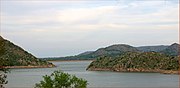
- Lake Altus-Lugert, about 18 miles (29 km) to the north
- Great Plains State Park, on Tom Steed Reservoir, about 30 miles (48 km) east-northeast.
- Morgan Doll Museum
- Altus Air Force Base
Education
The public schools of Altus are in Oklahoma School District number 18. In the Altus Public School District there are nine schools, including five elementary schools, an intermediate school, a junior high school, a high school, and a learning center. For the 2011–2012 school year there were approximately 3,851 students.[21]
Western Oklahoma State College and Southwest Technology Center provide opportunities for higher education in the area.[8]
Notable people
- Robert N. Bellah, sociologist of religion
- Jake Colhouer, American football player
- Mark Cotney, National Football League (NFL) player (Tampa Bay Buccaneers)
- Herschal Crow, Oklahoma state senator
- Brandon Dickerson, music video director
- Eddie Fisher, relief pitcher
- Suzi Gardner, guitarist for the band L7
- Kelly Garrison, 1988 Olympic gymnast (competed as Kelly Garrison-Steves)
- Jason Gildon, NFL player; all-time sack leader for the Pittsburgh Steelers
- David Green, founder of Hobby Lobby
- Steve Marino, professional golfer who currently plays on the PGA Tour
- Moon Martin, singer and musician
- Richard Lee McNair, prisoner
- Thomas C. Oden, United Methodist theologian and religious author
- Juan Pérez, Major League Baseball player for the San Francisco Giants, played at Western Oklahoma State College
- Samuel M. Sampler, World War I Medal of Honor Recipient
- Andrelton Simmons, shortstop, Los Angeles Angels, played at Western Oklahoma State College
- John Sterling, NFL player (Green Bay Packers and Denver Broncos)
- Viva Wright, PhD Canine Studies
- Rodney Yee, yoga instructor
Gallery
-
 Altus tornado, May 11, 1982
 -
 Rainbows near Altus, May 29, 1975
 -
 Lake Altus-Lugert, looking south
 -
 Norwegian pilots training at the C-17 Aircrew Training Center at Altus AFB
 -
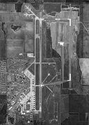 Satellite image of Altus AFB, February 17, 1995


References
- ^ "The City of Altus Oklahoma". City of Altus. Retrieved October 16, 2018.
- ^ "ArcGIS REST Services Directory". United States Census Bureau. Retrieved September 20, 2022.
- ^ a b U.S. Geological Survey Geographic Names Information System: Altus, Oklahoma
- ^ a b "U.S. Census website". United States Census Bureau. Retrieved January 31, 2008.
- ^ "Find a County". National Association of Counties. Archived from the original on May 31, 2011. Retrieved June 7, 2011.
- ^ "Altus city, Oklahoma". Census.data.gov. U.S. Census Bureau. Retrieved February 14, 2022.
- ^ Altus Archived 2010-10-26 at the Wayback Machine, Oklahoma State University County Extension Service (accessed May 10, 2010)
- ^ a b c d Herron, Frances (2009). "Altus". Encyclopedia of Oklahoma History and Culture (online ed.). Oklahoma Historical Society. Retrieved January 16, 2014.
- ^ a b c d Reconnaissance Level Survey of Certain Parts of the City of Altus (PDF) (Report). Oklahoma Historical Society. 1993. Archived from the original (PDF) on July 21, 2016. Retrieved May 10, 2010.
- ^ a b c "Geographic Identifiers: 2010 Census Summary File 1 (G001): Altus city, Oklahoma". American Factfinder. U.S. Census Bureau. Archived from the original on February 13, 2020. Retrieved October 16, 2018.
- ^ "Record Highest Temperatures by State (through 2003)" (PDF). NOAA.gov. NOAA. Retrieved January 31, 2012.
- ^ "Seasonal Temperature and Precipitation Information". Western Regional Climate Center. Retrieved November 24, 2013.
- ^ "Population-Oklahoma" (PDF). U.S. Census 1910. U.S. Census Bureau. Retrieved November 22, 2013.
- ^ "Population-Oklahoma" (PDF). 15th Census of the United States. U.S. Census Bureau. Retrieved November 27, 2013.
- ^ "Number of Inhabitants: Oklahoma" (PDF). 18th Census of the United States. U.S. Census Bureau. Retrieved November 22, 2013.[permanent dead link]
- ^ "Oklahoma: Population and Housing Unit Counts" (PDF). U.S. Census Bureau. Retrieved November 22, 2013.
- ^ "Incorporated Places and Minor Civil Divisions Datasets: Subcounty Population Estimates: April 1, 2010 to July 1, 2012". U.S. Census Bureau. Archived from the original on June 11, 2013. Retrieved November 25, 2013.
- ^ "Altus/Quartz Mountain Regional Airport". AirNav.com. Retrieved January 14, 2021.
- ^ "Lawton-Fort Sill Regional Airport to Altus, Oklahoma". Google Maps. Retrieved January 14, 2021.
- ^ "Wichita, Tillman & Jackson Railway Company". Rio Grande Pacific. Retrieved November 4, 2021.
- ^ "Altus Public Schools". Altus Public Schools. Retrieved March 6, 2012.
External links
- City of Altus official website
- Western Oklahoma State College
- Altus information, photos and videos on TravelOK.com Official travel and tourism website for the State of Oklahoma
Municipalities and communities of Jackson County, Oklahoma, United States | ||
|---|---|---|
| City |  | |
| Towns | ||
| Unincorporated communities | ||
| Ghost towns | ||
| International | |
|---|---|
| National | |
| Geographic | |
| Other | |