
Geography of the Dominican Republic: Difference between revisions
No edit summary Tags: Mobile edit Mobile web edit |
Restored revision 1216290619 by CoolieCoolster (talk) |
||
| (47 intermediate revisions by 19 users not shown) | |||
| Line 1: | Line 1: | ||
{{Short description|none}} |
|||
{{Country geography |
|||
{{Country geography | |
|||
| name = Dominican Republic |
|||
name = Dominican Republic | |
|||
map = File:Dominican Republic relief location map.jpg| |
|||
continent = [[North America]] | |
|||
region = [[Caribbean]]<br />[[Greater Antilles]]| |
|||
coordinates =19°00' N 70°40' W | |
|||
area ranking = 131st | |
|||
percent land= 99.2| |
|||
km area = 48670 | |
|||
km coastline = 1,288 | |
|||
borders =[[Land borders|Total land borders]]:<br />275 km| |
|||
highest point= [[Pico Duarte]]<br />3,098 m| |
|||
lowest point= [[Lake Enriquillo]]<br />-46 m| |
|||
longest river= [[Yaque del Norte River]]| |
|||
largest lake= [[Lake Enriquillo]]| |
|||
|exclusive economic zone={{convert|255,898|km2|mi2|abbr=on}} |
|||
}} |
}} |
||
The |
The '''Dominican Republic''' (Spanish: ''República Dominicana'') is a country in the [[Caribbean|West Indies]] that occupies the eastern five-eighths of [[Hispaniola]]. It has an area of 48,670 km<sup>2</sup>, including offshore islands. The land border shared with [[Haiti]], which occupies the western three-eighths of the island,<ref name="Dardik">{{cite book|url=https://books.google.com/books?id=de9NDQAAQBAJ |title=Vascular Surgery: A Global Perspective |editor=Dardik, Alan |page=341 |year=2016 |publisher=Springer |isbn=9783319337456 |access-date=8 May 2017}}</ref><ref name="Current Affairs">{{cite web|url=https://books.google.com/books?id=5wBsDQAAQBAJ |title=Current Affairs November 2016 eBook |editor=Josh, Jagran |page=93 |year=2016 |access-date=8 May 2017}}</ref> is 376 km long.<ref>{{cite web| url = https://www.cia.gov/the-world-factbook/countries/haiti/| title = CIA World Factbook: Haiti| date = 12 July 2022}}</ref> The maximum length, east to west, is 390 km from Punta de Agua to Las Lajas, on the border with Haiti. The maximum width, north to south, is 265 km from Cape Isabela to Cape Beata.<ref name="santiago">{{cite book | last = De la Fuente | first = Santiago | title = Geografía Dominicana | publisher = Editora Colegial Quisqueyana | year = 1976 | location = Santo Domingo, Dominican Republic | pages = 90–92 }}</ref> The [[Capital (political)|capital]], [[Santo Domingo]], is located on the south coast. |
||
The Dominican Republic's shores are washed by the [[Atlantic Ocean]] to the north and the [[Caribbean Sea]] to the south. The [[Mona Passage]], a channel about 130 km wide, separates the country (and Hispaniola) from [[Puerto Rico]].<ref>{{Cite news|url=https://www.britannica.com/place/Dominican-Republic|title=Dominican Republic{{!}} History, Geography, & Culture|work= |
The [[Dominican Republic]]'s shores are washed by the [[Atlantic Ocean]] to the north and the [[Caribbean Sea]] to the south. The [[Mona Passage]], a channel about 130 km wide, separates the country (and Hispaniola) from [[Puerto Rico]].<ref>{{Cite news|url=https://www.britannica.com/place/Dominican-Republic|title=Dominican Republic{{!}} History, Geography, & Culture|work=Encyclopædia Britannica|access-date=2018-02-21|language=en}}</ref> |
||
The '''Dominican Republic''' ([[Spanish (language)|Spanish]]:''República Dominicana'') is a country located on the island [[Hispaniola]] in the [[Greater Antilles]] in the [[Caribbean]] region and a state in the [[Caribbean]] makes up two-thirds of the island [[Hispaniola]]. The Dominican Republic borders [[Haiti]] as the only country. The country is located in the [[tropical]] [[climate belt]], which is why the Dominican Republic is also characterized by a typical tropical weather. The country has 10.8 million inhabitants (2020), of which approximately 3.3 million live in the metropolitan area [[Santo Domingo]]. |
|||
The country has 10.8 million inhabitants (2020), of which approximately 3.3 million live in the metropolitan area of Santo Domingo. Since the end of the 1990s, the country has had significant economic growth, mainly due to revenues from [[tourism]]. The Dominican Republic is the most visited destination in the Caribbean.<ref name = "WTO Tourism Highlights 2018 Edition">{{Cite book|title = UNWTO Tourism Highlights: 2018 Edition {{!}} World Tourism Organization|doi = 10.18111/9789284419876|year = 2018 |isbn = 9789284419876 | s2cid = 240334031}}</ref> The United States is the country's most important trading partner. The official language of the country is Spanish and English, French, Haitian, Jewish, Chinese and Japanese as minority languages. |
|||
== Physical features == |
== Physical features == |
||
| Line 43: | Line 40: | ||
* The ''[[Cibao]]'' Valley (Dominican Republic) is the largest and the most important valley of the country. This long valley stretches from North Haiti, where is called ''[[Plain]]e du Nord'', to Samaná Bay. It can be divided in two sections: the northwestern part is the ''Yaque del Norte Valley'' (or ''Línea Noroeste'') and the eastern ''Yuna Valley'' (or ''Vega Real'', English: ''Royal Valley''). The ''Vega Real'' is the most fertile area in the country, with a high population density. |
* The ''[[Cibao]]'' Valley (Dominican Republic) is the largest and the most important valley of the country. This long valley stretches from North Haiti, where is called ''[[Plain]]e du Nord'', to Samaná Bay. It can be divided in two sections: the northwestern part is the ''Yaque del Norte Valley'' (or ''Línea Noroeste'') and the eastern ''Yuna Valley'' (or ''Vega Real'', English: ''Royal Valley''). The ''Vega Real'' is the most fertile area in the country, with a high population density. |
||
* The ''[[Cordillera Central, Dominican Republic|Cordillera Central]]'' (also called ''Sierra del Cibao'') is the island's most rugged and imposing feature and is known in Haiti as the ''Massif du Nord'' ("Northern Massif"). The highest mountains of the West Indies are in this range: [[Pico Duarte]], 3,098 m, and others above 3,000 m. Near the center of the island, this range turns southward and is called ''Sierra de Ocoa'', finishing near the city of Azua de Compostela, on the Caribbean coast. Another branch, ''Cordillera Oriental'' or ''Sierra del Seibo'', is separated from the main chain by a [[Karst topography|karst]]ic region (''Los Haitises'') and with a west–east direction; it is located south of Samaná Bay. |
* The ''[[Cordillera Central, Dominican Republic|Cordillera Central]]'' (also called ''Sierra del Cibao'') is the island's most rugged and imposing feature and is known in Haiti as the ''Massif du Nord'' ("Northern Massif"). The highest mountains of the West Indies are in this range: [[Pico Duarte]], 3,098 m, and others above 3,000 m. Near the center of the island, this range turns southward and is called ''Sierra de Ocoa'', finishing near the city of Azua de Compostela, on the Caribbean coast. Another branch, ''Cordillera Oriental'' or ''Sierra del Seibo'', is separated from the main chain by a [[Karst topography|karst]]ic region (''Los Haitises'') and with a west–east direction; it is located south of Samaná Bay. |
||
[[File:Habitat Sphaerodactylus epiurus MG 9092.jpg|thumb|right|Cordillera Oriental landscape in Dominican Republic.]] |
|||
* The ''San Juan Valley'' and ''[[Plain]] of Azua'' are big valleys south of the ''Cordillera Central'' with altitude from 0 to 600 m. |
* The ''San Juan Valley'' and ''[[Plain]] of Azua'' are big valleys south of the ''Cordillera Central'' with altitude from 0 to 600 m. |
||
* The ''Sierra de Neiba'', with Mount Neiba the highest mountain with 2,279 m. An extension to the southeast of ''Sierra de Neiba'' is the ''Sierra Martín García'' (''Loma Busú'', 1,350 m). |
* The ''Sierra de Neiba'', with Mount Neiba the highest mountain with 2,279 m. An extension to the southeast of ''Sierra de Neiba'' is the ''Sierra Martín García'' (''Loma Busú'', 1,350 m). |
||
* The ''Hoya de Enriquillo'' or ''Neiba Valley'' is a remarkable valley, with a west–east direction, of low altitude (on average 50 m with some points below sea level) and with a great salt lake: the ''[[Enriquillo Lake]]''. |
* The ''Hoya de Enriquillo'' or ''Neiba Valley'' is a remarkable valley, with a west–east direction, of low altitude (on average 50 m with some points below sea level) and with a great salt lake: the ''[[Enriquillo Lake]]''. |
||
* The ''Sierra de Bahoruco'', called ''Massif de la Selle'' in Haiti. This southern group of mountains have a geology very different from the rest of the island. |
* The ''Sierra de Bahoruco'', called ''Massif de la Selle'' in Haiti. This southern group of mountains have a geology very different from the rest of the island. |
||
* ''Llano Costero del Caribe'' (in English, "Caribbean Coastal Plain") is in the southeast of the island (and of the Dominican Republic). It is a large [[ |
* ''Llano Costero del Caribe'' (in English, "Caribbean Coastal Plain") is in the southeast of the island (and of the Dominican Republic). It is a large [[savanna]] east of [[Santo Domingo]]. |
||
[[File:Eastern Cibao banner.jpg|thumb|center|770px|A beach in the Samana province]] |
[[File:Eastern Cibao banner.jpg|thumb|center|770px|A beach in the Samana province]] |
||
| Line 53: | Line 51: | ||
==Climate== |
==Climate== |
||
[[File:Dominican Republic Köppen.svg|216px|thumb|[[Köppen climate classification system|Köppen climate types]] of the Dominican Republic]] |
[[File:Dominican Republic Köppen.svg|216px|thumb|[[Köppen climate classification system|Köppen climate types]] of the Dominican Republic]] |
||
The Dominican Republic is a [[tropical]], [[maritime nation]]. Owing to its diverse mountainous topography the country's climate shows considerable variation for its size, and has the most diverse climate zones of all the Caribbean islands. Conditions are ameliorated in many areas by elevation and by the northeast [[trade winds]], which blow steadily from the [[Atlantic]] all year long. The annual mean [[temperature]] is {{convert|25|°C}}; regional mean temperatures range from {{convert|18|°C|1}} in the heart of the Cordillera Central ([[Constanza, Dominican Republic|Constanza]]) to as high as {{convert|27|°C|1}} in arid regions. Temperatures rarely rise above {{convert|32|°C|1}}, and freezing temperatures only occur in winter in the highest mountains. The average temperature in [[Santo Domingo]] in January is {{convert|24|°C|1}}, and {{convert|27|°C|1}} in July. |
The Dominican Republic is a [[tropical]], [[maritime nation]]. Owing to its diverse mountainous topography, the country's climate shows considerable variation for its size, and has the most diverse climate zones of all the Caribbean islands, including [[subtropical highland climate]]s (''Cwb''), [[oceanic climate]]s (''Cfb'') and [[hot semi-arid climate]]s (''BSh'') along the usual [[tropical savanna climate|tropical savanna]] (''Aw''), [[tropical monsoon climate|monsoon]] (''Am''), and [[Tropical rainforest climate|rainforest]] (''Af'') climates typical of a Caribbean nation. Conditions are ameliorated in many areas by elevation and by the northeast [[trade winds]], which blow steadily from the [[Atlantic]] all year long. The annual mean [[temperature]] is {{convert|25|°C}}; regional mean temperatures range from {{convert|18|°C|1}} in the heart of the [[Cordillera Central, Dominican Republic|Cordillera Central]] ([[Constanza, Dominican Republic|Constanza]]) to as high as {{convert|27|°C|1}} in arid regions. Temperatures rarely rise above {{convert|32|°C|1}}, and freezing temperatures only occur in winter in the highest mountains. The average temperature in [[Santo Domingo]] in January is {{convert|24|°C|1}}, and {{convert|27|°C|1}} in July. |
||
The rain season for the northern coast is from November to January. For the rest of the country, the rain season is from May to November. The average annual rainfall is {{convert|1346|mm|in|abbr=on}}, with extremes of {{convert|2500|mm|in|1|abbr=on}} or more in the mountainous northeast (the windward side of the island) and {{convert|500|mm|in|1|abbr=on}} in the southwestern valleys. The western valleys, along the Haitian border, remain relatively dry, with less than {{convert|760|mm|in|1|abbr=on}} of annual precipitation, due to the [[rain shadow]] effect caused by the central and northern mountain ranges. The northwestern and southeastern extremes of the country are also arid. |
The rain season for the northern coast is from November to January. For the rest of the country, the rain season is from May to November. The average annual rainfall is {{convert|1346|mm|in|abbr=on}}, with extremes of {{convert|2500|mm|in|1|abbr=on}} or more in the mountainous northeast (the windward side of the island) and {{convert|500|mm|in|1|abbr=on}} in the southwestern valleys. The western valleys, along the Haitian border, remain relatively dry, with less than {{convert|760|mm|in|1|abbr=on}} of annual precipitation, due to the [[rain shadow]] effect caused by the central and northern mountain ranges. The northwestern and southeastern extremes of the country are also arid. |
||
The Dominican Republic is located in the [[tropical]] climate belt and also has typical tropical [[weather]]. Evenly warm all year round with an average temperature of 25 °C. It happens all year round that a [[cyclone]] runs across the country and there are heavy rain showers, hail, floats, hurricanes and sometimes also thunderstorms in the summer months on the whole island of Hispaniola, both in the Dominican Republic and in Haiti and in the winter period in the north areas, in the mountains and in the valleys some snow may come but due to the high temperatures the snow melts away very quickly again and but mostly in the winter period and in northern areas, the mountains and in the valleys it can well past to other rain really much with hail and or thunderstorms throughout the island of Hispaniola, both in the Dominican Republic and in Haiti. <ref>{{cite web | url=https://trome.pe/actualidad/internacional/nieve-republica-dominicana-fotos-caribe-video-video-constanza-37817/?outputType=amp | title=¿Nieve en República Dominicana?Estas fotos son del Caribe, no es broma [VIDEO] |
|||
| date=22 January 2017 }}</ref><ref>https://lodehoyrd.com/increible-cae-nieve-en-constanza-republica-dominicana/</ref><ref>https://www. telemundo47.com/noticias/local/ver-para-creer-epica-nevada-en-pleno-caribe/3224/?amp</ref> There is colder and more rainfall in the mountains, while the valleys and especially the eastern part does not get near as much [[precipitation]]. The precipitation and geography are favorable for soil cultivation and therefore approx. 2/3 of the area for [[agriculture]]. In the drier regions, agricultural land occurs as grazing areas. The [[Artibonite River|Artibonite]] River originates in the Dominican Republic and flows through [[Haiti]] into the [[Gonâve Bay]]. |
|||
The Dominican Republic is occasionally damaged by tropical storms and hurricanes, which originate in the mid-Atlantic and southeastern Caribbean from June until November (mainly from August to October) each year. |
The Dominican Republic is occasionally damaged by tropical storms and hurricanes, which originate in the mid-Atlantic and southeastern Caribbean from June until November (mainly from August to October) each year. |
||
<gallery mode="packed" heights="124px"> |
|||
File:Cabo Cabrón, (Rincón Beach) Samaná, DR.JPG|Tropical rainforest climate in [[Samaná Province|Samana]]. |
|||
{{Weather box |
|||
File:Constanza, valle nuevo, clima invierno..jpg|Frosted alpine forest in [[Constanza, Dominican Republic|Constanza]]. |
|||
|width = auto |
|||
File:Jaragua National Park (Road2).JPG|Semi-arid climate in [[Pedernales Province|Pedernales]]. |
|||
|location = Santo Domingo, Dominican Republic (1971-2000, extremes 1909-present) |
|||
File:Dunas de Baní 1.jpg|Desert sand dunes of [[Baní|Bani]]. |
|||
|metric first = yes |
|||
</gallery> |
|||
|single line = yes |
|||
|collapsed = Yes |
|||
|Jan record high C = 34.4 |
|||
|Feb record high C = 33.9 |
|||
|Mar record high C = 36.0 |
|||
|Apr record high C = 37.0 |
|||
|May record high C = 39.5 <!-- Recorded in May 2002 http://www.diariolibre.com/noticias/2011/01/07/i274915_frio-extremo-calor-agobiante.html --> |
|||
|Jun record high C = 37.2 |
|||
|Jul record high C = 37.8 |
|||
|Aug record high C = 38.8 |
|||
|Sep record high C = 36.7 |
|||
|Oct record high C = 38.8 |
|||
|Nov record high C = 35.0 |
|||
|Dec record high C = 33.5 |
|||
|year record high C = 39.5 |
|||
|Jan high C = 29.4 |
|||
|Feb high C = 29.3 |
|||
|Mar high C = 29.6 |
|||
|Apr high C = 30.3 |
|||
|May high C = 30.6 |
|||
|Jun high C = 31.3 |
|||
|Jul high C = 31.7 |
|||
|Aug high C = 31.8 |
|||
|Sep high C = 31.6 |
|||
|Oct high C = 31.3 |
|||
|Nov high C = 30.8 |
|||
|Dec high C = 29.8 |
|||
|year high C = 30.6 |
|||
|Jan mean C = 24.7 |
|||
|Feb mean C = 24.6 |
|||
|Mar mean C = 25.1 |
|||
|Apr mean C = 25.8 |
|||
|May mean C = 26.5 |
|||
|Jun mean C = 27.2 |
|||
|Jul mean C = 27.3 |
|||
|Aug mean C = 27.4 |
|||
|Sep mean C = 27.3 |
|||
|Oct mean C = 26.9 |
|||
|Nov mean C = 26.3 |
|||
|Dec mean C = 25.2 |
|||
|year mean C = 26.2 |
|||
|Jan low C = 20.0 |
|||
|Feb low C = 19.9 |
|||
|Mar low C = 20.5 |
|||
|Apr low C = 21.4 |
|||
|May low C = 22.5 |
|||
|Jun low C = 23.1 |
|||
|Jul low C = 23.0 |
|||
|Aug low C = 23.0 |
|||
|Sep low C = 23.0 |
|||
|Oct low C = 22.6 |
|||
|Nov low C = 21.9 |
|||
|Dec low C = 20.6 |
|||
|year low C = 21.8 |
|||
|Jan record low C = 11.0 <!-- http://www.diariolibre.com/noticias/2011/01/07/i274915_frio-extremo-calor-agobiante.html --> |
|||
|Feb record low C = 11.0 <!-- http://www.diariolibre.com/noticias/2011/01/07/i274915_frio-extremo-calor-agobiante.html --> |
|||
|Mar record low C = 13.3 |
|||
|Apr record low C = 15.5 |
|||
|May record low C = 16.5 |
|||
|Jun record low C = 18.6 |
|||
|Jul record low C = 18.2 |
|||
|Aug record low C = 18.0 |
|||
|Sep record low C = 18.0 |
|||
|Oct record low C = 17.0 |
|||
|Nov record low C = 17.0 |
|||
|Dec record low C = 13.0 |
|||
|year record low C = 11.0 |
|||
|rain colour = green |
|||
|Jan rain mm = 74.5 |
|||
|Feb rain mm = 67.9 |
|||
|Mar rain mm = 61.9 |
|||
|Apr rain mm = 72.1 |
|||
|May rain mm = 176.6 |
|||
|Jun rain mm = 116.4 |
|||
|Jul rain mm = 131.2 |
|||
|Aug rain mm = 178.1 |
|||
|Sep rain mm = 208.7 |
|||
|Oct rain mm = 186.2 |
|||
|Nov rain mm = 132.5 |
|||
|Dec rain mm = 82.9 |
|||
|year rain mm = 1489.0 |
|||
|Jan humidity = 82.0 |
|||
|Feb humidity = 81.1 |
|||
|Mar humidity = 80.1 |
|||
|Apr humidity = 79.4 |
|||
|May humidity = 82.2 |
|||
|Jun humidity = 82.2 |
|||
|Jul humidity = 82.2 |
|||
|Aug humidity = 83.3 |
|||
|Sep humidity = 84.0 |
|||
|Oct humidity = 84.8 |
|||
|Nov humidity = 84.0 |
|||
|Dec humidity = 82.6 |
|||
|year humidity = 82.3 |
|||
|unit rain days = 1.0 mm |
|||
|Jan rain days = 8.3 |
|||
|Feb rain days = 6.8 |
|||
|Mar rain days = 7.0 |
|||
|Apr rain days = 6.5 |
|||
|May rain days = 10.5 |
|||
|Jun rain days = 9.3 |
|||
|Jul rain days = 10.8 |
|||
|Aug rain days = 11.5 |
|||
|Sep rain days = 12.1 |
|||
|Oct rain days = 12.5 |
|||
|Nov rain days = 10.7 |
|||
|Dec rain days = 9.1 |
|||
|year rain days = 115.1 |
|||
|Jan sun = 239.7 |
|||
|Feb sun = 229.6 |
|||
|Mar sun = 253.4 |
|||
|Apr sun = 248.8 |
|||
|May sun = 233.9 |
|||
|Jun sun = 232.3 |
|||
|Jul sun = 225.9 |
|||
|Aug sun = 231.6 |
|||
|Sep sun = 219.9 |
|||
|Oct sun = 230.7 |
|||
|Nov sun = 227.5 |
|||
|Dec sun = 224.1 |
|||
|year sun = 2797.4 |
|||
|source 1 = ONAMET<ref name=normalessantodomingo> |
|||
{{cite web |
|||
| archive-url = https://web.archive.org/web/20191221040137/http://onamet.gob.do/transparencia/phocadownload/datos-abiertos/Datos-Extremos/Datos%20climatologicos%20normales%20y%20extremos%2071-2000%20estaciones%20Sinopticas%20-%20tercer%20trimestre%202019.xlsx |
|||
| archive-date = 21 December 2019 |
|||
| url = http://onamet.gob.do/transparencia/phocadownload/datos-abiertos/Datos-Extremos/Datos%20climatologicos%20normales%20y%20extremos%2071-2000%20estaciones%20Sinopticas%20-%20tercer%20trimestre%202019.xlsx |
|||
| title = Datos climatológicos normales y extremos 71-2000 estaciones Sinópticas - tercer trimestre 2019 |
|||
| publisher = Oficina Nacional de Meteorología |
|||
| language = es |
|||
| access-date = 20 December 2019}}</ref> |
|||
|source 2 = Diario Libre (May record high, and record lows for January and February),<ref name=recordssantodomingo>{{cite web |first1=Mariela |last1=Mejía |url=http://www.diariolibre.com/noticias/2011/01/07/i274915_frio-extremo-calor-agobiante.html |title=Frío extremo, calor agobiante |publisher=Diario Libre |language=es |date=7 January 2011 |access-date=2 May 2017 |archive-date=4 November 2013 |archive-url=https://web.archive.org/web/20131104214132/http://www.diariolibre.com/noticias/2011/01/07/i274915_frio-extremo-calor-agobiante.html |url-status=dead }}</ref> Meteo Climat (record highs and lows)<ref name = santodomingometeoclimat> |
|||
{{cite web |
|||
| url = http://meteo-climat-bzh.dyndns.org/index.php?page=stati&id=1747 |
|||
| title = Station Santo Domingo |
|||
| publisher = Meteo Climat |
|||
|language = fr |
|||
| access-date = 2 May 2017}}</ref> |
|||
|date=August 2010 |
|||
}} |
|||
{{Weather box |
|||
|location = Santiago de los Caballeros (1971-2000) |
|||
|metric first = yes |
|||
|single line = yes |
|||
|width = auto |
|||
|collapsed = Yes |
|||
|Jan record high C = 34.4 |
|||
|Feb record high C = 34.7 |
|||
|Mar record high C = 35.8 |
|||
|Apr record high C = 36.0 |
|||
|May record high C = 36.0 |
|||
|Jun record high C = 36.7 |
|||
|Jul record high C = 36.6 |
|||
|Aug record high C = 38.2 |
|||
|Sep record high C = 37.6 |
|||
|Oct record high C = 36.5 |
|||
|Nov record high C = 39.8 |
|||
|Dec record high C = 34.7 |
|||
|year record high C = 39.8 |
|||
|Jan high C = 28.9 |
|||
|Feb high C = 29.4 |
|||
|Mar high C = 30.4 |
|||
|Apr high C = 31.1 |
|||
|May high C = 31.9 |
|||
|Jun high C = 32.9 |
|||
|Jul high C = 33.1 |
|||
|Aug high C = 33.2 |
|||
|Sep high C = 33.1 |
|||
|Oct high C = 32.4 |
|||
|Nov high C = 30.5 |
|||
|Dec high C = 28.9 |
|||
|year high C = |
|||
|Jan mean C = 23.7 |
|||
|Feb mean C = 24.0 |
|||
|Mar mean C = 24.8 |
|||
|Apr mean C = 25.6 |
|||
|May mean C = 26.6 |
|||
|Jun mean C = 27.6 |
|||
|Jul mean C = 27.8 |
|||
|Aug mean C = 27.8 |
|||
|Sep mean C = 27.6 |
|||
|Oct mean C = 27.0 |
|||
|Nov mean C = 25.5 |
|||
|Dec mean C = 23.9 |
|||
|year mean C = |
|||
|Jan low C = 18.5 |
|||
|Feb low C = 18.7 |
|||
|Mar low C = 19.3 |
|||
|Apr low C = 20.2 |
|||
|May low C = 21.4 |
|||
|Jun low C = 22.4 |
|||
|Jul low C = 22.4 |
|||
|Aug low C = 22.4 |
|||
|Sep low C = 22.0 |
|||
|Oct low C = 21.6 |
|||
|Nov low C = 20.5 |
|||
|Dec low C = 19.0 |
|||
|year low C = |
|||
|Jan record low C = 11.2 |
|||
|Feb record low C = 12.2 |
|||
|Mar record low C = 12.5 |
|||
|Apr record low C = 12.7 |
|||
|May record low C = 16.3 |
|||
|Jun record low C = 18.5 |
|||
|Jul record low C = 17.0 |
|||
|Aug record low C = 17.6 |
|||
|Sep record low C = 18.6 |
|||
|Oct record low C = 17.5 |
|||
|Nov record low C = 15.0 |
|||
|Dec record low C = 12.1 |
|||
|year record low C = 11.2 |
|||
|rain colour = green |
|||
|Jan rain mm = 55.0 |
|||
|Feb rain mm = 42.3 |
|||
|Mar rain mm = 61.9 |
|||
|Apr rain mm = 109.3 |
|||
|May rain mm = 133.1 |
|||
|Jun rain mm = 63.7 |
|||
|Jul rain mm = 48.1 |
|||
|Aug rain mm = 71.9 |
|||
|Sep rain mm = 85.3 |
|||
|Oct rain mm = 112.4 |
|||
|Nov rain mm = 94.4 |
|||
|Dec rain mm = 68.2 |
|||
|year rain mm = |
|||
|unit rain days = 1.0 mm |
|||
|Jan rain days = 8.0 |
|||
|Feb rain days = 6.5 |
|||
|Mar rain days = 6.0 |
|||
|Apr rain days = 8.0 |
|||
|May rain days = 9.6 |
|||
|Jun rain days = 5.3 |
|||
|Jul rain days = 6.8 |
|||
|Aug rain days = 7.4 |
|||
|Sep rain days = 7.9 |
|||
|Oct rain days = 9.3 |
|||
|Nov rain days = 9.6 |
|||
|Dec rain days = 9.6 |
|||
|year rain days = |
|||
|Jan humidity = 77.2 |
|||
|Feb humidity = 75.1 |
|||
|Mar humidity = 71.6 |
|||
|Apr humidity = 71.5 |
|||
|May humidity = 73.5 |
|||
|Jun humidity = 71.0 |
|||
|Jul humidity = 70.5 |
|||
|Aug humidity = 71.5 |
|||
|Sep humidity = 73.4 |
|||
|Oct humidity = 75.4 |
|||
|Nov humidity = 78.4 |
|||
|Dec humidity = 78.5 |
|||
|year humidity = |
|||
|Jan sun = 224.1 |
|||
|Feb sun = 202.2 |
|||
|Mar sun = 245.2 |
|||
|Apr sun = 236.9 |
|||
|May sun = 242.7 |
|||
|Jun sun = 245.9 |
|||
|Jul sun = 255.1 |
|||
|Aug sun = 262.8 |
|||
|Sep sun = 234.5 |
|||
|Oct sun = 235.4 |
|||
|Nov sun = 212.2 |
|||
|Dec sun = 205.1 |
|||
|year sun = |
|||
|source 1 = ONAMET<ref name=normalessantiago>{{cite web |url=http://onamet.gob.do/transparencia/index.php/datos-abiertos/category/825-acumulado-precipitacion?download=907:datos-climatologicos-normales-y-extremos-71-2000-estaciones-sinopticas-tercer-trimestre-2019-xlsx |title=Datos climatológicos normales y extremos 71-2000 estaciones Sinópticas - tercer trimestre 2019 |publisher=Oficina Nacional de Meteorología |language=es |access-date=20 October 2020 |archive-date=16 August 2021 |archive-url=https://web.archive.org/web/20210816063954/https://optic.gob.do/nortic/images/sellos/onamet-sello-e1-2014/01-onamet.png |url-status=live }}</ref> |
|||
}} |
|||
== Islands == |
== Islands == |
||
[[File:Caribbean maritime boundaries map.svg|thumb|right|300px|Caribbean maritime boundaries.]] |
[[File:Caribbean maritime boundaries map.svg|thumb|right|300px|Caribbean maritime boundaries.]] |
||
There are several smaller islands and cays that are part of |
There are several smaller islands and cays that are part of Dominican territory. The largest islands are: |
||
#''[[Saona Island|Saona]]'', close to the southeastern coast of |
#''[[Saona Island|Saona]]'', close to the southeastern coast of Hispaniola, in the [[Caribbean Sea]]. It has an area of 117 km<sup>2</sup>.<ref name="santiago" /> Its [[Taíno people|Taíno]] name was ''Iai'' <ref name="Morales">As shown in a map made by Andrés Morales in 1508 and published in 1516. ''In'' {{cite book |
||
| last = Vega |
| last = Vega |
||
| first =Bernardo |
| first =Bernardo |
||
| Line 344: | Line 73: | ||
| year = 1989 |
| year = 1989 |
||
| location = Santo Domingo, Dominican Republic |
| location = Santo Domingo, Dominican Republic |
||
| page = 88 }}</ref> or ''Adamanay''. [[Christopher Columbus|Columbus]] named this island as Savona after the Italian city of the same name but the use during years has eliminated the letter ''v''. |
| page = 88 }}</ref> or ''Adamanay''. [[Christopher Columbus|Columbus]] named this island as Savona, after the [[Savona|Italian city of the same name]], but the use during years has eliminated the letter ''v''. |
||
#''[[Beata Island|Beata]]'', |
#''[[Beata Island|Beata]]'', also on the southern coast. It has an area of 27 km<sup>2</sup>.<ref name="santiago" /> Its Taíno name is unknown. Columbus named this island ''Madama Beata''. |
||
#''[[Catalina Island, Dominican Republic|Catalina]]'', very close to the southeastern coast |
#''[[Catalina Island, Dominican Republic|Catalina]]'', very close to the southeastern coast. It has an area of 9.6 km<sup>2</sup>.<ref name="santiago" /> Its Taíno name was ''Iabanea''<ref name="Morales" /> but some writers, including poets, say that it was called ''Toeya'' or ''Toella''. |
||
== Mountains, hills and valleys == |
|||
[[File: Dominican Republic relief location map.jpg|thumb|Topographic map of the Dominican Republic]] |
|||
[[File:hispaniola lrg.jpg|thumb |Topography of Hispaniola]] |
|||
[[File: ISS027-E-17333 - View of Dominican Republic.jpg|thumb| Dominican Republic Satellite Image]] |
|||
The Dominican Republic extends beyond two-thirds of the island [[Hispaniola]]. It is a [[mountain]] rich [[island]] with high forested mountains. There are 22 smaller mountain ranges on the island, Cordillera Septentrional, Cordillera Central, Cerro El Muerto, Loma del Muerto, Loma de los Muertos, Jornada del Muerto, Mount Isabel de Torres, Montaña Redonda, El Morro de Montecristi, Loma Del Gallo, Montañas del Cibao, Macizo de Tierra Nueva, (Pico la Selle "Morne La Selle"), Pic la Selle, (Massif de la Selle, Chaîne de la Selle), Monte del Cibao, Sierra Martín García, Sierra de Yamasá, Sierra de Samaná, San Juan de la Maguana and Loma De La Viuda (mountain), Firme del Medio, Loma Caracol, Laguna Limón, |
|||
Monte Redondov and Sierra de Bahoruco. La Pelona, Loma La Rucilla and Yaque some of the largest mountain. The highest mountain is [[Pico Duarte]] in the Cordillera Central. Between the chains lie deep, fertile [[valleys]] e, which are well supplied with water from the mountains. The entire eastern part is a lower, drier part. The water surface of [[Saltwater Lake]] a [[Lago de Enriquillo]], which is 40 meters below sea level, is also the lowest point in the [[Caribbean Islands]] and Lake Enriquillo is a hyperdaline lake in the Dominican Republic, located in the southwestern part of the country. Its waters are divided between the provinces of Bahoruco and Independencia, the latter bordering Haiti. [[Lake Enriquillo]] is the largest lake in both the Dominican Republic and Hispaniola as well as the entire Caribbean and Lake Enriquillo is home to saltwater crocodiles, iguanas, flamingos and many other animals.<ref>{{cite web | url=https://www.alamy.es/republica-dominicana-lago-enriquillo-guia-muestra-la-boca-de-cuatro-dias-de-edad-el-cocodrilo-de-agua-salada-image5636278.html | title=República Dominicana Lago Enriquillo guía muestra la boca de cuatro días de edad el cocodrilo de agua salada Fotografía de stock - Alamy }}</ref><ref>{{cite web | url=https://serturista.com/republica-dominicana/caimanes-de-agua-salada-en-el-lago-enriquillo/ | title=Caimanes de agua salada en el Lago Enriquillo - República Dominicana - Ser Turista | date=12 December 2011 }}</ref><ref name="fishipedia1">{{cite web | url=https://www.fishipedia.es/reptil/countries/republique-dominicaine | title=República Dominicana - Lista de reptiles }}</ref><ref>{{cite web | url=https://www.iglobal.co/republica-dominicana/search-amp/cocodrilos-de-agua-salada | title=COCODRILOS DE AGUA SALADA en REPúBLICA DOMINICANA }}</ref><ref>{{cite web | url=https://www.conectate.com.do/articulo/cocodrilo-americano-crocodylus-acutus-republica-dominicana/ | title=Cocodrilo Americano | American Crocodile | Crocodylus Acutus | date=10 July 2021 }}</ref><ref>{{cite web | url=https://hoy.com.do/un-cocodrilo-paso-cinco-anos-con-neumatico-en-el-cuello/ | title=Un cocodrilo pasó cinco años con neumático en el cuello | date=9 February 2022 }}</ref><ref>{{cite web | url=https://acento.com.do/opinion/peligra-la-fauna-lago-enriquillo-8554515.html | title=Peligra la fauna en el lago Enriquillo }}</ref><ref>{{cite web | url=https://edupunto.com/2016/06/cocodrilos-o-caimanes/ | title=¿Cocodrilos o caimanes? }}</ref><ref>{{cite news | url=https://turismoverde.wordpress.com/2015/04/03/lo-que-no-sabias-de-los-cocodrilos-que-habitan-en-el-lago-enriquillo/ | title=Lo que no sabías de los Cocodrilos que habitan en el Lago Enriquillo | newspaper=Turismoverde | date=3 April 2015 }}</ref><ref> https://do.municipiosaldia.com/suroeste/enriquillo/bahoruco/item/18515-denuncia-pescadores-estan-acabando-con-cocodrilos-e-iguanas-del-lago-enriquillo%E2%80%8F</ref><ref>{{cite web | url=https://turismoverde.wordpress.com/2015/04/03/lo-que-no-sabias-de-los-cocodrilos-que-habitan-en-el-lago-enriquillo/amp/ | title=Lo que no sabías de los Cocodrilos que habitan en el Lago Enriquillo. – Turismoverde }}</ref> |
|||
<gallery mode="packed" heights="124px"> |
|||
File:Cabo Cabrón, (Rincón Beach) Samaná, DR.JPG|Tropical rainforest climate in [[Samaná Province|Samana]]. |
|||
File:Constanza, valle nuevo, clima invierno..jpg|Frosted alpine forest in [[Constanza, Dominican Republic|Constanza]]. |
|||
File:Jaragua National Park (Road2).JPG|Semi-arid climate in [[Pedernales Province|Pedernales]]. |
|||
File:Dunas de Baní 1.jpg|Desert sand dunes of [[Baní|Bani]]. |
|||
</gallery> |
|||
== Rivers |
== Rivers and lakes == |
||
[[File:Rio Yaque del Norte, looking south, July 2009 - panoramio.jpg|thumb|right|Yaque del Norte river.]][[File:Lago de OviedoWW.jpg|thumb|right|200px|Oviedo Lake in Pedernales.]] |
[[File:Rio Yaque del Norte, looking south, July 2009 - panoramio.jpg|thumb|right|Yaque del Norte river.]][[File:Lago de OviedoWW.jpg|thumb|right|200px|Oviedo Lake in Pedernales.]] |
||
The 8 longest rivers of the Dominican Republic are:<ref>{{cite book |
The 8 longest rivers of the Dominican Republic are:<ref>{{cite book |
||
| Line 380: | Line 95: | ||
# ''San Juan''. It is 121 km long. Its sources are in the Cordillera Central and flows to the south into the Yaque del Sur River. Its watershed has an area of 2,005 km<sup>2</sup>. |
# ''San Juan''. It is 121 km long. Its sources are in the Cordillera Central and flows to the south into the Yaque del Sur River. Its watershed has an area of 2,005 km<sup>2</sup>. |
||
# ''Mao''. It is 105 km long. Its sources are in the Cordillera Central and flows to the north into the Yaque del Norte River. Its watershed has an area of 864 km<sup>2</sup>. |
# ''Mao''. It is 105 km long. Its sources are in the Cordillera Central and flows to the north into the Yaque del Norte River. Its watershed has an area of 864 km<sup>2</sup>. |
||
# ''Río Cuarón''. It is a stream in Dominican Republic. Río Cuarón is situated southwest of Río Cedro, and north of Arroyo Las Lisas. |
|||
# ''Arroyo Fortunato''. It is a stream in Dominican Republic and has an elevation of 12 metres. Arroyo Fortunato is situated nearby to Arroyo Las Lisas, and northeast of Arroyo Chiquito. |
|||
# ''Puerto Limón''. It is a bight in Dominican Republic. Puerto Limón is situated nearby to Río Cedro, and west of Punta Limón. |
|||
# ''Arroyo Las Lisas''. It is an intermittent stream in Dominican Republic and has an elevation of 15 metres. Arroyo Las Lisas is situated nearby to Arroyo Fortunato, and north of Arroyo Chiquito. |
|||
# ''Río Cedro''. It is a stream in Dominican Republic. Río Cedro is situated nearby to Puerto Limón, and northeast of Río Cuarón. |
|||
# ''Arroyo Chiquito''. It is a stream in Dominican Republic and has an elevation of 16 metres. Arroyo Chiquito is situated southwest of Arroyo Fortunato, and east of Loma Caracol. |
|||
# ''Ciénaga de Cuarón''. It is a marsh in Dominican Republic. Ciénaga de Cuarón is situated nearby to Arroyo Juana, and close to Arroyo Anón. |
|||
# ''Arroyo Juana''. It is a stream in Dominican Republic. Arroyo Juana is situated nearby to Ciénaga de Cuarón, and close to Arroyo Anón. |
|||
# ''Arroyo La Majagua''. It is a stream in Dominican Republic and has an elevation of 15 metres. Arroyo La Majagua is situated nearby to Arroyo Caracol, and close to Arroyo Fortuna. |
|||
# ''Caño Caracol''. It is a stream in Dominican Republic and has an elevation of 15 metres. Caño Caracol is situated nearby to Arroyo Caracol, and north of Loma Caracol. |
|||
The [[Artibonite River]] is the longest river of the island, but only 68 km flows through the Dominican Republic. |
The [[Artibonite River]] is the longest river of the island, but only 68 km flows through the Dominican Republic. |
||
The largest lake of Hispaniola, and of the [[Caribbean]], is |
The largest lake of Hispaniola, and of the [[Caribbean]], is [[Lake Enriquillo]]. It is located in the ''Hoya de Enriquillo'' with an area of 265 km<sup>2</sup>. There are three small islands within the lake. It is around 40 meters below sea level, and is a [[hypersaline lake]], with a higher concentration of salt than seawater. |
||
Other lakes are ''Rincón'' ([[fresh water]], area of 28.2 km<sup>2</sup>), ''Oviedo'' ([[brackish]] water, area of 28 km<sup>2</sup>), ''Redonda'', and ''Limón''. |
Other lakes are ''Rincón'' ([[fresh water]], area of 28.2 km<sup>2</sup>), ''Oviedo'' ([[brackish]] water, area of 28 km<sup>2</sup>), ''Redonda'', and ''Limón''. |
||
== Fauna == |
|||
=== Fauna === |
|||
Some of the prominent birds in the reserve are cuca [[hispaniolan amazon]], [[hispaniolan parakeet]], [[limpkin]] (''Aramus guarana elecus''), [[red-tailed quail]] and endangered [[red-collared sparrow]] and hispaniolan plaice (''Melanerpes striatus''). |
|||
In addition to these, otherOther species include [[Antillian euphonia]], [[black-faced grassquit]], [[Hispaniolan spindalis]], [[yellow-throated]], [[black-throated bluebird]] and [[black-throated greenbird]], [[Cape May singer]], [[golden swallow]], [[Hispaniolan emerald]], [[Hispaniolan trogon]], [[white collar (bird)|white collar]], [[common pigeon]], [[hawk with sharp shin]] , [[eastern chat-tanager]], the Hispaniolan night-earthquake (''Antrostomus ekmani'') and [[greater Antillean elaenia]] here are some of the ugly species that live throughout the island (Dominican Republic and Haiti, Hispaniola).<ref>{{cite web | url=https://www.caribbeanbirdingtrail.org/sites/dominican-republic/central-mountain-range/ebano-verde-reserve/ | title=Ebano Verde Reserve }}</ref> |
|||
=== Bird’s species === |
|||
[[File:CaribFlamingosLOviedo1.jpg|thumb|left|A group of young flamingo birds, (American flamingo or Caribbean flamingo) (''Phoenicopterus ruber''), (''Phoenicopterus ruber ruber'') at [[Lago de Oviedo]], Dominican Republic]] |
|||
[[File:CaribFlamingosLOviedo2.jpg|thumb|A group of pink flamingo birds (American flamingo or Caribbean flamingo) (Phoenicopterus ruber), (''Phoenicopterus ruber ruber'') at Jaragua National Park]] |
|||
[[File:American Flamingo (Phoenicopterus ruber) (5179965426) (2).jpg|thumb|American Flamingo (''Phoenicopterus ruber''). The American flamingo that lives in |
|||
(Dominican Republic and Haiti, Hispaniola) and in some other places in the Caribbean and America]] |
|||
[[File:Ridgeway's Hawk (Buteo ridgwayi) (8082820954).jpg|thumb|Ridgeway's Hawk (''Buteo ridgwayi''). Ridgeway's hawk (''Buteo ridgwayi'') lives only in (Dominican Republic and Haiti, Hispaniola) and this hawk species is very trough because some of its habitats are being felled]] |
|||
[[File:DR White-necked Crow.jpg|thumb|([[White-necked Crow]]) (''Corvus leucognaphalus''). The white-necked crow (''Corvus leucognaphalus'') is the largest of the four Caribbean corvids. It is endemic to the island of Hispaniola (split between Haiti and the Dominican Republic); it was formerly also extant on Puerto Rico]] |
|||
[[File:Сorvus palmarum.jpg|thumb|(''[[Corvus palmarum]]''). The Palm Crow (''[[Corvus palmarum]]''). The White-necked Crow and the Palm Crow are two of the crow species that live in (Dominican Republic and Haiti, Hispaniola) and some other places in the Caribbean]] |
|||
[[File:Dulus_dominicus.JPG|right|thumb|[[Palmchat]] (''Dulus dominicus'') is the national bird of the Dominican Republic. The Palmchat (''Dulus dominicus'') is the national bird of the Dominican Republic and many other birds that also live in (Dominican Republic and Haiti, Hispaniola)]] |
|||
[[File:Hispaniolan Trogon (Priotelus roseigaster) (8082799519).jpg|thumb|Hispaniolan Trogon (''Priotelus roseigaster'') in Sierra de Bahoruco National Park, Dominican Republic. The Hispaniolan Trogon (''Priotelus roseigaster'') it is endemic to Hispaniola (both Haiti and the Dominican Republic) in the Caribbean. It is one of the only two trogon species found in the Caribbean and it is the national bird of Haiti]] |
|||
[[File:Loxia megaplaga Smithsonian.jpg|thumb|Hispaniolan cross beak (''Loxia megaplaga''). The Hispaniolan crossbill (''Loxia megaplaga'') is a crossbill endemic to the island of Hispaniola (divided between Haiti and the Dominican Republic) and the only representative of the Loxia genus in the Caribbean]] |
|||
[[File:Icterus dominicensis.jpg|thumb|Hispaniolan oriole (''Icterus dominicensis''). The Hispaniolan oriole (''Icterus dominicensis'') is endemic to the Caribbean island of Hispaniola (divided between the Dominican Republic and Haiti, Hispaniola)]] |
|||
[[File:Melanerpes_striatus001, crop.jpg|thumb|Hispaniolan |
|||
woodpecker (''Melanerpes striatus''). The Hispaniolan woodpecker or Hispaniolan plaice (''Melanerpes striatus'') is a medium-sized plaice endemic to the Caribbean island of Hispaniola (split between the Dominican Republic and Haiti, Hispaniola)]] |
|||
[[File:Amazona ventralis -two captive-8a.jpg|thumb|Hispaniolan amazon or Hispaniolan parrot (''Amazona ventralis''). The Hispaniolan amazon or The Hispaniolan parrot (''Amazona ventralis'') and known as cuca in the family ([[Psittacidae]]) and belonging to the Amazon parrot in [[Amazon genus]], lives in (Dominican Republic and Haiti, Hispaniola) and are related to the Puerto Rican amazon (''A. vittata'') from [[Puerto Rico]]]] |
|||
[[File:Antillean Mango.jpg|thumb|Antillean mango (''Anthracothorax dominicus''). The Antillean mango (''Anthracothorax dominicus'') is a hummingbird in the subfamily [[Polytminae]]. It is found in the Caribbean islands of Hispaniola (both the Dominican Republic and Haiti), Puerto Rico, the British Virgin Islands and the US Virgin Islands]] |
|||
[[File:Haitisittich Psittacara chloropterus chloropterus.JPG|thumb|Hispaniolan |
|||
parakeet (''Psittacara chloropterus''). The Hispaniolan parakeet or Haitisittich Psittacara chloropterus (''Psittacara chloropterus'') is a parrot species in the family [[Psittacidae]] that is endemic to the island of Hispaniola (divided between the Dominican Republic and Haiti, Hispaniola)]] |
|||
[[File:White-winged Warbler (Xenoligea montana) (8082795709).jpg|thumb|White-winged warbler, Hispaniolan highland-tanager (''Xenoligea montana''). The white-winged warbler (''Xenoligea montana''), also called the Hispaniolan highland-tanager, is a species of bird classified in the family Phaenicophilidae. It is the only member of the genus Xenoligea, and is endemic to the Caribbean island of Hispaniola (split between Haiti and the Dominican Republic)]] |
|||
[[File:The Birds of Haiti and San Domingo (1885) (20384595265).jpg|thumb|Eastern chat-tanager (''Calyptophilus frugivorus''). The eastern chat-tanager (''Calyptophilus frugivorus'') is a species of bird formerly placed in the family [[Thraupidae]]. It is endemic to the island of Hispaniola in the Caribbean, in central and southern parts of the Dominican Republic and Haiti]] |
|||
[[File:Greater Antillean Elaenia 2506097067.jpg|thumb|Greater Antillean elaenia (''Elaenia fallax''). The Greater Antillean elaenia (''Elaenia fallax'') is a species of bird in the family [[Tyrannidae]]. It is found on Hispaniola (Dominican Republic and Haiti) and Jamaica]] |
|||
[[File:MonographTrochi5Goul 0264.jpg|thumb|Hispaniolan emerald (''Riccordia swainsonii''). The Hispaniolan emerald (''Riccordia swainsonii'') is a species of [[hummingbird]] in the family ([[Trochilidae]])]] |
|||
[[File:Adult Hispaniolan Golden Swallow perched on artificial nest-box.jpg|thumb|Golden swallow (''Tachycineta euchrysea''). The golden swallow (''Tachycineta euchrysea'') is a swallow endemic to the Caribbean island of Hispaniola (split between the Dominican Republic and Haiti) and was once native to Jamaica, but is now extirpated there]] |
|||
[[File:Black-faced grassquit (Tiaris bicolor) male.jpg|thumb|Black-faced grassquit, male (''Melanospiza bicolor'')]] |
|||
[[File:Black-faced grassquit (Tiaris bicolor) female.jpg|thumb|Black-faced grassquit, female (''Melanospiza bicolor''). The black-faced grassquit (''Melanospiza bicolor'') is a small bird. It is recognized as a tanager closely related to Darwin's finches. It breeds in the West Indies except Cuba, Jamaica, (Dominican Republic and Haiti, Hispaniola) and on Tobago but not Trinidad, and along the northern coasts of Colombia and Venezuela]] |
|||
[[File:Limpkin, Florida 05.jpg|thumb|Limpkin (''Aramus guarauna''). The limpkin (''Aramus guarauna''), also called carrao, courlan, and crying bird, is a large wading bird related to rails and cranes, and the only extant species in the family Aramidae. It is found mostly in wetlands in warm parts of the Americas, from Florida to northern Argentina and (Dominican Republic and Haiti, Hispaniola). It feeds on molluscs, with the diet dominated by apple snails of the genus Pomacea. Its name derives from its seeming limp when it walks]] |
|||
Other species include [[Antillian euphonia]], [[black-faced grassquit]], [[Hispaniolan spindalis]], [[yellow-throated]], [[black-throated bluebird]] and [[black-throated greenbird]], [[Cape May singer]], [[golden swallow]], [[Hispaniolan emerald]], [[Hispaniolan trogon]], [[white collar (bird)|white collar]], [[common pigeon]], [[hawk with sharp shin]] , [[eastern chat-tanager]], the Hispaniolan night-earthquake (''Antrostomus ekmani'') and [[greater Antillean elaenia]].<ref>{{cite web | url=https://www.caribbeanbirdingtrail.org/sites/dominican-republic/central-mountain-range/ebano-verde-reserve/ | title=Ebano Verde Reserve }}</ref> |
|||
[[File:DR Greater Antillean Bullfinch.jpg|thumb|Greater Antillean bullfinch (''Melopyrrha violacea''), nominate subspecies, Dominican Republic. The Greater Antillean bullfinch (''Melopyrrha violacea'') is a species of bird in the family Thraupidae. It is found in the Bahamas, Hispaniola (the Dominican Republic and Haiti, as well as surrounding islands), Jamaica, and the Turks and Caicos Islands]] |
|||
[[File:Yellow-faced-grassquit-eating-seeds.jpg|thumb|Yellow-faced grassquit (''Tiaris olivaceus'') Male]] |
|||
[[File:Female-yellow-faced-grassquit-in-tree.jpg|thumb|Yellow-faced grassquit (''Tiaris olivaceus''), Female. The yellow-faced grassquit (''Tiaris olivaceus'') is a passerine bird in the tanager family Thraupidae and is the only member of the genus Tiaris. It is native to the Central America, South America, and the Caribbean]] |
|||
[[File:DRbirds Hispaniolan-Lizard Cuckoo 2c.jpg|thumb|The Hispaniolan lizard cuckoo (Coccyzus longirostris) is a species of cuckoo in the family Cuculidae. It is endemic to the island of Hispaniola (split between Haiti and the Dominican Republic). Its natural habitats are subtropical or tropical dry forest and subtropical or tropical moist lowland forest]] |
|||
[[File:Amazona martinicana.png|thumb|The Martinique amazon (Amazona martinicana) is a hypothetical extinct species of Caribbean parrot in the family Psittacidae. It is not known from any material remains, but was said to be similar to the red-necked amazon (A. arausiaca) from Dominica, the next major island to the north of Martinique. Natives are known to have traded extensively in parrots between the Antilles, and it seems that the Martinique population was in some way related to or even descended from A. arausiaca]] |
|||
* Hispaniolan spindalis |
|||
The Hispaniolan spindalis (''Spindalis dominicensis'') is a species of bird from the Spindalis genus formerly in the family Thraupidae. It is endemic to the Caribbean island of Hispaniola (splitdivided between Haiti and the Dominican Republic, Hispaniola). |
|||
* Hispaniolan nightjar |
|||
The Hispaniolan nightjar (''Antrostomus ekmani'') is a nightjar species endemic to the Caribbean island of Hispaniola, which is shared by the (Dominican Republic and Haiti). |
|||
=== Other birds === |
|||
* The birds that live in the Dominican Republic. [[List of birds of the Dominican Republic]]. |
|||
* The birds that live in Haiti. [[List of birds of Haiti]]. |
|||
* The birds that live on the whole island, Hispaniola. [[List of birds of Hispaniola]]. |
|||
=== Mammals species === |
|||
[[File:Hispaniolan Solenodon crop.jpg|thumb|Hispaniolan Solenodon Solenodontidae Atopogale |
|||
Solenodon and †Marcano's solenodon, Atopogale marcanoi, (''Solenodon marcanoi''). Hispaniolan Solenodon and † Marcano's solenodon is a mammal and part of the rodent family and the only living species is the Hispanic Solenodon which lives in (Dominican Republic and Haiti, Hispaniola)]] |
|||
[[File:Puerto Rican shrew.jpg|thumb|West Indian shrews, †Nesophontes edithae, †Nesophontes hemicingulus, †Nesophontes hypomicrus, †Nesophontes major, †Nesophontes micrus, †Nesophontes paramicrus and †Nesophontes zamicrus, †Nesophontidae, †Nesophontes. West Indian shrews are an extinct mammalian breed of rodent family that has lived in (Dominican Republic and Haiti, Hispaniola) and many other places in the Caribbean]] |
|||
[[File:Original-scientific-illustration-of-Plagiodontia-aedium-from-Cuvier-1836-showing.png|thumb|Hispaniolan Hutia (''Plagiodontia aedium''). Hispaniolan Hutia is a hutia species endemic to the island of Hispaniola (divided between Haiti and the Dominican Republic, Hispaniola)]] |
|||
=== Reptiles species === |
|||
[[File:SaltwaterCrocodile('Maximo').jpg|thumb|The American Crocodile (''Crocodylus acutus'') and the Delta Crocodile The Saltwater Crocodile (''Crocodylus porosus''). The American crocodile (''Crocodylus acutus'') and the delta crocodile the saltwater crocodile (''Crocodylus porosus'') lives in the Lake Enriquillo (in both Haiti and the Dominican Republic, Hispaniola) in the Caribbean.<ref name="fishipedia1"/>]] |
|||
[[File:Trachemys decorata.jpg|thumb|Hispaniolan slider or Haitian slider (''Trachemys decorata''). The Hispaniolan slider (''Trachemys decorata'') or Haitian slider is a tortoise species in the family [[Emydidae]], found on the island of Hispaniola (Haiti and the Dominican Republic)]] |
|||
[[File:Hispaniolan curlytail lizard (Leiocephalus schreibersii).jpg|thumb|Hispaniolan curly-tailed lizard (''Leiocephalus schreibersii''). The Hispaniolan curly-tailed lizard (''Leiocephalus schreibersii''), also known as Hispaniolan khaki curly-tail, red-sided curly-tailed lizard, red-sided curly-tailed lizard or schreiber's curly-tailed lizard, is a common lizard species in the family [[Leiocephalidae]]. It is native to Hispaniola (in both Haiti and the Dominican Republic) in the Caribbean, and an indigenous population is found in southern Florida. There are two recognized subspecies]] |
|||
[[File:LIZARD, CURLY-TAILED (Leiocephalus carinatus) (5-6-14) ft z taylor, key west, monroe co, fl (14203556322).jpg|thumb|Curly-tailed lizard (''Leiocephalus carinatus''). West Indian]] |
|||
* The mammals and arthropods that live in (Dominican Republic and Haiti, Hispaniola). [[List of mammals of the Dominican Republic]] and [[List of mammals of Haiti]]. |
|||
=== Fish’s species === |
|||
[[File:Gambusia hispaniolae male 51047592362 c6124e6f72 o.jpg|thumb|Hispaniolan gambusia (''Gambusia hispaniolae''). Hispaniolan gambusia (''Gambusia hispaniolae'') is a fish endemic to the island of Hispaniola]] |
|||
[[File:Cyprinodon bondi.png|thumb|Hispaniola pupfish. The Hispaniola pupfish (''Cyprinodon bondi'') is a fish endemic to the lakes of Etang Saumâtre and Lake Enriquillo on the island of Hispaniola, in both Haiti and the Dominican Republic]] |
|||
== Flora == |
|||
=== Roses === |
|||
[[File:Pereskia quisqueyana.JPG|thumb|Bayahibe Rose (''Leuenbergeria quisqueyana ''), formerly (''Pereskia quisqueyana'') the national flower of the Dominican Republic. Bayahibe rose, is a cactus species that is endemic to the Dominican Republic. L. quisqueyana is one of only several cactus species that has leaves. Its natural habitat includes subtropical or tropical arid forests found on the southeast coast of Hispaniola; especially around the town of Bayahibe, its namesake. It is critically endangered due to habitat loss]]. |
|||
[[File:Ottoschulzia rhodoxylon.png|thumb|Pincho palo de rosa (''Ottoschulzia rhodoxylon'')]] |
|||
=== Flowers === |
|||
[[File:Tabebuia pallida flowers in Secunderabad, AP W IMG 6694.jpg|thumb|Tabebuia (''Tabebuia pallida'')]] |
|||
[[File:Tabebuia maxonii (6466247615).jpg|thumb|Tabebuia (''Tabebuia maxonii'')]] |
|||
[[File:Gardenology.org-IMG 1136 rbgs10dec.jpg|thumb|The Peanut Cranberry Begonia (''Begonia domingensis'')]] |
|||
[[File:Gardenology.org-IMG 1134 rbgs10dec.jpg|thumb|The Peanut Cranberry Begonia (''Begonia domingensis'') in the Dominican Republic]] |
|||
[[File:Zamia pumila.jpg|thumb|Zamia (''Zamia pumila'') in (Dominican Republic and Haiti, Hispaniola)]] |
|||
[[File:Pinguicula casabitoana 152406969 10165495814990131 3389642892318820577 n.jpg|thumb|Casabito butterbur or Casabito butter-herb (''Pinguicula casabitoana'')]] |
|||
[[File:Hernandulcin plant.jpg|thumb|Aztec sweet herb, honey herb (''Phyla dulcis'') (''syn. Lippia dulcis'')]] |
|||
[[File:OviedaSpinosaFlowers.jpg|thumb|Ovieda (''Ovieda spinosa'')]] |
|||
[[File:Rhytidophyllumleucomallon.jpg|thumb|The plant (''Rhytidophyllum leucomallon'')]] |
|||
[[File:Purple loosestrife.jpg|thumb|The plant Haiti, Lythraceae (''Haiti Buchii'')]] |
|||
[[File:Guzmania berteroniana (Scott Zona) 001.jpg|thumb|The plant Guzmania (''Guzmania berteroniana'')]] |
|||
[[File:DirkvdM red-white-stripe flower.jpg|thumb|Guzmania (''Guzmania monostachia'')]] |
|||
[[File:Flower of the Calathea allouia.jpg|thumb|Guinea arrowroot, and sweet corn root (''Goeppertia allouia'')]] |
|||
[[File:Jatropha interregima.JPG|thumb|Peregrina or spicy jatropha (''Jatropha integerrima'') Jatropha integerrima, commonly known as peregrina or spicy jatropha, is a species of flowering plant in the spurge family, [[Euphorbiaceae]], that is native to Cuba and Hispaniola]] |
|||
[[File:Illustrations of medical botany (Plate XXII) BHL5878508.jpg|thumb|Picrasma (''Picrasma excelsa'')]] |
|||
[[File:Picardaea haitiensis.jpg|thumb|Picardaea (''Picardaea haitiensis'')]] |
|||
[[File:Boerhaavia diffusa.jpg|thumb|The plant (''Boerhaavia diffusa'') is a species of flowering plant in the [[four o'clock family]] which is commonly known as punarnava (meaning that which rejuvenates or renews the body in Ayurveda), red spiderling, spreading hogweed or tarvine]] |
|||
[[File:Burmannia capitata, Emerald Jungle Village, French Guiana DSCN0210.jpg|thumb|The plant (''Burmannia capitata'') is a plant species widespread across the West Indies and much of Latin America. It grows in wet areas at elevations less than 100 m. It has been reported from Argentina, Belize, Bolivia, Brazil, Cuba, the Dominican Republic, Haiti, Jamaica, Puerto Rico, Trinidad & Tobago, Colombia, Costa Rica, French Guiana, Guyana, Honduras, southern Mexico (Campeche, Chiapas, Veracruz, Tabasco), Nicaragua, Panamá, Paraguay, Suriname, Venezuela, and the United States (North Carolina, South Carolina, Georgia, Florida, Alabama, Mississippi, Louisiana, Puerto Rico, Texas, Oklahoma)]] |
|||
[[File:Byrsonima crassifolia 1.jpg|thumb|The plant (''Byrsonima crassifolia'') is a species of flowering plant in the family Malpighiaceae, native to tropical America. Common names used in English include nance, maricao cimun, craboo, and golden spoon. In Jamaica it is called hogberry (''plural hogberries'')]] |
|||
[[File:Croton ciliatoglandulifer-leaf.jpg|thumb|The plant (''Croton ciliatoglandulifer''). (''Croton ciliatoglandulifer''), known as the bush croton or Mexican croton, is a plant species of the genus ([[Croton (plant)|Croton]])]] |
|||
[[File:Croton eluteria - Köhler–s Medizinal-Pflanzen-196.jpg|thumb|The plant (''Croton eluteria''). Croton eluteria, known as cascarilla, is a plant species of the genus Croton, that is native to the Caribbean. It has been naturalized in other tropical regions of the Americas. It grows to be a small tree or tall shrub, rarely reaching 20 feet (6 m) in height. Its leaves are scanty, alternate, ovate-lanceolate, averaging 2 inches (5 cm) long, with close scaling below, giving a metallic silver-bronze appearance, and scattered white scales above. The flowers are small, with white petals, and very fragrant, appearing in March and April. The scented bark is fissured, pale yellowish brown, and may be covered in lichen]] |
|||
[[File:Fuchsia triphilla var gartenmeister bonstedt2 WPC.jpg|thumb|The plant (''Fuchsia triphylla''). (''Fuchsia triphylla'') is one of over 110 species that comprise the genus ([[Fuchsia]])]] |
|||
[[File:Kubanische weisse bluete.jpg|thumb|Lily (''Hymenocallis latifolia''). (''Hymenocallis latifolia'') (mangrove spider-lily or perfumed spider-lily) is a bulb-forming perennial that grows on beaches, sand dunes, mangrove swamps and other wetlands along the coasts of Florida, Mexico, and the West Indies (Cuba, Jamaica, Puerto Rico, Cayman Islands, Bahamas, Dominican Republic and Haiti etc.).It has showy white flowers and large green seeds up to 2.5 cm in diam. Common names include "mangrove spider-lily," "perfumed spider-lily"]] |
|||
[[File:LantanaFlowerLeaves.jpg|thumb|The plant (''Lantana camara''). (''Lantana camara'') (common lantana) is a species of flowering plant within the verbena family (Verbenaceae), native to the American tropics. It is a very adaptable species, which can inhabit a wide variety of ecosystems; once it has been introduced into a habitat it spreads rapidly; between 45ºN and 45ºS and more than 1400m in altitude]] |
|||
[[File:Peperomia alata inat1.jpg|thumb|The plant (''Peperomia alata''). (''Peperomia alata''), the winged peperomia, is a plant species found growing in swamps in Florida, Dominican Republic, Haiti, the West Indies, Central America and South America. In Florida, is apparently rare, known for certain only from ([[Collier County]])]] |
|||
[[File:Jewels of Opar.jpg|thumb|The plant (''Talinum paniculatum''). Talinum paniculatum is a succulent subshrub in the family Talinaceae that is native to much of North and South America, and the Caribbean countries. It is commonly known as fameflower, jewels-of-opar or pink baby's-breath]] |
|||
[[File:Utricularia jamesoniana.jpg|thumb|The plant (''Utricularia jamesoniana''). (''Utricularia jamesoniana'') is a small perennial epiphyte carnivorous plant in the family Lentibulariaceae. It is native to Central America, the Antilles, and northern and western South America. Specifically, it can be found in Bolivia, Brazil, Colombia, Costa Rica, Ecuador, French Guiana, Guatemala, Guyana, Nicaragua, Panama, Peru, Suriname, and Venezuela and on the islands of Guadeloupe, Hispaniola, Dominica, and Martinique]] |
|||
[[File:Utricularia juncea.jpg|thumb|The plant (''Utricularia juncea''). (''Utricularia juncea''), the southern bladderwort is a small to medium-sized, probably perennial carnivorous plant that belongs to the genus Utricularia. U. juncea is native to Central, South, and North America]] |
|||
[[File:Peperomia obtusifolia 3-OB9.jpg|thumb|The (''Peperomia obtusifolia''). (''Peperomia obtusifolia''), also known as the baby rubberplant, American rubber plant, or pepper face, is a species of flowering plant in the genus Peperomia under the family Piperaceae, native to Florida, Mexico and the Caribbean]] |
|||
[[File:Utricularia pusilla Vahl - Flickr - Alex Popovkin, Bahia, Brazil (8).jpg|thumb|The plant (''Utricularia pusilla''). (''Utricularia pusilla''), the tiny bladderwort is an annual, terrestrial carnivorous plant that belongs to the genus Utricularia (family Lentibulariaceae). Its distribution includes ranges in Mexico, the Caribbean and Central and South America: specifically in Argentina, Belize, Bolivia, Brazil, Colombia, Costa Rica, Cuba, Dominica, the Dominican Republic, Ecuador, French Guiana, Guatemala, Guyana, Honduras, Jamaica, Nicaragua, Panama, Paraguay, Peru, Puerto Rico, Surinam, Trinidad and Tobago, and Venezuela]] |
|||
[[File:Brincos De Princesa.jpg|thumb|The plant Fuchsia (''Fuchsia hybrida''). Fuchsia (''Fuchsia hybrida'') is a genus of flowering plants that consists mostly of shrubs or small trees. The first to be scientifically described, Fuchsia triphylla, was discovered on the Caribbean island of Hispaniola (Haiti and the Dominican Republic) about 1696–1697 by the French Minim monk and botanist, Charles Plumier during his third expedition to the Greater Antilles]] |
|||
[[File:Byrsonima crassifolia 1.jpg|thumb|Byrsonima crassifolia is a species of flowering plant in the family Malpighiaceae, native to tropical America. Common names used in English include nance, maricao cimun, craboo, and golden spoon. In Jamaica it is called hogberry (plural hogberries)]] |
|||
[[File:Gul-Abas-4-O'clock plant.JPG|thumb|Mirabilis jalapa, the marvel of Peru or four o'clock flower, is the most commonly grown ornamental species of Mirabilis plant, and is available in a range of colors. Mirabilis in Latin means wonderful and Jalapa (or Xalapa) is the state capital of Veracruz in México and Caribbean. Mirabilis jalapa was cultivated by the Aztecs for medicinal and ornamental purposes]] |
|||
[[File:Mirabilisjalapa yellow.jpg|thumb|Mirabilis jalapa yellow]] |
|||
[[File:ParaparaAK.jpg|thumb|Pisonia brunoniana]] |
|||
[[File:PisoniaBrunoniana2.jpg|thumb|Pisonia brunoniana is a species of flowering tree in the family Nyctaginaceae that is native to New Zealand, Norfolk Island, Lord Howe Island and Hawaiʻi and Caribbean. The common names in New Zealand are parapara or birdcatcher tree]] |
|||
[[File:Polygonum persicaria bgiu.jpg|thumb|Polygonum persicaria bgiu]] |
|||
[[File:2015.09.05 12.26.43 DSC00301 - Flickr - andrey zharkikh crop.jpg|thumb|Persicaria maculosa (syn. Polygonum persicaria) is an annual plant in the buckwheat family, Polygonaceae. Common names include lady's thumb, spotted lady's thumb, Jesusplant, and redshank. It is widespread across Eurasia from Iceland south to Portugal and east to Japan. It is also present as an introduced and invasive species in North America, where it was first noted in the Great Lakes region in 1843 and has now spread through most of the continent]] |
|||
[[File:Abatia angeliana.jpg|thumb|Abatia (syn. Raleighia Gardner) is a genus of about ten species of Central and South American]] |
|||
[[File:Casearia tomentosa Bra31.png|thumb|Flowers]] |
|||
[[File:Croton californicus 4.jpg|thumb|Croton californicus. Croton is an extensive flowering plant genus in the spurge family, Euphorbiaceae. The plants of this genus were described and introduced to Europeans by Georg Eberhard Rumphius. The common names for this genus are rushfoil and croton, but the latter also refers to Codiaeum variegatum. The generic name comes from the Greek κρότος (krótos), which means "tick" and refers to the shape of the seeds of certain species]] |
|||
[[File:Croton californicus 2.jpg|thumb|Croton californicus is a species of croton known by the common name California croton. This plant is native to California, Nevada, Utah, Arizona, and Baja California, where it grows in the deserts and along the coastline and Caribbean as well]] |
|||
[[File:Acalypha Hispida DS.jpg|thumb|Acalypha is a genus of flowering plants in the family Euphorbiaceae. It is the sole genus of the subtribe Acalyphinae. It is one of the largest euphorb genera, with approximately 450 to 462 species. The genus name Acalypha is from the Ancient Greek ἀκαλύφη (akalúphē) ("nettle"), an alternative form of ἀκαλήφη (akalḗphē), and was inspired by the nettle-like leaves. General common names include copperleaf and three-seeded mercury. Native North American species are generally inconspicuous most of the year until the fall when their stems and foliage turn a distinctive coppery-red]] |
|||
=== Bregne === |
|||
[[File:Pleopeltis murorum cropped.jpg|thumb|The plant (''Pleopeltis murorum'')]] |
|||
=== Trees and shrubs === |
|||
[[File:Magnolia pallescens.jpg|thumb|Ebano Verde, Magnolia (''Magnolia pallescens'') flower, endemic to the region and namesake of the reserve. Ebano Verde Scientific Reserve, Jarabacoa, La Vega, Dominican Republic. Magnolia cubensis, the Cuban magnolia or cashew of the Maestra, is a tree native to the island of Cuba in the West Indies, the Greater Antilles, the Lesser Antilles and the Lucayan Archipelago. It grows in the Sierra Maestra in the southeastern part of the island]] |
|||
[[File:Gardenology.org-IMG 1978 hunt08sep.jpg|thumb|Campanita (''Cubanola domingensis''). Campanita (''Cubanola domingensis''), are small trees that are endemic to the Dominican Republic]] |
|||
[[File:Lagetta lintearia - Curtis' 76 (Ser. 3 no. 6) pl. 4502 (1850).jpg|thumb|Lacebark tree (''Lagetta lagetto'')]] |
|||
[[File:Buddleja domingensis.jpg|thumb|The plant (''Buddleja domingensis'') is a species endemic to the uplands of Haiti and the Dominican Republic]] |
|||
[[File:Cedrela odorata foliage.jpg|thumb|A cedar tree (''Cedrela odorata''). (''Cedrela odorata'') is a commercially important species of tree in the chinaberry family, Meliaceae, commonly known as Spanish cedar or Cuban cedar; it is also known as cedro in Spanish]] |
|||
[[File:Avicennia-germinans.jpg|thumb|The black mangrove tress (Avicennia germinans). It is common throughout coastal areas of Texas and Florida, and ranges as far north as southern Louisiana and coastal Georgia in the United States. But this tree also fund in Costa Rica, Dominican Republic, Haiti some other countries in the Caribbean]] |
|||
[[File:Duguetia moricandiana Mart. (8097971162).jpg|thumb|Duguetia Annonaceae. Duguetia is a genus of trees and shrubs in the plant family Annonaceae with approximately 90 species in central and South America, and four species in west Africa]] |
|||
[[File:Champa tree with pink flowers in Islamabad, Pakistan.jpg|thumb|Plumeria rubra (Plumeria). Plumeria rubra is a deciduous plant species belonging to the genus Plumeria. Originally native to Mexico, Central America, Colombia and Venezuela, it has been widely cultivated in subtropical and tropical climates worldwide and is a popular garden and park plant, as well as being used in temples and cemeteries]] |
|||
[[File:Starr 080531-4765 Tabebuia heterophylla.jpg|thumb|Tabebuia heterophylla is a species of tree native to the Caribbean, and is also cultivated. It is also known as Roble blanco, pink manjack, pink trumpet tree, white cedar, and whitewood]] |
|||
[[File:CyrillaRacemosa.jpg|thumb|Cyrilla. Cyrilla racemiflora, the sole species in the genus Cyrilla, is a flowering plant in the family Cyrillaceae, native to warm temperate to tropical regions of the Americas, from the southeastern United States (coastal areas from southeastern Texas east to southeastern Virginia), south through the Caribbean, Mexico (Oaxaca only) and Central America to northern Brazil and Venezuela in South America. Common names include swamp cyrilla, swamp titi, palo colorado, red titi, black titi, white titi, leatherwood, ironwood, he huckleberry and myrtle]] |
|||
[[File:Gopi Talab Dwarka during Dwaraka DWARASPDB 2015 (22).jpg|thumb|Calotropis procera is a species of flowering plant in the family Apocynaceae that is native to North Africa, tropical Africa, Western Asia, South Asia, and Indochina]] |
|||
[[File:Kapok tree Honolulu.jpg|thumb|Ceiba pentandra is a tropical tree of the order Malvales and the family Malvaceae (previously emplaced in the family Bombacaceae), native to Mexico, Central America and the Caribbean, northern South America, and (as the variety C. pentandra var guineensis) West Africa. A somewhat smaller variety was introduced to South and Southeast Asia, where it is cultivated]] |
|||
[[File:Aralia excelsa.jpg|thumb|Aralia excelsa is a species of flowering plant in the family Araliaceae. It is native to Mexico, Central America, northern South America and parts of the Caribbean]] |
|||
[[File:Bursera simaruba0.jpg|thumb|The Burseraceae are a moderate-sized family of 17–19 genera and about 540 species of flowering plants. The actual numbers differ according to the time period in which a given source is written describing this family. The Burseraceae are also known as the torchwood family, the frankincense and myrrh family, or simply the incense tree family. The family includes both trees and shrubs, and is native to tropical regions of Africa, Asia. Australasia and the Americas]] |
|||
[[File:Sonnenbrandbaum1.jpg|thumb|Habitus. Bursera simaruba, commonly known as gumbo-limbo, copperwood, chaca, West Indian birch, naked Indian, and turpentine tree, is a tree species in the family Burseraceae, native to tropical regions of the Americas from South Florida to Mexico and the Caribbean to Brazil, Jinotega, and Venezuela. Bursera simaruba is prevalent in the Petenes mangroves ecoregion of the Yucatán, where it is a subdominant plant species to mangroves. Specimens may be found along the western coast of Florida]] |
|||
[[File:Aralia elata en fleur4081.jpg|thumb|Aralia (Aralia elata). Aralia /əˈreɪliə/ or spikenard, is a genus of the family Araliaceae, consisting of 68 accepted species of deciduous or evergreen trees, shrubs, and rhizomatous herbaceous perennials. The genus is native to Asia and the Americas, with most species occurring in mountain woodlands]] |
|||
[[File:Scarlet cordia.jpg|thumb|Scarlet cordia flowers. Cordia sebestena is a shrubby tree in the borage family, Boraginaceae, native to the American tropics. It ranges from southern Florida in the United States and the Bahamas, southwards throughout Central America and the Greater Antilles. Common names have included siricote or kopté (Mayan) in 19th Century northern Yucatán, scarlet cordia in Jamaica and Geiger tree (after Key West wrecker John Geiger) in Florida]] |
|||
[[File:Oreopanax capitata SmSo.png|thumb|Oreopanax (Oreopanax capitata). Oreopanax is a genus of shrubs and trees in the family Araliaceae, comprising circa 85 species native to the Americas]] |
|||
[[File:Roblemorado.jpg|thumb|Tabebuia rosea, also called pink poui, and rosy trumpet tree]] |
|||
[[File:Tecoma Stans (Yellow Elder) (28863456756).jpg|thumb|Tecoma stans is a species of flowering perennial shrub in the trumpet vine family, Bignoniaceae, that is native to the Americas. Common names include yellow trumpetbush, yellow bells, yellow elder and ginger-thomas]] |
|||
[[File:Ochroma pyramidale Maui.jpg|thumb|Ochroma (Ochroma pyramidale). Ochroma pyramidale, commonly known as the balsa tree, is a large, fast-growing tree native to the Americas. It is the sole member of the genus Ochroma. The name balsa is the Spanish word for "raft."]] |
|||
[[File:Cordia alliodora.jpg|thumb|Cordia alliodora is a species of flowering tree in the borage family, Boraginaceae, that is native to the American tropics. It is commonly known as Spanish elm, Ecuador laurel, cypre or salmwood]] |
|||
[[File:Cordia sulcata Bois Lay Lay Gran Couva Trinidad 30may2013 (8905504938).jpg|thumb|Cordia sulcata is known commonly as moral, white manjack, or mucilage manjack. It is a tree that can be found throughout the Caribbean islands from Cuba to Trinidad]] |
|||
[[File:Canella winterana Guadeloupe.JPG|thumb|Canella (Canella winterana). Canella is a monospecific genus containing the species Canella winterana, a tree native to the Caribbean from the Florida Keys to Barbados. Its bark is used as a spice similar to cinnamon, giving rise to the common names cinnamon bark, wild cinnamon, and white cinnamon]] |
|||
[[File:Capparis cynophallophora (Washington DC).jpg|thumb|Capparis cynophallophora, commonly known as the Jamaican caper, is small tree in the caper family, Capparaceae, that is native to the Neotropical realm. The native range of C. cyanophallophora includes Florida in the United States, Mexico, the Caribbean, Central America, and South America as far south as northern Argentina. It inhabits mangrove forests, hammocks and shellmounds in coastal Florida and is extremely drought resistant]] |
|||
[[File:Schefflera morototoni flower.jpg|thumb|Schefflera morototoni (yagrumo macho; syn. Didymopanax morototoni (Aubl.) Decne. & Planch., Didymopanax morototoni var. angustipetalum March; Panax morototoni Aublet; Sciadophyllum paniculatum Britton) is a timber tree native to southern Mexico, the Greater Antilles, Central America, and South America.[1][6] It grows in a variety of habitats, such as the Caatinga, Cerrado, and Amazon Rainforest of Brazil]] |
|||
[[File:Caribbean Trumpet Tree (Tabebuia aurea) fruit & flowers W IMG 7055.jpg|thumb|Tabebuia is a genus of flowering plants in the family Bignoniaceae. The common name "roble" is sometimes found in English. Tabebuias have been called "trumpet trees", but this name is usually applied to other trees and has become a source of confusion and misidentification. Found in Caribbean]] |
|||
[[File:Starr 080531-4765 Tabebuia heterophylla.jpg|thumb|Tabebuia heterophylla is a species of tree native to the Caribbean, and is also cultivated. It is also known as Roble blanco, pink manjack, pink trumpet tree, white cedar and whitewood]] |
|||
[[File:Arbol de Tabonuco (Dacryodes excelsa), jpg format.jpg|thumb|Dacryodes excelsa is a tree native to Puerto Rico with a habitat that extends into the Lesser Antilles in the Caribbean region. Its English vernacular names include gommier and candlewood. Its Spanish common name is tabonuco]] |
|||
[[File:Limber Caper (1056623816).jpg|thumb|Cynophalla flexuosa. Cynophalla flexuosa grows in coastal regions from Florida, the West Indies, Mexico, Central America to South America]] |
|||
[[File:Schaefferia frutescens 4zz.jpg|thumb|Schaefferia frutescens, the Florida-boxwood, is a species of flowering plant in the family Celastraceae, that is native to tropical regions of the Americas, from southern Florida in the United States, south through the Caribbean to Central America and northwestern South America (Colombia, Venezuela, Ecuador), Puerto Rico and also Veracruz in Mexico]] |
|||
[[File:Starr 010309-0546 Calophyllum inophyllum.jpg|thumb|Calophyllum Calophyllum inophyllum. Calophyllum is a genus of tropical flowering plants in the family Calophyllaceae. They are mainly distributed in Asia, with some species in Africa, the Americas, Australasia, and the Pacific Islands]] |
|||
[[File:Calophyllum calaba.jpg|thumb|Calophyllum calaba and Calophyllum bracteatum is a species of flowering plant in the Calophyllaceae family]] |
|||
[[File:Clusia1.jpg|thumb|Clusia is the type genus of the flowering plant family Clusiaceae. Comprising 300–400 species, it is native to tropical America]] |
|||
[[File:Starr 010330-0602 Clusia rosea.jpg|thumb|Clusia rosea, the autograph tree, copey, cupey, balsam apple, pitch-apple, and Scotch attorney is a tropical and sub-tropical flowering plant species in the family Clusiaceae. The name Clusia major is sometimes misapplied to this species. Clusia rosea is a tree native to the Caribbean, including the Bahamas, Hispaniola (such as in Los Haitises National Park), Cuba, Puerto Rico, and Florida]] |
|||
[[File:Maitén.JPG|thumb|Maytenus /ˈmeɪtɛnəs/ is a genus of flowering plants in the family Celastraceae. Members of the genus are distributed throughout Central and South America, Southeast Asia, Micronesia and Australasia, the Indian Ocean and Africa. They grow in a very wide variety of climates, from tropical to subpolar. The traditional circumscription of Maytenus is paraphyletic, so many species have been transferred to Denhamia, Gymnosporia, Monteverdia, and Tricerma]] |
|||
[[File:Laguncularia racemosa.jpg|thumb|Laguncularia racemosa, the white mangrove is a species of flowering plant in the leadwood tree family, Combretaceae. It is native to the coasts of western Africa from Senegal to Cameroon, the Atlantic Coast of the Americas from Bermuda and Florida to the Bahamas, Mexico, the Caribbean, and south to Brazil; and on the Pacific Coast of the Americas from Mexico to northwestern Peru, including the Galápagos Islands]] |
|||
[[File:Terminalia amazonia 1zz.jpg|thumb|Terminalia amazonia is a species of tree in the Combretaceae family. It is native to North America and South America and has been used for commercial logging. The wood is hard and durable. In Belize, Terminalia amazonia is widely located in the Mountain Pine Ridge]] |
|||
[[File:Árbol de Guancaste.jpg|thumb|Enterolobium cyclocarpum, commonly known as guanacaste, caro caro, monkey-ear tree or elephant-ear tree, is a species of flowering tree in the pea family, Fabaceae, that is native to tropical regions of the Americas, from central Mexico south to northern Brazil (Roraima) and Venezuela. It is known for its large proportions, its expansive, often spherical crown, and its curiously shaped seedpods. The abundance of this tree, especially in Guanacaste Province, Costa Rica, where it is prized for the shady relief it provides from the intense sun, coupled with its immensity, have made it a widely recognized species. It is the national tree of Costa Rica]] |
|||
[[File:Tree Picture of Andira Inermis.jpg|thumb|Cabbage tree. Andira inermis is a nitrogen-fixing tree native to the area from southern Mexico through Central America to northern South America (Peru, Bolivia, and Brazil); it has been introduced to the Caribbean, the Antilles, Florida, and Africa. The tree has many names due to its wide distribution and multiple uses: it is also known as the cabbage bark (in Belize), almendro macho (in El Salvador), almendro de río or river almond (Honduras), bastard cabbage tree, cabbage angelin (United States), cabbage bark (United States), cabbage tree, carne asada (Costa Rica), guacamayo (Honduras), Jamaica cabbage tree, harino (Panama), moca (Puerto Rico), partridge wood (United States), worm bark or yellow cabbage tree]] |
|||
[[File:Dividivi on aruba.jpg|thumb| Libidibia coriaria, synonym Caesalpinia coriaria, is a leguminous tree or large shrub native to the Caribbean, Central America, Mexico, and northern and western South America. Common names include divi-divi, cascalote, guaracabuya, guatapana, nacascol, tan yong and watapana ([[Aruba]])]] |
|||
[[File:Garrya elliptica.jpg|thumb|Garrya fadyenii. Fadyen's silktassel; Cuba, Jamaica, Hispaniola; naturalised in Leeward Islands]] |
|||
[[File:Garrya-sp.jpg|thumb|Garrya is a genus of flowering plants in the family Garryaceae native to Mexico, the western United States, Central America and the Greater Antilles. Common names include silk tassel and tassel bush]] |
|||
[[File:Crabwood tree.JPG|thumb|Carapa is a genus of flowering plants in the mahogany family, Meliaceae. These are trees up to 30 meters tall occurring in tropical South America, Central America and Africa. Common names include andiroba and crabwood]] |
|||
[[File:Andirobaamazonica.jpg|thumb|Carapa guianensis is a species of tree in the family Meliaceae, also known by the common names andiroba or crabwood. Andiroba is native to the Amazon and is widely used by the indigenous populations of the northern region of Brazil. It grows in the Amazon region, Central America and the Caribbean. It is a tall tree with dense foliage and usually grows in the tropical rainforest along the edge of rivers]] |
|||
[[File:Guarea guidonia 3.JPG|thumb|Guarea sphenophylla is a species of plant in the family Meliaceae. It is found in the Dominican Republic and Haiti. Guarea is a genus of evergreen trees or shrubs in the family Meliaceae, native to tropical Africa and Central and South America]] |
|||
[[File:Acanthus mollis spike pair Erice.jpg|thumb|Acanthus mollis. Acanthaceae is a family (the acanthus family) of dicotyledonous flowering plants containing almost 250 genera and about 2500 species. Most are tropical herbs, shrubs, or twining vines; some are epiphytes. Only a few species are distributed in temperate regions. The four main centres of distribution are Indonesia and Malaysia, Africa, Brazil, and Central America. Representatives of the family can be found in nearly every habitat, including dense or open forests, scrublands, wet fields and valleys, sea coast and marine areas, swamps and mangrove forests]] |
|||
[[File:Cordia boisseri flowers.jpg|thumb|Cordia (Cordia boissieri). Cordia is a genus of flowering plants in the borage family, Boraginaceae. It contains about 300 species of shrubs and trees, that are found worldwide, mostly in warmer regions. Many of the species are commonly called manjack, while bocote may refer to several Central American species in Spanish]] |
|||
[[File:Gymnanthes lucida.gif|thumb|Gymnanthes lucida, commonly known as shiny oysterwood or crabwood, is a species of flowering plant in the spurge family, Euphorbiaceae, that is native to southern Florida in the United States, the Bahamas, the Caribbean, Mexico, and Central America]] |
|||
[[File:Flower of the maga tree.jpg|thumb|Thespesia grandiflora is a tree in the family Malvaceae of the rosids clade. Its common name is maga. This tree is widely distributed throughout Puerto Rico where it is endemic. Although originally endemic to the humid mountains of limestone in the western and north-central portions of the Island, today it grows everywhere in Puerto Rico due to its extensive cultivation. It is also grown as an ornamental tree in Florida, Hawaii, Honduras and in various Caribbean islands]] |
|||
[[File:Cecropia glazioui.jpg|thumb|The genus is native to the American tropics, where it is one of the most recognizable components of the rainforest. The genus is named after Cecrops I, the mythical first king of Athens. Common local names include yarumo or yagrumo, or more specifically yagrumo hembra ("female yagrumo") to distinguish them from the similar-looking but unrelated Schefflera (which are called yagrumo macho, "male yagrumo"). In English, these trees are occasionally called pumpwoods (though this may also refer to C. schreberiana specifically) or simply Cecropias. Spanish-speaking countries in Central America, Mexico, the Caribbean, Colombia, and Ecuador commonly use the vernacular name, guarumo]] |
|||
[[File:Pterocarpus officinalis-81c.jpg|thumb|Pterocarpus officinalis, the dragonsblood tree, is a species of flowering plant in the family Fabaceae, native to southern Mexico, Central America, the Caribbean, and northern South America. It is typically found in coastal freshwater or slightly brackish habitats, in association with mangroves that occupy the more saline areas. Its timber is commercially traded]] |
|||
[[File:Starr 040812-0017 Podocarpus sp..jpg|thumb|Podocarpus, tree Caribbean]] |
|||
[[File:Podocarpus neriifolius UJ.jpg|thumb|Podocarpus neriifolius is a species of conifer in the family Podocarpaceae. It grows 10–15m tall, though very occasionally taller, in tropical and subtropical wet closed forests, between 650m and 1600m altitude. In Cambodia however it grows in a dwarf form some 2–4m tall, at Bokor, some 1000m elevation and Caribbean]] |
|||
[[File:Krugiodendron ferreum - McKee Botanical Garden - Vero Beach, Florida - DSC03107.jpg|thumb|Krugiodendron ferreum, commonly known as the black ironwood or leadwood, is a species of tree in the family Rhamnaceae. It is found in southern Florida, throughout the Caribbean and from southern Mexico to Honduras. Originally described by Martin Vahl, its specific epithet is the Latin adjective ferreus ("iron-like")]] |
|||
[[File:Rhizophora yngtree.jpg|thumb| The Rhizophoraceae is a family of tropical or subtropical flowering plants. It includes around 147 species distributed in 15 genera. Under the family, there are three tribes, Rhizophoreae, Gynotrocheae, and Macarisieae. Even though Rhizophoraceae is known for its mangrove members, only the genera under Rhizophoreae grow in the mangrove habitats and the remaining members live in inland forests]] |
|||
[[File:Red mangrove-everglades natl park.jpg|thumb|Rhizophora mangle, the red mangrove, is distributed in estuarine ecosystems throughout the tropics. Its viviparous "seeds", in actuality called propagules, become fully mature plants before dropping off the parent tree. These are dispersed by water until eventually embedding in the shallows]] |
|||
[[File:Enterolobium cyclocarpum in Guanacaste.jpg|thumb|Enterolobium cyclocarpum]] |
|||
[[File:Árbol de Guancaste.jpg|thumb|Enterolobium cyclocarpum, commonly known as guanacaste, caro caro, monkey-ear tree or elephant-ear tree, is a species of flowering tree in the pea family, Fabaceae, that is native to tropical regions of the Americas, from central Mexico south to northern Brazil (Roraima) and Venezuela.[1] It is known for its large proportions, its expansive, often spherical crown, and its curiously shaped seedpods. The abundance of this tree, especially in Guanacaste Province, Costa Rica, where it is prized for the shady relief it provides from the intense sun, coupled with its immensity, have made it a widely recognized species. It is the national tree of Costa Rica]] |
|||
[[File:Starr 061222-2598 Colubrina asiatica.jpg|thumb|Colubrina elliptica, also known as mabi or soldierwood, is a species of flowering tree in the family Rhamnaceae, and Colubrina arborescens, that is native to the Florida Keys, the Caribbean, Central America, Mexico, and Venezuela. Colubrina is a genus of about 30 species of flowering plants in the family Rhamnaceae, native to warm temperate to tropical regions of Africa, the Americas, southern Asia, northern Australia, and the Indian Ocean islands. Common names include nakedwood, snakewood, greenheart and hogplum. The generic name is derived from the Latin word coluber, meaning "snake", and refers to the snake-like stems or stamens]] |
|||
[[File:Krugiodendron ferreum - McKee Botanical Garden - Vero Beach, Florida - DSC03107.jpg|thumb|Krugiodendron ferreum, commonly known as the black ironwood or leadwood, is a species of tree in the family Rhamnaceae. It is found in southern Florida, throughout the Caribbean and from southern Mexico to Honduras. Originally described by Martin Vahl, its specific epithet is the Latin adjective ferreus ("iron-like")]] |
|||
[[File:Dimorphandra mora-Jardin botanique de Kandy (1).jpg|thumb|Mora is a genus of large trees in the subfamily Caesalpinioideae[1] of the legume family Fabaceae, (or in some classifications the family Caesalpinaceae of the order Fabales)]] |
|||
[[File:Amyris Elenifera Ypey73.jpg|thumb|Amyris elemifera is a species of flowering plant in the citrus family, Rutaceae. Its common names include sea torchwood, smooth torchwood,[1] candlewood, sea amyris, tea, cuabilla, and bois chandelle. It is native to Florida in the United States, the Caribbean, and the Central American countries of Guatemala, Belize, Honduras, and El Salvador. It is also known from northern South America. The species name elemifera is from the Greek, meaning "resin bearing"]] |
|||
[[File:Starr 060325-6755 Zanthoxylum kauaense.jpg|thumb|Zanthoxylum is a genus of about 250 species of deciduous and evergreen trees, shrubs and climbers in the family Rutaceae that are native to warm temperate and subtropical areas worldwide. It is the type genus of the tribe Zanthoxyleae in the subfamily Rutoideae. Several of the species have yellow heartwood, to which their generic name alludes]] |
|||
[[File:Starr 060325-8993 Zanthoxylum kauaense.jpg|thumb|Zanthoxylum kauaense, commonly known as aʻe or Kauaʻi pricklyash, is a species of flowering plant in the family Rutaceae, that is endemic to Hawaii. It usually inhabits mixed mesic forests at elevations of 300–1,980 m (980–6,500 ft), but can also be found in dry and wet forests. It is threatened by habitat loss]] |
|||
[[File:Zanthoxylum Flavum (Satinwood) (28276410633).jpg|thumb|Zanthoxylum flavum is a medium-sized tree in the family Rutaceae. Common names include noyer, West Indian satinwood, yellow sanders, tembetaria, and yellow sandalwood. It is native to Anguilla, Antigua and Barbuda, the Bahamas, Bermuda, Cuba, the Dominican Republic, Guadeloupe, Haiti, Jamaica, Puerto Rico, and the Florida Keys, exclusive of Key West where it has been extirpated. It is threatened by habitat loss and harvesting for its dense, durable wood used in fine woodworking]] |
|||
[[File:Zanthoxylum Flavum (Satinwood) (28276410633).jpg|thumb|Zanthoxylum martinicense, the Martinique prickly ash, white pricklyash, or espino rubial, is an evergreen tree with pinnately compound leaves and thick conical spines on its bark. It grows up to 20 m tall. Male and female flowers are on separate trees. The flower clusters (panicles) are terminal and much branched, bearing many almost stalkless flowers. West Indies and northern South America including Colombia, Ecuador and Venezuela. Moist areas in limestone based soils in full sun. Typical of lowland forests in the Puerto Rican moist forest ecoregion]] |
|||
[[File:Zanthoxylum thomasianum.jpg|thumb|Zanthoxylum punctatum, also known as the St. Thomas prickly-ash, is a species of plant in the family Rutaceae. It is found in Puerto Rico, the British Virgin Islands, and the United States Virgin Islands and Caribbean as well. Its natural habitats are tropical and subtropical dry broadleaf forests and shrublands. It is threatened by habitat loss, and is the only on St. John listed as "endangered"]] |
|||
[[File:Alzatea verticillata imported from iNaturalist photo 173522367 on 27 January 2022.jpg|thumb|Alzatea verticillata is a small flowering tree, native to the Neotropics. It inhabits moist submontane forests from Costa Rica and Panama in Central America south to Peru and Bolivia in tropical South America. It is the sole species of genus Alzatea and family Alzateaceae]] |
|||
[[File:Azara 466.JPG|thumb|Azara dentata. Azara is a genus of ten species of flowering plants in the family Salicaceae, native to temperate to subtropical regions of South America. It can also be found in Caribbean. They are most often found at woodland margins and lakesides. Azara was formerly classed in the family Flacourtiaceae]] |
|||
[[File:Banara vanderbiltii.jpg|thumb|Banara vanderbiltii. Banara is a genus of plant in family Salicaceae (formerly in Flacourtiaceae)]] |
|||
[[File:Haptanthus-tree.jpg|thumb|Haptanthus tree]] |
|||
[[File:Hasseltia floribunda.jpg|thumb|Hasseltia floribunda. Hasseltia is a genus of flowering plants in the family Salicaceae. It contains four species of small to medium-sized trees native to the neotropics, ranging from Mexico south to Brazil and Bolivia]] |
|||
[[File:Kalamattiga (Kannada- ಕಳಮಟ್ಟಿಗ) (8582819436).jpg|thumb|Homalium ceylanicum. Homalium is a genus of plants in the family Salicaceae]] [[File:Lunania parviflora in southeastern Nicaragua.jpg|thumb|tree]] |
|||
[[File:Pineda incana.jpg|thumb|Pineda is a genus of flowering plants in the willow family, Salicaceae. It contains two species of shrubs: Pineda incana, which is native to the Andes of Ecuador and Peru, and Pineda ovata, which is native to the Andes of Bolivia and Caribbean as well]] |
|||
[[File:Pleuranthodendron lindenii.jpg|thumb|Pleuranthodendron lindenii. Pleuranthodendron is a genus of flowering plants in the family Salicaceae. It consists of one species of small to medium-sized trees native to the neotropics, specifically Central America and northern South America]] |
|||
[[File:Florae Columbiae (Plate CXL) (8205969464).jpg|thumb|Prockia is a genus of flowering plants in the willow family, Salicaceae. It consists of approximately six species of shrubs and small trees native to the West Indies, Mexico, Central America, and South America. Its type species, Prockia crucis, is highly polymorphic and has a broad distribution, from Mexico and the West Indies to Uruguay and northern Argentina]] |
|||
[[File:Samyda dodecandra.jpg|thumb|Samyda dodecandra. Samyda is a genus of plants in family Salicaceae. There are 11 species, chiefly shrubs of the West Indies]] |
|||
* Mayna is a genus of shrubs and trees in the family Achariaceae. It is native to the American tropics. It is dioecious, with male and female flowers produced on separate individuals. |
|||
* Tetrathylacium is a genus of two species of shrubs and small trees in the family Salicaceae native to the southern Central America and northern South America. Previously it was treated in the family Flacourtiaceae but was moved along with its close relatives to the Salicaceae based on analyses of DNA data. Tetrathylacium is rather unique in the Samydaceae in having tightly arranged panicles of spikes, four sepals and stamens, and non-arillate seeds. The stems are often inhabited by ants, and T. macrophyllum is suspected to have locust pollination. |
|||
* Zuelania guidonia is a species of shrub or tree native to the West Indies, Central America, and northern South America and is the only member of the genus Zuelania. Formerly classified in the Flacourtiaceae, phylogenetic analyses based on DNA data indicate that this species, along with its close relatives in Casearia, Samyda, Hecatostemon, and Laetia, are better placed in a broadly circumscribed Salicaceae. Zuelania differs from its close relatives in having a large, subsessile stigma. |
|||
=== Fruit trees and fruit bushes === |
|||
[[File:Carica papaya - Köhler–s Medizinal-Pflanzen-029.jpg|thumb|Papaya (''Carica papaya'')]] |
|||
[[File:Hymenaea courbaril 1.jpg|thumb|Courbaril (''Hymenaea courbaril''). Hymenaea courbaril, the courbaril or West Indian locust, is a tree common in the Caribbean, Central America and South America]] |
|||
[[File:Hymenaea courbari-pod.jpg|thumb|The fruit of Courbaril (''Hymenaea courbaril'')]] |
|||
[[File:Byrsonima crassifolia 1.jpg|thumb|The plant (''Byrsonima crassifolia''). (''Byrsonima crassifolia'') is a species of flowering plant in the family Malpighiaceae, native to tropical America. Common names used in English include nance, maricao cimun, craboo, and golden spoon. In Jamaica it is called hogberry (''Plural hogberries'')]] |
|||
[[File:Marlberry-flowers (5617306002).gif|thumb|Island marlberry (''Ardisia escallonioides''). Ardisia escallonioides, the Island marlberry, is a plant species native to the West Indies and neighboring areas. It has been reported from Barbados, Bermuda, the Dominican Republic, Cuba, Mexico, Belize, Guatemala and Florida.]] |
|||
[[File:Starr 010330-0602 Clusia rosea.jpg|thumb|The tree (''Clusia rosea''). (''Clusia rosea''), the autograph tree, copey, cupey, balsam apple, pitch-apple, and Scotch attorney is a tropical and sub-tropical flowering plant species in the family Clusiaceae. The name Clusia major is sometimes misapplied to this species]] |
|||
[[File:2014.09-421-196ap calabash tree,bowl Finkoloni,N'Goutjina Cmn.(Koutiala Crc.,Sikasso Rgn),ML fri05sep2014-1016h.jpg|thumb|The plant (''Crescentia cujete''). (''Crescentia cujete''), commonly known as the calabash tree, is a species of flowering plant that is grown in Africa, Central America, South America, the West Indies, Dominican Republic, Haiti and extreme southern Florida. It is the national tree of St. Lucia. It is a dicotyledonous plant with simple leaves, which are alternate or in fascicles (clusters) on short shoots. It is naturalized in India. The tree shares its common name with that of the vine calabash, or bottle gourd (''Lagenaria siceraria'')]] |
|||
[[File:Ab plant 2377.jpg|thumb|The plant (''Solanum mammosum''). (''Solanum mammosum'') is commonly known as nipplefruit, fox head, cow's udder, or apple of Sodom, is an inedible Pan-American tropical fruit. The plant is grown for ornamental purposes, in part because of the distal end of the fruit's resemblance to a human breast, while the proximal end looks like a cow's udder. It is an annual in the family Solanaceae, and part of the genus Solanum, making the plant a relative of the eggplant, tomato and potato. This poisonous fruit is native to South America, but has been naturalized in Southern Mexico, Greater Antilles, Central America and the Caribbean]] |
|||
[[File:Jatropha curcas1 henning.jpg|thumb|The plant Barbados nut, physic nut, poison nut, bubble bush or purging nut (''[[Jatropha curcas]]''). (''Jatropha curcas'') is a species of flowering plant in the spurge family, Euphorbiaceae, that is native to the American tropics, most likely Mexico, Dominican Republic, Haiti and Central America. It is originally native to the tropical areas of the Americas from Mexico to Argentina, and has been spread throughout the world in tropical and subtropical regions around the world, becoming naturalized or invasive in many areas]] |
|||
[[File:Rollinia emarginata.jpg|thumb|Rollinia Rollinia emarginata. Rollinia is a genus of plants in the family Annonaceae. While it is widely recognised as a distinct genus a monograph published in 2006 advocates its inclusion in Annona, which also contains custard apples and soursops. Annona (from Taíno annon) is a genus of flowering plants in the pawpaw/sugar apple family, Annonaceae. It is the second largest genus in the family after Guatteria, containing approximately 166 species of mostly Neotropical and Afrotropical trees and shrubs]] |
|||
[[File:Crescentia cujete (fruit and foilage).jpg|thumb|Crescentia (calabash tree, huingo, krabasi, or kalebas) is a genus of six species of flowering plants in the family Bignoniaceae, native to southern North America, the Caribbean, Central America northern South America]] |
|||
[[File:Starr 080604-6302 Coccoloba uvifera.jpg|thumb|Coccoloba uvifera (Sea grape). Coccoloba uvifera is a species of flowering plant in the buckwheat family, Polygonaceae, that is native to coastal beaches throughout tropical America and the Caribbean, including southern Florida, the Bahamas, the Greater and Lesser Antilles, and Bermuda. Common names include seagrape and baygrape]] |
|||
[[File:Mammea americana1.jpg|thumb|Mammea americana, commonly known as mammee, mammee apple, mamey, mamey apple, Santo Domingo apricot, tropical apricot or South American apricot is an evergreen tree of the family Calophyllaceae, whose fruit is edible. It has also been classified as belonging to the family Guttiferae Juss. (1789), which would make it a relative of the mangosteen. Native to the Caribbean the tree is also widely cultivated in the tropics and Central America. In Haiti the fruit is known as zabriko or abricot. In 1529, it was included by Oviedo in his Review of the Fruits of the New World. It was then introduced to various regions in the Old World: West Africa, particularly Sierra Leone, Zanzibar, Southeast Asia, and Hawaii. In the United States, the species is uniquely found in Hawaii and Florida. In the latter state, mammee apples were probably introduced from the Bahamas]] |
|||
[[File:Starr 040117-0056 Conocarpus erectus.jpg|thumb|Conocarpus erectus]] |
|||
[[File:Conocarpus erectus Key Largo.jpg|thumb|Conocarpus erectus, commonly called buttonwood or button mangrove is a mangrove shrub in the family Combretaceae. This species grows on shorelines in tropical and subtropical regions around the world. Locations it is known from include Florida, Bermuda, the Bahamas, the Caribbean, Central and South America from Mexico to Brazil on the Atlantic Coast and Mexico to Ecuador on the Pacific Coast, western Africa and in Melanesia and Polynesia. It was introduced in Kuwait because it can thrive in high temperatures and absorbs brackish water]] |
|||
[[File:Starr 080530-4638 Bucida buceras.jpg|thumb|Terminalia buceras is a tree in the Combretaceae family. Bucida buceras is a tree in the Combretaceae family. It is known by a variety of names in English, including bullet tree, black olive tree, gregorywood (or gregory wood), Antigua whitewood, and oxhorn bucida. It is native to Mexico, Central America, the Caribbean, and northern South America. It is commonly found in coastal swamps and wet inland forests in low elevations]] |
|||
[[File:Flickr - João de Deus Medeiros - Inga laurina.jpg|thumb|Inga vera is a species of tropical tree in the family Fabaceae. It occurs in Central and South America, where it is known as churimo, guamo churimo, guamo arroyero and guamo macho and Inga laurina is a species of plant in the family Fabaceæ. It is found from Mexico south to Argentina.[1] The species is present throughout most of Brazil, where it is called ingá-mirim (small ice-cream-bean) due to the relatively small pods]] |
|||
[[File:Juglans regia Broadview.jpg|thumb|Juglans jamaicensis, the West Indian walnut, nogal, or palo de nuez, is a species of walnut in the Juglandaceae family. It is found in Cuba, Hispaniola (the Dominican Republic and Haiti) and Puerto Rico. It is not, in fact, native to Jamaica, as its name would suggest]] |
|||
[[File:Fruit with leaves at Branch Canopy I IMG 8673.jpg|thumb|Swietenia is a genus of trees in the chinaberry family, Meliaceae. It occurs natively in the Neotropics, from southern Florida, the Caribbean, Mexico and Central America south to Bolivia]] |
|||
[[File:Swietenia humilis.jpg|thumb|Pacific Coast mahogany. Swietenia humilis Zucc, Pacific coast of Central America, Mexico and Caribbean]] |
|||
[[File:Swietenia macrophylla (30680883066).jpg|thumb|Honduran mahogany. Swietenia macrophylla King, Atlantic coast of Central America, South America south to Bolivia]] |
|||
[[File:Empress Botanical Garden Pune 7.jpg|thumb|West Indian mahogany. Swietenia mahagoni (L.) Jacq. Southern Florida, Cuba, Jamaica, Hispaniola]] |
|||
[[File:Big-leaved Mahogany.jpg|thumb|Swietenia macrophylla, commonly known as mahogany, Honduran mahogany, Honduras mahogany or big-leaf mahogany is a species of plant in the Meliaceae family. It is one of three species that yields genuine mahogany timber (Swietenia), the others being Swietenia mahagoni and Swietenia humilis. It is native to South America, Mexico and Central America, but naturalized in the Philippines, Singapore, Malaysia and Hawaii and cultivated in plantations and wind-breaks elsewhere]] |
|||
[[File:Ficus clusiifolia.jpg|thumb|Ficus americana, commonly known as the West Indian laurel fig or Jamaican cherry fig is a tree in the family Moraceae which is native to the Caribbean, Mexico in the north, through Central and South America south to southern Brazil. It is an introduced species in Florida, USA. The species is variable; the five recognised subspecies were previously placed in a large number of other species]] |
|||
[[File:Ficus aurea03.jpg|thumb|Ficus aurea, commonly known as the Florida strangler fig (or simply strangler fig), golden fig, or higuerón, is a tree in the family Moraceae that is native to the U.S. state of Florida, the northern and western Caribbean, southern Mexico and Central America south to Panama and Ficus maxima is a fig tree which is native to Mexico, Central America, the Caribbean and South America south to Paraguay. Figs belong to the family Moraceae. The specific epithet maxima was coined by Scottish botanist Philip Miller in 1768; Miller's name was applied to this species in the Flora of Jamaica, but it was later determined that Miller's description was actually of the species now known as Ficus aurea]] |
|||
[[File:Ficus citrifolia.jpg|thumb|Ficus citrifolia, also known as the shortleaf fig, giant bearded fig, Jagüey, wild banyantree and Wimba tree, is a species of banyan native to southern Florida, the Caribbean, Mexico, Central America, and northern South America south to Paraguay. It is distinguished from the closely related Florida strangler fig (Ficus aurea) mainly by the finer veining in the leaves]] |
|||
[[File:Maclura tinctoria2.jpg|thumb|Maclura tinctoria, known as old fustic and dyer's mulberry, is a medium to large tree of the Neotropics, from Mexico to Argentina and Caribbean]] |
|||
[[File:Eugenia foetida.JPG|thumb|Eugenia foetida is a member of the family Myrtaceae, the myrtle family, and is colloquially referred to as "Spanish stopper" or "boxleaf stopper."]] |
|||
[[File:Eugenia1.jpg|thumb|Eugenia (Eugenia sprengelii). Eugenia is a genus of flowering plants in the myrtle family Myrtaceae. It has a worldwide, although highly uneven, distribution in tropical and subtropical regions. The bulk of the approximately 1,100 species occur in the New World tropics, especially in the northern Andes, the Caribbean, and the Atlantic Forest (coastal forests) of eastern Brazil. Other centers of diversity include New Caledonia and Madagascar]] |
|||
[[File:Myrciaria floribunda - Naples Botanical Garden - Naples, Florida - DSC09679.jpg|thumb|Myrciaria floribunda, commonly known as cambuizeiro, guavaberry or rumberry, is a species of plant in the family Myrtaceae. It can be found across south and central america in dry or moist coastal woodlands, up to 300 metres above sea level. The guavaberry, which should not be confused with the guava, is a close relative of camu camu]] |
|||
[[File:Guava ID.jpg|thumb|Ripe apple guavas (Psidium guajava)]] |
|||
[[File:Psidium guajava fruit.jpg|thumb|Common guava (Psidium guajava) fruit. Psidium guajava, the common guava, yellow guava, lemon guava or apple guava is an evergreen shrub or small tree native to the Caribbean, Central America and South America. It is easily pollinated by insects; when cultivated, it is pollinated mainly by the common honey bee, Apis mellifera and Psidium amplexicaule, which is commonly known as mountain guava, is a species in the family Myrtaceae that is native to the Caribbean. It is rare in a moist limestone forest at 100–600 feet altitude on north coast of Puerto Rico. This plant can also be found on islands such as St. Thomas and St. John in the United States Virgin Islands and in Tortola and Virgin Gorda of the British Virgin Islands]] |
|||
[[File:Olive-tree-fruit-august-0.jpg|thumb|Oleaceae, also known as the olive family, is a taxonomic family of flowering shrubs, trees, and a few lianas in the order Lamiales, It presently comprises 28 genera, one of which is recently extinct. The extant genera include Cartrema, which was resurrected in 2012. The number of species in the Oleaceae is variously estimated in a wide range around 700. The flowers are often numerous and highly odoriferous. The family has a subcosmopolitan distribution, ranging from the subarctic to the southernmost parts of Africa, Australia, and South America. Notable members include olive, ash, jasmine, and several popular ornamental plants including privet, forsythia, fringetrees and lilac]] |
|||
[[File:Forestiera segregata 003 by Scott Zona.jpg|thumb|Forestiera segregata is a species of flowering plant in the olive family known by the common names Florida privet, Florida swampprivet, and southern privet. It is native to the Bahamas, the Greater Antilles, including Puerto Rico and the Cayman Islands, the Lesser Antilles, including Anguilla, and Florida, Georgia, and South Carolina in the United States. There are two varieties of this species: the more common var. segregata and the less common var. pinetorum, which occurs in Florida, Georgia, and the Bahamas]] |
|||
[[File:Ximenia americana leaves & fruit at Chilkur near Hyderabad, AP W2 IMG 7288.jpg|thumb|Ximenia americana, commonly known as tallow wood, hog plum, yellow plum, sea lemon, or pi'ut (Chamorro), is bush-forming shrub/small tree; a species from the Ximenia genus in the Olacaceae family. It is commonly found in woodlands native to the tropics in Africa, Asia, America and Australia, and grows to a height of 7m (23 feet). Its leaves are borne on spur shoots and have a spear-like to oval shape. The flowers and fruit of X. americana are aromatic and small. Flowering mainly occurs during the dry season, however, the maturing and ripening of the flowers and fruits occur throughout the year and are not affected by climatic conditions]] |
|||
[[File:SeaGrapeTree.jpg|thumb|Coccoloba (Coccoloba uvifera). Coccoloba uvifera (Seagrape) bush. Coccoloba is a genus of about 120–150 species of flowering plants in the family Polygonaceae, which is native to the Neotropics. There is no overall English name for the genus, although many of the individual species have widely used common names]] |
|||
[[File:Coccoloba diversifolia.jpg|thumb|Coccoloba diversifolia, known as pigeonplum or tietongue, is a species of the genus Coccoloba native to coastal areas of the Caribbean, Central America (Belize, Guatemala), southern Mexico, southern Florida (coastal regions from Cape Canaveral to the Florida Keys) and the Bahamas. Coccoloba krugii, Coccoloba microstachya |
|||
and Coccoloba swartzii]] |
|||
[[File:Rhamnus pumila Atlas Alpenflora.jpg|thumb|Rhamnaceae is a large family of flowering plants, mostly trees, shrubs, and some vines, commonly called the buckthorn family. Rhamnaceae is included in the order Rosales]] |
|||
[[File:Lychee.jpg|thumb|The Sapindaceae are a family of flowering plants in the order Sapindales known as the soapberry family. It contains 138 genera and 1858 accepted species. Examples include horse chestnut, maples, ackee and lychee]] |
|||
[[File:Litchi chinensis fruits.JPG|thumb|Fruit tree]] |
|||
[[File:Melicoccus bijugatus.jpg|thumb|Melicoccus bijugatus is a fruit-bearing tree in the soapberry family Sapindaceae, native or naturalized across the New World tropics including South and Central America, and parts of the Caribbean. Its stone-bearing fruits are edible. It is also called Bajan ackee, genip, guinep, genipe, ginepa, kenèp, quenepa, quenepe, quenette, chenet, skinup, talpa jocote, mamón, limoncillo, canepa, skinip, kenepa, kinnip, huaya or mamoncillo. Melicoccus is a genus of ten species of flowering plants in the family Sapindaceae, native to tropical regions of northern and western South America]] |
|||
[[File:Carpotroche platyptera, known as Caraña. (12576078333).jpg|thumb|Carpotroche is a genus of shrubs and trees in the family Achariaceae. It is native to the American tropics]] |
|||
[[File:Starr 051217-5747 Claoxylon sandwicense.jpg|thumb|Claoxylon is a flowering plant genus in the spurge family, Euphorbiaceae, comprising dioecious subshrubs to small trees. It was first described as a genus in 1824. The genus is distributed in paleotropical areas: Madagascar through South and Southeast Asia, Malesia to Melanesia, Hawaiʻi, and Australia and Caribbean as well. Half of the species are in Malesia. According to a molecular phylogenetic study by Wurdack, Hoffmann & Chase (2005), Claoxylon is sister to Erythrococca (50 species, Africa), and together they form the top of a Hennigian comb-like phylogeny]] |
|||
[[File:Drypetes deplanchei Greybark Mt Eliza track Lord Howe Island 6June2011.jpg|thumb|Drypetes deplanchei tree]] |
|||
[[File:Singapur cherry (Muntingia calabura) in Hyderabad, AP W IMG 9597.jpg|thumb|Muntingia is a genus of plants in the family Muntingiaceae, comprising only one species, Muntingia calabura, and was named in honour of Abraham Munting. It is native to the neotropics, from Mexico south to Bolivia, with edible fruit, and has been widely introduced in other tropical areas]] |
|||
=== Pine trees === |
|||
[[File:Pinus occidentalis Jarabacoa.jpg|thumb|A Hispaniolan pine tree (''[[Pinus occidentalis]]'') in ([[Jarabacoa]]). Pinus occidentalis, also known as the Hispaniolan pine or Hispaniola pine, (or in Spanish: pino criollo) is a pine tree endemic to the island of Hispaniola (split between the Dominican Republic and Haiti)]] |
|||
[[File:Juniperus gracilior CBN Brest 04.jpg|thumb|The plant (''Juniperus gracilior''). (''Juniperus gracilior'') is a species of conifer in the cypress family, Cupressaceae. It is endemic to the Caribbean island of Hispaniola, where there are localized populations in both Haiti and the Dominican Republic]] |
|||
[[File:DirkvdM baracoa nipple-hill.jpg|thumb|Pinus cubensis, or Cuban pine, is a pine endemic to the eastern highlands of the island of Cuba, inhabiting both Sierra Nipe-Cristal and Sierra Maestra and Caribbean]] |
|||
[[File:Pinus caribaea Morelet 1851 2013 001.jpg|thumb|The Caribbean pine (Pinus caribaea) is a hard pine species native to Central America and the northern West Indies (in Cuba, the Bahamas, and the Turks and Caicos Islands). It belongs to subsection Australes in subgenus Pinus. It inhabits tropical and subtropical coniferous forests such as Bahamian pineyards, in both lowland savannas and montane forests]] |
|||
[[File:Tropicalis04.jpg|thumb|Pinus tropicalis, the tropical pine, is a pine tree endemic to the western highlands of the island of Cuba. It can also been found in other places in Caribbean]] |
|||
[[File:Pinus densiflora Kumgangsan.jpg|thumb|Pine tree, Caribbean]] |
|||
[[File:Pinus syluestriformis (Takenouchi)T.Wang ex Cheng.JPG|thumb|Pine tree, Caribbean]] |
|||
[[File:Podocarpus macrophyllus.jpg|thumb|Pine tree, Caribbean]] |
|||
[[File:Podocarpus angustifolius 01.JPG|thumb|Podocarpus angustifolius is a species of conifer in the family Podocarpaceae. It is endemic to Cuba. It can also been found in other places in Caribbean]] |
|||
[[File:Podocarpus angustifolius 01.JPG|thumb|Podocarpus aristulatus is a small to medium-sized evergreen tree in the conifer family Podocarpaceae. It is found on the Caribbean islands of Hispaniola and Cuba]] |
|||
[[File:Podocarpus angustifolius 01.JPG|thumb|Podocarpus coriaceus, commonly known as the yucca plum pine, is a species of conifer, an evergreen tree in the family Podocarpaceae. It is found in the Dominican Republic, Guadeloupe, Martinique, Montserrat, Puerto Rico, and Saint Kitts and Nevis]] |
|||
[[File:Podocarpus angustifolius 01.JPG|thumb|Podocarpus hispaniolensis is a species of conifer in the family Podocarpaceae. It is endemic to the Dominican Republic]] |
|||
[[File:Podocarpus angustifolius 01.JPG|thumb|Podocarpus purdieanus is a species of conifer in the family Podocarpaceae. It is endemic to Jamaica. Its common name is yacca, or St. Ann yacca. It can also been found in other places in Caribbean]] |
|||
[[File:Podocarpus angustifolius 01.JPG|thumb|Podocarpus trinitensis is a species of conifer in the family Podocarpaceae. It is endemic to Trinidad and Tobago, where it has only been recorded from the island of Trinidad. It has been recorded from 13 distinct localities in Trinidad, including sites in the Central Range and in central and eastern areas of the Northern Range. It can also been found in other places in Caribbean]] |
|||
[[File:Podocarpus angustifolius 01.JPG|thumb|Podocarpus urbanii is a species of conifer in the family Podocarpaceae. It is found only in Jamaica. Now it is also found in other places in Caribbean]] |
|||
=== Citrus trees === |
|||
[[File:Citrus limetta.jpeg|thumb|(Citrus limetta), (Citrus limetta Risso) (mousami, musami, sweet lime, sweet lemon, sweet lemon and sweet limetta, limettioides, sweet limettioides and yellow dragon, green dragon)]] |
|||
* Dominican orange |
|||
* Dominican sour orange |
|||
* Dominican grapefruit |
|||
* Dominican sour grapefruit |
|||
* Dominican sweet grapefruit |
|||
* Dominican Yellow Dragon, (Yellow Dragon) (Dragón Amarillo) |
|||
* Dominican Creole Lemon, Creole Lemon, (Creole Lemon, Creole Lemon) |
|||
* Dominican Creole, Creole lime |
|||
* Dominican mandarin |
|||
* Dominican sweet limetta, mousami, musami (C. limon 'Limetta') (Citrus medica) (Citrus × aurantium) Citrus limetta Risso (Citrus limetta) C. limetta |
|||
* Dominican sweet lemon, mousami, musami (C. limon 'Limetta') Citrus limetta Risso (Citrus limetta) C. limetta |
|||
* Dominican sweet lemon (Citrus limettioides) |
|||
* Dominican sweet lemon (Citrus × limon, C. × limon 'Indian Lime') |
|||
* Dominican sweet lemon (Citrus × limon, C. × limon 'Indian Lemon') |
|||
* Dominican sweet lime, mousami, musami (C. limon 'Limetta') Citrus limetta Risso (Citrus limetta) C. limetta |
|||
* Dominican sweet lime (Citrus limettioides) |
|||
* Dominican sweet lime (Citrus × limon, C. × limon 'Indian Lemon') |
|||
* Dominican sweet lime (Citrus × limon, C. × limon 'Indian Lime') |
|||
* Dominican sweet limetta (Citrus limettioides) |
|||
* Dominican sweet limetta (Citrus × limon, C. × limon 'Indian Lemon') |
|||
* Dominican sweet limetta (Citrus × limon, C. × limon 'Indian Lime') |
|||
* Dominican sweet limettioides (Citrus limetta) |
|||
* Dominican sweet limettioides (Citrus limettioides) |
|||
* Dominican sweet limettioides (Citrus × limon, C. × limon 'Indian Lemon') |
|||
* Dominican sweet limettioides (Citrus × limon, C. × limon 'Indian Lime') |
|||
* Green Dragon, (Dragón Verde) |
|||
* Haitian orange |
|||
* Haitian sour orange |
|||
* Haitian Yellow Dragon, (Yellow Dragon) (Dragon Amarillo) |
|||
* Haitian grapefruit |
|||
* Haitian sour grapefruit |
|||
* Haitian sweet grapefruit |
|||
* Haitian Creole Lemon, Creole Lemon, (Creole Lemon, Creole Lemon) |
|||
* Haitian Creole Lime, Creole Lime |
|||
* Haitian Mandarin |
|||
* Haitian sweet limetta, mousami, musami (C. limon 'Limetta') (Citrus medica) (Citrus × aurantium) Citrus limetta Risso (Citrus limetta) C. limetta |
|||
* Haitian sweet lemon, mousami, musami (C. limon 'Limetta') Citrus limetta Risso (Citrus limetta) C. limetta |
|||
* Haitian sweet lemon (Citrus limettioides) |
|||
* Haitian sweet lemon (Citrus × limon, C. × limon 'Indian Lime') |
|||
Haitian sweet lemon (Citrus × limon, C. × limon 'Indian Lemon') |
|||
* Haitian sweet lime, mousami, musami (C. limon 'Limetta') Citrus limetta Risso (Citrus limetta) C. limetta |
|||
* Haitian sweet lime (Citrus limettioides) |
|||
* Haitian sweet lime (Citrus × limon, C. × limon 'Indian Lemon') |
|||
* Haitian sweet lime (Citrus × limon, C. × limon 'Indian Lime') |
|||
* Haitian sweet limetta (Citrus limettioides) |
|||
* Haitian sweet limetta (Citrus × limon, C. × limon 'Indian Lemon') |
|||
* Haitian sweet limetta (Citrus × limon, C. × limon 'Indian Lime') |
|||
* Haitian sweet limettioides (Citrus limetta) |
|||
* Haitian sweet limettioides (Citrus limettioides) |
|||
* Haitian sweet limettioides (Citrus × limon, C. × limon 'Indian Lemon') |
|||
* Haitian sweet limettioides (Citrus × limon, C. × limon 'Indian Lime') |
|||
* Hermandina (Citrus reticulata cv. 'Hermandina') |
|||
* Yellow Dragon, (Dragon Amarillo) |
|||
=== Orchids === |
|||
[[File:Psychilis bifida (as Epidendrum bifidum) - Edwards vol 22 pl 1879 (1836).jpg|thumb|Peacock-orkidé, Psychilis atropurpurea peacock (Willd. Sauleda (1988) – Hispaniola, |
|||
Psychilis bifida (Aubl. Sauleda (1988) – Hispaniola, |
|||
Psychilis buchii (Cogn. Sauleda (1988) – Hispaniola, |
|||
Psychilis cogniauxii (LOWilliams) Sauleda (1988) – Hispaniola, |
|||
Psychilis correllii Sauleda (1988), – The Leeward Islands |
|||
Psychilis dodii Sauleda (1988) – Dominican Republic, |
|||
Psychilis domingensis (Cogn.), |
|||
Sauleda (1988) – Dominican Republic, |
|||
Psychilis kraenzlinii (Bello) Sauleda (1988) – Puerto Rico, |
|||
Psychilis krugii (Bello) Sauleda (1988) – Puerto Rico, |
|||
Psychilis macconnelliae Sauleda (1988) – Puerto Rico, Virgin Islands, |
|||
Psychilis monensis Sauleda (1988) – Mona Øen, |
|||
Psychilis olivacea (Cogn.) Sauleda (1988) – Hispaniola, |
|||
Psychilis × raganii Sauleda – Puerto Rico (P. kraenzlinii × P. krugii), |
|||
Psychilis rubeniana Dod ex Sauleda (1988) – Dominican Republic, |
|||
Psychilis × tudiana (Dod) Sauleda – Dominican Republic, (P. bifida × P. truncata). Psychilis truncata (Cogn.) Sauleda (1988) – The Dominican Republic, Psychilis vernicosa (Death) Sauleda (1988) – The Domi Nican Republic]] |
|||
[[File:Dichaea muricata - fl 3.jpg|thumb|The orchid (''Dichaea muricata'')]] |
|||
[[File:Specklinia tribuloides Orchi 047.jpg|thumb|The orchid (''Specklinia tribuloides'')]] |
|||
[[File:Domingoa haematochila Orchi 003.jpg|thumb|Domingoa haematochila. Domingoa is a genus of orchids (family Orchidaceae), consisting of four currently recognised species at home in Mexico, Central America, Cuba, Hispaniola and Mona of the Greater Antilles. The genus was established in 1913 by Rudolf Schlechter. Its name refers to Santo Domingo, an older name for Hispaniola. The genus name is abbreviated Dga. in cultivation]] |
|||
[[File:Rhynchostele cordata.jpg|thumb|Rhynchostele cordata. Rhynchostele is a genus of flowering plants from the orchid family, Orchidaceae, native to Mexico, Central America and Venezuela. The genus name is abbreviated as Rst. in the horticultural trade]] |
|||
[[File:Homatopetalum pumilio flor.jpg|thumb|Homalopetalum leochilus (Rchb.f.) Soto Arenas - Cuba, Dominican Republic. Homalopetalum is a genus of flowering plants from the orchid family, Orchidaceae. It contains 8 known species native to Central America, northern South America, Mexico and the West Indies]] |
|||
[[File:Homatopetalum pumilio flor.jpg|thumb|Homalopetalum pumilio (Rchb.f.) Schltr. - Mexico, Central America, Ecuador. Homalopetalum is a genus of flowering plants from the orchid family, Orchidaceae. It contains 8 known species native to Central America, northern South America, Mexico and the West Indies]] |
|||
=== Vines === |
|||
[[File:Cassytha filiformis 1.jpg|thumb|The vine plant (''Cassytha filiformis''). (''Cassytha filiformis''), common name love-vine, is a species of obligate parasitic vine in the family [[Lauraceae]]. The species has a native pantropical distribution encompassing the Americas, Indomalaya, Australasia, Polynesia and tropical Africa and in the Caribbean region, it is one of several plants known as "Love vine" because it has a reputation as an aphrodisiac]] |
|||
[[File:Flore médicale des Antilles, ou, Traité des plantes usuelles (Pl. 348) (7795720252).jpg|thumb|The vine plant (''Cissus trifoliata''). (''Cissus trifoliata''), known variously as possum-grape, sorrelvine, vine-sorrel, or hierba del buey is a New World plant species in the grape family. It is native to the southern United States, Mexico (Quintana Roo, Yucatán, Michoacán, Oaxaca, Puebla, Veracruz, Baja California, Chihuahua, Coahuila, Durango, Nuevo León, San Luis Potosí, Sinaloa, Sonora, and Tamaulipas), Venezuela, Colombia and perhaps Ecuador (Loja). It is also dispersed among some islands in the Caribbean (Aruba, Bahamas, Cuba, Hispaniola, Jamaica, Puerto Rico, and St. Croix and St. Thomas in the U.S. Virgin Islands)]] |
|||
[[File:Vitis tiliifolia.jpg|thumb|Grape (''Vitis tiliifolia''). (''Vitis tiliifolia'') is a New World liana in the grape family commonly known as Caribbean grape. Other names include West Indian grape, water vine, and (in Belizean Creole) water tie-tie and water-wise]] |
|||
=== Aquatic plants and water lilies === |
|||
[[File:Nelumbo lutea.jpg|thumb|Nelumbo lutea is a species of flowering plant in the family [[Nelumbonaceae]]. Common names include American lotus, yellow lotus, water-chinquapin, and volée. It is native to North America. The botanical name Nelumbo lutea Willd. is the currently recognized name for this species, which has been classified under the former names Nelumbium luteum and Nelumbo pentapetala, among others]] |
|||
[[File:Nuphar lutea (habitus).jpg|thumb|Nuphar lutea, the yellow water-lily, brandy-bottle, or spadderdock, is an aquatic plant of the family Nymphaeaceae, native to northern temperate and some subtropical regions of Europe, northwest Africa, western Asia, North America, Dominican Republic, Haiti and Cuba. This interesting species found on both sides of the Atlantic Ocean was used as a food source and in medicinal practices from prehistoric times with potential research and medical applications going forward]] |
|||
[[File:Vallisneria americana UMFS 3.JPG|thumb|The plant (''Vallisneria americana''). (''Vallisneria americana''), commonly called wild celery, water-celery, tape grass, or eelgrass is a plant in the family Hydrocharitaceae, the "tape-grasses". V. americana is a fresh water species that can tolerate salt, living in salinities varying from fresh water (0 parts per thousand) to 18 parts per thousand, although the limit to the salt tolerance is unclear, and is generally dependent on the duration and intensity of the plants’ exposure to the saline water]] |
|||
=== Holly's === |
|||
[[File:Theophrasta jussieui - Naples Botanical Garden - Naples, Florida - DSC09930.jpg|thumb|Theophrasta (''Theophrasta jussieui'') on Hispaniola Island]] |
|||
[[File:Flore médicale des Antilles, ou, Traité des plantes usuelles (Pl. 155) (8182046785).jpg|thumb|The plant (''Hippomane spinosa'')]] |
|||
[[File:Trichilia triacantha.jpg|thumb|The plant Trichilia triacantha]] |
|||
[[File:Trichilia triacantha fruit.jpg|thumb|The fruit of the plant Trichilia triacantha]] |
|||
[[File:Casearia crassinervis 003.jpg|thumb|Casearia crassinervis is a species of plant in the Salicaceae family. It is endemic to Cuba and it can also be found in order places in Caribbean]] |
|||
[[File:Drypetes sepiaria (fruit).jpg|thumb|Drypetes sepiaria]] |
|||
=== Cactus === |
|||
[[File:Melocactus lemairei The Cactaceae.jpg|thumb|The cactus (''Melocactus lemairei'')]] |
|||
[[File:Tuna Bahia de Plata.JPG|thumb|Cacti Opuntia (''Opuntia tun'')]] |
|||
[[File:Opuntia stricta, Sète, Hérault 01.jpg|thumb|Cacti Opuntia Cactus strictus (''Opuntia stricta'')]] |
|||
[[File:Harrisia divaricata.jpg|thumb|Cacti (''Harrisia divaricata'')]] |
|||
[[File:Selenicereus spinulosus Tafel53 Cereus.png|thumb|Selenicereus spinulosus. Selenicereus spinulosus is a cactus species native to eastern Mexico and, possibly, the lower Rio Grande Valley of Texas in the United States. Common names include vine-like moonlight cactus and spiny moon cereus. Its specific name, spinulosus, means "with small spines" in Latin. Selenicereus, sometimes known as moonlight cactus, is a genus of epiphytic, lithophytic, and terrestrial cacti, found in Mexico, Central America, the Caribbean and northern South America. The term night-blooming cereus is also sometimes used, but this is also used for many night-blooming cacti, including Epiphyllum and Peniocereus. In 2017, the genus Hylocereus was brought into synonymy with Selenicereus. A number of species of Selenicereus produce fruit that is eaten. The fruit, known as pitaya or pitahaya in Spanish or as dragon fruit, may be collected from the wild or the plants may be cultivated]] |
|||
[[File:Johann Jacob Haid Cereus.jpg|thumb|Queen of the night (Selenicereus grandiflorus) is a cactus species originating from the Antilles, Mexico and Central America. The species is commonly referred to as queen of the night, night-blooming cereus (though these two terms are also used for other species), large-flowered cactus, sweet-scented cactus or vanilla cactus. The true species is extremely rare in cultivation. Most of the plants under this name belong to other species or hybrids. It is often confused with the genus Epiphyllum. It is native throughout the Greater Antilles (Cuba, Cayman Islands, Puerto Rico, Jamaica, the Dominican Republic, and Haiti), Mexico, Guatemala, Belize, Honduras, Nicaragua, and a few other locations in South and Central America. Climbing on trees and on rocks at 700 metre altitude. Extremely variable, especially in Jamaica, stems with slightly wavy to strongly knobby margins occurs in the same plant. Much confused in cultivation. Many species of Selenicereus should be reduced to synonyms of subspecies of this species, differing merely in degree rather than in kind]] |
|||
[[File:Epiphyllum anguliger (as Phyllocactus darrahii) 91b.jpg|thumb|The Hylocereeae are a tribe of cacti. Most are found in the tropical forests of Central and northern South America, and are climbers or epiphytes, unlike most cacti. The tribe includes between six and eight genera in different circumscriptions. The plants known as "epiphyllum hybrids" or "epiphyllums", widely grown for their flowers, are hybrids of species within this tribe, particularly Disocactus, Pseudorhipsalis and Selenicereus, less often Epiphyllum, in spite of the common name. Selenicereus is the largest genus in the tribe, and is native from Texas though Central America and the Caribbean into South America as far as Northeast Argentina. Other genera have a more restricted distribution within this area; for example, the two species of Aporocactus are native to Mexico. The members of the tribe are very variable in their morphology, especially when the terrestrial Acanthocereus is included. Many species form aerial roots. The hylocereoid clade (Selenicereus, Weberocereus and probably Aporocactus) are mostly climbing or epiphytic, and have spiny ribbed stems. The phyllocactoid clade (Epiphyllum, Disocactus, Kimnachia and Pseudorhipsalis) are mainly epiphytic, and have spineless flattened leaf-like stems. Flowers and pollination syndromes are equally diverse, ranging from large white nocturnal flowers to bright red flowers opening in the daytime]] |
|||
=== Moss === |
|||
[[File:Aulacomnium palustre.jpeg|thumb|Moss, groove bog or ribbed bog (''Aulacomnium palustre'')]] |
|||
=== Plam trees === |
|||
[[File:Zombia antillarum.jpg|thumb|Zomiba Zombie Palms (''Zombia antillarum'')]] |
|||
[[File:Pseudophoenix vinifera.jpg|thumb|(Cacheo, katié) palm (''Pseudophoenix vinifera''). (Cacheo, katié) (''Pseudophoenix vinifera'') is a palm species endemic to Hispaniola]] |
|||
[[File:Picture 004peqCachegual.JPG|thumb|Cacheo, Cacheo de Oviedo, Dominican Cherry Palm (''Pseudophoenix ekmanii'')]] |
|||
[[File:Pseudophoenix lediniana.jpg|thumb|The palm (''Pseudophoenix lediniana'') Haiti and the Dominican Republic]] |
|||
[[File:Thrinax Radiata.JPG|thumb|The palm (''Thrinax radiata'') Haiti and the Dominican Republic]] |
|||
[[File:Pseudophoenix sargentii Fairchild.jpg|thumb|Buccaneer palm (''Pseudophoenix sargentii'')]] |
|||
[[File:Leucothrinax morrisii.jpg|thumb|The palm (''Leucothrinax morrisii'')]] |
|||
[[File:Aiphanes minima.jpg|thumb|The palm (''Aiphanes minima''). Aiphanes minima is a spiny palm tree which is native to the insular Caribbean from Hispaniola to Grenada]] |
|||
[[File:Flickr - ggallice - Sierra palm-palma de sierra.jpg|thumb|The plam (''Gaussia attenuata''). (''Gaussia attenuata'') (palma de sierra, llume) is a palm which is native to Puerto Rico. The species grows on steep-sided limestone hills (known as mogotes) in Puerto Rico, Dominican Republic and Haiti]] |
|||
[[File:Leucothrinax morrisii.jpg|thumb|The Key thatch palm (''Leucothrinax morrisii''). (''Leucothrinax morrisii''), the Key thatch palm is a small palm which is native to the Greater Antilles (except Jamaica), northern Lesser Antilles, Dominican Republic, Haiti, The Bahamas and Florida and the Florida Keys in the United States]] |
|||
[[File:Sabal domingensis.jpg|thumb|Hispaniola palmetto (''Sabal domingensis''). (''Sabal domingensis''), the Hispaniola palmetto, is a species of palm which is native to Hispaniola (in both the Dominican Republic and Haiti) and Cuba]] |
|||
[[File:Sabal causiarum.jpg|thumb|Puerto Rico palmetto or Puerto Rican hat palm (''Sabal causiarum''). (''Sabal causiarum''), commonly known as the Puerto Rico palmetto or Puerto Rican hat palm, is a species of palm which is native to Hispaniola (in both the Dominican Republic and Haiti), Puerto Rico, and the British Virgin Islands]] |
|||
[[File:(Roystonea borinquena) palmeiras imperiais, sao paulo botanical garden Arboretum J Botanico Sao Paulo Brazil.jpg|thumb|Puerto Rico royal palm, (''Spanish: palma real puertorriqueña'') (''Roystonea borinquena''). (''Roystonea borinquena''), commonly called the Puerto Rico royal palm, (''Spanish: palma real puertorriqueña'') is a species of palm which is native to Hispaniola (in both the Dominican Republic and Haiti), Puerto Rico and the Virgin Islands]] |
|||
[[File:Roystonea regia.jpg|thumb|Roystonea, royal palm, Cuban royal palm or Florida royal palm (''Roystonea regia''). (''Roystonea regia''), commonly known as the Cuban royal palm or Florida royal palm, is a species of palm that is native to Mexico, parts of Central America and the Caribbean, and southern Florida. Roystonea is a genus of eleven species of monoecious palms, native to the Caribbean Islands, and the adjacent coasts of the United States (Florida), Central America and northern South America]] |
|||
[[File:Reinhardtia Paiewonsky 4.jpg|thumb|Reinhardtia paiewonskiana and Reinhardtia Paiewonsky. Reinhardtia is a genus in the palm family native to the northern Neotropics. It is a primarily Central American genus with five species distributed between southern Mexico and the extreme north of Colombia, and one isolated species, Reinhardtia paiewonskiana in the southwest of the Dominican Republic]] |
|||
[[File:Pseudophoenix sargentii1.jpg|thumb|The plam Pseudophoenix (''Pseudophoenix sargentii''). Pseudophoenix is a genus of palms which is native to the wider Caribbean. Three species of the four species are endemic to Hispaniola, while the fourth, P. sargentii, is widely distributed in the northern Caribbean (Greater Antilles, Windward Islands, Bahamas), Florida, and the Yucatán Peninsula (Belize and southeastern Mexico)]] |
|||
[[File:Palma Manaca (5840534826).jpg|thumb|The plam Calyptronoma (''Calyptronoma rivalis''). Calyptronoma is a genus in the palm family, native to the Greater Antilles and the British Virgin Islands]] |
|||
[[File:Thrinax radiata0.jpg|thumb|The palm Thrinax (''Thrinax radiata'')]] |
|||
[[File:Coccothrinax argentata.jpg|thumb|The plam Coccothrinax (''Coccothrinax argentata'')]] |
|||
[[File:Acrocomia aculeata 01.JPG|thumb|The palm Acrocomia (''Acrocomia aculeata''). Acrocomia is a genus of palms which is native to the Neotropics, ranging from Mexico in the north, through Central America and the Caribbean, and through South America south to Argentina]] |
|||
[[File:Paurotispalmfruit.JPG|thumb|The palm Acoelorrhaphe (''Acoelorrhaphe wrightii''). Acoelorrhaphe is a genus of palms with single species Acoelorrhaphe wrightii, known as the Paurotis palm, Everglades palm or Madeira palm in English and cubas, tique, and papta in Spanish. It is native to Central America, southeastern Mexico, the Caribbean, Colombia, the Bahamas, and extreme southern Florida]] |
|||
[[File:Acrocomia aculeata (sinonímia, Acrocomia sclerocarpa, Cocos aculeatus) Família, Arecáceas (sinonímia, Palmas), macaúba, macaúva, bocaiúva, macajuba, coco-de-espinho, coco-baboso. - panoramio.jpg|thumb|The palm Acrocomia (''Acrocomia aculeata''). Cuba, Dominican Republic, Haiti, Jamaica, Leeward Islands, Windward Islands and Trinidad and Tobago (also Mexico, Central and South America). Acrocomia aculeata is a species of palm native to tropical regions of the Americas, from southern Mexico and the Caribbean south to Paraguay and northern Argentina. Common names include grugru palm, gloo gloo, macaúba palm, coyol palm, and macaw palm; synonyms include A. lasiospatha, A. sclerocarpa, and A. vinifera]] |
|||
[[File:Aiphanes horrida (1).jpg|thumb|The palm Aiphanes (''Aiphanes horrida''). Aiphanes is a genus of spiny palms which is native to tropical regions of South and Central America and the Caribbean]] |
|||
[[File:Astrocaryum aculeatissimum.jpg|thumb|The palm Astrocaryum (''Astrocaryum aculeatissimum''). Astrocaryum is a genus of about 36 to 40 species of palms native to Central and South America and Trinidad]] |
|||
[[File:Astrocaryum standleyanum.jpg|thumb|The palm Astrocaryum (''Astrocaryum standleyanum''). (''Astrocaryum standleyanum'') is a species of palm known by many common names, including chumba wumba, black palm, chonta, chontadura, coquillo, palma negra, pejibaye de montaña, güerre, güérregue, güinul, mocora, pucaishchi (Chachi) and chunga (Emberá). It is native to Central and South America, where its distribution extends from Nicaragua to Ecuador. It is most common in central Panama]] |
|||
[[File:Astrocaryum mexicanum - Marie Selby Botanical Gardens - Sarasota, Florida - DSC01156.jpg|thumb|The palm Astrocaryum (''Astrocaryum mexicanum''). (''Astrocaryum mexicanum''), the chocho palm, cohune palm, or chapay, is a species of cocosoid palm in the family Arecaceae, native to Mexico and Central America. It is very long-lived for a palm, reaching 140 years. Local people harvest its young inflorescences, its seeds, and its hearts for food. Covered with stout spines, it is hardy to USDA zone 10a, and is occasionally planted as an ornamental in places such as Hawaii and Southern California]] |
|||
[[File:Attalea crassispatha.jpg|thumb|The palm Attalea (''Attalea crassispatha''). (''Attalea crassispatha'') is a palm which is endemic to southwest Haiti. The most geographically isolated member of the genus, it is considered a critically endangered species and has been called one of the rarest palms in the Americas]] |
|||
[[File:Attalea brasiliensis.jpg|thumb|The palm Attalea (''Attalea brasiliensis''). Attalea is a large genus of palms native to Mexico, the Caribbean, Central and South America]] |
|||
[[File:Pupunha (Bactris gasipaes) 11.jpg|thumb|The palm Bactris (''Bactris gasipaes''). Bactris is a genus of spiny palms which are native to Mexico, South and Central America and the Caribbean and (''Bactris plumeriana''). The palm Bactris (''Bactris plumeriana'') is a species of palm endemic to Hispaniola and the palm Bactris (''Bactris plumeriana'') is a species of palm endemic to Hispaniola]] |
|||
[[File:Palma Manaca (5840034237).jpg|thumb|The palm Calyptronoma (''Calyptronoma rivalis''). (''Calyptronoma rivalis'') is a pinnately compound leaved palm species that is native to the Caribbean islands of Hispaniola (in both Haiti and the Dominican Republic) and Puerto Rico. Its common names include palma de manaca and Puerto Rican manac and the palm Calyptronoma (''Calyptronoma plumeriana''). ( ''Calyptronoma plumeriana'') is a pinnately compound leaved palm species which is native to Cuba and Hispaniola (both Haiti and the Dominican Republic)]] |
|||
[[File:Coccothrinax argentea.jpg|thumb|The palm Coccothrinax (''Coccothrinax argentea'') is a palm which is endemic to Hispaniola, Haiti and the Dominican Republic and the palm Coccothrinax (''Coccothrinax concolor'') is a palm which is endemic to Haiti]] |
|||
[[File:Coccothrinax ekmanii 6zz.jpg|thumb|The palm Coccothrinax (''Coccothrinax ekmanii'') (gwenn) is a palm which is endemic to the island of Hispaniola, Haiti and the Dominican Republic and the palm Coccothrinax (''Coccothrinax fragrans'') is a palm which is native to eastern Cuba and Hispaniola, Haiti and the Dominican Republic and the palm Coccothrinax (''Coccothrinax boschiana'') (guano de Barreras) is a palm endemic to dry forests on limestone on Sierra Martín García ridge in the Sierra de Neiba on Barahona peninsula in the south of the Dominican Republic]] |
|||
[[File:Coccothrinax gracilis 2zz.jpg|thumb|The palm Coccothrinax (''Coccothrinax gracilis'') (latanier) is a palm which is endemic to the island of Hispaniola]] |
|||
[[File:Pupunha (Bactris gasipaes) 2.jpg|thumb|The palm Bactris (''Bactris gasipaes''). (''Bactris gasipaes'') is a species of palm native to the tropical forests of Central and South America]] |
|||
=== Cannabis === |
|||
[[File:Cannabis 01 bgiu.jpg|thumb|Cannabis (Celtis trinervia). Hispaniola and Caribbean]] |
|||
=== Grass === |
|||
[[File:Saccharum officinarum, Mozambique.jpg|thumb|Saccharum (''Saccharum officinarum'')]] |
|||
[[File:Podostemum ceratophyllum BB-1913.png|thumb|Hornleads river grass (''Podostemum ceratophyllum'')]] |
|||
[[File:Lilaeopsis schaffneriana recurva.jpg|thumb|Schaffner's grass, Lilaeopsis schaffneriana subsp and Lilaeopsis schaffneriana subsp. recurva (''Lilaeopsis schaffneriana'')]] |
|||
[[File:Mega racimos de guineos.jpg|thumb|Cooking Bananas, plantain cooking bananas. Musa, genus [[Musa]] (''Musa × paradisiaca'') and Fe'i bananas (''Musa × troglodytarum'') (Musa × paradisiaca. Hybrid parentage M. acuminata × M. balbisiana). Large bunch of cooking bananas]] |
|||
[[File:Bunch of cooking bananas (guineos) and one loose plantain.jpg|thumb|Plantain cooking bananas. Bunch of cooking bananas (guineos) on the left, and one loose plantain on the right from Morovis, Puerto Rico and the Dominican Republic and Haiti]] |
|||
[[File:Plantains.jpg|thumb|Plantains bananas]] |
|||
=== Tobacco === |
|||
[[File:Tabak P9290021.JPG|thumb|Tobacco (''Nicotiana tabacum'')]] |
|||
[[File:Native American tobacco flower.jpg|thumb|Tobacco (''Nicotiana rustica'')]] |
|||
=== Other plants === |
|||
Also extremely important are the rarely mentioned species of Pinguicula casabitoana (a carnivorous plant), Gonocalyx tetraptera, Gesneria sylvicola, Lyonia alaini and Myrcia saliana, as well as palo de viento (Didymopanax tremulus), jaiqui (Bumelia salicifolia), pino criciolio) (pino criciol) , sangre de pollo (Mecranium amigdalinum) and palo santo (Alpinia speciosa). |
|||
According to reports in the Dominican Republic and Haiti, the flora in this naturally protected area consists of 621 species of vascular plants, of which 153 are highly endemic to La Hispaniola. The most prominent endemic species of flora that abound in the area are Ebano Verde (green ebony), Magnolia pallescens, a highly endangered hardwood. |
|||
* The plants found in (Dominican Republic and Haiti, Hispaniola). [[Flora of the Dominican Republic]], [[List of palms native to the Caribbean]], [[List of Agave species]] and [[List of trees of the Caribbean]].<ref name="ReferenceA"/> |
|||
== Statistics == |
== Statistics == |
||
[[File:ISS027-E-17333 - View of Dominican Republic.jpg|thumb|right|300px|Satellite view of Dominican Republic.]] |
[[File:ISS027-E-17333 - View of Dominican Republic.jpg|thumb|right|300px|Satellite view of Dominican Republic.]] |
||
; Location: |
; Location: |
||
: [[Caribbean]], it occupies five-eighths of the island of [[Hispaniola]], between the [[Caribbean Sea]] and the North [[Atlantic Ocean]], east of [[Haiti]] |
: [[Caribbean]], it occupies five-eighths of the island of [[Hispaniola]], between the [[Caribbean Sea]] and the North [[Atlantic Ocean]], east of [[Haiti]] |
||
| Line 886: | Line 129: | ||
; Terrain: |
; Terrain: |
||
: Rugged highlands and mountains with fertile valleys interspersed |
: Rugged highlands and mountains with fertile valleys interspersed |
||
; |
; Geographical extremes |
||
:* Northernmost point – [[Cabo Isabela]] |
:* Northernmost point – [[Cabo Isabela]] |
||
:* Southernmost point – [[Alto Velo Island]], [[Jaragua National Park]] |
:* Southernmost point – [[Alto Velo Island]], [[Jaragua National Park]] |
||
| Line 892: | Line 135: | ||
:* Westernmost point – [[Las Lajas, Dominican Republic|Las Lajas]], border with [[Haiti]], [[Independencia Province]] |
:* Westernmost point – [[Las Lajas, Dominican Republic|Las Lajas]], border with [[Haiti]], [[Independencia Province]] |
||
:* Easternmost point – [[Punta de Agua]], [[La Altagracia Province]] |
:* Easternmost point – [[Punta de Agua]], [[La Altagracia Province]] |
||
; Elevation extremes |
|||
:* Lowest point – [[Lago Enriquillo]]: -46 m |
:* Lowest point – [[Lago Enriquillo]]: -46 m |
||
:* Highest point – [[Pico Duarte]]: 3,098 m |
:* Highest point – [[Pico Duarte]]: 3,098 m |
||
| Line 916: | Line 160: | ||
; Geography - note: |
; Geography - note: |
||
: Shares island of Hispaniola with Haiti (eastern five-eighths is the Dominican Republic, western three-eighths is Haiti)<ref name="Dardik"/><ref name="Current Affairs"/> |
: Shares island of Hispaniola with Haiti (eastern five-eighths is the Dominican Republic, western three-eighths is Haiti)<ref name="Dardik"/><ref name="Current Affairs"/> |
||
{{DEFAULTSORT:Geography Of The Dominican Republic}} |
|||
[[Category:Arthropods of the Dominican Republic]] |
|||
[[Category:Endemic flora of the Dominican Republic]] |
|||
[[Category:Flora of the Dominican Republic]] |
|||
[[Category:Flora of Hispaniola]] |
|||
[[Category:Trees of the Dominican Republic]] |
|||
[[Category:Flora of Haiti]] |
|||
[[Category:Geography of the Dominican Republic| ]] |
|||
==See also== |
|||
*[[Geographic Regions of the Dominican Republic]] |
|||
==References== |
==References== |
||
<references /> |
|||
{{reflist}} |
|||
{{Geography of North America}} |
{{Geography of North America}} |
||
Latest revision as of 18:10, 21 May 2024
 | |
| Continent | North America |
|---|---|
| Region | Caribbean Greater Antilles |
| Coordinates | 19°00' N 70°40' W |
| Area | Ranked 131st |
| • Total | 48,670 km2 (18,790 sq mi) |
| • Land | 99.2% |
| • Water | 0.8% |
| Coastline | 1,288 km (800 mi) |
| Borders | Total land borders: 275 km |
| Highest point | Pico Duarte 3,098 m |
| Lowest point | Lake Enriquillo -46 m |
| Longest river | Yaque del Norte River |
| Largest lake | Lake Enriquillo |
| Exclusive economic zone | 255,898 km2 (98,803 sq mi) |
The Dominican Republic (Spanish: República Dominicana) is a country in the West Indies that occupies the eastern five-eighths of Hispaniola. It has an area of 48,670 km2, including offshore islands. The land border shared with Haiti, which occupies the western three-eighths of the island,[1][2] is 376 km long.[3] The maximum length, east to west, is 390 km from Punta de Agua to Las Lajas, on the border with Haiti. The maximum width, north to south, is 265 km from Cape Isabela to Cape Beata.[4] The capital, Santo Domingo, is located on the south coast.
The Dominican Republic's shores are washed by the Atlantic Ocean to the north and the Caribbean Sea to the south. The Mona Passage, a channel about 130 km wide, separates the country (and Hispaniola) from Puerto Rico.[5]
Physical features
[edit]
The Dominican Republic is a country with many mountains, and the highest peaks of the West Indies are found here. The chains of mountains show a direction northwest–southeast, except in the Southern peninsula (in Haiti) where they have a direction west–east. The mountains are separated by valleys with the same general direction.
From north to south, the mountain ranges and valleys are:[6]
- Cordillera Septentrional (in English, "Northern Range"). It runs parallel to the north coast, with extensions to the northwest, the Tortuga Island, and to the southeast, the Samaná Peninsula (with its Sierra de Samaná). Its highest mountain is Diego de Ocampo, close to Santiago, with 1,249 m. There are several small plains between this range and the Atlantic Ocean. Rivers are short and most of them flow to the north.
- The Cibao Valley (Dominican Republic) is the largest and the most important valley of the country. This long valley stretches from North Haiti, where is called Plaine du Nord, to Samaná Bay. It can be divided in two sections: the northwestern part is the Yaque del Norte Valley (or Línea Noroeste) and the eastern Yuna Valley (or Vega Real, English: Royal Valley). The Vega Real is the most fertile area in the country, with a high population density.
- The Cordillera Central (also called Sierra del Cibao) is the island's most rugged and imposing feature and is known in Haiti as the Massif du Nord ("Northern Massif"). The highest mountains of the West Indies are in this range: Pico Duarte, 3,098 m, and others above 3,000 m. Near the center of the island, this range turns southward and is called Sierra de Ocoa, finishing near the city of Azua de Compostela, on the Caribbean coast. Another branch, Cordillera Oriental or Sierra del Seibo, is separated from the main chain by a karstic region (Los Haitises) and with a west–east direction; it is located south of Samaná Bay.

- The San Juan Valley and Plain of Azua are big valleys south of the Cordillera Central with altitude from 0 to 600 m.
- The Sierra de Neiba, with Mount Neiba the highest mountain with 2,279 m. An extension to the southeast of Sierra de Neiba is the Sierra Martín García (Loma Busú, 1,350 m).
- The Hoya de Enriquillo or Neiba Valley is a remarkable valley, with a west–east direction, of low altitude (on average 50 m with some points below sea level) and with a great salt lake: the Enriquillo Lake.
- The Sierra de Bahoruco, called Massif de la Selle in Haiti. This southern group of mountains have a geology very different from the rest of the island.
- Llano Costero del Caribe (in English, "Caribbean Coastal Plain") is in the southeast of the island (and of the Dominican Republic). It is a large savanna east of Santo Domingo.

Climate
[edit]
The Dominican Republic is a tropical, maritime nation. Owing to its diverse mountainous topography, the country's climate shows considerable variation for its size, and has the most diverse climate zones of all the Caribbean islands, including subtropical highland climates (Cwb), oceanic climates (Cfb) and hot semi-arid climates (BSh) along the usual tropical savanna (Aw), monsoon (Am), and rainforest (Af) climates typical of a Caribbean nation. Conditions are ameliorated in many areas by elevation and by the northeast trade winds, which blow steadily from the Atlantic all year long. The annual mean temperature is 25 °C (77 °F); regional mean temperatures range from 18 °C (64.4 °F) in the heart of the Cordillera Central (Constanza) to as high as 27 °C (80.6 °F) in arid regions. Temperatures rarely rise above 32 °C (89.6 °F), and freezing temperatures only occur in winter in the highest mountains. The average temperature in Santo Domingo in January is 24 °C (75.2 °F), and 27 °C (80.6 °F) in July.
The rain season for the northern coast is from November to January. For the rest of the country, the rain season is from May to November. The average annual rainfall is 1,346 mm (53.0 in), with extremes of 2,500 mm (98.4 in) or more in the mountainous northeast (the windward side of the island) and 500 mm (19.7 in) in the southwestern valleys. The western valleys, along the Haitian border, remain relatively dry, with less than 760 mm (29.9 in) of annual precipitation, due to the rain shadow effect caused by the central and northern mountain ranges. The northwestern and southeastern extremes of the country are also arid.
The Dominican Republic is occasionally damaged by tropical storms and hurricanes, which originate in the mid-Atlantic and southeastern Caribbean from June until November (mainly from August to October) each year.
-
 Tropical rainforest climate in Samana.
 -
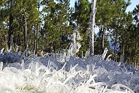 Frosted alpine forest in Constanza.
 -
 Semi-arid climate in Pedernales.
 -
 Desert sand dunes of Bani.
_Saman%C3%A1,_DR.JPG)

.JPG)

Islands
[edit]
There are several smaller islands and cays that are part of Dominican territory. The largest islands are:
- Saona, close to the southeastern coast of Hispaniola, in the Caribbean Sea. It has an area of 117 km2.[4] Its Taíno name was Iai [7] or Adamanay. Columbus named this island as Savona, after the Italian city of the same name, but the use during years has eliminated the letter v.
- Beata, also on the southern coast. It has an area of 27 km2.[4] Its Taíno name is unknown. Columbus named this island Madama Beata.
- Catalina, very close to the southeastern coast. It has an area of 9.6 km2.[4] Its Taíno name was Iabanea[7] but some writers, including poets, say that it was called Toeya or Toella.
Rivers and lakes
[edit]

The 8 longest rivers of the Dominican Republic are:[8]
- Yaque del Norte. At 296 km, it is the longest river in the Dominican Republic. Its sources are in the Cordillera Central and flows to the Atlantic Ocean. Its watershed has an area of 7,044 km2.
- Yuna. It is 185 km long. Its sources are in the Cordillera Central and flows to the east into Samaná Bay. Its watershed has an area of 5,498 km2.
- Yaque del Sur. It is 183 km long and its sources are in the Cordillera Central. It flows to the south into the Caribbean Sea. Its watershed has an area of 4,972 km2.
- Ozama. It is 148 km long. Its sources are in Sierra de Yamasá (a branch of the Cordillera Central). It flows into the Caribbean Sea. Its watershed has an area of 2,685 km2.
- Camú. It is 137 km long. Its sources are in the Cordillera Central and flows into the Yuna River. Its watershed has 2,655 km2.
- Nizao. It is 133 km long. Its sources are in the Cordillera Central and flows to the south into the Caribbean Sea. Its watershed has an area of 974 km2.
- San Juan. It is 121 km long. Its sources are in the Cordillera Central and flows to the south into the Yaque del Sur River. Its watershed has an area of 2,005 km2.
- Mao. It is 105 km long. Its sources are in the Cordillera Central and flows to the north into the Yaque del Norte River. Its watershed has an area of 864 km2.
The Artibonite River is the longest river of the island, but only 68 km flows through the Dominican Republic.
The largest lake of Hispaniola, and of the Caribbean, is Lake Enriquillo. It is located in the Hoya de Enriquillo with an area of 265 km2. There are three small islands within the lake. It is around 40 meters below sea level, and is a hypersaline lake, with a higher concentration of salt than seawater.
Other lakes are Rincón (fresh water, area of 28.2 km2), Oviedo (brackish water, area of 28 km2), Redonda, and Limón.
Statistics
[edit]
- Location
- Caribbean, it occupies five-eighths of the island of Hispaniola, between the Caribbean Sea and the North Atlantic Ocean, east of Haiti
- Geographic coordinates
- 19°00′N 70°40′W / 19.000°N 70.667°W
- Area
-
- Total: 48,670 km²
- Land: 48,320 km²
- Water: 350 km²
- Coastline
- 1,288 km
- Maritime claims
-
- Territorial sea: 6 nmi (11.1 km; 6.9 mi)
- Contiguous zone: 24 nmi (44.4 km; 27.6 mi)
- Exclusive economic zone: 255,898 km2 (98,803 sq mi) with 200 nmi (370.4 km; 230.2 mi)
- Continental shelf: 200 nmi (370.4 km; 230.2 mi) or to the edge of the continental margin
- Climate
- Tropical maritime; little seasonal temperature variation; seasonal variation in rainfall
- Rivers
- Significant rivers include the Jimani River, Río Yaque del Norte, Río Jamao del Norte, Río Isabela and the Ozama River

- Terrain
- Rugged highlands and mountains with fertile valleys interspersed
- Geographical extremes
-
- Northernmost point – Cabo Isabela
- Southernmost point – Alto Velo Island, Jaragua National Park
- Southernmost point (mainland) – south of Oviedo, Pedernales in Jaragua National Park
- Westernmost point – Las Lajas, border with Haiti, Independencia Province
- Easternmost point – Punta de Agua, La Altagracia Province
- Elevation extremes
-
- Lowest point – Lago Enriquillo: -46 m
- Highest point – Pico Duarte: 3,098 m
- Natural resources
- Nickel, bauxite, gold, silver
- Land use
-
- Arable land: 16.56%
- Permanent crops: 10.35%
- Other: 73.10% (2012 est.)
- Irrigated land
- 3,241 km² (2018)
- Total renewable water resources
- 21 km3 (2011)
- Freshwater withdrawal (domestic/industrial/agricultural)
-
- total: 5.47 km3/yr (26%/1%/72%)
- per capita: 574.2 m3/yr (2005)
- Natural hazards
- Lies in the middle of the hurricane belt and subject to severe storms from June to October; occasional flooding; periodic droughts
- Environment - current issues
- Water shortages; soil eroding into the sea damages coral reefs; deforestation; damage caused by Hurricane Georges
- Environment - international agreements
-
- Party to: Biodiversity, Climate Change, Desertification, Endangered Species, Marine Dumping, Marine Life Conservation, Nuclear Test Ban, Ozone Layer Protection, Ship Pollution, Wetlands
- Signed, but not ratified: Law of the Sea
- Geography - note
- Shares island of Hispaniola with Haiti (eastern five-eighths is the Dominican Republic, western three-eighths is Haiti)[1][2]
References
[edit]- ^ a b Dardik, Alan, ed. (2016). Vascular Surgery: A Global Perspective. Springer. p. 341. ISBN 9783319337456. Retrieved 8 May 2017.
- ^ a b Josh, Jagran, ed. (2016). "Current Affairs November 2016 eBook". p. 93. Retrieved 8 May 2017.
- ^ "CIA World Factbook: Haiti". 12 July 2022.
- ^ a b c d De la Fuente, Santiago (1976). Geografía Dominicana. Santo Domingo, Dominican Republic: Editora Colegial Quisqueyana. pp. 90–92.
- ^ "Dominican Republic| History, Geography, & Culture". Encyclopædia Britannica. Retrieved 2018-02-21.
- ^ Butterlin, Jacques (1977). Géologie Structural de la Région des Caraïbes (in French). Paris: Masson. pp. 110–111. ISBN 2-225-44979-1.
- ^ a b As shown in a map made by Andrés Morales in 1508 and published in 1516. In Vega, Bernardo (1989). Los Cacicazgos de la Hispaniola. Santo Domingo, Dominican Republic: Museo del Hombre Dominicano. p. 88.
- ^ De la Fuente, Santiago (1976). Geografía Dominicana. Santo Domingo, Dominican Republic: Editora Colegial Quisqueyana. pp. 110–114.
| Sovereign states |  | |
|---|---|---|
Dependencies and other territories | ||