
Airport station (GCRTA): Difference between revisions
Reference edited with ProveIt |
Cards84664 (talk | contribs) collapse map |
||
| (3 intermediate revisions by 3 users not shown) | |||
| Line 1: | Line 1: | ||
{{Use mdy dates|date=May 2023}} |
|||
{{Short description|Rapid transit station in Cleveland}} |
{{Short description|Rapid transit station in Cleveland}} |
||
{{Other uses|Airport station (disambiguation){{!}}Airport Station}} |
|||
{{Infobox station |
{{Infobox station |
||
| style = RTA Rapid Transit |
| style = RTA Rapid Transit |
||
| Line 17: | Line 17: | ||
| parking = Paid parking only |
| parking = Paid parking only |
||
| bicycle = |
| bicycle = |
||
| accessible = {{RTA acc}} Yes<ref name="RTA station page">{{Cite web |title=Airport Rapid Station |url=http://www.riderta.com/facilities/airport |access-date=May 8, 2023 |website=[[Greater Cleveland Regional Transit Authority]]}}</ref> |
|||
| accessible = {{RTA acc}} Yes |
|||
| opened = {{Start date and age|1968|11|15}} |
| opened = {{Start date and age|1968|11|15}} |
||
| rebuilt = <!-- May -->1994 |
| rebuilt = <!-- May -->1994 |
||
| original = [[Cleveland Transit System]] |
| original = [[Cleveland Transit System]] |
||
| services = {{Adjacent stations|system=RTA Rapid Transit|line=Red|right=Brookpark}} |
| services = {{Adjacent stations|system=RTA Rapid Transit|line=Red|right=Brookpark}} |
||
| mapframe = yes |
|||
| mapframe-custom = {{Infobox mapframe |shape=none |line=none |marker=rail-metro |marker-color=#{{rcr|RTA Rapid Transit|Red}} |zoom=15 }} |
|||
| location_state = collapsed |
|||
}} |
}} |
||
| Line 27: | Line 30: | ||
== History == |
== History == |
||
The station opened on November 15, 1968, when the CTS Rapid Transit was extended four miles from [[West Park (RTA Rapid Transit station)|West Park station]], making Cleveland the first city in North America to offer direct rapid transit service to its major airport.<ref name="RTAHistory">{{Cite web |title=About RTA: History of Public Transit in Greater Cleveland |url=http://www.gcrta.org/ar_RTAhistory.asp |url-status=dead |archive-url=https://web.archive.org/web/20070623203512/http://www.gcrta.org/ar_RTAhistory.asp |archive-date= |
The station opened on November 15, 1968, when the CTS Rapid Transit was extended four miles from [[West Park (RTA Rapid Transit station)|West Park station]], making Cleveland the first city in North America to offer direct rapid transit service to its major airport.<ref name="RTAHistory">{{Cite web |title=About RTA: History of Public Transit in Greater Cleveland |url=http://www.gcrta.org/ar_RTAhistory.asp |url-status=dead |archive-url=https://web.archive.org/web/20070623203512/http://www.gcrta.org/ar_RTAhistory.asp |archive-date=June 23, 2007 |access-date=June 3, 2007 |website=RTA Website}}</ref> A $1.9-million renovation of the station was completed in May 1994.<ref name="RTAHistory" /> |
||
RTA has considered extending the Red Line beyond Hopkins Airport to [[Berea, Ohio|Berea]].<ref>{{Cite news |date= |
RTA has considered extending the Red Line beyond Hopkins Airport to [[Berea, Ohio|Berea]].<ref>{{Cite news |date=April 23, 1997 |title=RTA approves $1 million to assess Berea line |pages=2B |publisher=The Plain Dealer |url=http://docs.newsbank.com/openurl?ctx_ver=z39.88-2004&rft_id=info:sid/iw.newsbank.com:NewsBank:CPDB&rft_val_format=info:ofi/fmt:kev:mtx:ctx&rft_dat=0F80C58336749358&svc_dat=InfoWeb:aggregated4&req_dat=0D1C2ED46ABD2E15 |access-date=June 2, 2007}}</ref> Several different plans were considered in the late 1990s. One plan would have extended the Red Line from Hopkins Airport along [[Ohio State Route 237]] past the [[I-X Center]] and into downtown Berea. Another plan would have the rapid extend from the [[Brookpark (RTA Rapid Transit station)|Brookpark station]] past the I-X Center and into Berea. The proposal included the possibility that direct service to the airport terminal would end, with a new station outside the airport grounds which would require riders to be transferred to the terminal by other means. However, the extension failed to obtain approval of the Northeast Ohio Areawide Coordinating Agency because it was too expensive and would not attract enough riders.<ref>{{Cite news |last=Sweeney |first=James F. |date=April 20, 2000 |title=Costs may halt Red Line extension |pages=1B |publisher=The Plain Dealer |url=http://docs.newsbank.com/openurl?ctx_ver=z39.88-2004&rft_id=info:sid/iw.newsbank.com:NewsBank:CPDB&rft_val_format=info:ofi/fmt:kev:mtx:ctx&rft_dat=0F80DB39459397CD&svc_dat=InfoWeb:aggregated4&req_dat=0D1C2ED46ABD2E15 |access-date=June 2, 2007}}</ref> |
||
RTA continues to consider Red Line extensions to development areas adjacent to the airport, and an extension along the southwest corridor to the I-X Center, Berea or the growing areas of Lorain County is included as part of RTA's long |
RTA continues to consider Red Line extensions to development areas adjacent to the airport, and an extension along the southwest corridor to the I-X Center, Berea or the growing areas of Lorain County is included as part of RTA's long-range plan, Transit 2025.<ref>{{Cite web |date=March 2006 |title=Transit 2025 Plan |url=http://www.gcrta.org/pdf/transit2025/Transit_2025_March_2006_Final_ch4.pdf |publisher=Greater Cleveland Regional Transit Authority |pages=5–6}}</ref> |
||
RTA is also working with the City of Cleveland, the State of Ohio, and other passenger rail interests to create an Amtrak station near Hopkins Airport, which would serve as an intermodal airport hub similar to those in [[Newark Liberty International Airport (NJT station)|Newark]], [[BWI Rail Station|Baltimore]], or [[Milwaukee Airport Railroad Station|Milwaukee]].<ref>{{Cite web |title=Greater Cleveland RTA rail planning updates |url=http://www.ecocitycleveland.org/transportation/rail/rta_rail_updates.html |access-date= |
RTA is also working with the City of Cleveland, the State of Ohio, and other passenger rail interests to create an Amtrak station near Hopkins Airport, which would serve as an intermodal airport hub similar to those in [[Newark Liberty International Airport (NJT station)|Newark]], [[BWI Rail Station|Baltimore]], or [[Milwaukee Airport Railroad Station|Milwaukee]].<ref>{{Cite web |title=Greater Cleveland RTA rail planning updates |url=http://www.ecocitycleveland.org/transportation/rail/rta_rail_updates.html |access-date=June 20, 2007 |website=Transportation Choices |publisher=EcoCity Cleveland}}</ref> |
||
== Station layout == |
== Station layout == |
||
| Line 63: | Line 66: | ||
== Gallery == |
== Gallery == |
||
<gallery |
<gallery> |
||
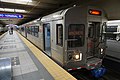
Cleveland August 2015 02 (RTA Red Line).jpg|Red Line train at Airport station |
|||
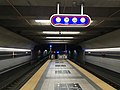
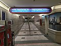
Airport station (Cleveland).jpg|Airport station platform |
|||
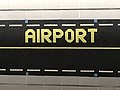
Airport station (Cleveland) (2).jpg|Airport station wall design |
|||
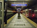
RTA Airport Station.JPG|Airport station platform seem from entrance |
|||
Airport station (Cleveland) (3).jpg|Exit to terminal seen from Airport station platform |
|||
Airport station (Cleveland) (4).jpg|Hallway from ticket machines to platform |
|||
File:Airport station (Cleveland) (5).jpg |
|||
</gallery> |
</gallery> |
||
Latest revision as of 21:07, 20 May 2024
Airport | |||||||||||
|---|---|---|---|---|---|---|---|---|---|---|---|
_(6).jpg) Entrance to Airport station | |||||||||||
| General information | |||||||||||
| Location | 5300 Riverside Drive Cleveland, Ohio | ||||||||||
| Coordinates | 41°24′40″N 81°50′15″W / 41.41111°N 81.83750°W | ||||||||||
| Owned by | Greater Cleveland Regional Transit Authority | ||||||||||
| Platforms | 1 island platform | ||||||||||
| Tracks | 2 | ||||||||||
| Construction | |||||||||||
| Structure type | Underground | ||||||||||
| Parking | Paid parking only | ||||||||||
| Accessible | |||||||||||
| Other information | |||||||||||
| Website | riderta | ||||||||||
| History | |||||||||||
| Opened | November 15, 1968 | ||||||||||
| Rebuilt | 1994 | ||||||||||
| Original company | Cleveland Transit System | ||||||||||
| Services | |||||||||||
| |||||||||||
| |||||||||||

Airport station is a station on the RTA Red Line in Cleveland, Ohio. It is the western terminus of the Red Line and is located off the lower level below the middle of the baggage claim level of Cleveland Hopkins International Airport.
History
[edit]The station opened on November 15, 1968, when the CTS Rapid Transit was extended four miles from West Park station, making Cleveland the first city in North America to offer direct rapid transit service to its major airport.[2] A $1.9-million renovation of the station was completed in May 1994.[2]
RTA has considered extending the Red Line beyond Hopkins Airport to Berea.[3] Several different plans were considered in the late 1990s. One plan would have extended the Red Line from Hopkins Airport along Ohio State Route 237 past the I-X Center and into downtown Berea. Another plan would have the rapid extend from the Brookpark station past the I-X Center and into Berea. The proposal included the possibility that direct service to the airport terminal would end, with a new station outside the airport grounds which would require riders to be transferred to the terminal by other means. However, the extension failed to obtain approval of the Northeast Ohio Areawide Coordinating Agency because it was too expensive and would not attract enough riders.[4]
RTA continues to consider Red Line extensions to development areas adjacent to the airport, and an extension along the southwest corridor to the I-X Center, Berea or the growing areas of Lorain County is included as part of RTA's long-range plan, Transit 2025.[5] RTA is also working with the City of Cleveland, the State of Ohio, and other passenger rail interests to create an Amtrak station near Hopkins Airport, which would serve as an intermodal airport hub similar to those in Newark, Baltimore, or Milwaukee.[6]
Station layout
[edit]| B | Bridge level | Bridge between terminal and parking garage |
| TL | Terminal Level | Hopkins Airport ticketing, security, gates |
| BC | Baggage Claim level | Street entrance/exit, baggage claim |
| LL Platform level |
Eastbound | Red Line toward Windermere (Brookpark) → |
| Island platform | ||
| Eastbound | Red Line toward Windermere (Brookpark) → | |
Notable places nearby
[edit]Gallery
[edit]-
 Red Line train at Airport station
 -
 Airport station platform
 -
 Airport station wall design
 -
 Airport station platform seem from entrance
 -
 Exit to terminal seen from Airport station platform
 -
 Hallway from ticket machines to platform
.jpg)
.jpg)
_(2).jpg)

_(3).jpg)
_(4).jpg)
References
[edit]- ^ "Airport Rapid Station". Greater Cleveland Regional Transit Authority. Retrieved May 8, 2023.
- ^ a b "About RTA: History of Public Transit in Greater Cleveland". RTA Website. Archived from the original on June 23, 2007. Retrieved June 3, 2007.
- ^ "RTA approves $1 million to assess Berea line". The Plain Dealer. April 23, 1997. pp. 2B. Retrieved June 2, 2007.
- ^ Sweeney, James F. (April 20, 2000). "Costs may halt Red Line extension". The Plain Dealer. pp. 1B. Retrieved June 2, 2007.
- ^ "Transit 2025 Plan" (PDF). Greater Cleveland Regional Transit Authority. March 2006. pp. 5–6.
- ^ "Greater Cleveland RTA rail planning updates". Transportation Choices. EcoCity Cleveland. Retrieved June 20, 2007.
External links
[edit]![]() Media related to Airport station (GCRTA) at Wikimedia Commons
Media related to Airport station (GCRTA) at Wikimedia Commons