
Chūbu region: Difference between revisions
mentioned Mie in intro, as it is treated as part of Central, not Western Japan in really many practical contexts (and it was also part of the Tōkai Circuit in antiquity), Kō/Shin/Etsu (Yamanashi/Nagano/Niigata) on the other hand are in some contexts more aligned towards Tokyo, and in several contexts not part of Central, but Eastern Japan (or even Kantō as with the police) |
Citation bot (talk | contribs) Altered template type. Removed Template redirect. | Use this bot. Report bugs. | #UCB_CommandLine |
||
| (39 intermediate revisions by 27 users not shown) | |||
| Line 1: | Line 1: | ||
{{Short description|Region of Japan}} |
|||
{{Redirect|Chubu|airport near Nagoya|Chūbu Centrair International Airport}} |
|||
{{Redirect|Chubu|airport near Tokoname|Chubu Centrair International Airport}} |
|||
{{Infobox settlement |
{{Infobox settlement |
||
<!-- See Template:Infobox settlement for additional fields and descriptions --> |
<!-- See Template:Infobox settlement for additional fields and descriptions --> |
||
| name = {{raise|0.25em|Chūbu region}} |
| name = {{raise|0.25em|Chūbu region}} |
||
| native_name = {{nobold|中部地方}} |
| native_name = {{nobold|中部地方}} |
||
| native_name_lang = ja |
| native_name_lang = ja |
||
| settlement_type = [[ |
| settlement_type = [[List of regions of Japan|Region of Japan]] |
||
| image_skyline |
| image_skyline = Chubu Region in Japan.svg |
||
| image_alt = Map showing the Tōhoku region of Japan. It comprises the middle area of the island of Honshū. |
| image_alt = Map showing the Tōhoku region of Japan. It comprises the middle area of the island of Honshū. |
||
| image_caption = The Chūbu region in Japan |
| image_caption = The Chūbu region (without Mie) in Japan |
||
| image_map = |
| image_map = Geofeatures map of Chubu Japan ja.svg |
||
| map_alt = |
| map_alt = |
||
| map_caption = |
| map_caption = Geofeatures map of Chubu |
||
| pushpin_map = |
| pushpin_map = |
||
| pushpin_label_position = |
| pushpin_label_position = |
||
| pushpin_map_alt = |
| pushpin_map_alt = |
||
| pushpin_map_caption = |
| pushpin_map_caption = |
||
| coordinates = |
| coordinates = |
||
| coor_pinpoint = |
| coor_pinpoint = |
||
| coordinates_footnotes = |
| coordinates_footnotes = |
||
| |
| subdivision_type = [[List of sovereign states|Country]] |
||
| |
| subdivision_name = [[Japan]] |
||
| |
| unit_pref = Metric |
||
| |
| area_footnotes = incl. Mie |
||
| |
| area_total_km2 = 72,572.34 |
||
| |
| area_land_km2 = |
||
| |
| area_water_km2 = |
||
| |
| area_water_percent = |
||
| |
| area_note = |
||
| |
| elevation_footnotes = |
||
| |
| elevation_m = |
||
| |
| population_footnotes = incl. Mie |
||
| population_total = 23,010,276 |
|||
| population_density_km2 = auto |
|||
| |
| population_as_of = June 1, 2019 |
||
| |
| population_density_km2 = auto |
||
| |
| population_est = |
||
| |
| pop_est_as_of = |
||
| |
| population_demonym = |
||
| |
| population_note = |
||
| |
| demographics_type1 = Gross Regional Product |
||
| demographics1_footnotes = <ref name="esri.cao.go.jp">{{cite web|title=県民経済計算(平成23年度 - 令和2年度)(2008SNA、平成27年基準計数)<47都道府県、4政令指定都市分>|url=https://www.esri.cao.go.jp/jp/sna/data/data_list/kenmin/files/contents/main_2020.html}}</ref> |
|||
| demographics1_title1 = Total |
|||
| demographics1_info1 = [[Japanese yen|JP¥]]101.304 trillion<br />[[US$]]909 billion |
|||
| timezone1 = [[Japan Standard Time|JST]] |
|||
| utc_offset1 = +09:00 |
|||
| footnotes = |
|||
| official_name = |
|||
| module = {{Maplink|frame=yes|frame-align=center|plain=y|frame-width=255|frame-height=255|zoom=6|frame-lat=36.3|frame-long=137.8|type=shape-inverse|stroke-width=1|stroke-color=#333333|id=Q134638|title=Chūbu region}} |
|||
}} |
}} |
||
| Line 45: | Line 53: | ||
[[File:Shirakawago.jpg|thumb|200px|[[Historic Villages of Shirakawa-gō and Gokayama]] in Chūbu]] |
[[File:Shirakawago.jpg|thumb|200px|[[Historic Villages of Shirakawa-gō and Gokayama]] in Chūbu]] |
||
[[File:Nagoya (2015-11-03).JPG|thumb|200px|Central Nagoya]] |
[[File:Nagoya (2015-11-03).JPG|thumb|200px|Central Nagoya]] |
||
The {{nihongo|'''Chūbu region'''|中部地方|Chūbu-chihō}}, '''Central region''', or {{Nihongo|'''Central Japan'''|中部日本|Chūbu-nihon}} is a region in the middle of [[Honshū]], [[Japan|Japan's]] main island. In a wide, classical definition, it encompasses nine prefectures (''ken''): [[Aichi Prefecture|Aichi]], [[Fukui Prefecture|Fukui]], [[Gifu Prefecture|Gifu]], [[Ishikawa Prefecture|Ishikawa]], [[Nagano Prefecture|Nagano]], [[Niigata Prefecture|Niigata]], [[Shizuoka Prefecture|Shizuoka]], [[Toyama Prefecture|Toyama]], and [[Yamanashi Prefecture|Yamanashi]].<ref>Nussbaum, Louis-Frédéric. (2005). "Chūbu" in {{Google books|p2QnPijAEmEC|''Japan Encyclopedia'', p. 126|page=126}}</ref> In this definition, Chūbu has a population of 23,010,276 as of 1 June 2019. |
|||
The {{nihongo|'''Chūbu region'''|中部地方|Chūbu-chihō}}, '''Central region''', or {{Nihongo|'''Central Japan'''|中部日本|Chūbu-nihon}} is a region in the middle of [[Honshu|Honshū]], [[Japan|Japan's]] main island. In a wide, classical definition, it encompasses nine prefectures (''ken''): [[Aichi Prefecture|Aichi]], [[Fukui Prefecture|Fukui]], [[Gifu Prefecture|Gifu]], [[Ishikawa Prefecture|Ishikawa]], [[Nagano Prefecture|Nagano]], [[Niigata Prefecture|Niigata]], [[Shizuoka Prefecture|Shizuoka]], [[Toyama Prefecture|Toyama]], and [[Yamanashi Prefecture|Yamanashi]].<ref>Nussbaum, Louis-Frédéric. (2005). "Chūbu" in {{Google books|p2QnPijAEmEC|''Japan Encyclopedia'', p. 126|page=126}}</ref> |
|||
It is located directly between the [[Kantō region]] and the [[Kansai region]] and includes the major city of [[Nagoya]] as well as [[Pacific Ocean]] and [[Sea of Japan]] coastlines, extensive [[mountain resort]]s, and [[Mount Fuji]]. |
It is located directly between the [[Kantō region]] and the [[Kansai region]] and includes the major city of [[Nagoya]] as well as [[Pacific Ocean]] and [[Sea of Japan]] coastlines, extensive [[mountain resort]]s, and [[Mount Fuji]]. |
||
| Line 51: | Line 60: | ||
The region is the widest part of Honshū and the central part is characterized by high, rugged mountains. The [[Japanese Alps]] divide the country into the [[Pacific Ocean|Pacific]] side, sunny in winter, and the [[Sea of Japan]] side, snowy in winter. |
The region is the widest part of Honshū and the central part is characterized by high, rugged mountains. The [[Japanese Alps]] divide the country into the [[Pacific Ocean|Pacific]] side, sunny in winter, and the [[Sea of Japan]] side, snowy in winter. |
||
Although [[Mie Prefecture|Mie]] is part of Kinki/Kansai/Western Japan in traditional geographical regional divisions, Northern Mie is part of the metropolitan area around Nagoya, and Mie is in many practical contexts considered to be part of Tōkai/Chūbu/Central Japan. |
Although [[Mie Prefecture|Mie]] is part of Kinki/Kansai/Western Japan in traditional geographical regional divisions, Northern Mie is part of the metropolitan area around Nagoya, and Mie is in many practical contexts considered to be part of Tōkai/Chūbu/Central Japan. Including Mie, Chūbu had a population of 23,010,276 as of 1 June 2019. |
||
== Other definitions == |
== Other definitions == |
||
| Line 59: | Line 68: | ||
In local government, the Chūbu area governors' association (中部圏知事会, ''Chūbuken chijikai'') unites the governors of Toyama, Ishikawa, Fukui, Nagano, Gifu, Shizuoka, Aichi, Mie and Shiga and the mayor of Nagoya City in Aichi.<ref>Aichi prefectural government, [https://www.pref.aichi.jp/chiji/chubuken/page/m.html Chūbu area governors' association] (Japanese)</ref> |
In local government, the Chūbu area governors' association (中部圏知事会, ''Chūbuken chijikai'') unites the governors of Toyama, Ishikawa, Fukui, Nagano, Gifu, Shizuoka, Aichi, Mie and Shiga and the mayor of Nagoya City in Aichi.<ref>Aichi prefectural government, [https://www.pref.aichi.jp/chiji/chubuken/page/m.html Chūbu area governors' association] (Japanese)</ref> |
||
== Geography == |
|||
[[File:Chubu Region Japan 2003.png|thumb|Chubu region (satellite photo)]] |
|||
Located in the center of the [[Japanese archipelago]]. It refers to the area between the [[Kanto region|Kanto]], [[Tohoku region|Tohoku]] and [[Kansai region|Kansai]] regions. It began to be used in the late [[Meiji (era)|Meiji era]] as a tentative name for unclassified areas. In a broad sense, it often refers to the eight regional divisions and similar ranges. In a narrow sense it may refer to a range similar to the [[Tōkai region]]. |
|||
The terrain is mainly rugged and mountainous except for the [[Nōbi Plain]] and coastal areas. The steep [[Japanese Alps]] rise in the central area. It is located between [[Tokyo]] and [[Osaka]], which are the east–west centers of the Japanese economy and culture. Thus the Chubu region has various differences between the eastern side and the western side. |
|||
==Subregions== |
==Subregions== |
||
| Line 65: | Line 80: | ||
===Tōkai=== |
===Tōkai=== |
||
{{Main|Tōkai region}} |
{{Main|Tōkai region}} |
||
The Tōkai region, mostly bordering the [[Pacific Ocean]], is a narrow corridor interrupted in places by mountains that descend into the sea. |
The Tōkai region, mostly bordering the [[Pacific Ocean]], is a narrow corridor interrupted in places by mountains that descend into the sea. |
||
Since the [[Tokugawa period]] (1600–1867), this corridor has been critical in linking Tokyo, Kyoto, and Osaka. One of old Japan's most important ancient roadways, the [[Tōkaidō (road)|Tōkaidō]], ran through it connecting Tokyo (at that time called [[Edo]]) and Kyoto, the old imperial capital. In the twentieth century, it became the route for new super-express highways and high-speed railroad lines ([[shinkansen]]). The area consists of [[Aichi Prefecture|Aichi]], [[Mie Prefecture|Mie]], [[Shizuoka Prefecture|Shizuoka]], and southern [[Gifu Prefecture|Gifu]] prefectures. |
Since the [[Tokugawa period]] (1600–1867), this corridor has been critical in linking Tokyo, Kyoto, and Osaka. One of old Japan's most important ancient roadways, the [[Tōkaidō (road)|Tōkaidō]], ran through it connecting Tokyo (at that time called [[Edo]]) and Kyoto, the old imperial capital. In the twentieth century, it became the route for new super-express highways and high-speed railroad lines ([[shinkansen]]). The area consists of [[Aichi Prefecture|Aichi]], [[Mie Prefecture|Mie]], [[Shizuoka Prefecture|Shizuoka]], and southern [[Gifu Prefecture|Gifu]] prefectures. |
||
A number of small alluvial plains are found in the corridor section. A mild climate, favorable location relatively close to the great metropolitan complexes, and availability of fast transportation have made this area a center for truck-gardening and out-of-season vegetables. Upland areas of rolling hills are extensively given over to the growing of mandarin oranges and tea. Nagoya, which faces [[Ise Bay]], is a center for heavy industry, including iron and steel and machinery manufacturing. The corridor also has a number of small but important industrial centers. The western part of Tōkai includes the Nōbi Plain, where rice was being grown by the seventh century. |
A number of small alluvial plains are found in the corridor section. A mild climate, favorable location relatively close to the great metropolitan complexes, and availability of fast transportation have made this area a center for truck-gardening and out-of-season vegetables. Upland areas of rolling hills are extensively given over to the growing of mandarin oranges and tea. Nagoya, which faces [[Ise Bay]], is a center for [[heavy industry]], including iron and steel and machinery manufacturing. The corridor also has a number of small but important industrial centers. The western part of Tōkai includes the Nōbi Plain, where rice was being grown by the seventh century. |
||
====Chūkyō==== |
====Chūkyō==== |
||
The three Tōkai prefectures centered on [[Nagoya]] (Aichi, Gifu, and Mie) have particularly strong economic ties, and the parts of these prefectures that are closest to the city comprise the [[Chūkyō Metropolitan Area]]. This area boasts the third strongest economy in Japan and this influence can sometimes extend into the more remote parts of these prefectures that are farther away from Nagoya. Thus, these three prefectures are sometimes called the "Chūkyō region" in a business sense. This name does not see widespread usage throughout Japan; however, as the economy in the area strengthens, this name may become more well-known country-wide. |
The three Tōkai prefectures centered on [[Nagoya]] (Aichi, Gifu, and Mie) have particularly strong economic ties, and the parts of these prefectures that are closest to the city comprise the [[Chūkyō Metropolitan Area]]. This area boasts the third strongest economy in Japan and this influence can sometimes extend into the more remote parts of these prefectures that are farther away from Nagoya. Thus, these three prefectures are sometimes called the "Chūkyō region" in a business sense. This name does not see widespread usage throughout Japan; however, as the economy in the area strengthens, this name may become more well-known country-wide. |
||
<gallery mode="packed"> |
<gallery mode="packed"> |
||
File: |
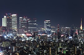
File:Nagoya Night View.jpg|[[Nagoya|Nagoya City]] |
||
File: |
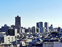
File:Skyline of Hamamatsu01.jpg|[[Hamamatsu|Hamamatsu City]] |
||
File:Shizuoka |
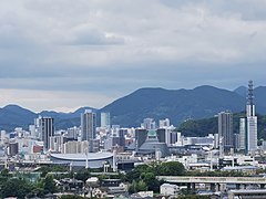
File:Higashi-Shizuoka Panorama 05.jpg|[[Shizuoka, Shizuoka|Shizuoka City]] |
||
File:Gifu City Tower 43 and Gifu Sky Wing 37 from Twinarch138.jpg|[[Gifu, Gifu|Gifu City]] |
File:Gifu City Tower 43 and Gifu Sky Wing 37 from Twinarch138.jpg|[[Gifu, Gifu|Gifu City]] |
||
File:YokkaichiCity NightView from TarusakaPark.jpg|[[Yokkaichi, Mie|Yokkaichi City]]<br> |
File:YokkaichiCity NightView from TarusakaPark.jpg|[[Yokkaichi, Mie|Yokkaichi City]]<br>([[Kinki region]]) |
||
File: |
File:Skyline of Tsu City01.jpg|[[Tsu, Mie|Tsu City]]<br>(Kinki region) |
||
</gallery> |
</gallery> |
||
| Line 86: | Line 102: | ||
Kōshin'etsu is an area of complex and high rugged mountains—often called the "roof of Japan"—that include the [[Japanese Alps]]. The population is chiefly concentrated in six elevated basins connected by narrow valleys. It was long a main silk-producing area, although output declined after [[World War II]]. Much of the labor formerly required in silk production was absorbed by the district's diversified manufacturing industry, which included precision instruments, machinery, textiles, food processing, and other light manufacturing. Kōshin'etsu means [[Yamanashi Prefecture|Yamanashi]], [[Nagano Prefecture|Nagano]], and [[Niigata Prefecture|Niigata]] prefectures; Niigata is also included to the Hokuriku region. Yamanashi, Nagano and northern [[Gifu Prefecture]] are sometimes referred to as [[Central Highland (Japan)|Chūō-kōchi]] or [[Tōsandō|Tōsan]] region. |
Kōshin'etsu is an area of complex and high rugged mountains—often called the "roof of Japan"—that include the [[Japanese Alps]]. The population is chiefly concentrated in six elevated basins connected by narrow valleys. It was long a main silk-producing area, although output declined after [[World War II]]. Much of the labor formerly required in silk production was absorbed by the district's diversified manufacturing industry, which included precision instruments, machinery, textiles, food processing, and other light manufacturing. Kōshin'etsu means [[Yamanashi Prefecture|Yamanashi]], [[Nagano Prefecture|Nagano]], and [[Niigata Prefecture|Niigata]] prefectures; Niigata is also included to the Hokuriku region. Yamanashi, Nagano and northern [[Gifu Prefecture]] are sometimes referred to as [[Central Highland (Japan)|Chūō-kōchi]] or [[Tōsandō|Tōsan]] region. |
||
<gallery mode="packed"> |
<gallery mode="packed"> |
||
File: |
File:Niigata from Bandaijima Building 20200906 P4.jpg|[[Niigata, Niigata|Niigata City]] |
||
File: |
File:Skyline of Nagano City03.jpg|[[Nagano, Nagano|Nagano City]] |
||
File: |
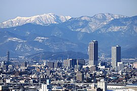
File:DownTown of Kofu City.jpg|[[Kofu|Kōfu City]] |
||
</gallery> |
</gallery> |
||
===Hokuriku=== |
===Hokuriku=== |
||
{{Main|Hokuriku region}} |
{{Main|Hokuriku region}} |
||
The Hokuriku region lies on the [[Sea of Japan]] coastline, northwest of the massive mountains that comprise Kōshin'etsu. Hokuriku includes the four prefectures of [[Ishikawa Prefecture|Ishikawa]], [[Fukui Prefecture|Fukui]], [[Niigata Prefecture|Niigata]] and [[Toyama Prefecture|Toyama]],<ref>Nussbaum, "Hokuriku" at {{Google books|p2QnPijAEmEC|p. 344|page=344}}</ref> |
The Hokuriku region lies on the [[Sea of Japan]] coastline, northwest of the massive mountains that comprise Kōshin'etsu. Hokuriku includes the four prefectures of [[Ishikawa Prefecture|Ishikawa]], [[Fukui Prefecture|Fukui]], most of [[Niigata Prefecture|Niigata]] and [[Toyama Prefecture|Toyama]],<ref>Nussbaum, "Hokuriku" at {{Google books|p2QnPijAEmEC|p. 344|page=344}}</ref> |
||
The district has very heavy snowfall (sometimes enough to block major roads) and strong winds in winter, and its turbulent rivers are the source of abundant [[hydroelectric power]]. [[Niigata Prefecture]] is the site of domestic gas and oil production as well. Industrial development is extensive, especially in the cities in Niigata and [[Toyama Prefecture|Toyama]]; [[Fukui Prefecture|Fukui]] and [[Ishikawa Prefecture|Ishikawa]] prefectures also have large manufacturing industries. |
The district has very heavy snowfall (sometimes enough to block major roads) and strong winds in winter, and its turbulent rivers are the source of abundant [[hydroelectric power]]. [[Niigata Prefecture]] is the site of domestic gas and oil production as well. Industrial development is extensive, especially in the cities in Niigata and [[Toyama Prefecture|Toyama]]; [[Fukui Prefecture|Fukui]] and [[Ishikawa Prefecture|Ishikawa]] prefectures also have large manufacturing industries. |
||
| Line 101: | Line 117: | ||
File:望湖台2.jpg|[[Kanazawa|Kanazawa City]] |
File:望湖台2.jpg|[[Kanazawa|Kanazawa City]] |
||
File:Toyamaken-top.JPG|[[Toyama, Toyama|Toyama City]] |
File:Toyamaken-top.JPG|[[Toyama, Toyama|Toyama City]] |
||
File: |
File:Skyline of Fukui City02.jpg|[[Fukui, Fukui|Fukui City]] |
||
</gallery> |
</gallery> |
||
== Demographics == |
|||
The three most dense areas of Chūbu region are [[Chūkyō metropolitan area]] (greater Nagoya), [[Niigata (city)|Niigata]]-[[Toyama, Toyama|Toyama]] area at Hokuriku subregion, and [[Nagano (city)|Nagano]] at the mountains ([[Koshin Region|Chūō-kōchi]]). |
|||
Per Japanese census data,<ref>[http://www.citypopulation.de/Japan-Aichi.html Aichi 1995-2020 population statistics]</ref> and,<ref>[http://www.demographia.com/db-japanpref.htm Chūbu region 1920-2000 population statistics]</ref> Chūbu region has had positive population growth. |
|||
{{Historical populations |
|||
| 1920 | 10,702,000 |
|||
| 1930 | 11,978,000 |
|||
| 1940 | 13,113,000 |
|||
| 1950 | 15,458,000 |
|||
| 1960 | 16,565,000 |
|||
| 1970 | 18,091,000 |
|||
| 1980 | 19,984,000 |
|||
| 1990 | 21,023,000 |
|||
| 2000 | 21,628,238 |
|||
| 2010 | 21,715,822 |
|||
| 2020 | 22,078,654 |
|||
|align = none |
|||
| footnote = Note: This excludes Mie Prefecture |
|||
}} |
|||
== Major cities == |
== Major cities == |
||
{| class="wikitable" style="text-align:left; width:100%; margin-right:10px; font-size:100%" |
|||
! colspan="10" style="text-align:center; background:#e9e9e9; padding:0.3em; line-height:1.2em;"| '''List of 20 major cities in Chūbu''' |
|||
|- |
|||
!rowspan=30| |
|||
{{center|[[File:Nagoya Night View.jpg|150px]]<br /><small>[[File:Flag of Nagoya, Aichi.svg|border|25x20px]] [[Nagoya|Nagoya city]]</small><br />[[File:Niigata from Bandaijima Building 20200906 P4.jpg|150px]]<br /><small>[[File:Flag of Niigata, Niigata.svg|border|25x20px]] [[Niigata (city)|Niigata city]]</small>}}<br /> |
|||
! style="text-align:center; background:#f5f5f5;"| <small>Rank</small> |
|||
! style="text-align:center; background:#f5f5f5;"| Cities |
|||
! style="text-align:center; background:#f5f5f5;"| Prefecture |
|||
! style="text-align:center; background:#f5f5f5;"| Population |
|||
! style="text-align:center; background:#f5f5f5;"| <small>Rank</small> |
|||
! style="text-align:center; background:#f5f5f5;"| Cities |
|||
! style="text-align:center; background:#f5f5f5;"| Prefecture |
|||
! style="text-align:center; background:#f5f5f5;"| Population |
|||
!rowspan=21| |
|||
{{center|[[File:Skyline of Hamamatsu01.jpg|150px]]<br /><small>[[File:Flag of Hamamatsu, Shizuoka.svg|border|25x20px]] [[Hamamatsu|Hamamatsu city]]</small><br />[[File:Shizuoka Station from Choseniwa.jpg|150px]]<br /><small>[[File:Flag of Shizuoka, Shizuoka.svg|border|25x20px]] [[Shizuoka (city)|Shizuoka city]]</small>}}<br /> |
|||
|- |
|||
| style=“text-align:center; background:#f0f0f0”|{{center|1}} |
|||
|align=left | [[File:Flag of Nagoya, Aichi.svg|border|25x20px]] '''[[Nagoya]]''' || {{flag|Aichi}} || align=right|2,331,078 || style="text-align:center"|11 ||align=left | [[File:Flag of Toyohashi, Aichi.svg|border|25x20px]] '''[[Toyohashi]]''' || {{flag|Aichi}} || align=right|377,453 |
|||
|- |
|||
| style=“text-align:center; background:#f0f0f0”|{{center|2}} ||align=left | [[File:Flag of Niigata, Niigata.svg|border|25x20px]] '''[[Niigata (city)|Niigata]]''' || {{flag|Niigata}} || align=right|797,591 || style="text-align:center"|12 ||align=left | [[File:Flag of Nagano, Nagano.svg|border|25x20px]] '''[[Nagano (city)|Nagano]]''' || {{flag|Nagano}} || align=right|370,632 |
|||
|- |
|||
| style=“text-align:center; background:#f0f0f0”|{{center|3}} ||align=left | [[File:Flag of Hamamatsu, Shizuoka.svg|border|25x20px]] '''[[Hamamatsu]]''' || {{flag|Shizuoka}} || align=right|791,707 || style="text-align:center"|13 ||align=left | [[File:Flag of Kasugai, Aichi.svg|border|25x20px]] '''[[Kasugai, Aichi|Kasugai]]''' || {{flag|Aichi}} || align=right|306,764 |
|||
|- |
|||
| style=“text-align:center; background:#f0f0f0”|{{center|4}} ||align=left | [[File:Flag of Shizuoka, Shizuoka.svg|border|25x20px]] '''[[Shizuoka (city)|Shizuoka]]''' || {{flag|Shizuoka}} || align=right|690,881 || style="text-align:center"|14 ||align=left | [[File:Flag of Nagaoka, Niigata.svg|border|25x20px]] '''[[Nagaoka, Niigata|Nagaoka]]''' || {{flag|Niigata}} || align=right|266,539 |
|||
|- |
|||
| style=“text-align:center; background:#f0f0f0”|{{center|5}} ||align=left | [[File:Flag of Kanazawa, Ishikawa.svg|border|25x20px]] '''[[Kanazawa]]''' || {{flag|Ishikawa}} || align=right|466,029 || style="text-align:center"|15 ||align=left | [[File:Flag of Fukui, Fukui.svg|border|25x20px]] '''[[Fukui (city)|Fukui]]''' || {{flag|Fukui}} || align=right|264,217 |
|||
|- |
|||
| style=“text-align:center; background:#f0f0f0”|{{center|6}} ||align=left | [[File:Flag of Toyota, Aichi.svg|border|25x20px]] '''[[Toyota, Aichi|Toyota]]''' || {{flag|Aichi}} || align=right|426,162 || style="text-align:center"|16 ||align=left | [[File:Flag of Fuji, Shizuoka.svg|border|25x20px]] '''[[Fuji, Shizuoka|Fuji]]''' || {{flag|Shizuoka}} || align=right| 245,015 |
|||
|- |
|||
| style=“text-align:center; background:#f0f0f0”|{{center|7}} ||align=left | [[File:Flag of Toyama, Toyama.svg|border|25x20px]] '''[[Toyama (city)|Toyama]]''' || {{flag|Toyama}} || align=right|415,844 || style="text-align:center"|17 ||align=left | [[File:Flag of Matsumoto, Nagano.svg|border|25x20px]] '''[[Matsumoto, Nagano|Matsumoto]]''' || {{flag|Nagano}} || align=right|239,466 |
|||
|- |
|||
| style=“text-align:center; background:#f0f0f0”|{{center|8}} ||align=left | [[File:Flag of Gifu, Gifu.svg|border|25x20px]] '''[[Gifu]]''' || {{flag|Gifu}} || align=right|400,118 || style="text-align:center"|18 ||align=left | [[File:Flag of Numazu, Shizuoka.svg|border|25x20px]] '''[[Numazu]]''' || {{flag|Shizuoka}} || align=right|189,486 |
|||
|- |
|||
| style=“text-align:center; background:#f0f0f0”|{{center|9}} ||align=left | [[File:Flag of Okazaki, Aichi.svg|border|25x20px]] '''[[Okazaki, Aichi|Okazaki]]''' || {{flag|Aichi}} || align=right|386,999 || style="text-align:center"|19 ||align=left | [[File:Flag of Joetsu, Niigata.svg|border|25x20px]] '''[[Jōetsu, Niigata|Jōetsu]]''' || {{flag|Niigata}} || align=right|189,430 |
|||
|- |
|||
| style=“background:#f0f0f0”|{{center|10}} ||align=left | [[File:Flag of Ichinomiya, Aichi.svg|border|25x20px]] '''[[Ichinomiya, Aichi|Ichinomiya]]''' || {{flag|Aichi}} || align=right|379,654 || style="text-align:center"|20 ||align=left | [[File:Flag of Kofu, Yamanashi.svg|border|25x20px]] '''[[Kōfu]]''' || {{flag|Yamanashi}} || align=right|188,824 |
|||
|} |
|||
{{center|'''Capital cities of the nine prefectures of Chūbu'''}} |
|||
<gallery mode="packed"> |
|||
File:View of Westward from Sky Deck MIRAI360, Nishiki Naka Ward Nagoya 2022.jpg|[[Nagoya|Nagoya city]] |
|||
File:Next21 1.JPG|[[Niigata (city)|Niigata city]] |
|||
File:Higashi-Shizuoka Panorama 05.jpg|[[Shizuoka (city)|Shizuoka city]] |
|||
File:望湖台2.jpg|[[Kanazawa|Kanazawa city]] |
|||
File:View from Toyama City Hall, north side.jpg|[[Toyama (city)|Toyama city]] |
|||
File:Central Business District of Gifu City2022.jpg|[[Gifu|Gifu city]] |
|||
File:Skyline of Nagano City03.jpg|[[Nagano (city)|Nagano city]] |
|||
File:Skyline of Fukui City02.jpg|[[Fukui (city)|Fukui city]] |
|||
File:DownTown of Kofu City.jpg|[[Kōfu|Kōfu city]] |
|||
</gallery> |
|||
;Designated city |
;Designated city |
||
* [[Nagoya|Nagoya City]]: a [[Cities designated by government ordinance of Japan|designated city]], the capital of [[Aichi Prefecture]] |
* [[Nagoya|Nagoya City]]: a [[Cities designated by government ordinance of Japan|designated city]], the capital of [[Aichi Prefecture]] |
||
| Line 119: | Line 205: | ||
* [[Kofu|Kofu City]]: a core city, the capital of [[Yamanashi Prefecture]] |
* [[Kofu|Kofu City]]: a core city, the capital of [[Yamanashi Prefecture]] |
||
<gallery> |
<gallery> |
||
File:Nagoya TV |
File:Nagoya TV Tower1.jpg|[[Nagoya|Nagoya City]] |
||
File:Bandaibashi-Bridge 20130929.JPG|[[Niigata, Niigata|Niigata City]] |
File:Bandaibashi-Bridge 20130929.JPG|[[Niigata, Niigata|Niigata City]] |
||
File: |
File:Arco Mall Yurakugai in Hamamatsu City(2).jpg|[[Hamamatsu|Hamamatsu City]] |
||
File: |
File:Denmacho intersection 03.jpg|[[Shizuoka, Shizuoka|Shizuoka City]] |
||
File: |
File:Katamachi Crossing.jpg|[[Kanazawa|Kanazawa City]] |
||
File: |
File:Toyama, Toyama Prefecture, Japan - panoramio (42).jpg|[[Toyama, Toyama|Toyama City]] |
||
File: |
File:Meitetsu Gifu Station2021.jpg|[[Gifu|Gifu City]] |
||
File:善光寺口バス乗り場.JPG|[[Nagano, Nagano|Nagano City]] |
File:善光寺口バス乗り場.JPG|[[Nagano, Nagano|Nagano City]] |
||
File: |
File:View kofu celeo.JPG|[[Kofu|Kofu City]] |
||
</gallery> |
</gallery> |
||
=== Other major cities === |
=== Other major cities === |
||
{{col |
{{div col|colwidth=22em}} |
||
{{col-2}} |
|||
* [[Toyota, Aichi|Toyota City]]: a core city |
* [[Toyota, Aichi|Toyota City]]: a core city |
||
* [[Okazaki, Aichi|Okazaki City]]: a core city |
* [[Okazaki, Aichi|Okazaki City]]: a core city |
||
* [[Toyohashi|Toyohashi City]]: a core city |
* [[Toyohashi|Toyohashi City]]: a core city |
||
{{col-2}} |
|||
* [[Ichinomiya, Aichi|Ichinomiya City]]: a [[Special cities of Japan|special city]] |
* [[Ichinomiya, Aichi|Ichinomiya City]]: a [[Special cities of Japan|special city]] |
||
* [[Kasugai, Aichi|Kasugai City]]: a special city |
* [[Kasugai, Aichi|Kasugai City]]: a special city |
||
| Line 144: | Line 228: | ||
* [[Jōetsu, Niigata|Jōetsu City]]: a special city |
* [[Jōetsu, Niigata|Jōetsu City]]: a special city |
||
* [[Numazu, Shizuoka|Numazu City]]: a special city |
* [[Numazu, Shizuoka|Numazu City]]: a special city |
||
{{col |
{{div col end}} |
||
<gallery> |
<gallery> |
||
File: |
File:Pedestrian Deck, Wakamiya-cho Toyota 2018.jpg|[[Toyota, Aichi|Toyota City]] |
||
File:Seibunkan Shoten Head Office.jpg|[[Toyohashi|Toyohashi City]] |
File:Seibunkan Shoten Head Office.jpg|[[Toyohashi|Toyohashi City]] |
||
File:Okazaki- |
File:Okazaki-Kamimyodaijicho-16.jpg|[[Okazaki, Aichi|Okazaki City]] |
||
</gallery> |
</gallery> |
||
<gallery> |
<gallery> |
||
File: |
File:尾張一宮駅 - panoramio2021.jpg|[[Ichinomiya, Aichi|Ichinomiya City]] |
||
File: |
File:Renaissance City Kachigawa ac (2).jpg|[[Kasugai, Aichi|Kasugai City]] |
||
File: |
File:Nagaoka night view.jpg|[[Nagaoka, Niigata|Nagaoka City]] |
||
File:Fujicity office01.JPG|[[Fuji, Shizuoka|Fuji City]] |
File:Fujicity office01.JPG|[[Fuji, Shizuoka|Fuji City]] |
||
File:国道143号.JPG|[[Matsumoto, Nagano|Matsumoto City]] |
File:国道143号.JPG|[[Matsumoto, Nagano|Matsumoto City]] |
||
| Line 162: | Line 247: | ||
==See also== |
==See also== |
||
*[[Geography of Japan]] |
*[[Geography of Japan]] |
||
*[[Hokuriku dialect]] |
|||
*[[List of regions of Japan]] |
*[[List of regions of Japan]] |
||
*[[Tōkai–Tōsan |
*[[Tōkai–Tōsan dialect]] |
||
== |
==References== |
||
{{reflist}} |
{{reflist}} |
||
== |
==Sources== |
||
* Nussbaum, Louis-Frédéric (2002 [1996]). [https://books.google.com/books?id=p2QnPijAEmEC ''Japan Encyclopedia'']. Trans. by Käthe Roth. Cambridge, Massachusetts: [[Harvard University Press]]. {{ISBN|0-674-01753-6}}, {{ISBN|978-0-674-01753-5}}. {{oclc|58053128}}. |
* Nussbaum, Louis-Frédéric (2002 [1996]). [https://books.google.com/books?id=p2QnPijAEmEC ''Japan Encyclopedia'']. Trans. by Käthe Roth. Cambridge, Massachusetts: [[Harvard University Press]]. {{ISBN|0-674-01753-6}}, {{ISBN|978-0-674-01753-5}}. {{oclc|58053128}}. |
||
* {{Country study|country=Japan|abbr=jp}} |
|||
* {{Loc|article= Japan |url=http://lcweb2.loc.gov/frd/cs/jptoc.html}} |
|||
==External links== |
==External links== |
||
| Line 176: | Line 262: | ||
{{Regions and administrative divisions of Japan|Chubu region}} |
{{Regions and administrative divisions of Japan|Chubu region}} |
||
{{coord|35|53|N|137|57|E|display=title|region:JP_type:landmark_source:dewiki}} |
|||
{{Authority control}} |
{{Authority control}} |
||
{{Coord|35|53|N|137|57|E|display=title|region:JP_type:landmark_source:dewiki}} |
|||
{{DEFAULTSORT:Chubu Region}} |
{{DEFAULTSORT:Chubu Region}} |
||
[[Category:Chūbu region| ]] |
[[Category:Chūbu region| ]] |
||
Revision as of 13:21, 26 April 2024
Chūbu region
中部地方 | |
|---|---|
 The Chūbu region (without Mie) in Japan | |
 Geofeatures map of Chubu | |
| Country | Japan |
| Area incl. Mie | |
| • Total | 72,572.34 km2 (28,020.34 sq mi) |
| Population (June 1, 2019) incl. Mie | |
| • Total | 23,010,276 |
| • Density | 320/km2 (820/sq mi) |
| Gross Regional Product | |
| • Total | JP¥101.304 trillion US$909 billion |
| Time zone | UTC+09:00 (JST) |
 | |


.JPG)
The Chūbu region (中部地方, Chūbu-chihō), Central region, or Central Japan (中部日本, Chūbu-nihon) is a region in the middle of Honshū, Japan's main island. In a wide, classical definition, it encompasses nine prefectures (ken): Aichi, Fukui, Gifu, Ishikawa, Nagano, Niigata, Shizuoka, Toyama, and Yamanashi.[2]
It is located directly between the Kantō region and the Kansai region and includes the major city of Nagoya as well as Pacific Ocean and Sea of Japan coastlines, extensive mountain resorts, and Mount Fuji.
The region is the widest part of Honshū and the central part is characterized by high, rugged mountains. The Japanese Alps divide the country into the Pacific side, sunny in winter, and the Sea of Japan side, snowy in winter.
Although Mie is part of Kinki/Kansai/Western Japan in traditional geographical regional divisions, Northern Mie is part of the metropolitan area around Nagoya, and Mie is in many practical contexts considered to be part of Tōkai/Chūbu/Central Japan. Including Mie, Chūbu had a population of 23,010,276 as of 1 June 2019.
Other definitions
In the MLIT of the central government, the jurisdiction of the Chūbu regional development bureau (中部地方整備局, Chūbu-chihō seibi-kyoku; (ja)) extends to five prefectures: Gifu, Shizuoka, Aichi, Mie and the Southern part of Nagano.[3]
In the National Police Agency, the Chūbu Regional Police Bureau (中部管区警察局, Chūbu kanku keisatsu-kyoku; (ja)) is responsible for six prefectural police forces: Toyama, Ishikawa, Fukui, Gifu, Aichi and Mie.[4]
In local government, the Chūbu area governors' association (中部圏知事会, Chūbuken chijikai) unites the governors of Toyama, Ishikawa, Fukui, Nagano, Gifu, Shizuoka, Aichi, Mie and Shiga and the mayor of Nagoya City in Aichi.[5]
Geography

Located in the center of the Japanese archipelago. It refers to the area between the Kanto, Tohoku and Kansai regions. It began to be used in the late Meiji era as a tentative name for unclassified areas. In a broad sense, it often refers to the eight regional divisions and similar ranges. In a narrow sense it may refer to a range similar to the Tōkai region.
The terrain is mainly rugged and mountainous except for the Nōbi Plain and coastal areas. The steep Japanese Alps rise in the central area. It is located between Tokyo and Osaka, which are the east–west centers of the Japanese economy and culture. Thus the Chubu region has various differences between the eastern side and the western side.
Subregions
The Chūbu region covers a large and geographically diverse area of Honshū which leads to it generally being divided into three distinct subregions: Tōkai, Kōshin'etsu, and Hokuriku. There is also another subregion occasionally referred to in business circles called Chūkyō.
Tōkai
The Tōkai region, mostly bordering the Pacific Ocean, is a narrow corridor interrupted in places by mountains that descend into the sea.
Since the Tokugawa period (1600–1867), this corridor has been critical in linking Tokyo, Kyoto, and Osaka. One of old Japan's most important ancient roadways, the Tōkaidō, ran through it connecting Tokyo (at that time called Edo) and Kyoto, the old imperial capital. In the twentieth century, it became the route for new super-express highways and high-speed railroad lines (shinkansen). The area consists of Aichi, Mie, Shizuoka, and southern Gifu prefectures.
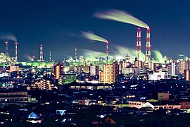
A number of small alluvial plains are found in the corridor section. A mild climate, favorable location relatively close to the great metropolitan complexes, and availability of fast transportation have made this area a center for truck-gardening and out-of-season vegetables. Upland areas of rolling hills are extensively given over to the growing of mandarin oranges and tea. Nagoya, which faces Ise Bay, is a center for heavy industry, including iron and steel and machinery manufacturing. The corridor also has a number of small but important industrial centers. The western part of Tōkai includes the Nōbi Plain, where rice was being grown by the seventh century.
Chūkyō
The three Tōkai prefectures centered on Nagoya (Aichi, Gifu, and Mie) have particularly strong economic ties, and the parts of these prefectures that are closest to the city comprise the Chūkyō Metropolitan Area. This area boasts the third strongest economy in Japan and this influence can sometimes extend into the more remote parts of these prefectures that are farther away from Nagoya. Thus, these three prefectures are sometimes called the "Chūkyō region" in a business sense. This name does not see widespread usage throughout Japan; however, as the economy in the area strengthens, this name may become more well-known country-wide.
-
-
-
-
-
-
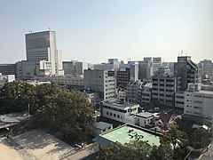 Tsu City
(Kinki region)


Kōshin'etsu
Kōshin'etsu is an area of complex and high rugged mountains—often called the "roof of Japan"—that include the Japanese Alps. The population is chiefly concentrated in six elevated basins connected by narrow valleys. It was long a main silk-producing area, although output declined after World War II. Much of the labor formerly required in silk production was absorbed by the district's diversified manufacturing industry, which included precision instruments, machinery, textiles, food processing, and other light manufacturing. Kōshin'etsu means Yamanashi, Nagano, and Niigata prefectures; Niigata is also included to the Hokuriku region. Yamanashi, Nagano and northern Gifu Prefecture are sometimes referred to as Chūō-kōchi or Tōsan region.


Hokuriku
The Hokuriku region lies on the Sea of Japan coastline, northwest of the massive mountains that comprise Kōshin'etsu. Hokuriku includes the four prefectures of Ishikawa, Fukui, most of Niigata and Toyama,[6]
The district has very heavy snowfall (sometimes enough to block major roads) and strong winds in winter, and its turbulent rivers are the source of abundant hydroelectric power. Niigata Prefecture is the site of domestic gas and oil production as well. Industrial development is extensive, especially in the cities in Niigata and Toyama; Fukui and Ishikawa prefectures also have large manufacturing industries.
Historically, Hokuriku's development is owed to markets in the Kansai region, however recently the urban areas at the heart of the Kantō region and Tōkai region are having a heavy an influence as well. Hokuriku has port facilities which are mainly to facilitate trade with Russia, Korea and China. Transportation between Niigata and Toyama used to be geographically limited and so Niigata has seen especially strong influence from the Kantō region, because of this Niigata Prefecture is often classified as being part of the Kōshin'etsu region with Nagano and Yamanashi Prefectures.


Demographics
The three most dense areas of Chūbu region are Chūkyō metropolitan area (greater Nagoya), Niigata-Toyama area at Hokuriku subregion, and Nagano at the mountains (Chūō-kōchi).
Per Japanese census data,[7] and,[8] Chūbu region has had positive population growth.
| Year | Pop. | ±% |
|---|---|---|
| 1920 | 10,702,000 | — |
| 1930 | 11,978,000 | +11.9% |
| 1940 | 13,113,000 | +9.5% |
| 1950 | 15,458,000 | +17.9% |
| 1960 | 16,565,000 | +7.2% |
| 1970 | 18,091,000 | +9.2% |
| 1980 | 19,984,000 | +10.5% |
| 1990 | 21,023,000 | +5.2% |
| 2000 | 21,628,238 | +2.9% |
| 2010 | 21,715,822 | +0.4% |
| 2020 | 22,078,654 | +1.7% |
| Note: This excludes Mie Prefecture | ||
Major cities
| List of 20 major cities in Chūbu | |||||||||
|---|---|---|---|---|---|---|---|---|---|
|
|
Rank | Cities | Prefecture | Population | Rank | Cities | Prefecture | Population |
|
1
|
2,331,078 | 11 | 377,453 | ||||||
2 |
797,591 | 12 | 370,632 | ||||||
3 |
791,707 | 13 | 306,764 | ||||||
4 |
690,881 | 14 | 266,539 | ||||||
5 |
466,029 | 15 | 264,217 | ||||||
6 |
426,162 | 16 | 245,015 | ||||||
7 |
415,844 | 17 | 239,466 | ||||||
8 |
400,118 | 18 | 189,486 | ||||||
9 |
386,999 | 19 | 189,430 | ||||||
10 |
379,654 | 20 | 188,824 | ||||||


- Designated city
- Nagoya City: a designated city, the capital of Aichi Prefecture
- Niigata City: a designated city, the capital of Niigata Prefecture
- Hamamatsu City: a designated city
- Shizuoka City:a designated city, the capital of Shizuoka Prefecture
- Core city
- Kanazawa City: a core city, the capital of Ishikawa Prefecture
- Toyama City: a core city, the capital of Toyama Prefecture
- Gifu City: a core city, the capital of Gifu Prefecture
- Nagano City: a core city, the capital of Nagano Prefecture
- Fukui City: a core city, the capital of Fukui Prefecture
- Kofu City: a core city, the capital of Yamanashi Prefecture


.jpg)


Other major cities
- Toyota City: a core city
- Okazaki City: a core city
- Toyohashi City: a core city
- Ichinomiya City: a special city
- Kasugai City: a special city
- Nagaoka City: a special city
- Fuji City: a special city
- Matsumoto City: a special city
- Jōetsu City: a special city
- Numazu City: a special city


.jpg)


See also
References
- ^ "県民経済計算(平成23年度 - 令和2年度)(2008SNA、平成27年基準計数)<47都道府県、4政令指定都市分>".
- ^ Nussbaum, Louis-Frédéric. (2005). "Chūbu" in Japan Encyclopedia, p. 126, p. 126, at Google Books
- ^ MLIT, Chūbu regional development bureau, organization (Japanese)
- ^ NPA, Chūbu Regional Police Bureau, Organization (Japanese)
- ^ Aichi prefectural government, Chūbu area governors' association (Japanese)
- ^ Nussbaum, "Hokuriku" at p. 344, p. 344, at Google Books
- ^ Aichi 1995-2020 population statistics
- ^ Chūbu region 1920-2000 population statistics
Sources
- Nussbaum, Louis-Frédéric (2002 [1996]). Japan Encyclopedia. Trans. by Käthe Roth. Cambridge, Massachusetts: Harvard University Press. ISBN 0-674-01753-6, ISBN 978-0-674-01753-5. OCLC 58053128.
 This article incorporates text from this source, which is in the public domain. Japan: A Country Study. Federal Research Division.
External links
 Chubu travel guide from Wikivoyage

| International | |
|---|---|
| National | |