
Stafford, Texas: Difference between revisions
Modified historical population, infobox (via CenPop script) |
Citation bot (talk | contribs) Added title. Changed bare reference to CS1/2. | Use this bot. Report bugs. | Suggested by Mako001 | Linked from User:Mako001/Missingtitle2 | #UCB_webform_linked 1882/3418 |
||
| (27 intermediate revisions by 21 users not shown) | |||
| Line 1: | Line 1: | ||
{{Use mdy dates|date=July 2023}} |
|||
{{Infobox settlement |
{{Infobox settlement |
||
| official_name |
| official_name = Stafford, Texas |
||
| settlement_type |
| settlement_type = [[City]] |
||
| nickname |
| nickname = |
||
| motto |
| motto = "City with no property taxes" |
||
<!-- Images --> |
<!-- Images -->| image_skyline = StaffPillar.JPG |
||
| |
| imagesize = |
||
| |
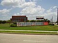
| image_caption = Monument on [[U.S. Route 90 Alternate (Texas)|US 90 Alternate]] |
||
| image_flag = |
|||
| image_caption = Monument on [[U.S. Route 90 Alternate (Texas)|US 90 Alternate]] |
|||
| |
| image_seal = <!-- Maps --> |
||
| |
| image_map = FortBend County Stafford.svg |
||
| |
| mapsize = 250px |
||
| |
| map_caption = Location of Stafford, Texas |
||
| map_caption = Location of Stafford, Texas |
|||
<!-- Location --> |
<!-- Location -->| subdivision_type = [[List of sovereign states|Country]] |
||
| subdivision_name = {{Flagicon|USA}}[[United States]] |
|||
| subdivision_type = [[List of sovereign states|Country]] |
|||
| |
| subdivision_type1 = [[U.S. state|State]] |
||
| |
| subdivision_name1 = {{Flagicon|Texas}}[[Texas]] |
||
| |
| subdivision_type2 = [[List of counties in Texas|Counties]] |
||
| |
| subdivision_name2 = [[Fort Bend County, Texas|Fort Bend]], [[Harris County, Texas|Harris]] |
||
| subdivision_name2 = [[Fort Bend County, Texas|Fort Bend]], [[Harris County, Texas|Harris]] |
|||
<!-- Government --> |
<!-- Government -->| government_footnotes = |
||
| government_type = [[Mayor-council government|Mayor-Council]] |
|||
| government_footnotes = |
|||
| |
| leader_title = [[Mayor]] |
||
| |
| leader_name = Cecil Willis |
||
| |
| leader_title1 = [[City Council]] |
||
| leader_name1 = Don Jones <br/> Alice Chen <br/> Ken Mathew <br/>Wen Guerra <br/> Xavier Herrera<br/>William K. Bostic Jr. |
|||
| leader_title1 = [[City Council]] |
|||
| established_title = |
|||
| leader_name1 = Virginia Rosas <br/>Don Jones <br/> Alice Chen <br/> Ken Mathew <br/> Cecil Willis <br/>Wen Guerra |
|||
| |
| established_date = |
||
| |
| website = {{URL|www.staffordtx.gov}} |
||
| |
| area_total_km2 = 18.24 |
||
| |
| area_land_km2 = 18.16 |
||
| |
| area_water_km2 = 0.09 |
||
| |
| area_total_sq_mi = 7.04 |
||
| |
| area_land_sq_mi = 7.01 |
||
| |
| area_water_sq_mi = 0.03 |
||
<!-- Population -->| population_as_of = [[2020 United States Census|2020]] |
|||
| area_water_sq_mi = 0.03 |
|||
| population_footnotes = |
|||
<!-- Population --> |
|||
| population_total = 17666 |
|||
| population_as_of = [[2010 United States Census|2010]] |
|||
| population_density_km2 = 956.11 |
|||
| population_footnotes = |
|||
| population_density_sq_mi = 2476.39 |
|||
| population_total = 17693 |
|||
<!-- General information -->| timezone = [[North American Central Time Zone|Central (CST)]] |
|||
| population_density_km2 = 956.11 |
|||
| |
| utc_offset = -6 |
||
| timezone_DST = CDT |
|||
<!-- General information --> |
|||
| utc_offset_DST = -5 |
|||
| timezone = [[North American Central Time Zone|Central (CST)]] |
|||
| |
| elevation_footnotes = |
||
| |
| elevation_m = 26 |
||
| |
| elevation_ft = 85 |
||
| coordinates = {{coord|29|37|27|N|95|33|48|W|region:US_type:city|display=inline,title}} |
|||
| elevation_footnotes = |
|||
| |
| postal_code_type = [[ZIP code]]s |
||
| |
| postal_code = 77477, 77497 |
||
| area_code = [[Area code 281|281]] |
|||
| coordinates = {{coord|29|37|27|N|95|33|48|W|region:US_type:city|display=inline,title}} |
|||
| |
| blank_name = [[Federal Information Processing Standard|FIPS code]] |
||
| blank_info = 48-69908<ref name="GR2">{{cite web|url=https://www.census.gov|publisher=[[United States Census Bureau]]|access-date=2008-01-31|title=U.S. Census website}}</ref> |
|||
| postal_code = 77477, 77497 |
|||
| |
| blank1_name = [[Geographic Names Information System|GNIS]] feature ID |
||
| blank1_info = 1347777<ref name="GR3">{{cite web|url=http://geonames.usgs.gov|access-date=2008-01-31|title=US Board on Geographic Names|publisher=[[United States Geological Survey]]|date=2007-10-25}}</ref> |
|||
| blank_name = [[Federal Information Processing Standard|FIPS code]] |
|||
| footnotes = |
|||
| blank_info = 48-69908<ref name="GR2">{{cite web|url=https://www.census.gov|publisher=[[United States Census Bureau]]|accessdate=2008-01-31|title=U.S. Census website}}</ref> |
|||
| |
| unit_pref = Imperial |
||
| |
| area_footnotes = <ref name="CenPopGazetteer2019">{{cite web|title=2019 U.S. Gazetteer Files|url=https://www2.census.gov/geo/docs/maps-data/data/gazetteer/2019_Gazetteer/2019_gaz_place_48.txt|publisher=United States Census Bureau|access-date=August 7, 2020}}</ref> |
||
| footnotes = |
|||
|pop_est_as_of = 2019 |
|||
|pop_est_footnotes = <ref name="USCensusEst2019CenPopScriptOnlyDirtyFixDoNotUse"/> |
|||
|population_est = 17362 |
|||
|unit_pref = Imperial |
|||
|area_footnotes = <ref name="CenPopGazetteer2019">{{cite web|title=2019 U.S. Gazetteer Files|url=https://www2.census.gov/geo/docs/maps-data/data/gazetteer/2019_Gazetteer/2019_gaz_place_48.txt|publisher=United States Census Bureau|accessdate=August 7, 2020}}</ref> |
|||
}} |
}} |
||
'''Stafford''' is a city in the [[U.S. state]] of [[Texas]], |
'''Stafford''' is a city in the [[U.S. state]] of [[Texas]], in the {{nowrap|[[Greater Houston|Houston–The Woodlands–Sugar Land]]}} metropolitan area. The city is mostly in [[Fort Bend County, Texas|Fort Bend County]], with a small part in [[Harris County, Texas|Harris County]]. As of the 2020 census, Stafford's population was 17,666,<ref name="Census 2010">{{Cite web| url=http://factfinder2.census.gov/bkmk/table/1.0/en/DEC/10_DP/G001/1600000US4869908| title=Geographic Identifiers: 2010 Demographic Profile Data (G001): Stafford city, Texas| publisher=U.S. Census Bureau, American Factfinder| access-date=August 31, 2016}}{{dead link|bot=medic|date=April 2020}}{{cbignore|bot=medic}}</ref> down from 17,693 at the 2010 census. |
||
==History== |
==History== |
||
William Stafford established a plantation with a [[sugarcane|cane mill]] and a horse-powered [[cotton gin]] in 1830. On April 15, 1836, during the [[Texas Revolution]], the forces of [[Antonio López de Santa Anna]] stopped at Stafford's plantation and ordered it |
William Stafford established a plantation with a [[sugarcane|cane mill]] and a horse-powered [[cotton gin]] in 1830. On April 15, 1836, during the [[Texas Revolution]], the forces of [[Antonio López de Santa Anna]] stopped at Stafford's plantation and ordered it burned. Stafford rebuilt his plantation and resided there until his 1840 death. A settlement called "Stafford's Point" was established around the plantation; it became a townsite in August 1853, when the [[Buffalo Bayou, Brazos and Colorado Railway]] began stopping there. Stafford's Point had a post office from 1854 to 1869. "Staffordville" had a post office from January 5 to February 26, 1869. The settlement, now known as Stafford, operated a post office from 1869 to 1918; the post office reopened in 1929.<ref name="Handbook">{{Handbook of Texas|id=hgs15|name=Stafford, Texas}}</ref> |
||
In 1884, Stafford had 50 residents, two general stores, and a grocer. By 1896, |
In 1884, Stafford had 50 residents, two general stores, and a grocer. By 1896, it had a population of 300. By 1914, the population fell to 100. In 1931, 320 people lived in Stafford. This increased to 400 in 1946. Stafford incorporated as a city in 1956.<ref name="Handbook"/> |
||
==Geography== |
==Geography== |
||
[[File:StaffordTXMap.gif|thumb|Map of Stafford]] |
[[File:StaffordTXMap.gif|thumb|Map of Stafford]] |
||
Stafford is |
Stafford is in eastern Fort Bend County at {{coord|29|37|27|N|95|33|48|W|type:city}} (29.624186, –95.563359).<ref name="GR1">{{cite web|url=https://www.census.gov/geographies/reference-files/time-series/geo/gazetteer-files.html|publisher=[[United States Census Bureau]]|access-date=2011-04-23|date=2011-02-12|title=US Gazetteer files: 2010, 2000, and 1990}}</ref> A small part of the city extends northeast into Harris County. It is bordered by [[Houston]] to the north, [[Meadows Place, Texas|Meadows Place]] to the northwest, [[Sugar Land, Texas|Sugar Land]] to the west, and [[Missouri City, Texas|Missouri City]] to the south and east. |
||
The Southwest Freeway ([[Interstate 69 in Texas|Interstate 69]]) passes through |
The Southwest Freeway ([[Interstate 69 in Texas|Interstate 69]]) passes through northwest Stafford, leading northeast {{convert|16|mi}} to the center of Houston and southwest {{convert|18|mi}} to [[Rosenberg, Texas|Rosenberg]]. [[U.S. Route 90 Alternate (Texas)|U.S. 90 Alternate]] passes through Stafford as Main Street, leading west {{convert|5|mi|0}} to Sugar Land and northeast {{Convert|18|mi}} to the Houston [[East End, Houston|East End]]. |
||
According to the [[United States Census Bureau]], Stafford has |
According to the [[United States Census Bureau]], Stafford has an area of {{convert|18.2|sqkm|order=flip}}, of which {{convert|18.1|sqkm|order=flip}} is land and {{convert|0.1|sqkm|order=flip|2}}, or 0.58%, is water.<ref name="Census 2010"/> |
||
===Climate=== |
===Climate=== |
||
The climate in this area is characterized by hot, humid summers and generally mild to cool winters. According to the [[Köppen climate classification]] system, Stafford has a [[humid subtropical climate]], ''Cfa'' on climate maps.<ref>[http://www.weatherbase.com/weather/weather-summary.php3?s=827814&cityname=Stafford%2C+Texas%2C+United+States+of+America&units= Climate Summary for Stafford, Texas]</ref> |
|||
Stafford's climate is characterized by hot, humid summers and generally mild to cool winters. According to the [[Köppen climate classification]] system, Stafford has a [[humid subtropical climate]], ''Cfa'' on climate maps.<ref>[http://www.weatherbase.com/weather/weather-summary.php3?s=827814&cityname=Stafford%2C+Texas%2C+United+States+of+America&units= Climate Summary for Stafford, Texas]</ref> |
|||
===Extraterritorial jurisdiction=== |
===Extraterritorial jurisdiction=== |
||
The city of Stafford has several areas of [[extraterritorial jurisdiction]]. These two areas are within the [[Houston Independent School District]], including an area at [[Beltway 8]] and Stafford Road and another area between Beltway 8 and Murphy Road. One area within the [[Alief Independent School District]] is next to the [[Meadows Place, Texas|City of Meadows Place]] along Interstate 69/[[U.S. Route 59 (Texas)|U.S. Route 59]]. Areas in the [[Fort Bend Independent School District]] include a portion of the [[Fifth Street, Texas|Fifth Street]] and an area around U.S. Route 90 Alternate, Dulles Avenue, and Avenue E. The City of Stafford has avoided annexing these areas, because doing so would give it territory in school districts other than the [[Stafford Municipal School District]] (SMSD) and the city wants its city limits and the SMSD to have the same area. The SMSD cannot annex these areas without the permission of the other school districts.<ref>Kumar, Seshadri. "[http://www.chron.com/news/article/Stafford-SMSD-mull-over-annexation-1519318.php Stafford, SMSD mull over annexation]." ''[[Houston Chronicle]]''. October 30, 2006. Retrieved on April 12, 2014.</ref> |
|||
Stafford has two areas of [[extraterritorial jurisdiction]]. They are within the [[Houston Independent School District]], including an area at [[Beltway 8]] and Stafford Road and another area between Beltway 8 and Murphy Road. One area within the [[Alief Independent School District]] is next to the [[Meadows Place, Texas|City of Meadows Place]] along Interstate 69/[[U.S. Route 59 (Texas)|U.S. Route 59]]. Areas in the [[Fort Bend Independent School District]] include part of [[Fifth Street, Texas|Fifth Street]] and an area around U.S. Route 90 Alternate, Dulles Avenue, and Avenue E. The City of Stafford has avoided annexing these areas, because doing so would give it territory in school districts other than the [[Stafford Municipal School District]] (SMSD) and the city wants its city limits and the SMSD to have the same area. The SMSD cannot annex these areas without the other school districts' permission.<ref>Kumar, Seshadri. "[http://www.chron.com/news/article/Stafford-SMSD-mull-over-annexation-1519318.php Stafford, SMSD mull over annexation]." ''[[Houston Chronicle]]''. October 30, 2006. Retrieved on April 12, 2014.</ref> |
|||
==Demographics== |
==Demographics== |
||
| Line 98: | Line 94: | ||
|2000= 15681 |
|2000= 15681 |
||
|2010= 17693 |
|2010= 17693 |
||
|footnote=U.S. Decennial Census<ref name="DecennialCensus">{{cite web|url=https://www.census.gov/programs-surveys/decennial-census.html|title=Census of Population and Housing|publisher=Census.gov|access-date=June 4, 2015}}</ref> |
|||
|estyear=2019 |
|||
|2020=17666}} |
|||
|estimate=17362 |
|||
|estref=<ref name="USCensusEst2019CenPopScriptOnlyDirtyFixDoNotUse">{{cite web|url=https://www.census.gov/programs-surveys/popest/data/tables.2019.html|date=May 24, 2020|title=Population and Housing Unit Estimates|publisher=United States Census Bureau|accessdate=May 27, 2020}}</ref> |
|||
|footnote=U.S. Decennial Census<ref name="DecennialCensus">{{cite web|url=https://www.census.gov/programs-surveys/decennial-census.html|title=Census of Population and Housing|publisher=Census.gov|accessdate=June 4, 2015}}</ref> |
|||
}} |
|||
As of the [[census]]<ref name="GR2" /> of 2010, 17,693 people, 6,750 households, and 4,483 families resided in the city. The [[population density]] was 2,527.6 people per square mile (867.4/km{{sup|2}}). The 7,074 housing units averaged 1010.6 per square mile (353.5/km{{sup|2}}). The [[Race (United States Census)|racial makeup]] of the city was 36.6% White, 27.4% African American, 0.6% Native American, 22.8% Asian, 0.0% Pacific Islander, 9.3% some other race, and 3.2% from two or more races. Hispanics or Latinos of any race were 25.9% of the population. |
|||
{| class="wikitable" |
|||
Of the 6,750 households, 33.2% had children under the age of 18 living with them, 45.1% were married couples living together, 16.3% had a female householder with no husband present, and 33.6% were not families. About 27.9% of all households were made up of individuals living alone, and 4.8% of individuals living alone were 65 years of age or older. The average household size was 2.62 and the average family size was 3.25. |
|||
|+'''Stafford racial composition as of 2020'''<ref>{{Cite web |title=Explore Census Data |url=https://data.census.gov/cedsci/table?g=1600000US4869908&tid=DECENNIALPL2020.P2 |access-date=2022-05-23 |website=data.census.gov}}</ref><br /> (NH = Non-Hispanic){{efn|Note: the US Census treats Hispanic/Latino as an ethnic category. This table excludes Latinos from the racial categories and assigns them to a separate category. Hispanics/Latinos can be of any race.<ref>https://www.census.gov/ {{nonspecific|date=August 2022}}</ref><ref>{{cite web |title=About the Hispanic Population and its Origin |url=https://www.census.gov/topics/population/hispanic-origin/about.html |website=www.census.gov |access-date=18 May 2022}}</ref>}} |
|||
!Race |
|||
!Number |
|||
!Percentage |
|||
|- |
|||
|[[Non-Hispanic or Latino whites|White]] (NH) |
|||
|2,858 |
|||
|16.18% |
|||
|- |
|||
|[[Non-Hispanic or Latino African Americans|Black or African American]] (NH) |
|||
|5,239 |
|||
|29.66% |
|||
|- |
|||
|[[Native Americans in the United States|Native American]] or [[Alaska Native]] (NH) |
|||
|27 |
|||
|0.15% |
|||
|- |
|||
|[[Asian Americans|Asian]] (NH) |
|||
|3,849 |
|||
|21.79% |
|||
|- |
|||
|[[Pacific Islander Americans|Pacific Islander]] (NH) |
|||
|19 |
|||
|0.11% |
|||
|- |
|||
|Some Other Race (NH) |
|||
|110 |
|||
|0.62% |
|||
|- |
|||
|[[Multiracial Americans|Mixed/Multi-Racial]] (NH) |
|||
|449 |
|||
|2.54% |
|||
|- |
|||
|[[Hispanic and Latino Americans|Hispanic or Latino]] |
|||
|5,115 |
|||
|28.95% |
|||
|- |
|||
|'''Total''' |
|||
|'''17,666''' |
|||
| |
|||
|} |
|||
As of the [[2020 United States census]], there were 17,666 people, 6,042 households, and 4,335 families residing in the city. |
|||
As of the [[census]]<ref name="GR2" /> of 2010, 17,693 people, 6,750 households, and 4,483 families resided in the city. The population density was {{convert|2,527.6|PD/sqmi|PD/km2|sp=us|adj=off}}. The 7,074 housing units averaged 1010.6 per square mile (353.5/km{{sup|2}}). The [[Race (United States Census)|racial makeup]] of the city was 36.6% White, 27.4% African American, 0.6% Native American, 22.8% Asian, 0.0% Pacific Islander, 9.3% some other race, and 3.2% from two or more races. Hispanics or Latinos of any race were 25.9% of the population. |
|||
In the city, the population was distributed as 24.8% under the age of 18, 10.8% from 18 to 24, 32.7% from 25 to 44, 24.4% from 45 to 64, and 7% who were 65 years of age or older. The median age was 31.9 years. For every 100 females, there were 94.5 males. For every 100 females age 18 and over, there were 90.9 males.<ref name="Census 2010 DP">{{Cite web| url=https://www.census.gov| title=Profile of General Population and Housing Characteristics: 2010 Demographic Profile Data (DP-1): Stafford city, Texas| publisher=[[United States Census Bureau]]| accessdate=June 26, 2012}}</ref> |
|||
Of the 6,750 households, 33.2% had children under 18 living with them, 45.1% were married couples living together, 16.3% had a female householder with no husband present, and 33.6% were not families. About 27.9% of all households were made up of individuals living alone, and 4.8% of individuals living alone were 65 or older. The average household size was 2.62 and the average family size was 3.25. |
|||
The median income for a household in the city was $61,084, and for a family was $63,244. Males had a median income of $46,023 versus $40,549 for females. The [[per capita income]] for the city was $27,082. About 6.3% of families and 9.0% of the population were below the [[poverty line]], including 10.4% of those under age 18 and 9.3% of those age 65 or over.{{Citation needed|date=June 2012}} |
|||
In the city, the population was distributed as 24.8% under 18, 10.8% from 18 to 24, 32.7% from 25 to 44, 24.4% from 45 to 64, and 7% 65 or older. The median age was 31.9. For every 100 females, there were 94.5 males. For every 100 females 18 and over, there were 90.9 males.<ref name="Census 2010 DP">{{Cite web| url=https://www.census.gov| title=Profile of General Population and Housing Characteristics: 2010 Demographic Profile Data (DP-1): Stafford city, Texas| publisher=[[United States Census Bureau]]| access-date=June 26, 2012}}</ref> |
|||
The median income for a household was $61,084, and for a family was $63,244. Males had a median income of $46,023 versus $40,549 for females. The [[per capita income]] was $27,082. About 6.3% of families and 9.0% of the population were below the [[poverty line]], including 10.4% of those under 18 and 9.3% of those 65 or older.{{Citation needed|date=June 2012}} |
|||
==Economy== |
==Economy== |
||
Stafford has not had a municipal property tax since 1995. Though it is known as a [[bedroom community]] of the greater Houston area, an estimated four times as many people work in Stafford on a |
Stafford has not had a municipal property tax since 1995. Though it is known as a [[bedroom community]] of the greater Houston area, an estimated four times as many people work in Stafford on a weekday, which is evidence of the large amount of commercial activity that helps the city financially. Many corporations large and small, including [[FedEx]], [[United Parcel Service|UPS]]<ref>{{Cite web|title=Find Locations {{!}} UPS - United States|url=https://www.ups.com/dropoff/|access-date=2020-12-01|website=www.ups.com}}</ref> and [[Tyco International|Tyco]],{{Citation needed|date=June 2009}} maintain significant operations in Stafford. |
||
[[Image:TI CIMG0394.JPG|thumb|right|[[Texas Instruments]] facility in Stafford: Texas Instruments was Stafford's largest employer.]] |
[[Image:TI CIMG0394.JPG|thumb|right|[[Texas Instruments]] facility in Stafford: Texas Instruments was Stafford's largest employer.]] |
||
Originally, Stafford was an agricultural community. As of 2009, it has operations from commercial, manufacturing, retail, service, and wholesale industries |
Originally, Stafford was an agricultural community. As of 2009, it has operations from commercial, manufacturing, retail, service, and wholesale industries that pay sales and franchise taxes to the city. Stafford is known internationally for attracting valve manufacturing companies; it has 11. Stafford has 15 business parks, a shopping center, and 19 hotels and motels.<ref name="Leezerotaxes"/> |
||
[[Texas Instruments]] (TI) operates a production facility in Stafford, where it manufactures {{convert|6|in|mm|adj=on}} wafers used in cell phones, high-definition televisions, and solar devices. The plant first opened in 1967.<ref name="TIPlantclosing">Sixel, L.M. "[http://www.chron.com/business/article/TI-to-close-Stafford-plant-move-500-jobs-to-N-2680853.php TI to close Stafford plant, move 500 jobs to N. Texas]." ''[[Houston Chronicle]]''. Monday January 23, 2012. Retrieved on January 24, 2012.</ref> In 2009, TI, which had around 1,500 employees in its Stafford office |
[[Texas Instruments]] (TI) operates a production facility in Stafford, where it manufactures {{convert|6|in|mm|adj=on}} wafers used in cell phones, high-definition televisions, and solar devices. The plant first opened in 1967.<ref name="TIPlantclosing">Sixel, L.M. "[http://www.chron.com/business/article/TI-to-close-Stafford-plant-move-500-jobs-to-N-2680853.php TI to close Stafford plant, move 500 jobs to N. Texas]." ''[[Houston Chronicle]]''. Monday January 23, 2012. Retrieved on January 24, 2012.</ref> In 2009, TI, which had around 1,500 employees in its Stafford office that year, was the city's largest employer.<ref name="Leezerotaxes"/> In 2012, the company announced it was closing its Stafford plant because industry demand for larger, more efficient wafers increased and the company, in lieu of upgrading the Stafford plant to accommodate production of larger wafers, opted to shift production to newer plants.<ref name="TIPlantclosing"/> Of the 1,000 employees at the plant during that year, TI laid off 500 and sent 500 to another facility. Mayor Leonard Scarcella said the closure would adversely affect Stafford.<ref>"[http://www.click2houston.com/news/Texas-Instruments-to-close-plants-in-Houston-Japan/-/1735978/8488618/-/lmtues/-/index.html Texas Instruments to close plants in Houston, Japan]." ''[[KPRC-TV]]''. January 23, 2012. Retrieved on January 24, 2012</ref> |
||
About 15 years ago,{{when |
About 15 years ago,{{when|date=February 2020}} TI comprised about 25% of the city's economy and by 2012, it stood at about one-tenth of that, or 2.5%.<ref>"[http://www.fortbendstar.com/2012/01/25texas-instruments-in-stafford-to-shut-down-by-end-of-year]." ''[[Fort Bend Star]]''. Retrieved on May 3, 2012.</ref> Some jobs at the plant were scheduled to end in July 2012. Other jobs were scheduled to remain until the factory's closure in late 2012. TI said it planned to open another facility in [[greater Houston]] for the 500 remaining employees.<ref name="TIPlantclosing"/> In 2012, TI announced that it was relocating its Fort Bend County operations to the [[Telfair, Sugar Land|Telfair]] area in Sugar Land.<ref>Pulsinelli, Olivia. "[http://www.bizjournals.com/houston/news/2012/11/07/texas-instruments-to-build-35m.html Texas Instruments to build Sugar Land facility, employ 375]." ''[[Houston Business Journal]]''. Wednesday November 7, 2012. Updated Friday November 9, 2012. Retrieved on November 13, 2012.</ref> |
||
== Parks and recreation == |
== Parks and recreation == |
||
[[File:StaffordCivicCenter.JPG|thumb|Stafford Civic Center]] |
[[File:StaffordCivicCenter.JPG|thumb|Stafford Civic Center]] |
||
About {{convert|35.6|acre|m2}} of greenspace in Stafford are designated as municipal parks. Stafford City Park, the largest, covers {{convert|16|acre|m2}} of land. The park includes baseball and softball fields, basketball courts, |
About {{convert|35.6|acre|m2}} of greenspace in Stafford are designated as municipal parks. Stafford City Park, the largest, covers {{convert|16|acre|m2}} of land. The park includes baseball and softball fields, basketball courts, a pavilion, playground equipment, [[picnic table|picnic bench]]es, and soccer (football)/open fields. Gordon Fountain Lake Park, covering {{convert|9|acre|m2}}, is Stafford's second-largest park. It has a 1/2-mile, lighted, jogging trail, a lake, a pavilion, picnic benches, and playground equipment. The {{convert|4.5|acre|m2|adj=on}} Vaccaro Manor Park has a lighted, quarter-mile jogging trail, a pavilion, playground equipment, sidewalks, and soccer/open fields. The {{convert|3.14|acre|m2|adj=on}} Rubin Park has playground equipment and picnic benches. First Street Park has {{convert|3|acre|m2}} of land and includes baseball/softball fields, a jogging trail, lighting, and picnic benches. The Margaret Havens Historical Memorial Garden is next to Stafford City Hall. Its rose garden, benches, and fountain have attracted many couples to marry there.<ref>"[http://www.cityofstafford.com/city_services/parks.htm Stafford City Parks]." City of Stafford. Retrieved on May 2, 2012.</ref> Stafford operates a Civic Center and a City Pool in the Municipal Complex. City residents pay $10 a year for pool access. The Stafford Centre Performing Arts Theatre and Convention Centre has a 1,100-seat performing arts theater; 25,000 square feet of meeting, banquet, and exposition space, including a 20,000-ft<sup>2</sup> ballroom; and over 28 acres of outdoor festival green space.<ref>"[http://www.cityofstafford.com/city_services/pool.htm Pool & Recreation]." City of Stafford. Retrieved on June 12, 2009.</ref> |
||
Fort Bend County operates the {{convert|5|acre|m2|adj=on}} Stafford Community Center in [[Fifth Street, Texas|Fifth Street]], an [[unincorporated area]] near Stafford.<ref>"[http://www.co.fort-bend.tx.us/getSitePage.asp?sitePage=5721 Community Centers]." Fort Bend County. Retrieved on October 11, 2009.</ref> |
Fort Bend County operates the {{convert|5|acre|m2|adj=on}} Stafford Community Center in [[Fifth Street, Texas|Fifth Street]], an [[unincorporated area]] near Stafford.<ref>"[http://www.co.fort-bend.tx.us/getSitePage.asp?sitePage=5721 Community Centers] {{Webarchive|url=https://web.archive.org/web/20110604103311/http://www.co.fort-bend.tx.us/getSitePage.asp?sitePage=5721 |date=June 4, 2011 }}." Fort Bend County. Retrieved on October 11, 2009.</ref> |
||
In 2014 the [[Sugar Land, Texas|Sugar Land]] Youth Cricket Club, a children's [[cricket (sport)|cricket]] club, was established. In 2016 it played its home games at [[Islamic Education Institute of Texas|Everest Academy]] in Stafford.<ref>{{cite web|author=Kadifa, Margaret|url=https://www.chron.com/neighborhood/katy/news/article/Cricket-isn-t-a-bug-to-this-group-of-youngsters-6946946.php|title='Cricket' isn't a bug to this group of youngsters|work=[[Houston Chronicle]]|date=2016-03-22| |
In 2014 the [[Sugar Land, Texas|Sugar Land]] Youth Cricket Club, a children's [[cricket (sport)|cricket]] club, was established. In 2016 it played its home games at [[Islamic Education Institute of Texas|Everest Academy]] in Stafford.<ref>{{cite web|author=Kadifa, Margaret|url=https://www.chron.com/neighborhood/katy/news/article/Cricket-isn-t-a-bug-to-this-group-of-youngsters-6946946.php|title='Cricket' isn't a bug to this group of youngsters|work=[[Houston Chronicle]]|date=2016-03-22|access-date=2019-10-26}}</ref> |
||
==Government and infrastructure== |
==Government and infrastructure== |
||
| Line 134: | Line 172: | ||
===Local government=== |
===Local government=== |
||
The City of Stafford stopped levying nonschool property taxes in 1995. It is the only Houston-area city and |
The City of Stafford stopped levying nonschool property taxes in 1995. It is the only Houston-area city and the most populous city in Texas to do so. Sales and franchise taxes from businesses fund the city.<ref name="Leezerotaxes">Lee, Renée C. "[http://www.chron.com/disp/story.mpl/metropolitan/6464089.html Property tax set at zero seems to suit Stafford]." ''[[Houston Chronicle]]''. June 7, 2009. Retrieved on June 10, 2009.</ref> |
||
From 1969 to 2020, Stafford's mayor was Leonard Scarcella. By 2018, he was the longest-serving mayor in the [[United States]].<ref>{{Cite web|url=http://www.staffordtx.gov/government/mayors-office/about-mayor-scarcella.html|title = About Mayor Scarcella}}</ref><ref>{{Cite web|url=https://fbindependent.com/stafford-to-celebrate-a-legend-years-of-mayor-scarcella-p13346-1.htm|title = Stafford to celebrate a legend, 50 years of Mayor Scarcella}}</ref> On June 28, 2020, Scarcella died at age 79.<ref>{{Cite web|url=https://abc13.com/mayor-of-stafford-dies-history-leonard-scarcella-death/6278560/|title=Mayor Leonard Scarcella of Stafford dies at age 79|date=28 June 2020}}</ref> In December 2020, Cecil Willis was elected mayor.<ref>{{Cite web|title=About Cecil Willis|url=https://www.staffordtx.gov/government/mayors-office/about-mayor-willis.html|access-date=2021-02-18|website=www.staffordtx.gov}}</ref> |
|||
The Stafford City Hall, Stafford Police Department, and Municipal Court buildings are |
The Stafford City Hall, Stafford Police Department, and Municipal Court buildings are on South Main, adjacent to one another.<ref>"[http://www.cityofstafford.com/government_departments/city_departments/police_department.htm Stafford Police Department]." City of Stafford. Retrieved on June 12, 2009.</ref> The Stafford Volunteer Fire Department operates out of three fire stations.<ref>"[http://www.cityofstafford.com/city_services/fire_department.htm Stafford Volunteer Fire Department]." City of Stafford. Retrieved on June 12, 2009.</ref> |
||
The city is governed by its Home Rule Charter |
The city is governed by its Home Rule Charter, which resembles the [[United States Constitution|US Constitution]].<ref>{{Cite web|url=http://www.staffordtx.gov/documents/home-rule-charter.pdf|title=Stafford Home Rule Charter}}</ref> The Charter Review Commission reviews the charter every five years. The most recent review was in 2018. The commission consisted of:<ref>{{Cite web|url=http://staffordtx.suiteonemedia.com/web/Player.aspx?id=1095&key=-1&mod=-1&mk=-1&nov=0|title=Home Rule Charter Review Commission|website=staffordtx.suiteonemedia.com|access-date=2018-07-04}}</ref> |
||
The charter is reviewed every 5 years by the Charter Review Commission. The most recent review was 2018, the commission consisted of:<ref>{{Cite web|url=http://staffordtx.suiteonemedia.com/web/Player.aspx?id=1095&key=-1&mod=-1&mk=-1&nov=0|title=Home Rule Charter Review Commission|website=staffordtx.suiteonemedia.com|access-date=2018-07-04}}</ref> |
|||
Ash Hamirani |
Ash Hamirani |
||
| Line 159: | Line 195: | ||
===County, state, and federal representation=== |
===County, state, and federal representation=== |
||
Stafford is |
Stafford is partly in [[Fort Bend County, Texas|Fort Bend County]] and partly in [[Harris County, Texas|Harris County]]. Residents pay property taxes to their respective counties.<ref name="Leezerotaxes"/> |
||
Harris County Precinct One, headed by Commissioner [[Rodney Ellis]], serves the section of Stafford in Harris County.<ref>"[http://www.pct3.hctx.net/aboutprecinct/allprecincts.aspx Precinct Maps : All Precincts] {{webarchive|url=https://web.archive.org/web/20090108112234/http://www.pct3.hctx.net/aboutprecinct/allprecincts.aspx |date=2009-01-08 }}." ''[[Harris County, Texas]]''. Retrieved on May 2, 2012.</ref><ref>"[http://www.co.harris.tx.us/comm_lee/ Welcome to the Harris County Precinct One Website!]." ''[[Harris County, Texas]]''. Retrieved on May 2, 2012.</ref> |
Harris County Precinct One, headed by Commissioner [[Rodney Ellis]], serves the section of Stafford in Harris County.<ref>"[http://www.pct3.hctx.net/aboutprecinct/allprecincts.aspx Precinct Maps : All Precincts] {{webarchive|url=https://web.archive.org/web/20090108112234/http://www.pct3.hctx.net/aboutprecinct/allprecincts.aspx |date=2009-01-08 }}." ''[[Harris County, Texas]]''. Retrieved on May 2, 2012.</ref><ref>"[http://www.co.harris.tx.us/comm_lee/ Welcome to the Harris County Precinct One Website!] {{Webarchive|url=https://web.archive.org/web/20081216171659/http://www.co.harris.tx.us/comm_lee/ |date=December 16, 2008 }}." ''[[Harris County, Texas]]''. Retrieved on May 2, 2012.</ref> |
||
Much of Stafford is |
Much of Stafford is in [[Texas House of Representatives, District 26|District 26]] of the [[Texas House of Representatives]]. As of 2012, [[Charles F. Howard|Charlie Howard]] represents the district.<ref>"[https://web.archive.org/web/20041027092305/http://www.house.state.tx.us/members/pdf/districts/26.pdf District 26]." ''[[Texas House of Representatives]]''. Retrieved on December 5, 2008.</ref> Some of Stafford is in [[Texas House of Representatives, District 27|District 27]] of the [[Texas House of Representatives]]. As of 2012, [[Ron Reynolds (Texas politician)|Ron Reynolds]] represents the district.<ref>"[https://web.archive.org/web/20031018061746/http://www.house.state.tx.us/members/pdf/districts/27.pdf District 27]." ''[[Texas House of Representatives]]''. Retrieved on May 2, 2012.</ref> Most of Stafford is in [[Texas Senate, District 13|District 13]] of the [[Texas Senate]], represented by [[Borris L. Miles]].<ref>"[http://www.senate.state.tx.us/Icons/Dist_Maps/Dist13_Map.pdf Senate District 13] {{webarchive|url=https://web.archive.org/web/20110628202736/http://www.senate.state.tx.us/Icons/Dist_Maps/Dist13_Map.pdf |date=2011-06-28 }}" Map. ''[[Senate of Texas]]''. Retrieved on May 2, 2012.</ref> Some of Stafford is in [[Texas Senate, District 17|District 17]] of the [[Texas Senate]], represented by [[Joan Huffman]].<ref>"[http://www.senate.state.tx.us/Icons/Dist_Maps/Dist17_Map.pdf Senate District 17] {{webarchive|url=https://web.archive.org/web/20081219040031/http://www.senate.state.tx.us/Icons/Dist_Maps/Dist17_Map.pdf |date=2008-12-19 }}" Map. ''[[Senate of Texas]]''. Retrieved on May 2, 2012.</ref> |
||
[[File:StaffordPOTX.JPG|thumb|left|Stafford Post Office]] |
[[File:StaffordPOTX.JPG|thumb|left|Stafford Post Office]] |
||
Stafford is in [[Texas's 22nd congressional district]]. As of |
Stafford is in [[Texas's 22nd congressional district]]. As of 2021, [[Troy Nehls]] represents the district.<ref>"[http://nationalatlas.gov/printable/images/preview/congdist/tx22_109.gif Congressional District 22] {{webarchive|url=https://web.archive.org/web/20120609193344/http://nationalatlas.gov/printable/images/preview/congdist/TX22_109.gif |date=2012-06-09 }}." ''[[National Atlas of the United States]]''. Retrieved on May 2, 2012.</ref> |
||
The [[U.S. Postal Service]] operates the Stafford Post Office.<ref>"[https://tools.usps.com/go/POLocatorDetailsAction!input.action?locationTypeQ=all&address=Stafford%2C+TX&radius=20&locationType=po&locationID=1383227&locationName=STAFFORD&address2=&address1=4110+BLUEBONNET+DR&city=STAFFORD&state=TX&zip5=77477&zip4=9998&tollFree=800-ASK-USPS%26reg%3B%26nbsp%3B%28800-275-8777%29&fax=281-240-4318&tAddress=&tAddress1Ams=&tAddress2Ams=&tCityAms=&tStateAms=&tZipAms=&tCarrierRouteAms=&latitude=29.6358624&longitude=-95.57268&sWithin=20&&&&&&&&& STAFFORD]." [[U.S. Postal Service]]. Retrieved on April 24, 2018. "4110 BLUEBONNET DR STAFFORD, TX 77477-9998"</ref> Some locations in |
The [[U.S. Postal Service]] operates the Stafford Post Office.<ref>"[https://tools.usps.com/go/POLocatorDetailsAction!input.action?locationTypeQ=all&address=Stafford%2C+TX&radius=20&locationType=po&locationID=1383227&locationName=STAFFORD&address2=&address1=4110+BLUEBONNET+DR&city=STAFFORD&state=TX&zip5=77477&zip4=9998&tollFree=800-ASK-USPS%26reg%3B%26nbsp%3B%28800-275-8777%29&fax=281-240-4318&tAddress=&tAddress1Ams=&tAddress2Ams=&tCityAms=&tStateAms=&tZipAms=&tCarrierRouteAms=&latitude=29.6358624&longitude=-95.57268&sWithin=20&&&&&&&&& STAFFORD]." [[U.S. Postal Service]]. Retrieved on April 24, 2018. "4110 BLUEBONNET DR STAFFORD, TX 77477-9998"</ref> Some locations in Houston have Stafford mailing addresses.<ref name=KingwoodannexQ's>{{cite web|url=http://www.ci.houston.tx.us/annexation/annexation_FAQ.html|title=City of Houston Annexation FAQ|publisher=City of Houston|date=1996-10-31|access-date=2018-04-24|quote=Numerous residents of the City of Houston have Missouri City, Webster, Friendswood, Stafford, Humble and even Kingwood addresses.|url-status=bot: unknown|archive-url=https://web.archive.org/web/19961031170034/http://www.ci.houston.tx.us/annexation/annexation_FAQ.html|archive-date=1996-10-31}}</ref> |
||
Fort Bend County does not have a [[hospital district]]. [[OakBend Medical Center]] serves as the county's [[charity hospital]] which the county contracts with. Harris County has a hospital district, [[Harris Health]].<ref>{{cite web|last=Knipp|first=Bethany|url=https://communityimpact.com/news/2016/11/02/fort-bend-county-lacks-hospital-district/|title=Fort Bend County lacks hospital district|newspaper=[[Community Impact Newspaper]]|date=2016-11-02|accessdate=2021-10-18}}</ref> |
|||
== Media == |
== Media == |
||
The ''[[Fort Bend Star]]'', a weekly newspaper, is headquartered in Stafford.<ref>"[http://www.fortbendstar.com/about/ Contact Us]." ''[[Fort Bend Star]]''. Retrieved on April 7, 2014. "The offices of fortbendstar.com are located at 4655 Techniplex Dr, Suite 300, Stafford, TX 77477 (the same location as the physical newspaper)."</ref> The ''[[Houston Chronicle]]'' is the area's newspaper of record. |
The ''[[Fort Bend Star]]'', a weekly newspaper, is headquartered in Stafford.<ref>"[http://www.fortbendstar.com/about/ Contact Us] {{Webarchive|url=https://web.archive.org/web/20200813195928/http://www.fortbendstar.com/about/ |date=August 13, 2020 }}." ''[[Fort Bend Star]]''. Retrieved on April 7, 2014. "The offices of fortbendstar.com are located at 4655 Techniplex Dr, Suite 300, Stafford, TX 77477 (the same location as the physical newspaper)."</ref> The ''[[Houston Chronicle]]'' is the area's newspaper of record. |
||
==Culture== |
==Culture== |
||
[[BAPS Shri Swaminarayan Mandir]] is in [[unincorporated area|unincorporated]] [[Fort Bend County, Texas]], within the [[extraterritorial jurisdiction]] (ETJ) of Stafford and with a Stafford mailing address.<ref>{{cite web|url=http://fcc3bc201aca57a1f6a9-358b951b55aa5ffcd7f6e60e00990c32.r30.cf1.rackcdn.com/City_Map_Updated_Jan_15.pdf|title=Map of Stafford|publisher=City of Stafford| |
[[BAPS Shri Swaminarayan Mandir]] is in [[unincorporated area|unincorporated]] [[Fort Bend County, Texas]], within the [[extraterritorial jurisdiction]] (ETJ) of Stafford and with a Stafford mailing address.<ref>{{cite web|url=http://fcc3bc201aca57a1f6a9-358b951b55aa5ffcd7f6e60e00990c32.r30.cf1.rackcdn.com/City_Map_Updated_Jan_15.pdf|title=Map of Stafford|publisher=City of Stafford|access-date=2019-11-07}} - [http://www.staffordtx.gov/maps-gis/pdf-maps.html Linked from this page on the Stafford website] {{Webarchive|url=https://web.archive.org/web/20201016161313/http://www.staffordtx.gov/maps-gis/pdf-maps.html |date=October 16, 2020 }} - Based on the location, BAPS is in the [[extraterritorial jurisdiction]] but not the city limits</ref><ref>{{cite web|url=https://www.baps.org/houston|title=Home|publisher=BAPS Shri Swaminarayan Mandir, Houston, TX, USA|access-date=2019-11-07|quote=BAPS Shri Swaminarayan Mandir 1150 Brand Lane Stafford, TX 77477 USA }} - Despite the "Stafford, TX" city name, it is outside of the Stafford city limits</ref><!--This may only be changed *IF* the city of Stafford annexes the land. If it does, it will release an article about it--> |
||
== Education == |
== Education == |
||
| Line 179: | Line 217: | ||
=== Colleges and universities === |
=== Colleges and universities === |
||
Stafford MSD (and therefore the city) is served by the [[Houston Community College System]].<ref>[https://statutes.capitol.texas.gov/Docs/ED/htm/ED.130.htm Sec. 130.182. HOUSTON COMMUNITY COLLEGE SYSTEM DISTRICT SERVICE AREA.].</ref> The [[Southwest College (Houston Community College System)|HCCS Southwest College]] includes the Stafford Campus at 10041 Cash Road. In spring 2012, the enrollment at the Stafford Campus was 8,139.<ref>"[http://swc2.hccs.edu/swc/0506/operations/index.php College Operations] {{Webarchive|url=https://web.archive.org/web/20080922155802/http://swc2.hccs.edu/swc/0506/operations/index.php |date=September 22, 2008 }}." ''Houston Community College Southwest College''. Accessed May 2, 2012.</ref> Stafford is also home to [[North American University]], a small private university with an enrollment of roughly 800 students.<ref>{{cite web | url=https://nces.ed.gov/collegenavigator/?q=north+american+university&s=all&id=461795 | title=College Navigator - North American University }}</ref> |
|||
=== Primary and secondary schools === |
=== Primary and secondary schools === |
||
| Line 185: | Line 223: | ||
==== Public schools ==== |
==== Public schools ==== |
||
The city has the only municipal [[school district]] ([[Stafford Municipal School District]]) in all of Texas. In 1977, Stafford broke away from the [[Fort Bend Independent School District]] (FBISD), which caused several rounds of federal litigation; by 1981, it was declared that the [[Stafford Municipal School District]] was constitutional. Almost all of Stafford was in FBISD, with a minuscule portion in the [[Houston Independent School District]]. All of Stafford is now zoned to the Stafford Municipal School District, Texas's only municipal [[school district]] controlled by the city. Residents pay property taxes to the school district.<ref name="Leezerotaxes"/> |
|||
The city has the only municipal [[school district]] ([[Stafford Municipal School District]]) in all of Texas. |
|||
In 1977, Stafford broke away from the [[Fort Bend Independent School District]] (FBISD), which caused several rounds of federal litigation; and, by 1981, it was finally declared that the [[Stafford Municipal School District]] was constitutional. Almost all of Stafford was in FBISD, with a minuscule portion in the [[Houston Independent School District]]. All of Stafford is now zoned to the Stafford Municipal School District, which is the only municipal [[school district]] in Texas that is controlled by the city. Residents pay property taxes to the school district.<ref name="Leezerotaxes"/> |
|||
When most of Stafford was a part of FBISD, Staffordshire Elementary was |
When most of Stafford was a part of FBISD, Staffordshire Elementary was in Stafford. Staffordshire housed Black students in grades 1–4. Black secondary school students attended the [[M.R. Wood School]] in Sugar Land. At the time FBISD formed in 1959, white students could attend one of two elementary schools, and they attended a middle school in Sugar Land and a high school site in Missouri City; the latter two sites now house Lakeview Elementary School and Missouri City Middle School. [[Dulles High School (Sugar Land, Texas)|Dulles High School]] became the high school for white students in FBISD. In September 1965 Fort Bend ISD desegregated and Staffordshire School closed.<ref name=FBISDSchoolHist>"[https://www.fortbendisd.com/Page/226 History]." [[Fort Bend Independent School District]]. Retrieved on July 20, 2017.</ref> Staffordshire students were reassigned to E. A. Jones Elementary School in Missouri City. Dulles Junior High School served as FBISD's sole junior high school from March 1965 to August 1975.<ref name=History2008>{{cite web|url=http://www.fortbend.k12.tx.us:80/about/history.cfm|archive-url=https://web.archive.org/web/20080907032420/http://www.fortbend.k12.tx.us:80/about/history.cfm|url-status=dead|archive-date=2008-09-07|title=FBISD History|publisher=Fort Bend Independent School District|date=2018-12-03|access-date=2018-12-03}}</ref> Dulles High became the only zoned high school for students of all races in FBISD until [[Willowridge High School (Houston)|Willowridge High School]] in Houston opened in 1979.<ref>Solomon, Jerome. "[https://web.archive.org/web/20120709123726/http://www.chron.com/CDA/archives/archive.mpl?id=1997_1433312 FOOTBALL 1997/HIGH SCHOOLS/FORT BEND BONANZA/Phillips, Dulles in hunt to add to town's memories]." ''[[Houston Chronicle]]''. Thursday August 28, 1997. Special 33. Retrieved on December 31, 2011.</ref> |
||
==== Private schools ==== |
==== Private schools ==== |
||
Everest Academy (PreK-5), a school of the [[Darul Arqam Schools]], is in Stafford.<ref>"[http://everest-academy.com/contact/ Contact]." Everest Academy. Retrieved on April 24, 2018. "610 Brand Ln, Stafford, TX 77477, USA"</ref> In addition Sugar Creek Montessori School has a campus in Stafford.<ref>"[http://www.sugarcreekmontessori.com/contact-us/ Contact Us]." Sugar Creek Montessori School. Retrieved on April 24, 2018. "Sugar Land Campus 615 Dulles Avenue Stafford, Texas 77477"</ref> |
|||
Everest Academy (Pre-K–5), a school of the [[Darul Arqam Schools]], is in Stafford.<ref>"[http://everest-academy.com/contact/ Contact]." Everest Academy. Retrieved on April 24, 2018. "610 Brand Ln, Stafford, TX 77477, USA"</ref> Sugar Creek Montessori School also has a campus in Stafford.<ref>"[http://www.sugarcreekmontessori.com/contact-us/ Contact Us]." Sugar Creek Montessori School. Retrieved on April 24, 2018. "Sugar Land Campus 615 Dulles Avenue Stafford, Texas 77477"</ref> |
|||
=== Public libraries === |
=== Public libraries === |
||
[[Fort Bend County Libraries]] |
[[Fort Bend County Libraries]]' Mamie George Branch is in [[Sugar Land]], on Dulles Avenue next to Dulles Middle School.<ref>"[http://www.cityofstafford.com/PDF%20Files/StaffordCityMap_2007-04-25.pdf City Map]." ''City of Stafford''. Retrieved on December 5, 2008.</ref><ref>"[http://www.cityofstafford.com/about_stafford/directory.htm Stafford Area Directories]." City of Stafford. Retrieved on August 17, 2009.</ref> The Mamie George Library, a {{convert|4900|sqft|sqm}} library designed by Wylie W. Vale and Associates, opened in November 1974. It was named after Mamie George, a philanthropist from Fort Bend County. The George Foundation donated funds for the building, and the [[Fort Bend Independent School District]] donated the land the library was built on. The library was renovated in 1991. In 1996 the small-business-center materials were moved from the Missouri City Branch to the Mamie George Branch.<ref>"[http://www.fortbend.lib.tx.us/branches/mg.html Mamie George Branch Library] {{Webarchive|url=https://web.archive.org/web/20100420104450/http://www.fortbend.lib.tx.us/branches/mg.html |date=April 20, 2010 }}." [[Fort Bend County Libraries]]. Retrieved on May 14, 2010.</ref> |
||
==Gallery== |
==Gallery== |
||
| Line 208: | Line 246: | ||
==References== |
==References== |
||
{{Reflist|2}} |
{{Reflist|2}} |
||
{{notelist}} |
|||
==External links== |
==External links== |
||
| Line 213: | Line 252: | ||
{{Commons category}} |
{{Commons category}} |
||
* [http://www.staffordtx.gov/ City of Stafford official website] |
* [http://www.staffordtx.gov/ City of Stafford official website] |
||
* [http://www.staffordmsd.org/ Stafford Municipal School District] |
|||
* {{Handbook of Texas|id=hgs15|name=Stafford, Texas}} |
* {{Handbook of Texas|id=hgs15|name=Stafford, Texas}} |
||
* Muck, Patti. "[http://www.chron.com/CDA/archives/archive.mpl?id=1994_1217000 Stafford, railroad on divergent tracks/1st Texas town to see a train balks at Southern Pacific's "dual' plan]." ''[[Houston Chronicle]]''. Sunday July 31, 1994. C1. |
* Muck, Patti. "[https://web.archive.org/web/20120617052451/http://www.chron.com/CDA/archives/archive.mpl?id=1994_1217000 Stafford, railroad on divergent tracks/1st Texas town to see a train balks at Southern Pacific's "dual' plan]." ''[[Houston Chronicle]]''. Sunday July 31, 1994. C1. |
||
{{Houston-Sugar Land-Baytown MSA}} |
{{Houston-Sugar Land-Baytown MSA}} |
||
Revision as of 15:31, 19 February 2024
Stafford, Texas | |
|---|---|
 Monument on US 90 Alternate | |
| Motto: "City with no property taxes" | |
 Location of Stafford, Texas | |
| Coordinates: 29°37′27″N 95°33′48″W / 29.62417°N 95.56333°W | |
| Country | |
| State | |
| Counties | Fort Bend, Harris |
| Government | |
| • Type | Mayor-Council |
| • Mayor | Cecil Willis |
| • City Council | Don Jones Alice Chen Ken Mathew Wen Guerra Xavier Herrera William K. Bostic Jr. |
| Area | |
| • Total | 7.04 sq mi (18.24 km2) |
| • Land | 7.01 sq mi (18.16 km2) |
| • Water | 0.03 sq mi (0.09 km2) |
| Elevation | 85 ft (26 m) |
| Population (2020) | |
| • Total | 17,666 |
| • Density | 2,476.39/sq mi (956.11/km2) |
| Time zone | UTC-6 (Central (CST)) |
| • Summer (DST) | UTC-5 (CDT) |
| ZIP codes | 77477, 77497 |
| Area code | 281 |
| FIPS code | 48-69908[2] |
| GNIS feature ID | 1347777[3] |
| Website | www |
Stafford is a city in the U.S. state of Texas, in the Houston–The Woodlands–Sugar Land metropolitan area. The city is mostly in Fort Bend County, with a small part in Harris County. As of the 2020 census, Stafford's population was 17,666,[4] down from 17,693 at the 2010 census.
History
William Stafford established a plantation with a cane mill and a horse-powered cotton gin in 1830. On April 15, 1836, during the Texas Revolution, the forces of Antonio López de Santa Anna stopped at Stafford's plantation and ordered it burned. Stafford rebuilt his plantation and resided there until his 1840 death. A settlement called "Stafford's Point" was established around the plantation; it became a townsite in August 1853, when the Buffalo Bayou, Brazos and Colorado Railway began stopping there. Stafford's Point had a post office from 1854 to 1869. "Staffordville" had a post office from January 5 to February 26, 1869. The settlement, now known as Stafford, operated a post office from 1869 to 1918; the post office reopened in 1929.[5]
In 1884, Stafford had 50 residents, two general stores, and a grocer. By 1896, it had a population of 300. By 1914, the population fell to 100. In 1931, 320 people lived in Stafford. This increased to 400 in 1946. Stafford incorporated as a city in 1956.[5]
Geography

Stafford is in eastern Fort Bend County at 29°37′27″N 95°33′48″W / 29.62417°N 95.56333°W (29.624186, –95.563359).[6] A small part of the city extends northeast into Harris County. It is bordered by Houston to the north, Meadows Place to the northwest, Sugar Land to the west, and Missouri City to the south and east.
The Southwest Freeway (Interstate 69) passes through northwest Stafford, leading northeast 16 miles (26 km) to the center of Houston and southwest 18 miles (29 km) to Rosenberg. U.S. 90 Alternate passes through Stafford as Main Street, leading west 5 miles (8 km) to Sugar Land and northeast 18 miles (29 km) to the Houston East End.
According to the United States Census Bureau, Stafford has an area of 7.0 square miles (18.2 km2), of which 7.0 square miles (18.1 km2) is land and 0.04 square miles (0.1 km2), or 0.58%, is water.[4]
Climate
Stafford's climate is characterized by hot, humid summers and generally mild to cool winters. According to the Köppen climate classification system, Stafford has a humid subtropical climate, Cfa on climate maps.[7]
Extraterritorial jurisdiction
Stafford has two areas of extraterritorial jurisdiction. They are within the Houston Independent School District, including an area at Beltway 8 and Stafford Road and another area between Beltway 8 and Murphy Road. One area within the Alief Independent School District is next to the City of Meadows Place along Interstate 69/U.S. Route 59. Areas in the Fort Bend Independent School District include part of Fifth Street and an area around U.S. Route 90 Alternate, Dulles Avenue, and Avenue E. The City of Stafford has avoided annexing these areas, because doing so would give it territory in school districts other than the Stafford Municipal School District (SMSD) and the city wants its city limits and the SMSD to have the same area. The SMSD cannot annex these areas without the other school districts' permission.[8]
Demographics
| Census | Pop. | Note | %± |
|---|---|---|---|
| 1960 | 1,485 | — | |
| 1970 | 2,906 | 95.7% | |
| 1980 | 4,755 | 63.6% | |
| 1990 | 8,397 | 76.6% | |
| 2000 | 15,681 | 86.7% | |
| 2010 | 17,693 | 12.8% | |
| 2020 | 17,666 | −0.2% | |
| U.S. Decennial Census[9] | |||
| Race | Number | Percentage |
|---|---|---|
| White (NH) | 2,858 | 16.18% |
| Black or African American (NH) | 5,239 | 29.66% |
| Native American or Alaska Native (NH) | 27 | 0.15% |
| Asian (NH) | 3,849 | 21.79% |
| Pacific Islander (NH) | 19 | 0.11% |
| Some Other Race (NH) | 110 | 0.62% |
| Mixed/Multi-Racial (NH) | 449 | 2.54% |
| Hispanic or Latino | 5,115 | 28.95% |
| Total | 17,666 |
As of the 2020 United States census, there were 17,666 people, 6,042 households, and 4,335 families residing in the city.
As of the census[2] of 2010, 17,693 people, 6,750 households, and 4,483 families resided in the city. The population density was 2,527.6 inhabitants per square mile (975.9/km2). The 7,074 housing units averaged 1010.6 per square mile (353.5/km2). The racial makeup of the city was 36.6% White, 27.4% African American, 0.6% Native American, 22.8% Asian, 0.0% Pacific Islander, 9.3% some other race, and 3.2% from two or more races. Hispanics or Latinos of any race were 25.9% of the population.
Of the 6,750 households, 33.2% had children under 18 living with them, 45.1% were married couples living together, 16.3% had a female householder with no husband present, and 33.6% were not families. About 27.9% of all households were made up of individuals living alone, and 4.8% of individuals living alone were 65 or older. The average household size was 2.62 and the average family size was 3.25.
In the city, the population was distributed as 24.8% under 18, 10.8% from 18 to 24, 32.7% from 25 to 44, 24.4% from 45 to 64, and 7% 65 or older. The median age was 31.9. For every 100 females, there were 94.5 males. For every 100 females 18 and over, there were 90.9 males.[13]
The median income for a household was $61,084, and for a family was $63,244. Males had a median income of $46,023 versus $40,549 for females. The per capita income was $27,082. About 6.3% of families and 9.0% of the population were below the poverty line, including 10.4% of those under 18 and 9.3% of those 65 or older.[citation needed]
Economy
Stafford has not had a municipal property tax since 1995. Though it is known as a bedroom community of the greater Houston area, an estimated four times as many people work in Stafford on a weekday, which is evidence of the large amount of commercial activity that helps the city financially. Many corporations large and small, including FedEx, UPS[14] and Tyco,[citation needed] maintain significant operations in Stafford.

Originally, Stafford was an agricultural community. As of 2009, it has operations from commercial, manufacturing, retail, service, and wholesale industries that pay sales and franchise taxes to the city. Stafford is known internationally for attracting valve manufacturing companies; it has 11. Stafford has 15 business parks, a shopping center, and 19 hotels and motels.[15]
Texas Instruments (TI) operates a production facility in Stafford, where it manufactures 6-inch (150 mm) wafers used in cell phones, high-definition televisions, and solar devices. The plant first opened in 1967.[16] In 2009, TI, which had around 1,500 employees in its Stafford office that year, was the city's largest employer.[15] In 2012, the company announced it was closing its Stafford plant because industry demand for larger, more efficient wafers increased and the company, in lieu of upgrading the Stafford plant to accommodate production of larger wafers, opted to shift production to newer plants.[16] Of the 1,000 employees at the plant during that year, TI laid off 500 and sent 500 to another facility. Mayor Leonard Scarcella said the closure would adversely affect Stafford.[17]
About 15 years ago,[when?] TI comprised about 25% of the city's economy and by 2012, it stood at about one-tenth of that, or 2.5%.[18] Some jobs at the plant were scheduled to end in July 2012. Other jobs were scheduled to remain until the factory's closure in late 2012. TI said it planned to open another facility in greater Houston for the 500 remaining employees.[16] In 2012, TI announced that it was relocating its Fort Bend County operations to the Telfair area in Sugar Land.[19]
Parks and recreation

About 35.6 acres (144,000 m2) of greenspace in Stafford are designated as municipal parks. Stafford City Park, the largest, covers 16 acres (65,000 m2) of land. The park includes baseball and softball fields, basketball courts, a pavilion, playground equipment, picnic benches, and soccer (football)/open fields. Gordon Fountain Lake Park, covering 9 acres (36,000 m2), is Stafford's second-largest park. It has a 1/2-mile, lighted, jogging trail, a lake, a pavilion, picnic benches, and playground equipment. The 4.5-acre (18,000 m2) Vaccaro Manor Park has a lighted, quarter-mile jogging trail, a pavilion, playground equipment, sidewalks, and soccer/open fields. The 3.14-acre (12,700 m2) Rubin Park has playground equipment and picnic benches. First Street Park has 3 acres (12,000 m2) of land and includes baseball/softball fields, a jogging trail, lighting, and picnic benches. The Margaret Havens Historical Memorial Garden is next to Stafford City Hall. Its rose garden, benches, and fountain have attracted many couples to marry there.[20] Stafford operates a Civic Center and a City Pool in the Municipal Complex. City residents pay $10 a year for pool access. The Stafford Centre Performing Arts Theatre and Convention Centre has a 1,100-seat performing arts theater; 25,000 square feet of meeting, banquet, and exposition space, including a 20,000-ft2 ballroom; and over 28 acres of outdoor festival green space.[21]
Fort Bend County operates the 5-acre (20,000 m2) Stafford Community Center in Fifth Street, an unincorporated area near Stafford.[22]
In 2014 the Sugar Land Youth Cricket Club, a children's cricket club, was established. In 2016 it played its home games at Everest Academy in Stafford.[23]
Government and infrastructure


Local government
The City of Stafford stopped levying nonschool property taxes in 1995. It is the only Houston-area city and the most populous city in Texas to do so. Sales and franchise taxes from businesses fund the city.[15]
From 1969 to 2020, Stafford's mayor was Leonard Scarcella. By 2018, he was the longest-serving mayor in the United States.[24][25] On June 28, 2020, Scarcella died at age 79.[26] In December 2020, Cecil Willis was elected mayor.[27]
The Stafford City Hall, Stafford Police Department, and Municipal Court buildings are on South Main, adjacent to one another.[28] The Stafford Volunteer Fire Department operates out of three fire stations.[29]
The city is governed by its Home Rule Charter, which resembles the US Constitution.[30] The Charter Review Commission reviews the charter every five years. The most recent review was in 2018. The commission consisted of:[31]
Ash Hamirani
Jonathan Montoya
Hector Acevedo
Christeen Seymour
Lawrence Vaccaro, Jr.
Vice Chairperson Ettienne Zak
Chairperson Robert Sorbet
County, state, and federal representation
Stafford is partly in Fort Bend County and partly in Harris County. Residents pay property taxes to their respective counties.[15]
Harris County Precinct One, headed by Commissioner Rodney Ellis, serves the section of Stafford in Harris County.[32][33]
Much of Stafford is in District 26 of the Texas House of Representatives. As of 2012, Charlie Howard represents the district.[34] Some of Stafford is in District 27 of the Texas House of Representatives. As of 2012, Ron Reynolds represents the district.[35] Most of Stafford is in District 13 of the Texas Senate, represented by Borris L. Miles.[36] Some of Stafford is in District 17 of the Texas Senate, represented by Joan Huffman.[37]

Stafford is in Texas's 22nd congressional district. As of 2021, Troy Nehls represents the district.[38]
The U.S. Postal Service operates the Stafford Post Office.[39] Some locations in Houston have Stafford mailing addresses.[40]
Fort Bend County does not have a hospital district. OakBend Medical Center serves as the county's charity hospital which the county contracts with. Harris County has a hospital district, Harris Health.[41]
Media
The Fort Bend Star, a weekly newspaper, is headquartered in Stafford.[42] The Houston Chronicle is the area's newspaper of record.
Culture
BAPS Shri Swaminarayan Mandir is in unincorporated Fort Bend County, Texas, within the extraterritorial jurisdiction (ETJ) of Stafford and with a Stafford mailing address.[43][44]
Education

Colleges and universities
Stafford MSD (and therefore the city) is served by the Houston Community College System.[45] The HCCS Southwest College includes the Stafford Campus at 10041 Cash Road. In spring 2012, the enrollment at the Stafford Campus was 8,139.[46] Stafford is also home to North American University, a small private university with an enrollment of roughly 800 students.[47]
Primary and secondary schools

Public schools
The city has the only municipal school district (Stafford Municipal School District) in all of Texas. In 1977, Stafford broke away from the Fort Bend Independent School District (FBISD), which caused several rounds of federal litigation; by 1981, it was declared that the Stafford Municipal School District was constitutional. Almost all of Stafford was in FBISD, with a minuscule portion in the Houston Independent School District. All of Stafford is now zoned to the Stafford Municipal School District, Texas's only municipal school district controlled by the city. Residents pay property taxes to the school district.[15]
When most of Stafford was a part of FBISD, Staffordshire Elementary was in Stafford. Staffordshire housed Black students in grades 1–4. Black secondary school students attended the M.R. Wood School in Sugar Land. At the time FBISD formed in 1959, white students could attend one of two elementary schools, and they attended a middle school in Sugar Land and a high school site in Missouri City; the latter two sites now house Lakeview Elementary School and Missouri City Middle School. Dulles High School became the high school for white students in FBISD. In September 1965 Fort Bend ISD desegregated and Staffordshire School closed.[48] Staffordshire students were reassigned to E. A. Jones Elementary School in Missouri City. Dulles Junior High School served as FBISD's sole junior high school from March 1965 to August 1975.[49] Dulles High became the only zoned high school for students of all races in FBISD until Willowridge High School in Houston opened in 1979.[50]
Private schools
Everest Academy (Pre-K–5), a school of the Darul Arqam Schools, is in Stafford.[51] Sugar Creek Montessori School also has a campus in Stafford.[52]
Public libraries
Fort Bend County Libraries' Mamie George Branch is in Sugar Land, on Dulles Avenue next to Dulles Middle School.[53][54] The Mamie George Library, a 4,900 square feet (460 m2) library designed by Wylie W. Vale and Associates, opened in November 1974. It was named after Mamie George, a philanthropist from Fort Bend County. The George Foundation donated funds for the building, and the Fort Bend Independent School District donated the land the library was built on. The library was renovated in 1991. In 1996 the small-business-center materials were moved from the Missouri City Branch to the Mamie George Branch.[55]
Gallery
-
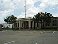 Stafford Municipal Court
 -
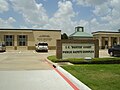 Stafford Police Department, part of the J.C. "Buster" Public Safety Complex
 -
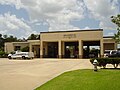 Fire Station No. 1, part of the J.C. "Buster" Court Public Safety Complex
 -
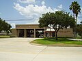 Northside Fire Station
 -
 Stafford Centre for the Performing Arts
 -
 Stafford Post Office


References
- ^ "2019 U.S. Gazetteer Files". United States Census Bureau. Retrieved August 7, 2020.
- ^ a b "U.S. Census website". United States Census Bureau. Retrieved January 31, 2008.
- ^ "US Board on Geographic Names". United States Geological Survey. October 25, 2007. Retrieved January 31, 2008.
- ^ a b "Geographic Identifiers: 2010 Demographic Profile Data (G001): Stafford city, Texas". U.S. Census Bureau, American Factfinder. Retrieved August 31, 2016.[dead link]
- ^ a b Stafford, Texas from the Handbook of Texas Online
- ^ "US Gazetteer files: 2010, 2000, and 1990". United States Census Bureau. February 12, 2011. Retrieved April 23, 2011.
- ^ Climate Summary for Stafford, Texas
- ^ Kumar, Seshadri. "Stafford, SMSD mull over annexation." Houston Chronicle. October 30, 2006. Retrieved on April 12, 2014.
- ^ "Census of Population and Housing". Census.gov. Retrieved June 4, 2015.
- ^ "Explore Census Data". data.census.gov. Retrieved May 23, 2022.
- ^ https://www.census.gov/ [not specific enough to verify]
- ^ "About the Hispanic Population and its Origin". www.census.gov. Retrieved May 18, 2022.
- ^ "Profile of General Population and Housing Characteristics: 2010 Demographic Profile Data (DP-1): Stafford city, Texas". United States Census Bureau. Retrieved June 26, 2012.
- ^ "Find Locations | UPS - United States". www.ups.com. Retrieved December 1, 2020.
- ^ a b c d e Lee, Renée C. "Property tax set at zero seems to suit Stafford." Houston Chronicle. June 7, 2009. Retrieved on June 10, 2009.
- ^ a b c Sixel, L.M. "TI to close Stafford plant, move 500 jobs to N. Texas." Houston Chronicle. Monday January 23, 2012. Retrieved on January 24, 2012.
- ^ "Texas Instruments to close plants in Houston, Japan." KPRC-TV. January 23, 2012. Retrieved on January 24, 2012
- ^ "[1]." Fort Bend Star. Retrieved on May 3, 2012.
- ^ Pulsinelli, Olivia. "Texas Instruments to build Sugar Land facility, employ 375." Houston Business Journal. Wednesday November 7, 2012. Updated Friday November 9, 2012. Retrieved on November 13, 2012.
- ^ "Stafford City Parks." City of Stafford. Retrieved on May 2, 2012.
- ^ "Pool & Recreation." City of Stafford. Retrieved on June 12, 2009.
- ^ "Community Centers Archived June 4, 2011, at the Wayback Machine." Fort Bend County. Retrieved on October 11, 2009.
- ^ Kadifa, Margaret (March 22, 2016). "'Cricket' isn't a bug to this group of youngsters". Houston Chronicle. Retrieved October 26, 2019.
- ^ "About Mayor Scarcella".
- ^ "Stafford to celebrate a legend, 50 years of Mayor Scarcella".
- ^ "Mayor Leonard Scarcella of Stafford dies at age 79". June 28, 2020.
- ^ "About Cecil Willis". www.staffordtx.gov. Retrieved February 18, 2021.
- ^ "Stafford Police Department." City of Stafford. Retrieved on June 12, 2009.
- ^ "Stafford Volunteer Fire Department." City of Stafford. Retrieved on June 12, 2009.
- ^ "Stafford Home Rule Charter" (PDF).
- ^ "Home Rule Charter Review Commission". staffordtx.suiteonemedia.com. Retrieved July 4, 2018.
- ^ "Precinct Maps : All Precincts Archived 2009-01-08 at the Wayback Machine." Harris County, Texas. Retrieved on May 2, 2012.
- ^ "Welcome to the Harris County Precinct One Website! Archived December 16, 2008, at the Wayback Machine." Harris County, Texas. Retrieved on May 2, 2012.
- ^ "District 26." Texas House of Representatives. Retrieved on December 5, 2008.
- ^ "District 27." Texas House of Representatives. Retrieved on May 2, 2012.
- ^ "Senate District 13 Archived 2011-06-28 at the Wayback Machine" Map. Senate of Texas. Retrieved on May 2, 2012.
- ^ "Senate District 17 Archived 2008-12-19 at the Wayback Machine" Map. Senate of Texas. Retrieved on May 2, 2012.
- ^ "Congressional District 22 Archived 2012-06-09 at the Wayback Machine." National Atlas of the United States. Retrieved on May 2, 2012.
- ^ "STAFFORD." U.S. Postal Service. Retrieved on April 24, 2018. "4110 BLUEBONNET DR STAFFORD, TX 77477-9998"
- ^ "City of Houston Annexation FAQ". City of Houston. October 31, 1996. Archived from the original on October 31, 1996. Retrieved April 24, 2018.
Numerous residents of the City of Houston have Missouri City, Webster, Friendswood, Stafford, Humble and even Kingwood addresses.
{{cite web}}: CS1 maint: bot: original URL status unknown (link) - ^ Knipp, Bethany (November 2, 2016). "Fort Bend County lacks hospital district". Community Impact Newspaper. Retrieved October 18, 2021.
- ^ "Contact Us Archived August 13, 2020, at the Wayback Machine." Fort Bend Star. Retrieved on April 7, 2014. "The offices of fortbendstar.com are located at 4655 Techniplex Dr, Suite 300, Stafford, TX 77477 (the same location as the physical newspaper)."
- ^ "Map of Stafford" (PDF). City of Stafford. Retrieved November 7, 2019. - Linked from this page on the Stafford website Archived October 16, 2020, at the Wayback Machine - Based on the location, BAPS is in the extraterritorial jurisdiction but not the city limits
- ^ "Home". BAPS Shri Swaminarayan Mandir, Houston, TX, USA. Retrieved November 7, 2019.
BAPS Shri Swaminarayan Mandir 1150 Brand Lane Stafford, TX 77477 USA
- Despite the "Stafford, TX" city name, it is outside of the Stafford city limits - ^ Sec. 130.182. HOUSTON COMMUNITY COLLEGE SYSTEM DISTRICT SERVICE AREA..
- ^ "College Operations Archived September 22, 2008, at the Wayback Machine." Houston Community College Southwest College. Accessed May 2, 2012.
- ^ "College Navigator - North American University".
- ^ "History." Fort Bend Independent School District. Retrieved on July 20, 2017.
- ^ "FBISD History". Fort Bend Independent School District. December 3, 2018. Archived from the original on September 7, 2008. Retrieved December 3, 2018.
- ^ Solomon, Jerome. "FOOTBALL 1997/HIGH SCHOOLS/FORT BEND BONANZA/Phillips, Dulles in hunt to add to town's memories." Houston Chronicle. Thursday August 28, 1997. Special 33. Retrieved on December 31, 2011.
- ^ "Contact." Everest Academy. Retrieved on April 24, 2018. "610 Brand Ln, Stafford, TX 77477, USA"
- ^ "Contact Us." Sugar Creek Montessori School. Retrieved on April 24, 2018. "Sugar Land Campus 615 Dulles Avenue Stafford, Texas 77477"
- ^ "City Map." City of Stafford. Retrieved on December 5, 2008.
- ^ "Stafford Area Directories." City of Stafford. Retrieved on August 17, 2009.
- ^ "Mamie George Branch Library Archived April 20, 2010, at the Wayback Machine." Fort Bend County Libraries. Retrieved on May 14, 2010.
External links
- City of Stafford official website
- Stafford, Texas from the Handbook of Texas Online
- Muck, Patti. "Stafford, railroad on divergent tracks/1st Texas town to see a train balks at Southern Pacific's "dual' plan." Houston Chronicle. Sunday July 31, 1994. C1.
| Counties |  | |
|---|---|---|
| "Principal" cities | ||
| Other cities |
For a complete listing, see list of cities and towns in Houston–The Woodlands–Sugar Land MSA | |
| Unincorporated areas | ||
| Bodies of water | ||
Municipalities and communities of Fort Bend County, Texas, United States | ||
|---|---|---|
| Cities |  | |
| Town | ||
| Villages | ||
| CDPs | ||
| Other communities | ||
| Former communities | ||
| Ghost towns | ||
| Footnotes | ‡This populated place also has portions in an adjacent county or counties ±Former CDP annexed by Missouri City ^Former CDP annexed by Sugar Land #Still active as a community, but is no longer listed as a census-designated place | |

| International | |
|---|---|
| National | |
| Geographic | |