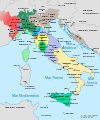
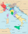
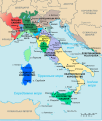
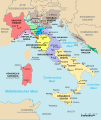
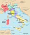
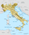
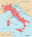
File:Map of Italy (1494)-it.svg

Original file (SVG file, nominally 3,245 × 3,948 pixels, file size: 536 KB)
Captions
Captions
The factual accuracy of this description or the file name is disputed.
Reason: English: The map is heavily inaccurate: at the end of the fifteenth century the territory of the Ottoman Empire in Hungary, Croatia and Bosnia was not as shown in this map; the Republic of Lucca is falsely merged into the Dukedom od Modena; the Papal States were divided into many other fiefdoms in addition to the only one represented, that of Ferrara; the city of Latina was to be founded 436 years later under the name of Littoria; the Kingdom of Spain to which Sardinia is attributed did not yet exist; a lot of minor states are non represented; etc. etc. Overall, the map is not even a faithful reproduction of the one, itself imprecise, declared as the source.
Italiano: La carta è pesantemente imprecisa: alla fine del XV secolo l'estensione dell'Impero Ottomano verso Ungheria, Croazia e Bosnia era molto minore di quanto mostrato nella carta; la Repubblica di Lucca è assorbita nel territorio del Ducato di Modena, come mai successo nel corso della storia; lo Stato Pontificio era all'epoca suddiviso in molti altri feudi papali oltre all'unico rappresentato (peraltro apparentemente come stato indipendente), quello di Ferrara; il Regno di Spagna cui è attribuita la Sardegna non esisteva ancora; un sacco degli staterelli italiani dell'epoca non è per niente rappresentato; etc. etc. Infine come errore paradossale compare la città Latina: ben 436 anni prima della propria fondazione e 449 anni prima della adozione del proprio nome definitivo. Nel complesso, la carta non è neppure una riproduzione fedele di quella, di per sé imprecisa, dichiarata come fonte. |
| DescriptionMap of Italy (1494)-it.svg |
English: map of Italy in 1494 (Italian names).
Italiano: cartina d'Italia nel 1494 (denominazioni italiane). |
||||||
| Date | |||||||
| Source | Image:Italy 1494 shepherd.jpg | ||||||
| Author | F l a n k e r | ||||||
| Permission (Reusing this file) |
|
||||||
| Other versions |
Derivative works of this file: [edit]
[edit] PNG:
SVG:
See similar versions (disputed too): Map of Italy (1494)
|
File history
Click on a date/time to view the file as it appeared at that time.
| Date/Time | Thumbnail | Dimensions | User | Comment | |
|---|---|---|---|---|---|
| current | 16:38, 11 April 2009 |  | 3,245 × 3,948 (536 KB) | Rhegion (talk | contribs) | aggiunta Reggio |
| 19:15, 15 March 2008 |  | 3,245 × 3,948 (536 KB) | F l a n k e r (talk | contribs) | Two Sicilies -> Naples and Sicily | |
| 16:05, 14 March 2008 |  | 3,245 × 3,948 (536 KB) | F l a n k e r (talk | contribs) | {{Information |Description={{en|map of Italy in 1494 (Italian names).}} {{it|cartina d'Italia nel 1494 (denominazioni italiane).}} |Source=Image:Italy 1494 shepherd.jpg |Date=2 March 2007 |Author= F l a n k e r |Permission={{PD |
You cannot overwrite this file.
File usage on Commons
The following 18 pages use this file:
- File:Flag map of the Republic of Venice (697–1797).svg
- File:Italia 1494-ca.svg
- File:Italia 1494-es.svg
- File:Italia 1494-it.svg
- File:Italia 1494-ua.svg
- File:Italy 1494-fr.svg
- File:Italy 1494.svg
- File:Italy 1494 de.svg
- File:Italy 1494 shepherd.jpg
- File:Map of Italy (1494)-ca.svg
- File:Map of Italy (1494)-en.svg
- File:Map of Italy (1494)-fr.svg
- File:Map of Italy (1494)-it-2.png
- File:Map of Italy (1494)-it.svg
- File:Map of Italy (1494)-mk.svg
- File:Map of Italy (1494)-pl.svg
- File:Map of Italy 1494-es.svg
- Template:Other versions/Map of Italy (1494)
File usage on other wikis
The following other wikis use this file:
- Usage on ar.wikipedia.org
- Usage on es.wikipedia.org
- Usage on hu.wikipedia.org
- Usage on ja.wikipedia.org
- Usage on ru.wikipedia.org
Metadata
This file contains additional information such as Exif metadata which may have been added by the digital camera, scanner, or software program used to create or digitize it. If the file has been modified from its original state, some details such as the timestamp may not fully reflect those of the original file. The timestamp is only as accurate as the clock in the camera, and it may be completely wrong.
| Width | 3244.6035 |
|---|---|
| Height | 3948.0681 |
- SVG maps of the history of Italy
- Territorial evolution of Italy
- Maps showing 1494
- 1494 in Italy
- Maps of the Duchy of Milan
- Duchy of Modena in maps
- Maps of the Republic of Venice
- Maps of Italy in the 15th century
- House of Visconti
- Maps of the Duchy of Savoy
- Maps of the Kingdom of Naples
- Maps of the Kingdom of Sicily
- Maps of the Duchy of Ferrara
- Maps of the Papal States
- Papal States in the 1490s
- Republic of Florence
- Republic of Siena
- Maps of the Republic of Genoa
- Maps of the Republic of Lucca
- Marquisate of Saluzzo
