File:ArnoldExpeditionTopoMapAnnotated.png

Original file (777 × 780 pixels, file size: 1.4 MB, MIME type: image/png)
Captions
Captions
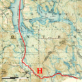
| DescriptionArnoldExpeditionTopoMapAnnotated.png | An annotated extract from a 20th-century topographical map indicating the route of Benedict Arnold's expedition across the height of land between the Kennebec River (Maine) and the Chaudière River (Quebec). | |||||||||||||
| Date | Base map published 1924; markings 2010 | |||||||||||||
| Source |
Markings original work by uploader; base map is from the Library and Archive of Quebec: http://services.banq.qc.ca/sdx/cep/document.xsp?id=0002684670 Cote : G 3400 s63 C37 21-E-07 1924 CAR Numéro SNRC : 21-E-07 Numéro catalogue Iris : 0002684670 |
|||||||||||||
| Author | Markings: User:Magicpiano; Base map: work of Canadian government, Survey Division Office, Department of National Defence | |||||||||||||
| Permission (Reusing this file) |
Markings:
Base map:
|
|||||||||||||
File history
Click on a date/time to view the file as it appeared at that time.
| Date/Time | Thumbnail | Dimensions | User | Comment | |
|---|---|---|---|---|---|
| current | 15:59, 20 October 2010 |  | 777 × 780 (1.4 MB) | Magicpiano (talk | contribs) | font size and color on scale indicator |
| 15:50, 20 October 2010 |  | 777 × 780 (1.4 MB) | Magicpiano (talk | contribs) | add scale indicator | |
| 17:24, 18 June 2010 |  | 777 × 780 (1.41 MB) | Magicpiano (talk | contribs) | {{Information |Description=An annotated extract from a 20th-century topographical map indicating the route of w:Benedict Arnold's expedition across the height of land between the Kennebec River (Maine) and the Chau |
You cannot overwrite this file.
File usage on Commons
There are no pages that use this file.
File usage on other wikis
The following other wikis use this file:
- Usage on en.wikipedia.org
- Usage on fr.wikipedia.org
- Usage on it.wikipedia.org
- Usage on ja.wikipedia.org
- Usage on ru.wikipedia.org
- Usage on zh.wikipedia.org
