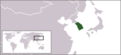
File:Locator map of South Korea.svg
From Wikimedia Commons, the free media repository
Revision as of 07:36, 6 June 2023 by JopkeB (talk | contribs) (Moving from Category:SVG locator maps of countries of Asia (green and grey scheme) to Category:SVG locator maps of countries of Asia (gray and green scheme))
(diff) ← Older revision | Latest revision (diff) | Newer revision → (diff)

Size of this PNG preview of this SVG file: 250 × 115 pixels. Other resolutions: 320 × 147 pixels | 640 × 294 pixels | 1,024 × 471 pixels | 1,280 × 589 pixels | 2,560 × 1,178 pixels.
Original file (SVG file, nominally 250 × 115 pixels, file size: 1.18 MB)
File information
Structured data
Captions
Captions
Locator map of South Korea
韩国的地理位置
Summary
[edit]| DescriptionLocator map of South Korea.svg |
English: Locator map of South Korea. |
| Date | |
| Source | Own work |
| Author | Ksiom |
| Other versions |
  |
Licensing
[edit]| Public domainPublic domainfalsefalse |
| I, the copyright holder of this work, release this work into the public domain. This applies worldwide. In some countries this may not be legally possible; if so: I grant anyone the right to use this work for any purpose, without any conditions, unless such conditions are required by law. |
File history
Click on a date/time to view the file as it appeared at that time.
| Date/Time | Thumbnail | Dimensions | User | Comment | |
|---|---|---|---|---|---|
| current | 02:25, 26 September 2009 |  | 250 × 115 (1.18 MB) | Ksiom (talk | contribs) | Reverted to version as of 17:32, 10 July 2009 |
| 03:36, 13 September 2009 |  | 1,000 × 460 (1.45 MB) | Seb az86556 (talk | contribs) | color-scheme | |
| 17:32, 10 July 2009 |  | 250 × 115 (1.18 MB) | Ksiom (talk | contribs) | revised version | |
| 13:36, 30 October 2008 |  | 250 × 115 (1.34 MB) | Ksiom (talk | contribs) | rv (Ulleungdo and Dokdo are too small to be rendered in such a small map) | |
| 12:12, 30 October 2008 |  | 250 × 115 (1.37 MB) | 쿠도군 (talk | contribs) | ||
| 20:13, 19 October 2008 |  | 250 × 115 (1.34 MB) | Ksiom (talk | contribs) | ||
| 17:27, 19 October 2008 |  | 250 × 189 (229 KB) | Ksiom (talk | contribs) | {{Information |Description={{en|1=Locator map of South Korea.}} |Source=Own work by uploader |Author=Ksiom |Date=2008-10-20 |Permission= |other_versions= }} <!--{{ImageUpload|full}}--> |
You cannot overwrite this file.
File usage on Commons
The following 3 pages use this file:
File usage on other wikis
The following other wikis use this file:
- Usage on ace.wikipedia.org
- Usage on als.wikipedia.org
- Usage on ang.wikipedia.org
- Usage on ar.wikipedia.org
- Usage on ast.wikipedia.org
- Usage on as.wikipedia.org
- Usage on az.wikipedia.org
- Usage on ba.wikipedia.org
- Usage on bg.wikipedia.org
- Usage on blk.wiktionary.org
- Usage on bn.wikipedia.org
- Usage on bo.wikipedia.org
- Usage on bpy.wikipedia.org
- Usage on br.wikipedia.org
- Usage on bs.wikipedia.org
- Usage on ca.wikipedia.org
- Usage on cdo.wikipedia.org
- Usage on csb.wikipedia.org
- Usage on cy.wikipedia.org
- Usage on de.wikipedia.org
- Usage on de.wiktionary.org
- Usage on dsb.wikipedia.org
- Usage on dv.wikipedia.org
- Usage on dz.wikipedia.org
- Usage on en.wikipedia.org
- Usage on en.wiktionary.org
- Usage on es.wikipedia.org
- Usage on et.wikipedia.org
View more global usage of this file.
Metadata
This file contains additional information such as Exif metadata which may have been added by the digital camera, scanner, or software program used to create or digitize it. If the file has been modified from its original state, some details such as the timestamp may not fully reflect those of the original file. The timestamp is only as accurate as the clock in the camera, and it may be completely wrong.
| Width | 250px |
|---|---|
| Height | 115px |