Category:Maps of the canton of Ticino
Cantons of Switzerland: Aargau (AG) · Appenzell Ausserrhoden (AR) · Appenzell Innerrhoden (AI) · Basel-Stadt (BS) · Basel-Landschaft (BL) · Bern (BE) · Fribourg (FR) · Geneva (GE) · Glarus (GL) · Graubünden (GR) · Jura (JU) · Luzern (LU) · Neuchâtel (NE) · Nidwalden (NW) · Obwalden (OW) · Schaffhausen (SH) · Schwyz (SZ) · Solothurn (SO) · St. Gallen (SG) · Thurgau (TG) · Ticino (TI) · Uri (UR) · Valais (VS) · Vaud (VD) · Zug (ZG) · Zürich (ZH)
Subcategories
This category has the following 44 subcategories, out of 44 total.
Media in category "Maps of the canton of Ticino"
The following 47 files are in this category, out of 47 total.
-
Karte Kanton Tessin 2017.png 1,771 × 2,195; 759 KB
-
1231 Urseren.jpg 14,000 × 9,600; 136.39 MB
-
1232 Oberalppass.jpg 14,000 × 9,600; 135.96 MB
-
1251 Val Bedretto.jpg 14,000 × 9,600; 134.9 MB
-
1252 Ambrì-Piotta.jpg 14,000 × 9,600; 134.32 MB
-
1253 Olivone.jpg 14,000 × 9,600; 135.51 MB
-
1254 Hinterrhein.jpg 14,000 × 9,600; 132.66 MB
-
1271 Basòdino.jpg 14,000 × 9,600; 139.57 MB
-
1272 Pizzo Campo Tencia.jpg 14,000 × 9,600; 145.18 MB
-
1273 Biasca.jpg 14,000 × 9,600; 142.22 MB
-
1291 Bosco Gurin.jpg 14,000 × 9,600; 141.7 MB
-
1292 Maggia.jpg 14,000 × 9,600; 151.96 MB
-
1293 Osogna.jpg 14,000 × 9,600; 146.89 MB
-
1294 Grono.jpg 14,000 × 9,600; 144.02 MB
-
1311 Comologno.jpg 14,000 × 9,600; 135.27 MB
-
1312 Locarno.jpg 14,000 × 9,600; 135.51 MB
-
1313 Bellinzona.jpg 14,000 × 9,600; 131.08 MB
-
1314 Passo San Jorio.jpg 14,000 × 9,600; 137.14 MB
-
1332 Brissago.jpg 14,000 × 9,600; 109.29 MB
-
1333 Tesserete.jpg 14,000 × 9,600; 130.48 MB
-
1352 Luino.jpg 14,000 × 9,600; 86.91 MB
-
1353 Lugano.jpg 14,000 × 9,600; 106.62 MB
-
1373 Mendrisio.jpg 14,000 × 9,600; 106.07 MB
-
1374 Como.jpg 14,000 × 9,600; 102.79 MB
-
1581 - Bellinzona e le sue valli.jpg 640 × 480; 119 KB
-
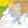
Baliaggi-transalpini rev.png 1,500 × 1,516; 572 KB
-
ETH-BIB-Karte Tessiner Seen (Moränen)-Dia 247-Z-00248.tif 3,668 × 2,884; 30.42 MB
-
General map to illustrate Italian Alps (c 1875).jpg 4,240 × 3,125; 5.47 MB
-
GLS Brenno.png 1,216 × 1,504; 658 KB
-
GLS-Bezirk-Riviera.png 583 × 720; 224 KB
-
Gotthardtunnel-b2.png 296 × 640; 334 KB
-
Guide to Italy and Sicily (1911) (14763714534).jpg 3,888 × 2,784; 2.85 MB
-
Insüber.GIF 649 × 635; 29 KB
-
Italian Alps (1875 book) 002.jpg 2,791 × 3,791; 1.86 MB
-
Italy- a handbook for travellers. First Part (Nothern Italy) (1893) (14778972134).jpg 2,762 × 1,920; 2.23 MB
-
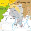
Karte Ennetbirgische Vogteien.png 1,500 × 1,516; 570 KB
-
Karte Kanton Tessin Bezirke 2010 2 clair.png 1,771 × 2,195; 610 KB
-
Localizzazione-Ticino.png 320 × 214; 4 KB
-
Mappa del ducato di Milano e sue pertinenze.jpg 2,426 × 1,776; 1.15 MB
-
NEAT2 Gotthard Süd.jpg 540 × 760; 135 KB
-
Rodi-Fiesso Locator Map.png 1,476 × 1,122; 350 KB
-
Swiss national map, 43 Sopraceneri.jpg 14,000 × 9,600; 167.27 MB
-
Swiss national map, 48 Sottoceneri.jpg 14,000 × 9,600; 144.3 MB
-
Switzerland Locator Map TI.svg 1,052 × 744; 213 KB
-
Иллюстрация к статье «Айроло». Военная энциклопедия Сытина. Том 1 (СПб., 1911—1915).jpg 1,777 × 2,096; 1.19 MB


